Stock Wood

Wood, Forest in Kent Canterbury

England

Stock Wood

Footpath in Blean Woods
Footpath in Blean Woods Credit: Elliott Simpson

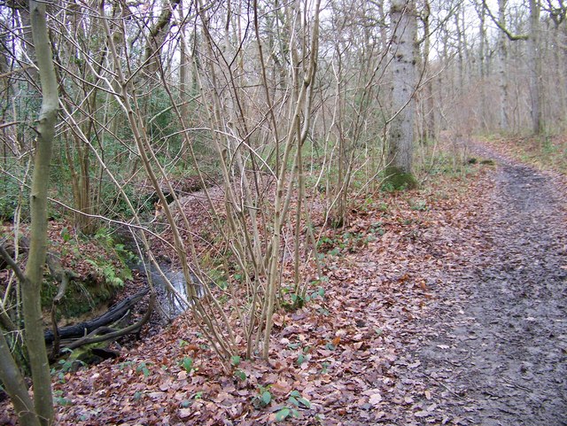
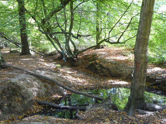
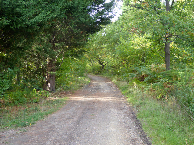
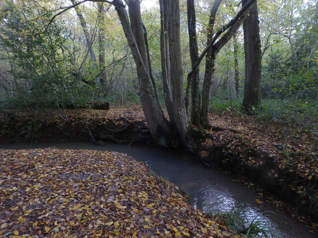
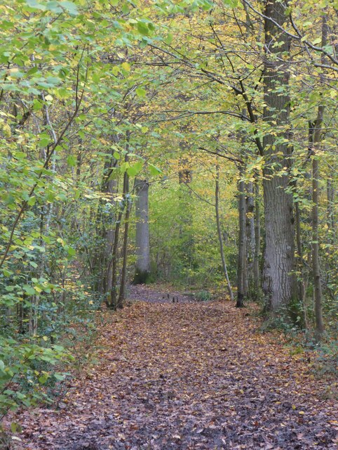
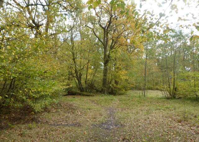
Stock Wood is a small woodland located in the county of Kent, England. It is situated near the village of Stockbury, approximately 5 miles southeast of the town of Sittingbourne. Covering an area of around 30 acres, the wood is a mix of mature and young trees, creating a diverse and vibrant ecosystem.

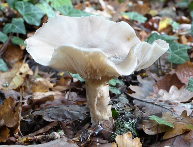
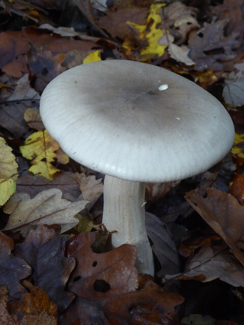
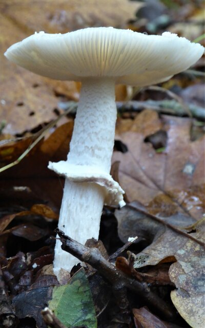
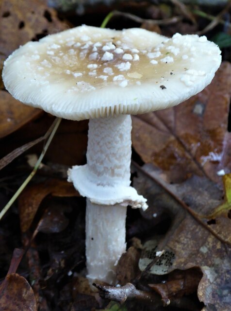
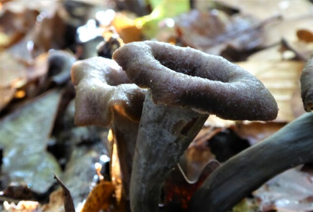
The woodland is primarily composed of native tree species such as oak, ash, beech, and birch. These trees provide a habitat for a variety of wildlife, including birds, small mammals, and insects. The wood is also home to several species of fungi, which thrive in the damp and shaded conditions.

Stock Wood is a popular destination for nature enthusiasts and walkers, with a network of footpaths and trails traversing the area. It offers a peaceful and tranquil environment, providing visitors with an opportunity to experience the beauty of nature and enjoy the sights and sounds of the woodland.

In addition to its natural beauty, Stock Wood also has historical significance. It is believed to have been part of a larger forest that covered much of the surrounding area in medieval times. The wood has been managed and preserved by local authorities to maintain its ecological value and protect its biodiversity.

Overall, Stock Wood in Kent is a cherished natural resource, offering a haven for wildlife and a place of relaxation and recreation for visitors. Its combination of native trees, diverse wildlife, and historical significance make it a unique and valuable woodland in the region.

If you have any feedback on the listing, please let us know in the comments section below.

Stock Wood Images

Images are sourced within 2km of 51.291972/1.0413892 or Grid Reference TR1259. Thanks to Geograph Open Source API. All images are credited.

Footpath in Blean Woods
A290 past the Blean Tavern Heading towards Whitstable.
A290 past the Blean Tavern
Heading towards Whitstable.
Stream in Blean Woods Currently running dry, but with a pool at the culvert outlet under one of the woodland tracks.
Stream in Blean Woods
Currently running dry, but with a pool at the culvert outlet under one of the woodland tracks.
Track in Blean Woods
Old Milestone by the A290, Tile Kiln Hill, Blean Metal plate attached to stone post by the A290, in parish of ST COSMUS AND ST DAMIAN IN THE BLEAN (CANTERBURY District), Tile Kiln Hill, opposite No. 32, by No. 27, in domestic hedge at back of tarmac footpath, on West side of road. Whitstable iron plate, erected by the Whitstable turnpike trust in the 19th century. 

Inscription reads:- : 4½ / MILES / TO / WHITSTABLE : : 2 / MILES / TO / CANTERBURY : 
Carved benchmark and rivet on top.

Milestone Society National ID: KE_CYWS02.
Old Milestone by the A290, Tile Kiln Hill, Blean
Metal plate attached to stone post by the A290, in parish of ST COSMUS AND ST DAMIAN IN THE BLEAN (CANTERBURY District), Tile Kiln Hill, opposite No. 32, by No. 27, in domestic hedge at back of tarmac footpath, on West side of road. Whitstable iron plate, erected by the Whitstable turnpike trust in the 19th century. Inscription reads:- : 4½ / MILES / TO / WHITSTABLE : : 2 / MILES / TO / CANTERBURY : Carved benchmark and rivet on top. Milestone Society National ID: KE_CYWS02.
Fungus in Blean Woods Part of the RSPB Blean Woods Nature Reserve.
Fungus in Blean Woods
Part of the RSPB Blean Woods Nature Reserve.
Fungus in Blean Woods Part of the RSPB Blean Woods Nature Reserve.
Fungus in Blean Woods
Part of the RSPB Blean Woods Nature Reserve.
Stream in Blean Woods, near Rough Common Part of the RSPB Blean Woods Nature Reserve.
Stream in Blean Woods, near Rough Common
Part of the RSPB Blean Woods Nature Reserve.
Fungus in Blean Woods Part of the RSPB Blean Woods Nature Reserve.
Fungus in Blean Woods
Part of the RSPB Blean Woods Nature Reserve.
Fungus in Blean Woods Part of the RSPB Blean Woods Nature Reserve.
Fungus in Blean Woods
Part of the RSPB Blean Woods Nature Reserve.
Fungus in Blean Woods This is a chanterelle fungus known as Horn-of-Plenty, an uncommon fungus supposed to be edible but it doesn't look appetising.
Fungus in Blean Woods
This is a chanterelle fungus known as Horn-of-Plenty, an uncommon fungus supposed to be edible but it doesn't look appetising.
Path in Blean Woods Part of the RSPB Blean Woods Nature Reserve.
Path in Blean Woods
Part of the RSPB Blean Woods Nature Reserve.
RSPB Blean Woods Nature Reserve
St Cosmus & St Damian, Blean
St Cosmus & St Damian, Blean - Chancel
St Cosmus & St Damian, Blean - Font
St Cosmus & St Damian, Blean - Stained glass window
Show me another place!

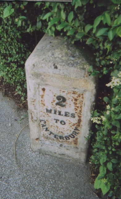
Stock Wood is located at Grid Ref: TR1259 (Lat: 51.291972, Lng: 1.0413892)

Administrative County: Kent

District: Canterbury

Police Authority: Kent

What 3 Words

///darts.flame.reapply. Near Blean, Kent

Nearby Locations

Rough Common Stock Wood

Related Wikis

Rough Common

Rough Common is a village in Canterbury in the parrish of Harbledown, Kent, England. It forms part of the civil parish of Harbledown and Rough Common...

Kent College

Kent College, Canterbury is a co-educational private school for boarding and day pupils between the ages of 3 months and 18 years. It was founded in 1885...

Upper Harbledown

Upper Harbledown is a village in Harbledown and Rough Common civil parish about 2 miles (3 km) west of Canterbury, Kent, England. The population is roughly...

Canterbury (UK Parliament constituency)

Canterbury is a constituency in Kent represented in the House of Commons of the UK Parliament since 2017 by Rosie Duffield of the Labour Party.The seat...

St Edmund's School Canterbury

St Edmund's School Canterbury is a private day and boarding school located in Canterbury, Kent, England and established in 1749. The extensive school grounds...

Harbledown

Harbledown is a village in Kent, England, immediately west of Canterbury and contiguous with the city. At local government level the village is designated...

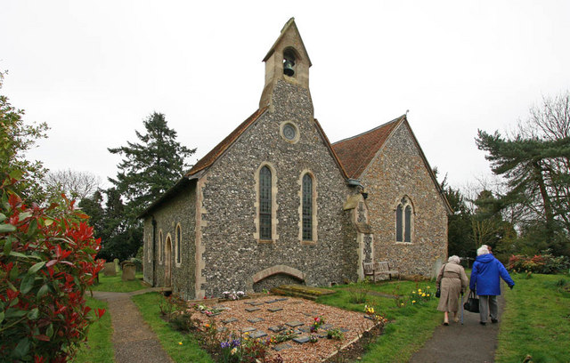
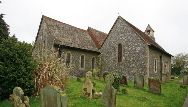
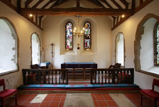
St Michael and All Angels Church, Harbledown

The Church of St Michael and All Angels is a Norman stone church in the village of Harbledown, near Canterbury, England. A part of the Church of England...

Fifteenth Lambeth Conference

The fifteenth Lambeth Conference was an assembly of bishops of the Anglican Communion convened by the archbishop of Canterbury, Justin Welby, between 27...

Nearby Amenities

Located within 500m of 51.291972,1.0413892
Rough Common
Is In: Kent, England, UK
Place: village
Source: NPE maps
Wikidata: Q7370806
Lat/Long: 51.2915964/1.047419
Post Box
Post Box Type: lamp
Postal Code: CT2
Ref: CT2 53
Source: survey
Lat/Long: 51.2914381/1.0479177
Rough Common Stores
Addr City: Canterbury
Addr Country: GB
Addr Housenumber: 77
Addr Postcode: CT2 9DA
Addr Street: Rough Common Road
Addr Village: Rough Common
Fhrs Id: 1102178;1675751
Shop: convenience
Wheelchair: limited
Lat/Long: 51.2913192/1.0479302
kentunilet.com
Addr City: Canterbury
Addr Country: GB
Addr Housenumber: 88
Addr Postcode: CT2 9DE
Addr Street: Rough Common Road
Addr Village: Rough Common
Contact Phone: +44 1227 464444
Contact Website: http://www.kentunilet.com/
Office: estate_agent
Lat/Long: 51.2910915/1.047585
Public Building
Rough Common Village Hall
Lat/Long: 51.2887278/1.0462881
Bus Stop
Bench: no
Naptan AtcoCode: 2400A050370A
Naptan NaptanCode: kntgatmd
Ref: KNTGATMD
Shelter: yes
Lat/Long: 51.2923972/1.0482587
Bus Stop
Churchwood Close
Naptan AtcoCode: 2400A050340A
Naptan Bearing: N
Naptan CommonName: Churchwood Close
Naptan Indicator: opp
Naptan Landmark: Churchwood Close
Naptan NaptanCode: kntgatjt
Naptan PlusbusZoneRef: CNTBE
Naptan Street: Rough Common Rd
Naptan Verified: no
Ref: kntgatjt
Shelter: no
Source: naptan_import
Lat/Long: 51.2896804/1.0465867
Bus Stop
Churchwood Close
Naptan AtcoCode: 2400A050350A
Naptan Bearing: S
Naptan CommonName: Churchwood Close
Naptan Indicator: adj
Naptan Landmark: Churchwood Close
Naptan NaptanCode: kntgatjw
Naptan PlusbusZoneRef: CNTBE
Naptan Street: Rough Common Rd
Naptan Verified: no
Ref: kntgatjw
Shelter: yes
Source: naptan_import
Lat/Long: 51.2898566/1.046953
Bus Stop
Lovell Road
Bench: no
Bin: no
Naptan AtcoCode: 2400A050360A
Naptan Bearing: S
Naptan CommonName: Lovell Road
Naptan Indicator: adj
Naptan Landmark: Rough Common Rd
Naptan NaptanCode: kntgatma
Naptan PlusbusZoneRef: CNTBE
Naptan Street: Rough Common Rd
Naptan Verified: no
Ref: kntgatma
Shelter: no
Source: naptan_import
Lat/Long: 51.292068/1.0482487
Barrier: stile
Lat/Long: 51.2926109/1.0456312
Barrier: height_restrictor
Maxheight: 1.8
Lat/Long: 51.2943935/1.0420314
Barrier: height_restrictor
Maxheight: 1.8
Lat/Long: 51.294471/1.0418389
Board Type: nature
Check Date: 2023-03-05
Information: board
Tourism: information
Lat/Long: 51.2947128/1.0419372
Covered: no
Leisure: picnic_table
Lat/Long: 51.2948145/1.0424169
Bench
Backrest: no
Lat/Long: 51.2947103/1.0420608
Bench
Backrest: no
Lat/Long: 51.2946948/1.0421369
Board Type: nature
Check Date: 2023-03-05
Information: board
Tourism: information
Lat/Long: 51.2947326/1.0420001
Generator Method: photovoltaic
Generator Output Electricity: yes
Generator Source: solar
Generator Type: solar_photovoltaic_panel
Location: roof
Power: generator
Lat/Long: 51.2921518/1.0462627
Generator Method: photovoltaic
Generator Orientation: 213
Generator Output Electricity: yes
Generator Solar Modules: 16
Generator Source: solar
Generator Type: solar_photovoltaic_panel
Location: roof
Power: generator
Lat/Long: 51.2933041/1.0467803
Generator Method: photovoltaic
Generator Orientation: 196
Generator Output Electricity: yes
Generator Solar Modules: 14
Generator Source: solar
Generator Type: solar_photovoltaic_panel
Location: roof
Power: generator
Lat/Long: 51.2912963/1.0456914
Generator Method: photovoltaic
Generator Output Electricity: yes
Generator Source: solar
Generator Type: solar_photovoltaic_panel
Location: roof
Power: generator
Lat/Long: 51.2896516/1.0474147
Defibrillator
Access: yes
Defibrillator Location: Front outside wall of Rough Common Village Hall. Yellow box.
Emergency: defibrillator
Indoor: no
Level: 0
Opening Hours: 24/7
Ref GB The Circuit: 21A296A5-B939-4186-BC07-AE7800E54F6E
Lat/Long: 51.2887868/1.0462123
The data included in this document is from www.openstreetmap.org. The data is made available under ODbL.

Have you been to Stock Wood?

Leave your review of Stock Wood below (or comments, questions and feedback).