Rabbit Wood

Wood, Forest in Kent Canterbury

England

Rabbit Wood

Swarling Manor Farm
Swarling Manor Farm Credit: Nick Smith

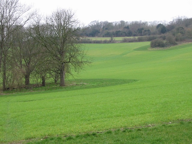
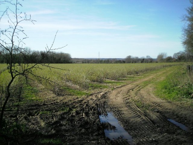
Rabbit Wood is a serene forest located in the county of Kent, England. Covering an area of approximately 100 acres, it is nestled in the picturesque countryside, offering visitors a tranquil escape from the bustling city life. The wood is named after the abundant population of rabbits that inhabit the area.

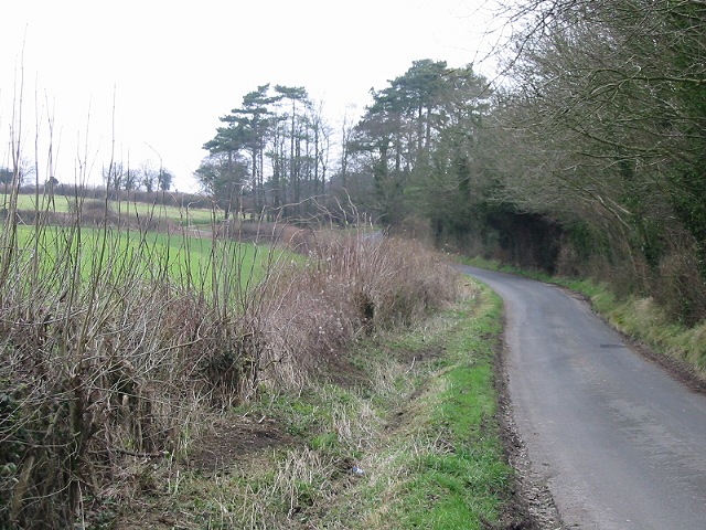
The woodland is characterized by its dense canopy of trees, primarily consisting of oak, beech, and ash, which create a cool and shaded environment. The forest floor is covered with a rich carpet of wildflowers, ferns, and moss, adding to its natural beauty. The wood is crisscrossed by a network of well-maintained footpaths and trails, providing ample opportunities for walking, hiking, and exploring.

Rabbit Wood is home to a diverse range of flora and fauna, making it a haven for nature enthusiasts and wildlife lovers. Birdwatchers can spot a variety of avian species such as woodpeckers, owls, and thrushes. Additionally, the wood is inhabited by small mammals like squirrels, badgers, and of course, rabbits, which can often be seen darting among the undergrowth.

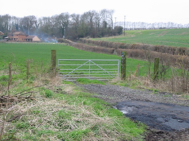
The wood is managed by the local conservation authority, ensuring its preservation and protection. It is a popular destination for families, nature study groups, and individuals seeking solace in nature. Rabbit Wood offers a peaceful retreat where one can immerse themselves in the sights and sounds of the natural world, making it a cherished asset to the community and a must-visit location in the beautiful county of Kent.

If you have any feedback on the listing, please let us know in the comments section below.

Rabbit Wood Images

Images are sourced within 2km of 51.242656/1.0382191 or Grid Reference TR1253. Thanks to Geograph Open Source API. All images are credited.

Swarling Manor Farm
Swarling Manor Farm
Open farmland near Swarling Manor Farm
Town Road leading to Petham
Swarling Hill Road, looking S
Swarling Manor Farm
Swarling Manor Farm
Looking N along Swarling Hill Road
Gate to field off Town Road
Entering Petham on Town Road
New House Farm
New House Farm
Entrance to Larkey Valley Wood Car park at entrance to Larkey Valley Wood, a local nature reserve near Chartham.
Entrance to Larkey Valley Wood
Car park at entrance to Larkey Valley Wood, a local nature reserve near Chartham.
Cottage at Upper Horton Farm On a track leading to Upper Horton Farm - this cottage is just before the farm, surrounded by fields of oilseed rape.
Cottage at Upper Horton Farm
On a track leading to Upper Horton Farm - this cottage is just before the farm, surrounded by fields of oilseed rape.
Garlinge Green The very attractive and peaceful village green at Garlinge Green, complete with old style telephone box.
Garlinge Green
The very attractive and peaceful village green at Garlinge Green, complete with old style telephone box.
Canterbury Steiner School Canterbury Steiner School at Perry Court Farm. The school's reception is a converted oast house - one of many former oast houses that dot the landscape here, they are easily spotted by their air intake "chimneys" with a sail that ensures they face the wind.
Canterbury Steiner School
Canterbury Steiner School at Perry Court Farm. The school's reception is a converted oast house - one of many former oast houses that dot the landscape here, they are easily spotted by their air intake "chimneys" with a sail that ensures they face the wind.
Road Junction The road to the right here drops steeply down Chartham Downs.
Road Junction
The road to the right here drops steeply down Chartham Downs.
Town House at St Augustine's This converted town house is part of a complex, formerly Kent County Lunatic Asylum, now a huge housing development. This building retains much of its Victorian charm and would have been the reception for the hospital.
Town House at St Augustine's
This converted town house is part of a complex, formerly Kent County Lunatic Asylum, now a huge housing development. This building retains much of its Victorian charm and would have been the reception for the hospital.
Thruxted Thruxted Farm, an attractive looking farm in the Chartham Downs.
Thruxted
Thruxted Farm, an attractive looking farm in the Chartham Downs.
Rattington Street Bridge Carrying the minor road out of Chartham over a mill leat used to power the paper mills.
Rattington Street Bridge
Carrying the minor road out of Chartham over a mill leat used to power the paper mills.
Stour Valley Walk The Great Stour is to the right concealed by the foliage on the raised bank. I'm not sure what the structure ahead is but looks like something used to convey gravel or other such materials.
Stour Valley Walk
The Great Stour is to the right concealed by the foliage on the raised bank. I'm not sure what the structure ahead is but looks like something used to convey gravel or other such materials.
Show me another place!

Rabbit Wood is located at Grid Ref: TR1253 (Lat: 51.242656, Lng: 1.0382191)

Administrative County: Kent

District: Canterbury

Police Authority: Kent

What 3 Words

///carpeted.irrigated.flames. Near Chartham, Kent

Related Wikis

St Augustine's Hospital, Chartham

St Augustine's Hospital was a psychiatric hospital in Chartham, Kent, England. It was founded as the second, or East, Kent County Asylum in 1872. In 1948...

Larkey Valley Wood

Larkey Valley Wood is a 44.1-hectare (109-acre) biological Site of Special Scientific Interest south of Canterbury in Kent. It is also a Local Nature Reserve...

Church of St Mary, Chartham

St Mary's Church is in the village of Chartham, Kent, England. It is an active Anglican parish church in the Diocese of Canterbury. Constructed between...

Chartham railway station

Chartham railway station is in Chartham, Kent, on the Ashford to Ramsgate line. The station, and all trains serving it, is operated by Southeastern....

Petham

Petham is a rural village and civil parish in the North Downs, five miles south of Canterbury in Kent, South East England. The village church is All Saints...

Chartham

Chartham is a village and civil parish in the Canterbury district of Kent, England. It is situated on the Ashford side of the city, and is in the North...

Denge Wood

Denge Wood is a wood located 8 miles southwest of Canterbury in Kent, England. The wood is owned by the Forestry Commission and the Woodland Trust. Part...

Lower Hardres

Lower Hardres is a village and former civil parish, now in the parish of Lower Hardres and Nackington, in the City of Canterbury district of Kent, England...

Nearby Amenities

Located within 500m of 51.242656,1.0382191
Barrier: bollard
Bicycle: yes
Foot: yes
Lat/Long: 51.2453541/1.0333071
Waste Basket
Waste: dog_excrement
Lat/Long: 51.2453429/1.0333237
Street Lamp
Lat/Long: 51.2453475/1.0333385
Street Lamp
Lat/Long: 51.2454617/1.0330448
Street Lamp
Lat/Long: 51.2455608/1.0330608
Note: School sign
Traffic Sign: GB:545
Lat/Long: 51.2434398/1.0332442
The data included in this document is from www.openstreetmap.org. The data is made available under ODbL.

Have you been to Rabbit Wood?

Leave your review of Rabbit Wood below (or comments, questions and feedback).