Redhouse Plantation

Wood, Forest in Suffolk Mid Suffolk

England

Redhouse Plantation

Footpath from Thornham Magna to Wickham Skeith
Footpath from Thornham Magna to Wickham Skeith Credit: Sandy Gerrard

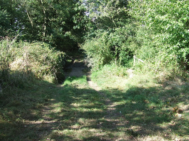
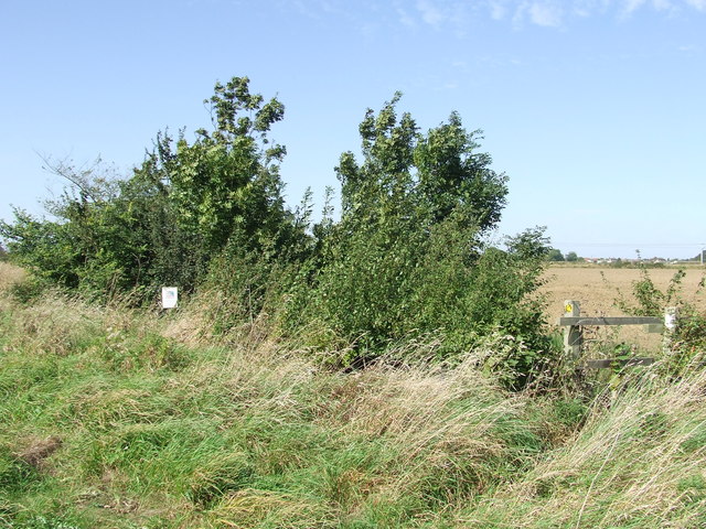
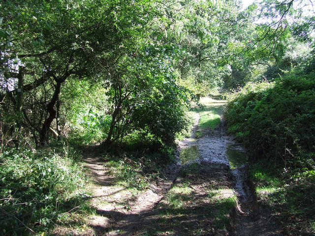
Redhouse Plantation is a magnificent woodland located in Suffolk, England. Spanning over a vast area, this enchanting forest is a popular destination for nature enthusiasts and visitors seeking tranquility and natural beauty. Redhouse Plantation is part of the larger Suffolk Woodlands, a collection of ancient woodlands that are known for their biodiversity and ecological importance.

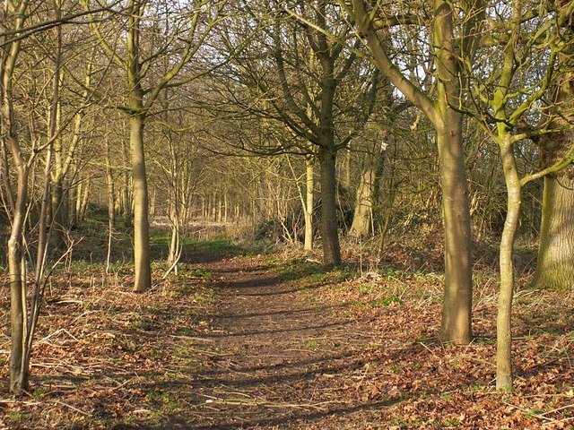
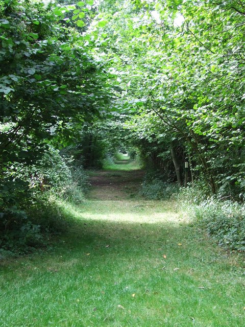
The woodland is characterized by its dense canopy of tall, majestic trees, primarily consisting of oak, beech, and birch. These trees create a serene and shady environment, providing a haven for various plant and animal species. The forest floor is adorned with a diverse array of wildflowers, ferns, and mosses, adding to the enchanting atmosphere of the woodland.

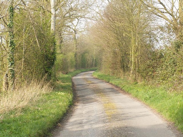
Redhouse Plantation offers numerous walking trails and footpaths, allowing visitors to explore and immerse themselves in the natural surroundings. The trails are well-maintained and provide access to various viewpoints, where one can soak in breathtaking vistas of the woodland.

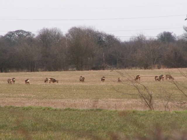
The woodland is home to a rich and diverse wildlife population. Birdwatchers can spot a wide range of avian species, including woodpeckers, owls, and various songbirds. Small mammals such as squirrels, rabbits, and deer can also be observed throughout the forest.

Redhouse Plantation is not only a haven for wildlife but also an important site for conservation efforts. The woodland is actively managed to preserve its delicate ecosystem, with regular tree planting and maintenance programs. The site also serves as an educational resource, with guided tours and workshops available to the public.

In conclusion, Redhouse Plantation is a captivating woodland in Suffolk that offers a tranquil escape into nature. With its breathtaking scenery, diverse wildlife, and commitment to conservation, it is a must-visit destination for anyone seeking solace in the beauty of the natural world.

If you have any feedback on the listing, please let us know in the comments section below.

Redhouse Plantation Images

Images are sourced within 2km of 52.300885/1.0752492 or Grid Reference TM0971. Thanks to Geograph Open Source API. All images are credited.

Footpath from Thornham Magna to Wickham Skeith
Roe deer on arable farmland between Gislingham and Mellis Roe deer are very common in North Suffolk and can often be seen in open fields. Sometimes in winter large numbers can be seen together although usually they are in much smaller groups than this. When the crops are high only their heads are visible and they can easily go unnoticed. It is difficult to get close enough to the deer to get a good photograph. I prefer to watch them from a distance -if you try to get too near they can panic and dash across roads, putting themselves and motorists at risk.
Roe deer on arable farmland between Gislingham and Mellis
Roe deer are very common in North Suffolk and can often be seen in open fields. Sometimes in winter large numbers can be seen together although usually they are in much smaller groups than this. When the crops are high only their heads are visible and they can easily go unnoticed. It is difficult to get close enough to the deer to get a good photograph. I prefer to watch them from a distance -if you try to get too near they can panic and dash across roads, putting themselves and motorists at risk.
Railway Bridge This brick railway bridge carries the Norwich to London main line and it blends well into the surrounding wooded countryside between Gislinham and Thornham Magna.
Railway Bridge
This brick railway bridge carries the Norwich to London main line and it blends well into the surrounding wooded countryside between Gislinham and Thornham Magna.
Path on the Thornham Estate Thornham Estate is a beautiful place to walk and is open to the public each day. There are 12 miles of footpaths through ancient parkland, woodland, farmland and water meadows.
Path on the Thornham Estate
Thornham Estate is a beautiful place to walk and is open to the public each day. There are 12 miles of footpaths through ancient parkland, woodland, farmland and water meadows.
Star House Lane
Star House Lane
To Dormans Wood Footpath to Dormans Wood from Clay Street near to Wickham Street Suffolk.
To Dormans Wood
Footpath to Dormans Wood from Clay Street near to Wickham Street Suffolk.
Through the trees A view along the many miles of walks at Thornham walks Thornham Parva Suffolk.
Through the trees
A view along the many miles of walks at Thornham walks Thornham Parva Suffolk.
Unbridged track A ford across the footpath with footpath bridge on the right. The track as marked on the O.S. 1:25:000 is called Cowpasture Lane near to Mellis Suffolk.
Unbridged track
A ford across the footpath with footpath bridge on the right. The track as marked on the O.S. 1:25:000 is called Cowpasture Lane near to Mellis Suffolk.
Looking northeast Looking northeast along the London to Norwich line from a footpath crossing point near Gislingham Suffolk.
Looking northeast
Looking northeast along the London to Norwich line from a footpath crossing point near Gislingham Suffolk.
Danger sign Danger sign at footpath crossing point near Gislingham Suffolk.
Danger sign
Danger sign at footpath crossing point near Gislingham Suffolk.
F.W.A.G.  area A F.W.A.G. area for info on F.W.A.G. see <a title="https://www.geograph.org.uk/photo/557913" href="https://www.geograph.org.uk/photo/557913">Link</a> near to Gislingham Suffolk.
F.W.A.G. area
A F.W.A.G. area for info on F.W.A.G. see Link near to Gislingham Suffolk.
F.W.A.G.  sign A F.W.A.G. sign for photo of the area near to Gislingham Suffolk see <a title="https://www.geograph.org.uk/photo/557906" href="https://www.geograph.org.uk/photo/557906">Link</a>
F.W.A.G. sign
A F.W.A.G. sign for photo of the area near to Gislingham Suffolk see Link
Starhouse Farm Starhouse Farm near to Wickham Street Suffolk.
Starhouse Farm
Starhouse Farm near to Wickham Street Suffolk.
Free range children Sign seen at Starhouse farm near Wickham Street Suffolk.
Free range children
Sign seen at Starhouse farm near Wickham Street Suffolk.
Un bridged track A ford across the footpath with footpath bridge on the left. The track as marked on the O.S. 1:25:000 is called Cowpasture Lane near to Mellis Suffolk.
Un bridged track
A ford across the footpath with footpath bridge on the left. The track as marked on the O.S. 1:25:000 is called Cowpasture Lane near to Mellis Suffolk.
Railway bridge Farmers railway bridge over the Norwich to Ipswich line near to Gislingham Suffolk.
Railway bridge
Farmers railway bridge over the Norwich to Ipswich line near to Gislingham Suffolk.
Farm track Farm track looking north just north of Wickham Street Suffolk.
Farm track
Farm track looking north just north of Wickham Street Suffolk.
Road junction Road junction looking east Wickham Skeith Suffolk.
Road junction
Road junction looking east Wickham Skeith Suffolk.
Show me another place!

Redhouse Plantation is located at Grid Ref: TM0971 (Lat: 52.300885, Lng: 1.0752492)

Administrative County: Suffolk

District: Mid Suffolk

Police Authority: Suffolk

What 3 Words

///tweezers.pigtails.maple. Near Bacton, Suffolk

Related Wikis

Hartismere Hundred

Hartismere was a hundred of Suffolk, that later gave its name to a poor law union, a rural sanitary district, and the Hartismere Rural District. Listed...

Thornham Magna

Thornham Magna is the larger sister village of Thornham Parva on the former estate of Thornham Hall, the Henniker family seat, in Suffolk. It is about...

St Mary's Church, Thornham Parva

St Mary's Church is a medieval church in Thornham Parva, Suffolk, England. Much of the fabric dates from the 12th century, and it is a Grade I listed building...

Gislingham

Gislingham is a village and civil parish in the Mid Suffolk district of Suffolk in eastern England. == History == Gislingham is situated around the area...

Thornham Parva

Thornham Parva is a village and civil parish in the Mid Suffolk district of Suffolk in eastern England. Located to the north of sister village Thornham...

Pye Road

Pye Road is a Roman road running from the capital of the Iceni at Venta Icenorum (Caistor St Edmund near Norwich) to the original Roman provincial capital...

Stoke Ash

Stoke Ash is a village and civil parish in the Mid Suffolk district of Suffolk in eastern England. Located around six miles south of Diss, in 2011 its...

Major Farm Meadow

Major Farm Meadow is a 1.8-hectare (4.4-acre) biological Site of Special Scientific Interest south-west of Eye in Suffolk.This is one of the few surviving...

Nearby Amenities

Located within 500m of 52.300885,1.0752492
Thornham Walks
Tourism: attraction
Lat/Long: 52.3013557/1.0782419
Cafe
The Forge Cafe
Addr City: Eye
Addr Hamlet: Thornham Magna
Addr Housenumber: 3
Addr Postcode: IP23 8HH
Addr Street: Red House Yard
Fhrs Id: 874847
Opening Hours: We-Fr 10:30-15:30; Sa,Su 10:00-16:00; PH 10:00-16:00
Source Addr: fhrs_database
Lat/Long: 52.3013991/1.0778029
Post Box
Collection Times: Mo-Fr 09:00; Sa 07:00
Operator: Royal Mail
Post Box Type: lamp
Ref: IP23 7173D
Royal Cypher: EIIR
Royal Cypher Wikidata: Q33102113
Lat/Long: 52.3010321/1.0775953
Waste Basket
Source: survey
Waste: dog_excrement
Lat/Long: 52.3024597/1.0779905
Bench
Backrest: no
Material: wood
Source: survey
Lat/Long: 52.3022432/1.07813
Toilets
Fee: no
Source: survey
Wheelchair: yes
Lat/Long: 52.3022399/1.0780603
Bench
Material: wood
Source: survey
Lat/Long: 52.3033683/1.0777035
Bench
Backrest: yes
Material: wood
Source: survey
Lat/Long: 52.3034503/1.0774648
Bench
Backrest: yes
Material: wood
Source: survey
Lat/Long: 52.3040276/1.0775399
Bench
Backrest: yes
Material: wood
Source: survey
Lat/Long: 52.3039965/1.077497
Bench
Backrest: no
Material: wood
Source: survey
Lat/Long: 52.3043118/1.0775077
Waste Basket
Source: survey
Waste: dog_excrement
Lat/Long: 52.3046492/1.0783312
Bench
Backrest: yes
Material: wood
Source: survey
Lat/Long: 52.3047124/1.0787952
Thronham Estate Office
Office: estate
Lat/Long: 52.3017446/1.0762914
AJP Schooling Art / J Parker Studios
Craft: art
Shop: art
Lat/Long: 52.3021858/1.0772087
JPR
Addr Unit: 15
Office: yes
Lat/Long: 52.3019004/1.0767058
Art at 15a
Addr Unit: 15a
Shop: art
Lat/Long: 52.3018889/1.0768157
Bagel or Beigel and More
Addr Unit: 14
Shop: bakery
Lat/Long: 52.301875/1.076915
Addr Unit: 10
Disused Shop: yes
Lat/Long: 52.3018438/1.0769954
Beyond the Image
Shop: art
Tourism: gallery
Lat/Long: 52.3017585/1.0769458
Addr Unit: 12a
Lat/Long: 52.3016265/1.0769968
Disused Shop: gift
Old Name: Thornham Gift and Eco Shop
Lat/Long: 52.3018364/1.0771
Transfromation
Healthcare: alternative
Lat/Long: 52.3018192/1.0773307
Quick Shaves
Shop: hairdresser
Lat/Long: 52.3017913/1.0774849
The data included in this document is from www.openstreetmap.org. The data is made available under ODbL.

Have you been to Redhouse Plantation?

Leave your review of Redhouse Plantation below (or comments, questions and feedback).