Dalehill Plantation
Wood, Forest in Norfolk South Norfolk
England
Dalehill Plantation

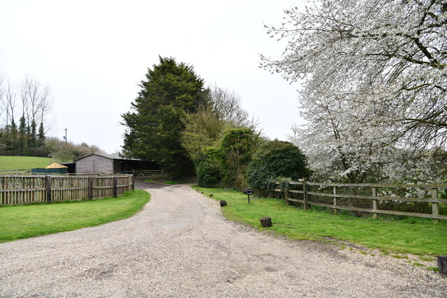
Dalehill Plantation is a picturesque woodland area located in Norfolk, England. Spread across a sprawling expanse, it covers an approximate area of 200 acres. Nestled amidst the county's rural landscape, Dalehill Plantation is renowned for its natural beauty and diverse flora and fauna.
The plantation primarily consists of an ancient forest, characterized by a mix of deciduous and coniferous trees. Towering oak, beech, and ash trees dominate the landscape, providing a rich canopy that filters sunlight and creates a serene ambiance. The forest floor is adorned with a variety of wildflowers, ferns, and mosses, adding color and texture to the surroundings.
Dalehill Plantation is home to a wide range of wildlife, making it an ideal spot for nature enthusiasts and birdwatchers. Visitors can spot numerous bird species, including woodpeckers, owls, and various songbirds. The plantation is also a haven for mammals such as deer, foxes, and rabbits.
The plantation offers several well-maintained walking trails that wind through the woodland, allowing visitors to explore the area at their own pace. These trails provide an opportunity to immerse oneself in the peaceful ambiance and observe the natural wonders of the forest.
Moreover, Dalehill Plantation is committed to conservation efforts and sustainable land management. The plantation is carefully managed to preserve its ecological balance and protect its biodiversity. This includes controlled logging practices and the establishment of designated wildlife habitats.
Overall, Dalehill Plantation is a captivating natural retreat that offers visitors a chance to connect with nature and appreciate the tranquility of Norfolk's woodlands.
If you have any feedback on the listing, please let us know in the comments section below.
Dalehill Plantation Images
Images are sourced within 2km of 52.641382/1.098977 or Grid Reference TG0909. Thanks to Geograph Open Source API. All images are credited.


Dalehill Plantation is located at Grid Ref: TG0909 (Lat: 52.641382, Lng: 1.098977)
Administrative County: Norfolk
District: South Norfolk
Police Authority: Norfolk
What 3 Words
///cobbles.bleaching.magically. Near Mattishall, Norfolk
Nearby Locations
Related Wikis

Colton, Norfolk
Colton is a village and former civil parish, 8 miles (13 km) west of Norwich, now in the parish of Marlingford and Colton, in the South Norfolk district...

Marlingford and Colton
Marlingford and Colton, formerly Marlingford is a civil parish in the English county of Norfolk, made from the villages of Colton and Marlingford. It covers...

Barford, Norfolk
Barford is a village and civil parish in the English county of Norfolk, situated some 4 miles (6 km) north of Wymondham and 8 miles (13 km) west of Norwich...

Honingham
Honingham is a village and civil parish in the English county of Norfolk, located 8 miles (13 km) to the west of Norwich along the A47 trunk road. It covers...

East Tuddenham
East Tuddenham is a village in the English county of Norfolk. The village is located 5.6 miles (9.0 km) south-west of Dereham and 9.5 miles (15.3 km) north...

Barnham Broom
Barnham Broom is a village and civil parish in the English county of Norfolk. The village is situated on the River Yare, 9 miles (15 km) West of Norwich...
Brandon Parva
Brandon Parva is a village and former civil parish, now in the parish of Brandon Parva, Coston, Runhall and Welborne, in the South Norfolk district, in...

River Tiffey
The River Tiffey is a small river in Norfolk, England and a tributary of the River Yare. It rises near Hethel and passes through Wymondham before flowing...
Nearby Amenities
Located within 500m of 52.641382,1.098977Have you been to Dalehill Plantation?
Leave your review of Dalehill Plantation below (or comments, questions and feedback).