Denstead Wood

Wood, Forest in Kent Canterbury

England

Denstead Wood

Grassland near Selling Tunnel
Grassland near Selling Tunnel Credit: James Emmans

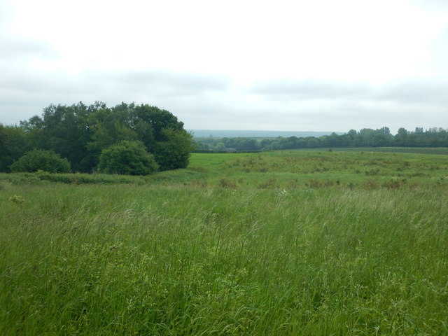
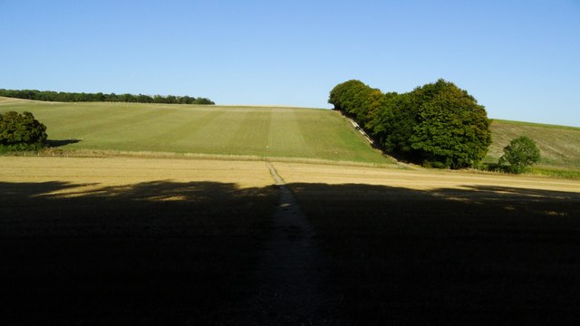
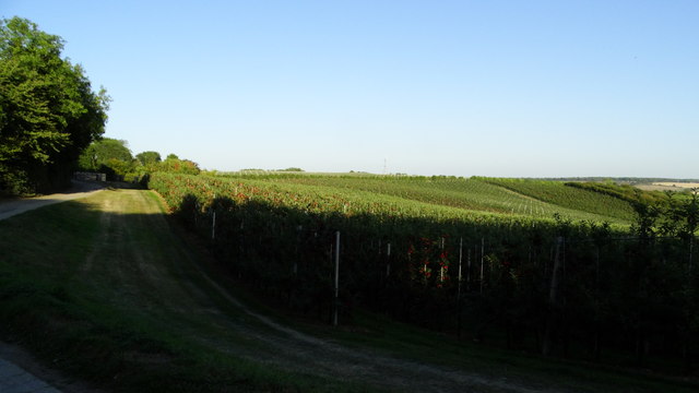
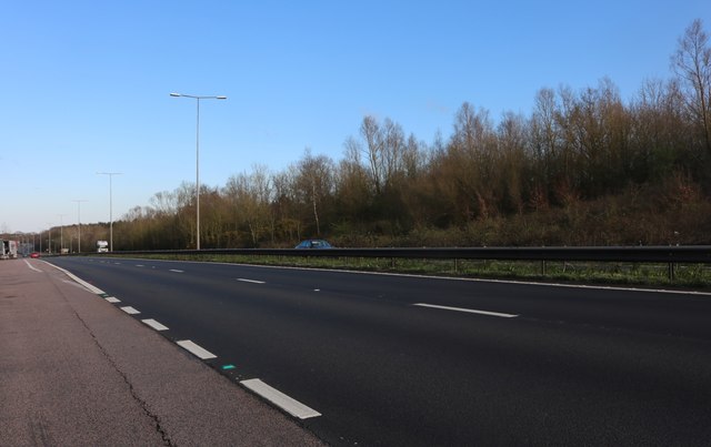
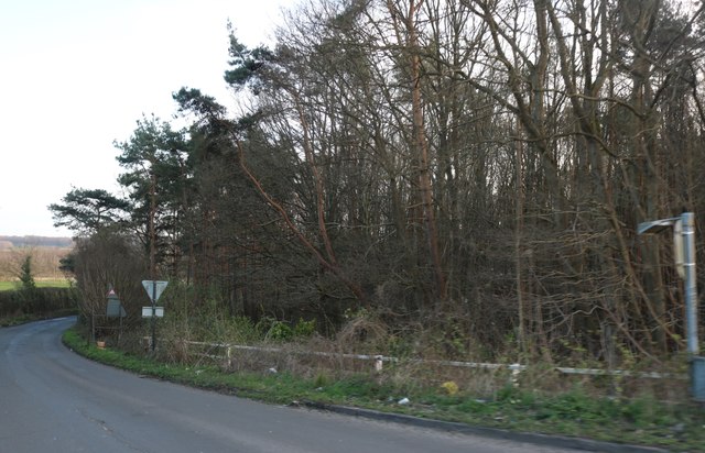
Denstead Wood is a picturesque woodland located in the county of Kent, England. Covering an area of approximately 100 acres, this enchanting forest is a popular destination for nature enthusiasts and those seeking tranquility amidst the beauty of the natural world.

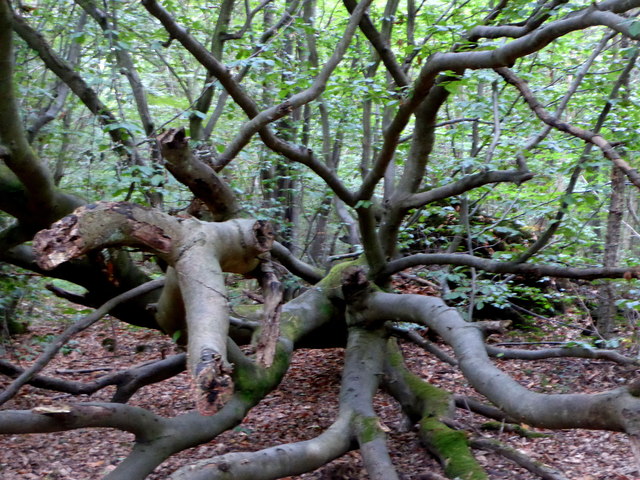
The woodland is primarily composed of native tree species such as oak, beech, and birch, creating a diverse and rich ecosystem. The dense canopy of trees provides a shaded and cool environment, perfect for leisurely walks or escaping the summer heat.

Denstead Wood is home to a variety of wildlife, including several species of birds such as woodpeckers, owls, and thrushes. The forest floor is teeming with smaller creatures like squirrels and rabbits, while occasional sightings of deer add to the charm of the area.

A network of well-maintained footpaths weaves through the wood, allowing visitors to explore its stunning beauty at their own pace. These paths provide access to hidden spots and peaceful glades, where one can sit and listen to the soothing sounds of nature.

The wood is particularly renowned for its vibrant display of bluebells during the spring season. As the weather warms, the forest floor becomes a sea of delicate blue, creating a breathtaking spectacle that attracts visitors from near and far.

Denstead Wood offers a perfect retreat from the hustle and bustle of everyday life, providing an opportunity to reconnect with nature and enjoy the serene atmosphere of this ancient woodland. Whether it be for a leisurely stroll, birdwatching, or simply finding solace in the beauty of the natural world, Denstead Wood is a true gem in the heart of Kent.

If you have any feedback on the listing, please let us know in the comments section below.

Denstead Wood Images

Images are sourced within 2km of 51.275006/0.98984859 or Grid Reference TR0857. Thanks to Geograph Open Source API. All images are credited.

Grassland near Selling Tunnel
Dead tree by a path in Bossenden Wood, Dunkirk It was in this wood in 1835 that what is thought to be the last battle on English soil took place. During a period of unrest a group of rural labourers led by John Tom, who called himself Sir William Courtenay, entered into battle with soldiers after Courtenay had murdered a local constable. A total of 11 men were killed including 8 of Courtenay's followers.
Dead tree by a path in Bossenden Wood, Dunkirk
It was in this wood in 1835 that what is thought to be the last battle on English soil took place. During a period of unrest a group of rural labourers led by John Tom, who called himself Sir William Courtenay, entered into battle with soldiers after Courtenay had murdered a local constable. A total of 11 men were killed including 8 of Courtenay's followers.
A2 The A2 runs 72 miles from Borough <a href="https://www.geograph.org.uk/photo/5739288">TQ3279 : Great Dover St</a> in London to Dover, through Kent, formerly known as the Dover Road or Great Dover Road. It follows roughly the course of the Roman Watling Street and historically it has always been an important road because it connects London with Canterbury and the port of Dover. In the 18th and 19th century it was turnpiked and given its present designation in the 1920s.
A2
The A2 runs 72 miles from Borough TQ3279 : Great Dover St in London to Dover, through Kent, formerly known as the Dover Road or Great Dover Road. It follows roughly the course of the Roman Watling Street and historically it has always been an important road because it connects London with Canterbury and the port of Dover. In the 18th and 19th century it was turnpiked and given its present designation in the 1920s.
Dunkirk turning, A2 The A2 runs 72 miles from Borough <a href="https://www.geograph.org.uk/photo/5739288">TQ3279 : Great Dover St</a> in London to Dover, through Kent, formerly known as the Dover Road or Great Dover Road. It follows roughly the course of the Roman Watling Street and historically it has always been an important road because it connects London with Canterbury and the port of Dover. In the 18th and 19th century it was turnpiked and given its present designation in the 1920s.
Dunkirk turning, A2
The A2 runs 72 miles from Borough TQ3279 : Great Dover St in London to Dover, through Kent, formerly known as the Dover Road or Great Dover Road. It follows roughly the course of the Roman Watling Street and historically it has always been an important road because it connects London with Canterbury and the port of Dover. In the 18th and 19th century it was turnpiked and given its present designation in the 1920s.
Bridge over the A2 The A2 runs 72 miles from Borough <a href="https://www.geograph.org.uk/photo/5739288">TQ3279 : Great Dover St</a> in London to Dover, through Kent, formerly known as the Dover Road or Great Dover Road. It follows roughly the course of the Roman Watling Street and historically it has always been an important road because it connects London with Canterbury and the port of Dover. In the 18th and 19th century it was turnpiked and given its present designation in the 1920s.
Bridge over the A2
The A2 runs 72 miles from Borough TQ3279 : Great Dover St in London to Dover, through Kent, formerly known as the Dover Road or Great Dover Road. It follows roughly the course of the Roman Watling Street and historically it has always been an important road because it connects London with Canterbury and the port of Dover. In the 18th and 19th century it was turnpiked and given its present designation in the 1920s.
Lower Ensden Road Heading towards Canterbury Road.
Lower Ensden Road
Heading towards Canterbury Road.
A28 Ashford Road Heading towards Canterbury along the valley of the Great Stour.
A28 Ashford Road
Heading towards Canterbury along the valley of the Great Stour.
Westbound A2
Westbound A2
Esso petrol station, Gate services, Upper Harbledown, Canterbury Esso services on A2
Esso petrol station, Gate services, Upper Harbledown, Canterbury
Esso services on A2
Old Milestone by London Road, Dunkirk Stone post (plates lost) by the UC road (was A2), in parish of DUNKIRK (SWALE District), London Road, West of link road to A2, East of Prospect House, in hedge behind path, on North side of road. Dover Road facet, erected by the Chatham & Canterbury turnpike trust in the 19th century. 

Inscription once read:-
: (Canterbury / 4) : : (London / 51) :

Kent HER.
HER Number: TR 05 NE 161 <span class="nowrap"><a title="https://www.heritagegateway.org.uk/Gateway/Results_Single.aspx?uid=MKE77992&resourceID=1005" rel="nofollow ugc noopener" href="https://www.heritagegateway.org.uk/Gateway/Results_Single.aspx?uid=MKE77992&resourceID=1005">Link</a><img style="margin-left:2px;" alt="External link" title="External link - shift click to open in new window" src="https://s1.geograph.org.uk/img/external.png" width="10" height="10"/></span>

Milestone Society National ID: KE_LD51.
Old Milestone by London Road, Dunkirk
Stone post (plates lost) by the UC road (was A2), in parish of DUNKIRK (SWALE District), London Road, West of link road to A2, East of Prospect House, in hedge behind path, on North side of road. Dover Road facet, erected by the Chatham & Canterbury turnpike trust in the 19th century. Inscription once read:- : (Canterbury / 4) : : (London / 51) : Kent HER. HER Number: TR 05 NE 161 LinkExternal link Milestone Society National ID: KE_LD51.
Old Milestone by the A2, London Road, Dunkirk parish Stone post (plate lost) by the A2, in parish of Dunkirk (Swale District), London Road, opposite Denstead Lane, West of Service area, at West end of crash barrier, on North side of road. Dover Road facet, erected by the Chatham & Canterbury turnpike trust in the 19th century. 

Inscription reads:-
(London 53 / Canterbury 3)

Kent HER.
HER Number: TR 05 NE 162 <span class="nowrap"><a title="https://www.heritagegateway.org.uk/Gateway/Results_Single.aspx?uid=MKE77994&resourceID=1005" rel="nofollow ugc noopener" href="https://www.heritagegateway.org.uk/Gateway/Results_Single.aspx?uid=MKE77994&resourceID=1005">Link</a><img style="margin-left:2px;" alt="External link" title="External link - shift click to open in new window" src="https://s1.geograph.org.uk/img/external.png" width="10" height="10"/></span>

Milestone Society National ID: KE_LD52
Old Milestone by the A2, London Road, Dunkirk parish
Stone post (plate lost) by the A2, in parish of Dunkirk (Swale District), London Road, opposite Denstead Lane, West of Service area, at West end of crash barrier, on North side of road. Dover Road facet, erected by the Chatham & Canterbury turnpike trust in the 19th century. Inscription reads:- (London 53 / Canterbury 3) Kent HER. HER Number: TR 05 NE 162 LinkExternal link Milestone Society National ID: KE_LD52
On North Downs Way at Chestnut Plantation, NE of Old Wives Lees
Apple orchard above Dunning Shaw, Stour Valley, Kent
Denstead Lane at the Boughton Bypass junction
Filthy layby on the Broughton Bypass, Dunkirk If you've seen the recent series about the teams cleaning the major roads everything you saw was real.
Filthy layby on the Broughton Bypass, Dunkirk
If you've seen the recent series about the teams cleaning the major roads everything you saw was real.
The Broughton Bypass, Dunkirk
Denstead Lane near Dunkirk
Show me another place!

Denstead Wood is located at Grid Ref: TR0857 (Lat: 51.275006, Lng: 0.98984859)

Administrative County: Kent

District: Canterbury

Police Authority: Kent

What 3 Words

///patching.punctured.lads. Near Chartham, Kent

Related Wikis

South Blean

South Blean is a 329-hectare (810-acre) nature reserve near Chartham Hatch, west of Canterbury in Kent. It is owned and managed by the Kent Wildlife Trust...

Dunkirk, Kent

Dunkirk is a village and civil parish between Faversham and Canterbury in southeast England. It lies on the Canterbury Road between Boughton under Blean...

No Man's Orchard

No Man's Orchard is a 4.1-hectare (10-acre) Local Nature Reserve west of Canterbury in Kent. It is owned by Chartham and Harbledown Parish Councils and...

Boughton under Blean

Boughton under Blean is a village and civil parish between Faversham and Canterbury in south-east England. "Boughton under Blean" technically refers only...

Battle of Bossenden Wood

The Battle of Bossenden Wood took place on 31 May 1838 near Hernhill in Kent; it has been called the last battle on English soil. The battle was fought...

Chartham railway station

Chartham railway station is in Chartham, Kent, on the Ashford to Ramsgate line. The station, and all trains serving it, is operated by Southeastern....

Church of St Mary, Chartham

St Mary's Church is in the village of Chartham, Kent, England. It is an active Anglican parish church in the Diocese of Canterbury. Constructed between...

Bigbury Camp

Bigbury Camp (formerly Bigberry Camp) is a univallate hill fort in the parish of Harbledown and Rough Common in Kent in England. The fort is a Scheduled...

Nearby Amenities

Located within 500m of 51.275006,0.98984859
The data included in this document is from www.openstreetmap.org. The data is made available under ODbL.

Have you been to Denstead Wood?

Leave your review of Denstead Wood below (or comments, questions and feedback).