Yalden Wood

Wood, Forest in Kent Ashford

England

Yalden Wood

The Horsemarsh Sewer Not such an unpleasant spot as the name would suggest!
The Horsemarsh Sewer Credit: Andy Stephenson

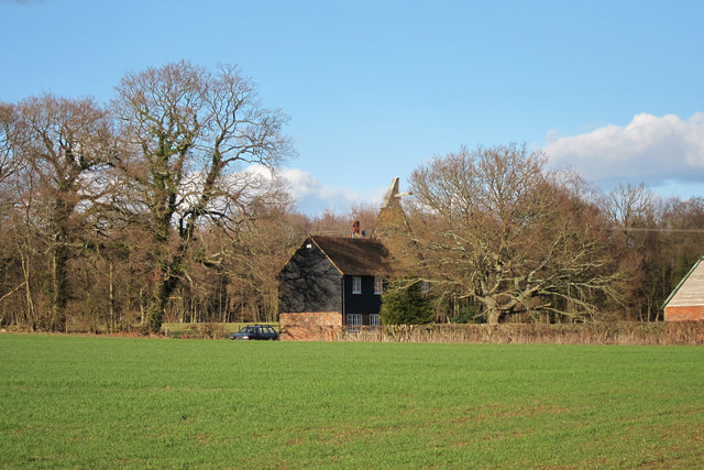
Yalden Wood, located in Kent, England, is a picturesque forest renowned for its natural beauty and diverse wildlife. Spanning an area of approximately 500 acres, this woodland sanctuary offers visitors a tranquil retreat away from the hustle and bustle of city life.

The wood is primarily comprised of broadleaf trees such as oak, beech, and ash, which form a dense canopy overhead, creating a cool and shaded environment. The forest floor is covered with a carpet of moss, ferns, and wildflowers, adding to the enchanting ambiance of the woodland.

Yalden Wood is home to a wide range of wildlife, making it a popular destination for nature enthusiasts and birdwatchers. Visitors may spot various bird species, including woodpeckers, owls, and warblers, as well as smaller creatures like squirrels, rabbits, and foxes. The wood also provides a habitat for several rare and endangered species, such as the dormouse and the silver-washed fritillary butterfly.

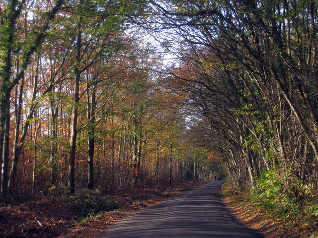
For those seeking outdoor activities, Yalden Wood offers a network of well-maintained walking trails, allowing visitors to explore its beauty at their own pace. These trails wind through the forest, offering glimpses of tranquil ponds and babbling brooks along the way. The wood is particularly stunning during the autumn months when the foliage transforms into a vibrant display of red, orange, and gold.

Yalden Wood is easily accessible by car or public transportation, with ample parking available for visitors. Whether it's a leisurely stroll, birdwatching, or simply unwinding amidst nature, Yalden Wood offers a serene and captivating experience for all who venture within its leafy embrace.

If you have any feedback on the listing, please let us know in the comments section below.
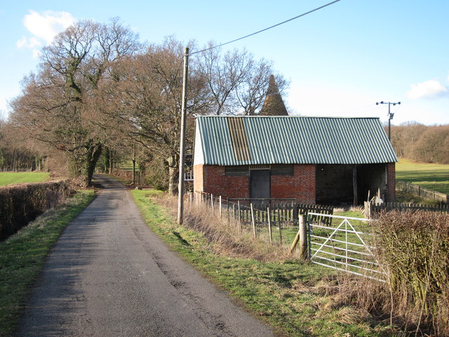
Yalden Wood Images

Images are sourced within 2km of 51.069826/0.81403783 or Grid Reference TQ9733. Thanks to Geograph Open Source API. All images are credited.

The Horsemarsh Sewer Not such an unpleasant spot as the name would suggest!
The Horsemarsh Sewer
Not such an unpleasant spot as the name would suggest!
St. Mary, Kenardington A view from the "other" side of the church on a fine winter morning.
St. Mary, Kenardington
A view from the "other" side of the church on a fine winter morning.
Oast House, Leacon Hall, Warehorne Single round kiln oast house. Cowl replaced with weather vane.
Oast House, Leacon Hall, Warehorne
Single round kiln oast house. Cowl replaced with weather vane.
Oast House, Leacon Hall, Warehorne Single round kiln oast house. Cowl replaced with weather vane.
Oast House, Leacon Hall, Warehorne
Single round kiln oast house. Cowl replaced with weather vane.
Oast House, Leacon Hall, Warehorne Single round kiln oast house. Cowl replaced with weather vane.
Oast House, Leacon Hall, Warehorne
Single round kiln oast house. Cowl replaced with weather vane.
Weathervane on Oast House at Leacon Hall A weather vane in place of a cowl on the kiln.
Weathervane on Oast House at Leacon Hall
A weather vane in place of a cowl on the kiln.
Hockley Oast, Warehorne Single round kiln oast house. Black weatherboard stowage.
Hockley Oast, Warehorne
Single round kiln oast house. Black weatherboard stowage.
Hockley Oast, Warehorne Single round kiln oast house. Black weatherboard stowage.
Hockley Oast, Warehorne
Single round kiln oast house. Black weatherboard stowage.
Hockley Oast, Warehorne Single round kiln oast house. Black weatherboard stowage.
Hockley Oast, Warehorne
Single round kiln oast house. Black weatherboard stowage.
Cowl of Hockley Oast Single round kiln oast house. Black weatherboard stowage.
Cowl of Hockley Oast
Single round kiln oast house. Black weatherboard stowage.
Malthouse Lane Tree-lined section of the lane, with Woodlands Farm seen to the left.
Malthouse Lane
Tree-lined section of the lane, with Woodlands Farm seen to the left.
Hockley Oast Single round kiln oast house. Black weatherboard stowage.
Hockley Oast
Single round kiln oast house. Black weatherboard stowage.
Hockley Farm
Hockley Farm
Field by Hockley Oast
Sheep off Church Road
House off the B2067
House off the B2067
Leacon Hall Grade II* listed <span class="nowrap"><a title="http://list.english-heritage.org.uk/resultsingle.aspx?uid=1185579" rel="nofollow ugc noopener" href="http://list.english-heritage.org.uk/resultsingle.aspx?uid=1185579">Link</a><img style="margin-left:2px;" alt="External link" title="External link - shift click to open in new window" src="https://s1.geograph.org.uk/img/external.png" width="10" height="10"/></span>
Leacon Hall
Grade II* listed LinkExternal link
Show me another place!

Yalden Wood is located at Grid Ref: TQ9733 (Lat: 51.069826, Lng: 0.81403783)

Administrative County: Kent

District: Ashford

Police Authority: Kent

What 3 Words

///jubilant.decks.statement. Near Woodchurch, Kent

Related Wikis

Kenardington

Kenardington is a small clustered village and the centre of a relatively small rural civil parish of the same name, in the Ashford District of Kent, England...

Canterbury Oast Trust

Canterbury Oast Trust (COT) is a registered charity in England providing accommodation, care and training for people with learning disabilities in Kent...

Orlestone Forest

Orlestone Forest is a 347.6-hectare (859-acre) biological Site of Special Scientific Interest south of Ashford in Kent. It is a Nature Conservation Review...

Leacon Hall

Leacon Hall, Warehorne, Kent, England, is a grade II* listed building constructed for Thomas Hodges in 1708. == Description == The house remains on a low...

Nearby Amenities

Located within 500m of 51.069826,0.81403783
Barrier: stile
Lat/Long: 51.0732253/0.8150302
Birch Wood
Place: locality
Lat/Long: 51.0674169/0.8170051
Kiln Wood
Place: locality
Lat/Long: 51.0724706/0.8101559
Penfold Wood
Place: locality
Lat/Long: 51.0680038/0.8120585
Taylor Wood
Place: locality
Lat/Long: 51.0693624/0.8095851
Wadland Wood
Place: locality
Lat/Long: 51.0713186/0.8121277
Yalden Wood
Place: locality
Lat/Long: 51.0692972/0.8155004
The data included in this document is from www.openstreetmap.org. The data is made available under ODbL.

Have you been to Yalden Wood?

Leave your review of Yalden Wood below (or comments, questions and feedback).