Stony Wood
Wood, Forest in Kent Maidstone
England
Stony Wood

Stony Wood is a picturesque forest located in the county of Kent, England. Covering an area of approximately 500 acres, this woodland is renowned for its natural beauty and diverse range of flora and fauna. Situated near the village of Kenton, Stony Wood offers visitors a tranquil escape from the bustling city life.
The forest is dominated by an enchanting mix of broadleaf and coniferous trees, creating a dense canopy that provides a haven for various bird species. It is not uncommon to spot colorful woodpeckers, jays, and owls amidst the towering trees. The forest floor is carpeted with a rich array of wildflowers, including bluebells and primroses, which bloom in abundance during the spring season.
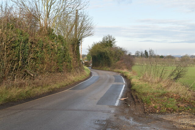
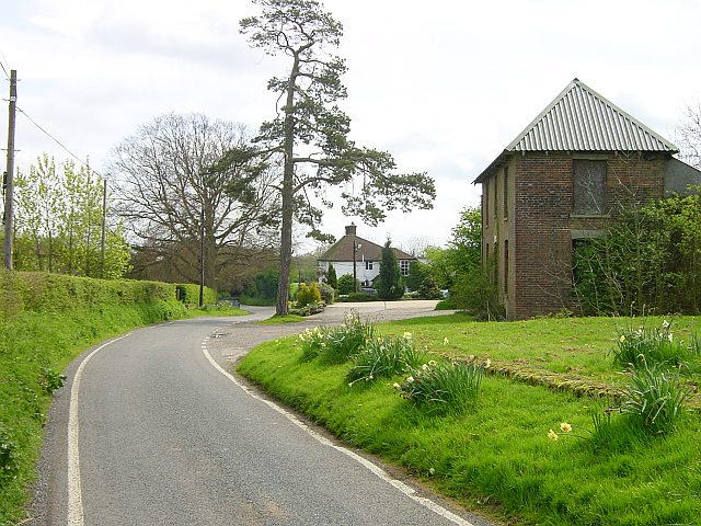
Stony Wood is intersected by several well-maintained walking trails, offering visitors the opportunity to explore the forest's natural wonders at their own pace. The paths wind through ancient oak groves and meander alongside babbling brooks, providing a serene ambiance for leisurely strolls or invigorating hikes. Along the way, visitors may stumble upon hidden clearings where they can pause and soak in the tranquil surroundings.
In addition to its natural beauty, Stony Wood also holds historical significance. The forest is home to the ruins of an ancient manor house, dating back to the 14th century. These ruins serve as a reminder of the area's rich heritage and offer visitors a glimpse into the past.
Overall, Stony Wood in Kent is a captivating destination for nature enthusiasts, history buffs, and anyone seeking solace in the embrace of unspoiled woodlands. Its breathtaking scenery, abundant wildlife, and historical remnants make it a must-visit location for those exploring the beauty of Kent.
If you have any feedback on the listing, please let us know in the comments section below.
Stony Wood Images
Images are sourced within 2km of 51.288478/0.69008001 or Grid Reference TQ8757. Thanks to Geograph Open Source API. All images are credited.


Stony Wood is located at Grid Ref: TQ8757 (Lat: 51.288478, Lng: 0.69008001)
Administrative County: Kent
District: Maidstone
Police Authority: Kent
What 3 Words
///pedicure.submerge.fingertip. Near Harrietsham, Kent
Nearby Locations
Related Wikis

Bedmonton
Bedmonton or Bedmanton is a hamlet situated about five miles (8 km) on a minor road between the B2163 road and Wormshill to the south of Sittingbourne...

Wormshill
Wormshill ( wurmz-HIL), historically Wormsell, is a small village and civil parish within the Borough of Maidstone, Kent, England. The parish is approximately...
St Giles Church, Wormshill
St Giles Church is the sole church in the village of Wormshill in Kent. The church is Anglican and is dedicated to Saint Giles. It forms part of the united...

Frinsted
Frinsted or Frinstead is a small village and civil parish in the ecclesiastical parish of Wormshill and in the Maidstone District of Kent, England. and...
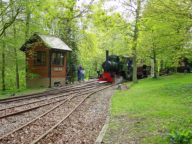
Bredgar and Wormshill Light Railway
The Bredgar and Wormshill Light Railway (BWLR) is located near the villages of Wormshill and Bredgar in Kent, just south of Sittingbourne. It is a 2 ft...

Bicknor
Bicknor is a village and civil parish in the Maidstone district of Kent, England, north-east of Maidstone and south-west of Sittingbourne. It had a population...
Ringlestone
Ringlestone is a hamlet between Wormshill and Harrietsham in the Maidstone district of Kent, England. It is in the civil parish of Wormshill. Ringlestone...
Ringlestone Inn
The Ringlestone Inn is an historic public house and restaurant, located in the Ringlestone hamlet near the village of Wormshill in Kent, England. Dating...
Nearby Amenities
Located within 500m of 51.288478,0.69008001Have you been to Stony Wood?
Leave your review of Stony Wood below (or comments, questions and feedback).