Elvedon Road Belt

Wood, Forest in Suffolk West Suffolk

England

Elvedon Road Belt

Nightingale Road, Brandon
Nightingale Road, Brandon Credit: David Howard

Elvedon Road Belt, located in Suffolk, England, is a picturesque woodland area known for its natural beauty and rich history. Covering an expansive area, it is part of the larger Elveden Forest and is situated near the village of Elveden.

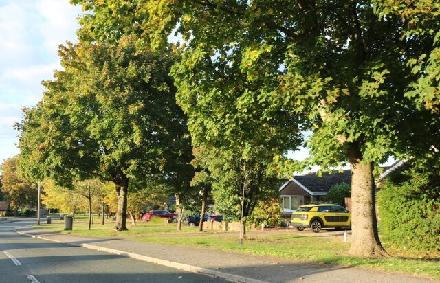
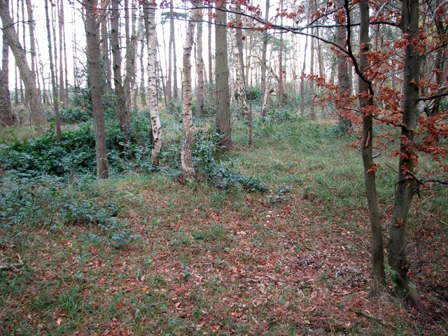
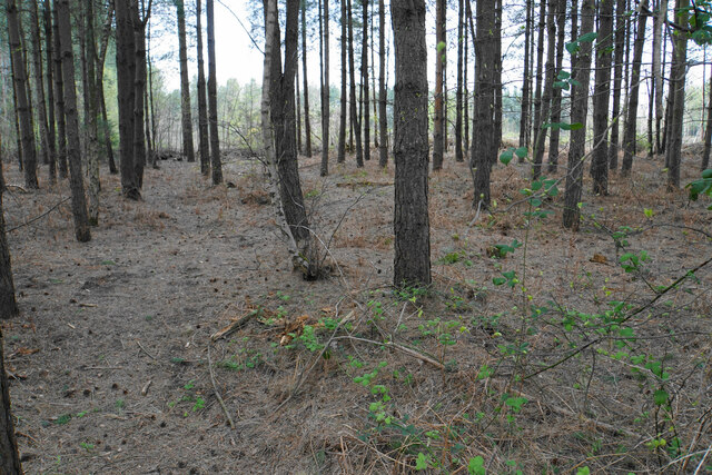
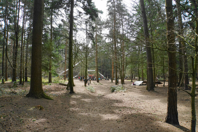
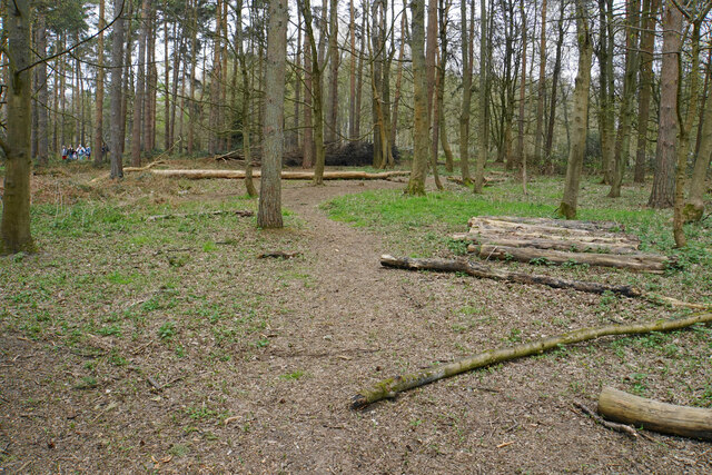
The woodland is characterized by a diverse range of tree species, including oak, beech, pine, and birch, which create a dense and lush canopy. The forest floor is adorned with an array of wildflowers, ferns, and mosses, further enhancing the enchanting atmosphere. The Elvedon Road Belt is home to numerous wildlife species, such as deer, rabbits, squirrels, and a variety of bird species, making it a haven for nature enthusiasts and birdwatchers.

The history of the area dates back centuries, with evidence of human activity from the Neolithic period. The woodlands have been used for timber production, hunting, and recreational purposes throughout the years. Elvedon Road Belt also played a significant role during World War II, serving as a training ground for British and American troops.

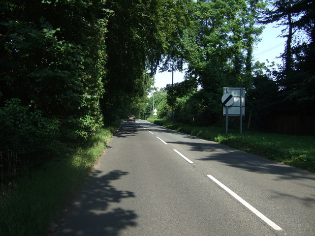
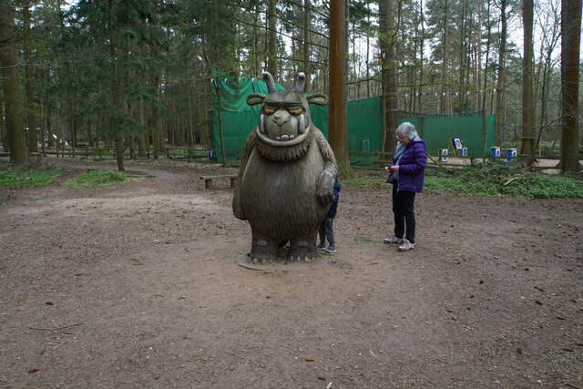
Today, the woodlands are managed by the Forestry Commission, ensuring the preservation of its natural charm and providing opportunities for visitors to explore and enjoy the area. There are well-maintained walking trails that meander through the forest, allowing visitors to immerse themselves in the tranquility of nature. Additionally, there are designated picnic areas and viewpoints offering breathtaking vistas of the surrounding countryside.

Elvedon Road Belt, Suffolk, is an idyllic woodland destination that combines natural beauty with a rich historical heritage, making it an ideal place for anyone seeking a peaceful retreat or an opportunity to connect with nature.

If you have any feedback on the listing, please let us know in the comments section below.

Elvedon Road Belt Images

Images are sourced within 2km of 52.438241/0.6673631 or Grid Reference TL8185. Thanks to Geograph Open Source API. All images are credited.

Nightingale Road, Brandon
Green Road at the junction of Blackbird Avenue
Blackbird Avenue, Brandon
Track junction on Session Heath This area of Thetford Forest in the Brecks is open access.
Track junction on Session Heath
This area of Thetford Forest in the Brecks is open access.
Cycle path in Session Heath, Brandon
On the edge of Ling Heath, Brandon
Crater of neolithic flint mine on the edge of Ling Heath, Brandon The flint mines in the area were a major industrial development several thousand years ago, ranging from the manufacture of flint axes that were exported all over southern England to the making of gun flints in more recent times. The first large army order (for 100,000 musket flints) was received by Brandon flintknapper Philip Hayward in 1790.  Before the Battle of Waterloo in 1815 all the gunflints used by the British Army came from Brandon.
Crater of neolithic flint mine on the edge of Ling Heath, Brandon
The flint mines in the area were a major industrial development several thousand years ago, ranging from the manufacture of flint axes that were exported all over southern England to the making of gun flints in more recent times. The first large army order (for 100,000 musket flints) was received by Brandon flintknapper Philip Hayward in 1790. Before the Battle of Waterloo in 1815 all the gunflints used by the British Army came from Brandon.
Thetford Road, Brandon meeting the A1107
Path to the river
Path to the river
Thetford Road Minor road off the B1107 heading east towards Santon Downham.
Thetford Road
Minor road off the B1107 heading east towards Santon Downham.
B1107 heading east Towards Thetford.
B1107 heading east
Towards Thetford.
Trees in Thetford Forest These are near High Lodge, but a similar view extends over a wide area.
Trees in Thetford Forest
These are near High Lodge, but a similar view extends over a wide area.
Forest activities at High Lodge The Forestry Commission runs a site with numerous forest activities such as zip wires and aerial walkways.
Forest activities at High Lodge
The Forestry Commission runs a site with numerous forest activities such as zip wires and aerial walkways.
Forest slides at High Lodge Tube slides are one of the forest activities here.
Forest slides at High Lodge
Tube slides are one of the forest activities here.
A few abandoned logs There are not enough logs to suggest any commercial activity. This part of the forest is used by numerous trails from High Lodge.
A few abandoned logs
There are not enough logs to suggest any commercial activity. This part of the forest is used by numerous trails from High Lodge.
The mouse in the deep dark wood One of the Gruffalo sculptures at High Lodge.
The mouse in the deep dark wood
One of the Gruffalo sculptures at High Lodge.
Part of the Superworm trail A small walking trail in Thetford Forest designed for small children.
Part of the Superworm trail
A small walking trail in Thetford Forest designed for small children.
The Gruffalo Making an appearance at High Lodge as a wooden sculpture.
The Gruffalo
Making an appearance at High Lodge as a wooden sculpture.
Show me another place!

Elvedon Road Belt is located at Grid Ref: TL8185 (Lat: 52.438241, Lng: 0.6673631)

Administrative County: Suffolk

District: West Suffolk

Police Authority: Suffolk

What 3 Words

///charmingly.intro.smuggled. Near Weeting, Norfolk

Related Wikis

Santon Downham

Santon Downham is a village and civil parish in the West Suffolk district of Suffolk in eastern England. In 2005 it had a population of 240. The village...

Santon, Norfolk

Santon is a depopulated village located near Santon Downham in Norfolk, England. Moated earthworks and other remains of the medieval village are a scheduled...

Thetford Forest

Thetford Forest is the largest lowland pine forest in Britain and is located in a region straddling the north of Suffolk and the south of Norfolk in England...

Brandon Country Park

Brandon Country Park is a country park in Brandon, Suffolk, England. == History == In 1820 Edward Bliss bought Brandon Park house and grounds using wealth...

Brandon, Suffolk

Brandon is a town and civil parish in the English county of Suffolk. Brandon is located in the Breckland area of Suffolk, close to the adjoining county...

St Helen's Church, Santon

St Helen's Church was a church located near Santon, Norfolk, England. Its site is a scheduled monument. It was no longer in existence by 1368.The church...

Brandon railway station

Brandon railway station is on the Breckland Line in the East of England, serving the town of Brandon, Suffolk, although the station is actually situated...

Thetford Golf Course and Marsh

Thetford Golf Course and Marsh is a 122.3-hectare (302-acre) biological Site of Special Scientific Interest on the western outskirts of Thetford in Norfolk...

Nearby Amenities

Located within 500m of 52.438241,0.6673631
Barrier: bar
Motor Vehicle: no
Lat/Long: 52.4358223/0.6629473
Bicycle Rental
Bike Art
Addr City: Brandon
Addr Place: High Lodge
Addr Postcode: IP27 0AF
Addr Village: Santon Downham
Url: http://bikeartthetford.co.uk/
Lat/Long: 52.4346111/0.6631772
Power: pole
Lat/Long: 52.4406287/0.670148
Power: pole
Lat/Long: 52.4401277/0.6733677
Barrier: lift_gate
Lat/Long: 52.4351182/0.6654922
Barrier: lift_gate
Lat/Long: 52.4351616/0.66552
Answer: A
Marker: post
Orienteering: marker
Ref: 1
Sport: orienteering
Lat/Long: 52.4366139/0.6647478
Orienteering / Nature Trail
Information: board
Tourism: information
Lat/Long: 52.4355752/0.6644846
Parking
Access: no
Coach: yes
Lat/Long: 52.4359743/0.6621564
Answer: F
Marker: post
Orienteering: marker
Ref: 4
Sport: orienteering
Lat/Long: 52.4407217/0.6650795
Answer: J
Marker: post
Orienteering: marker
Ref: 8
Sport: orienteering
Lat/Long: 52.4368921/0.6610988
Barrier: swing_gate
Lat/Long: 52.4364835/0.6606757
Generator Location: roof
Generator Method: photovoltaic
Generator Orientation: 195
Generator Output Electricity: yes
Generator Solar Modules: 28
Generator Source: solar
Generator Type: solar_photovoltaic_panel
Power: generator
Lat/Long: 52.4345967/0.6631286
Answer: G
Marker: post
Orienteering: marker
Ref: 7
Sport: orienteering
Lat/Long: 52.4360015/0.667288
Answer: D
Marker: post
Orienteering: marker
Ref: 6
Sport: orienteering
Lat/Long: 52.4368052/0.6685272
10 Traquil Trees
Information: board
Tourism: information
Lat/Long: 52.4373751/0.6687499
9 Working Wonders
Information: board
Tourism: information
Lat/Long: 52.4373416/0.6697798
Leisure: picnic_table
Lat/Long: 52.4371928/0.6698348
8 Meadow Madness
Information: board
Tourism: information
Lat/Long: 52.4371265/0.6709767
6 Brilliant Birds
Information: board
Tourism: information
Lat/Long: 52.4370285/0.6715763
5 Luscious Layers
Information: board
Tourism: information
Lat/Long: 52.4364716/0.6698978
4 Delightful Deer
Information: board
Tourism: information
Lat/Long: 52.436116/0.6685701
3 Tremendous Trees
Information: board
Tourism: information
Lat/Long: 52.4360751/0.6673819
2 Magnifying Minibeasts
Information: board
Tourism: information
Lat/Long: 52.4358658/0.6660046
1 Munching Mammals
Information: board
Tourism: information
Lat/Long: 52.4355952/0.6650376
Entrance: main
Lat/Long: 52.4370228/0.6715734
Entrance: yes
Lat/Long: 52.4345818/0.6631582
Power: pole
Lat/Long: 52.4413689/0.6636553
Bbq
BBQ 5
Lat/Long: 52.435551/0.6627215
Bbq
BBQ 6
Lat/Long: 52.4354153/0.6629589
Bbq
BBQ 8
Lat/Long: 52.4352722/0.6628382
Bbq
BBQ 7
Lat/Long: 52.4352624/0.6625606
7 Look out, Listen up
Information: board
Note: Inside bird hide
Tourism: information
Lat/Long: 52.4370179/0.6715978
High Lodge Disc Golf
Leisure: disc_golf_course
Sport: disc_golf
Website: https://www.forestryengland.uk/high-lodge/disc-golf-high-lodge
Lat/Long: 52.4358339/0.6632905
Disc Golf: basket
Sport: disc_golf
Lat/Long: 52.4358016/0.6631289
Disc Golf: tee
Sport: disc_golf
Lat/Long: 52.4357441/0.6633474
The data included in this document is from www.openstreetmap.org. The data is made available under ODbL.

Have you been to Elvedon Road Belt?

Leave your review of Elvedon Road Belt below (or comments, questions and feedback).