Fishersgate

Settlement in Sussex Adur

England

Fishersgate

Shoreham Power Station A 420MW gas powered Power Station completed in 2000, on the site of the old Brighton 'B' coal fired Power Station, seen here from the entrance lock into Shoreham Harbour.
Shoreham Power Station Credit: Ian Capper

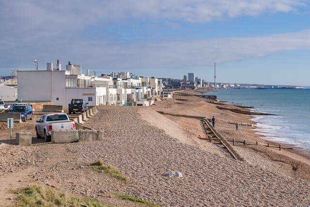
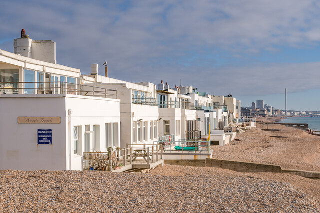
Fishersgate is a small coastal village located in Sussex, England. It is situated near the larger town of Portslade and lies between Brighton and Shoreham-by-Sea. The village is primarily residential, with a mix of housing ranging from traditional cottages to modern developments.

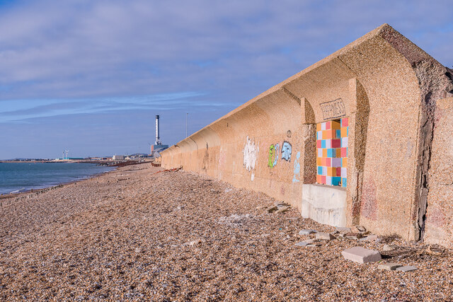
Fishersgate is known for its picturesque coastal views and proximity to the beach, making it a popular destination for tourists and locals alike. The village also boasts a small but thriving community, with a handful of shops, pubs, and restaurants serving the local population.

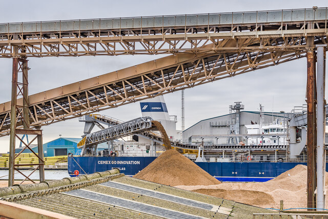
One of the main attractions in Fishersgate is the nearby Shoreham Port, which serves as a hub for commercial shipping and leisure activities. Visitors can enjoy watching the boats come and go, or take a stroll along the waterfront promenade.

Overall, Fishersgate offers a peaceful and charming atmosphere, perfect for those seeking a quiet retreat by the sea. Its convenient location and natural beauty make it a desirable place to live or visit in Sussex.

If you have any feedback on the listing, please let us know in the comments section below.

Fishersgate Images

Images are sourced within 2km of 50.832036/-0.223098 or Grid Reference TQ2505. Thanks to Geograph Open Source API. All images are credited.

Shoreham Power Station A 420MW gas powered Power Station completed in 2000, on the site of the old Brighton 'B' coal fired Power Station, seen here from the entrance lock into Shoreham Harbour.
Shoreham Power Station
A 420MW gas powered Power Station completed in 2000, on the site of the old Brighton 'B' coal fired Power Station, seen here from the entrance lock into Shoreham Harbour.
City of Chichester A hopper dredger built in 1997, seen here about to enter Shoreham Harbour for unloading.
City of Chichester
A hopper dredger built in 1997, seen here about to enter Shoreham Harbour for unloading.
Southwick Beach Looking along Southwick Beach towards the East Breakwater at the entrance to Shoreham Harbour.
Southwick Beach
Looking along Southwick Beach towards the East Breakwater at the entrance to Shoreham Harbour.
Southwick Beach Looking along the promenade above Southwick Beach towards the East Breakwater at the entrance to Shoreham Harbour.  On the right are warehouses fronting Shoreham Harbour.
Southwick Beach
Looking along the promenade above Southwick Beach towards the East Breakwater at the entrance to Shoreham Harbour. On the right are warehouses fronting Shoreham Harbour.
Wind turbines A pair of 100kW wind turbines on the promenade above Southwick Beach with the East Breakwater at the entrance to Shoreham Harbour in the background.  Notices on the fence by the turbines state that they have been nicknamed "Spinny" (nearest) and "Gusty" (beyond) following a competition among local schoolchildren after they were installed in 2016.
Wind turbines
A pair of 100kW wind turbines on the promenade above Southwick Beach with the East Breakwater at the entrance to Shoreham Harbour in the background. Notices on the fence by the turbines state that they have been nicknamed "Spinny" (nearest) and "Gusty" (beyond) following a competition among local schoolchildren after they were installed in 2016.
Southwick Beach Looking along Southwick Beach with the two wind turbines providing power to Shoreham Harbour in the right background and the East Breakwater at the entrance to the harbour beyond.
Southwick Beach
Looking along Southwick Beach with the two wind turbines providing power to Shoreham Harbour in the right background and the East Breakwater at the entrance to the harbour beyond.
Shoreham Power Station A 420MW gas powered Power Station completed in 2000, on the site of the old Brighton 'B' coal fired Power Station, seen here from Basin Road South.
Shoreham Power Station
A 420MW gas powered Power Station completed in 2000, on the site of the old Brighton 'B' coal fired Power Station, seen here from Basin Road South.
Shoreham Power Station outfall The outfall from Shoreham Power Station, seen here largely submerged at high tide.  In the far distance are wind turbines in the Rampion Offshore Wind Farm.
Shoreham Power Station outfall
The outfall from Shoreham Power Station, seen here largely submerged at high tide. In the far distance are wind turbines in the Rampion Offshore Wind Farm.
Sea wall Sea wall on the beach at Portslade-by-Sea, protecting Basin Road South and the warehouses beyond on Shoreham Harbour.  For a close up if the artwork on the right, see <a href="https://www.geograph.org.uk/photo/7077545">TQ2604 : Happiness</a>.  In the background is Shoreham Power Station.
Sea wall
Sea wall on the beach at Portslade-by-Sea, protecting Basin Road South and the warehouses beyond on Shoreham Harbour. For a close up if the artwork on the right, see TQ2604 : Happiness. In the background is Shoreham Power Station.
Happiness Artwork on the sea wall on the beach at Portslade-by-Sea (see <a href="https://www.geograph.org.uk/photo/7077537">TQ2604 : Sea wall</a>).
Happiness
Artwork on the sea wall on the beach at Portslade-by-Sea (see TQ2604 : Sea wall).
Western Esplanade Row of 12 houses (originally 11) with private beach on Western Esplanade, dubbed "Millionaire's Row" for the number of celebrities that have owned properties here over the years.  Initially called Aldrington Beach Bungalows, later Seaside Bungalows, and by the 1920s Hove Seaside Villas, they were built in 1908-10 with the architect being E J Holland.  In the distance is Brighton with the i360 tower prominent.
Western Esplanade
Row of 12 houses (originally 11) with private beach on Western Esplanade, dubbed "Millionaire's Row" for the number of celebrities that have owned properties here over the years. Initially called Aldrington Beach Bungalows, later Seaside Bungalows, and by the 1920s Hove Seaside Villas, they were built in 1908-10 with the architect being E J Holland. In the distance is Brighton with the i360 tower prominent.
Cemex Go Innovation A hopper dredger built in 2020, seen here unloading at Cemex's wharf in Shoreham Harbour.
Cemex Go Innovation
A hopper dredger built in 2020, seen here unloading at Cemex's wharf in Shoreham Harbour.
The Green Looking across the cricket square on The Green.
The Green
Looking across the cricket square on The Green.
The Green Looking across the cricket square on The Green.  The road leading away in the background is Albert Road.
The Green
Looking across the cricket square on The Green. The road leading away in the background is Albert Road.
War Memorial War memorial dating from 1922 to commemorate those from Southwick and Fishersgate who died in the First World War.  Grade II listed - see <span class="nowrap"><a title="https://historicengland.org.uk/listing/the-list/list-entry/1389099?section=official-listing" rel="nofollow ugc noopener" href="https://historicengland.org.uk/listing/the-list/list-entry/1389099?section=official-listing">Link</a><img style="margin-left:2px;" alt="External link" title="External link - shift click to open in new window" src="https://s1.geograph.org.uk/img/external.png" width="10" height="10"/></span>.
War Memorial
War memorial dating from 1922 to commemorate those from Southwick and Fishersgate who died in the First World War. Grade II listed - see LinkExternal link.
Coates Court Housing on Butts Road, facing on to Albion Street, part of the redevelopment of this area in the c.1960s.
Coates Court
Housing on Butts Road, facing on to Albion Street, part of the redevelopment of this area in the c.1960s.
Shoreham Harbour Offices of aggregates group Dudman alongside Shoreham Harbour.
Shoreham Harbour
Offices of aggregates group Dudman alongside Shoreham Harbour.
Show me another place!

Fishersgate is located at Grid Ref: TQ2505 (Lat: 50.832036, Lng: -0.223098)

Administrative County: West Sussex

District: Adur

Police Authority: Sussex

What 3 Words

///push.likely.filed. Near Portslade, East Sussex

Nearby Locations

Fishersgate Southern Cross

Related Wikis

Southwick F.C.

Southwick Football Club was a football club based in Southwick, West Sussex, England. The club was founded in 1882 and was among the founding members of...

Fishersgate railway station

Fishersgate railway station is a railway station in West Sussex, England, serving both the eastern part of Southwick, as well as the western part of Portslade...

Shoreham Power Station

Shoreham Power Station is a 420MWe combined cycle gas-fired power station in Southwick, West Sussex. It was built on the site of the Brighton B Power Station...

Shri Swaminarayan Mandir, Brighton

Shri Swaminarayan Mandir, Brighton is a Swaminarayan Hindu Temple located in the Portslade area of the city of Brighton and Hove, on the south east coast...

Nearby Amenities

Located within 500m of 50.832036,-0.223098
Source: Landsat photo
Lat/Long: 50.8334626/-0.2278801
Mini Roundabout
Direction: clockwise
Lat/Long: 50.8334858/-0.2219558
Fishersgate
Naptan AtcoCode: 9100FSHRSGT
Network: National Rail
Network Website: https://www.nationalrail.co.uk/stations/fsg/
Network Wikidata: Q26334
Note: might only be a halt, needs checking
Operator: Southern
Public Transport: station
Railway: station
Ref Crs: FSG
Train: yes
Wikidata: Q2193586
Wikipedia: en:Fishersgate railway station
Lat/Long: 50.8343013/-0.2195601
Power: tower
Lat/Long: 50.8349923/-0.2210998
Traffic Signals
Lat/Long: 50.8317877/-0.2251955
Traffic Signals
Lat/Long: 50.8317083/-0.2260849
Bus Stop
Old Barn Way
Naptan AtcoCode: 4400AD0265
Naptan Bearing: E
Naptan CommonName: Manor Hall Road Post Office
Naptan Indicator: o/s 159
Naptan Landmark: Old Barn Way
Naptan NaptanCode: wsxadtdw
Naptan PlusbusZoneRef: BRGHTN
Naptan Street: Manor Hall Road
Naptan Verified: no
Public Transport: platform
Source: naptan_import
Lat/Long: 50.8357714/-0.2239621
Bus Stop
Old Barn Way
Naptan AtcoCode: 4400AD0266
Naptan Bearing: W
Naptan CommonName: Manor Hall Road Post Office
Naptan Indicator: opp Post Office
Naptan Landmark: Old Barn Way
Naptan NaptanCode: wsxadtga
Naptan PlusbusZoneRef: BRGHTN
Naptan Street: Manor Hall Road
Naptan Verified: no
Public Transport: platform
Source: naptan_import
Lat/Long: 50.8356418/-0.2238255
Bus Stop
Fishersgate Station
Bus: yes
Naptan AtcoCode: 4400AD0267
Naptan Bearing: W
Naptan CommonName: Fishersgate Station
Naptan Indicator: o/s202
Naptan Landmark: Manor Close
Naptan NaptanCode: wsxadtgd
Naptan PlusbusZoneRef: BRGHTN
Naptan Street: Manor Hall Road
Naptan Verified: no
Public Transport: platform
Source: naptan_import
Lat/Long: 50.8355376/-0.2202319
Bus Stop
Fishersgate Station
Bus: yes
Naptan AtcoCode: 4400AD0268
Naptan Bearing: E
Naptan CommonName: Fishersgate Station
Naptan Indicator: o/s 219
Naptan Landmark: Manor Close
Naptan NaptanCode: wsxadtgj
Naptan PlusbusZoneRef: BRGHTN
Naptan Street: Manor Hall Road
Naptan Verified: no
Public Transport: platform
Source: naptan_import
Lat/Long: 50.8356366/-0.2201551
Bus Stop
The Gardens
Naptan AtcoCode: 4400AD0333
Naptan Bearing: W
Naptan CommonName: The Gardens
Naptan Indicator: opp No.19
Naptan Landmark: The Gardens
Naptan NaptanCode: wsxadwmp
Naptan PlusbusZoneRef: BRGHTN
Naptan Street: Albion Street A259
Naptan Verified: no
Public Transport: platform
Source: naptan_import
Lat/Long: 50.831512/-0.2270268
Bus Stop
The Gardens
Naptan AtcoCode: 4400AD0334
Naptan Bearing: E
Naptan CommonName: The Gardens
Naptan Indicator: Adj The Gardens
Naptan Landmark: The Gardens
Naptan NaptanCode: wsxadwmt
Naptan PlusbusZoneRef: BRGHTN
Naptan Street: Albion Street A259
Naptan Verified: no
Source: naptan_import
Lat/Long: 50.8317039/-0.2266361
Bus Stop
The Albion PH
Bench: yes
Bin: no
Bus: yes
Naptan AtcoCode: 4400AD0335
Naptan Bearing: W
Naptan CommonName: The Albion PH
Naptan Indicator: opp The Albion Pub
Naptan Landmark: The Albion PH
Naptan NaptanCode: wsxadwmw
Naptan PlusbusZoneRef: BRGHTN
Naptan Street: Albion Street A259
Naptan Verified: no
Public Transport: platform
Shelter: yes
Source: naptan_import
Tactile Paving: no
Lat/Long: 50.8316896/-0.2221491
Bus Stop
The Albion
Bench: yes
Bin: no
Bus: yes
Naptan AtcoCode: 4400AD0336
Naptan Bearing: E
Naptan BusStopType: CUS
Naptan CommonName: The Albion
Naptan Indicator: Adj West Rd
Naptan Landmark: The Albion PH
Naptan NaptanCode: wsxadwpa
Naptan PlusbusZoneRef: BRGHTN
Naptan Street: Albion Street A259
Naptan Verified: no
Public Transport: platform
Shelter: yes
Source: naptan_import
Tactile Paving: no
Lat/Long: 50.8317464/-0.2217493
Bus Stop
Kings Head
Bench: no
Bus: yes
Naptan AtcoCode: 4400AD0337
Naptan Bearing: W
Naptan CommonName: Kings Head
Naptan Indicator: Opp Williams Road
Naptan Landmark: Mill Road
Naptan NaptanCode: wsxadwpd
Naptan PlusbusZoneRef: BRGHTN
Naptan Street: Fishergate Terrace
Naptan Verified: no
Public Transport: platform
Shelter: no
Source: naptan_import
Tactile Paving: no
Lat/Long: 50.8310887/-0.2187211
Bus Stop
Kings Head
Bus: yes
Naptan AtcoCode: 4400AD0338
Naptan Bearing: E
Naptan CommonName: Kings Head
Naptan Indicator: opp King's Head
Naptan Landmark: Mill Road
Naptan NaptanCode: wsxadwpg
Naptan PlusbusZoneRef: BRGHTN
Naptan Street: Fishergate Terrace
Naptan Verified: no
Public Transport: platform
Shelter: no
Source: naptan_import
Lat/Long: 50.8310967/-0.2180675
Bus Stop
St Aubins Crescent
Bus: yes
Naptan AtcoCode: 4400AD0339
Naptan Bearing: E
Naptan CommonName: St Aubins Crescent
Naptan Indicator: outside No. 27
Naptan Landmark: St Aubins Crescent
Naptan NaptanCode: wsxadwpj
Naptan PlusbusZoneRef: BRGHTN
Naptan Street: Eastbrook Road
Naptan Verified: no
Public Transport: platform
Source: naptan_import
Lat/Long: 50.8330643/-0.2179358
Bus Stop
Gardner Road
Bus: yes
Naptan AtcoCode: 4400AD0340
Naptan Bearing: S
Naptan CommonName: Gardner Road
Naptan Indicator: outside Technology House
Naptan Landmark: Gardner Road
Naptan NaptanCode: wsxadwpm
Naptan PlusbusZoneRef: BRGHTN
Naptan Street: West Road
Naptan Verified: no
Public Transport: platform
Source: naptan_import
Lat/Long: 50.833187/-0.2218507
Bus Stop
Fishersgate Station
Alt Name: St Aubyns Crescent
Bus: yes
Naptan AltCommonName: St Aubyns Crescent
Naptan AltStreet: Not Specified
Naptan AtcoCode: 4400AD0341
Naptan Bearing: W
Naptan CommonName: Fishersgate Station
Naptan Indicator: o/s 31
Naptan Landmark: outside No.31
Naptan NaptanCode: wsxadwpt
Naptan PlusbusZoneRef: BRGHTN
Naptan Street: Gardner Road
Naptan Verified: no
Public Transport: platform
Source: naptan_import
Lat/Long: 50.8337197/-0.2196292
Portslade
Natural: beach
Nudism: permissive
Url: http://www.naturistholiday.info/UK/1974/Portslade.aspx
Lat/Long: 50.8281073/-0.2222487
Colemans Quality Foods Home Meals
Addr City: Fishersgate
Addr Street: Laylands Road
Craft: caterer
Source: survey
Lat/Long: 50.832908/-0.2211907
Laylands News
Description: The full name of this convenience store is "Laylands Fruit & Vegetable & Off Licence Laylands News".
Note: The aisles in this shop are narrow.
Pay Point: yes
Payment Credit Cards: £2 minimum spend.
Shop: convenience
Source: survey
Lat/Long: 50.8328152/-0.2211886
Post Box
Collection Plate: CP1D
Collection Times: Mo-Fr 09:00; Sa 07:00
Last Checked: 2020-10-05
Operator: Royal Mail
Operator Wikidata: Q638098
Post Box Type: wall
Ref: BN41 670D
Royal Cypher: EIIR
Royal Cypher Wikidata: Q33102113
Source: survey
Lat/Long: 50.8327542/-0.22121
Vending Machine
Vending: public_transport_tickets
Lat/Long: 50.8344118/-0.2191194
Bicycle Parking
Capacity: 10
Lat/Long: 50.8345269/-0.218884
Parking
Layer: -1
Parking: underground
Lat/Long: 50.8320091/-0.2249527
Post Box
Brand: Royal Mail
Brand Wikidata: Q638098
Collection Plate: CP1D
Collection Times: Mo-Fr 09:00; Sa 07:00
Last Checked: 2020-10-05
Operator: Royal Mail
Operator Wikidata: Q638098
Post Box Type: pillar
Ref: BN42 675D
Royal Cypher: GR
Royal Cypher Wikidata: Q33102273
Source: survey
Lat/Long: 50.8354745/-0.2239444
Waste Basket
Colour: red
Covered: yes
Source: survey
Waste: dog_excrement
Lat/Long: 50.8357131/-0.2241592
Bench
Backrest: yes
Colour: brown
Material: wood
Source: survey
Lat/Long: 50.8356367/-0.223863
Post Box
Collection Plate: CP1D
Collection Times: Mo-Fr 09:00; Sa 07:00
Last Checked: 2020-10-05
Operator: Royal Mail
Operator Wikidata: Q638098
Post Box Type: wall
Ref: BN41 671D
Royal Cypher: GR
Royal Cypher Wikidata: Q33102273
Source: survey
Lat/Long: 50.8338133/-0.2185935
Telephone
Booth: KX100
Covered: booth
Operator: BT
Operator Wikidata: Q593786
Payment Coins: yes
Source: survey
Lat/Long: 50.8330822/-0.2220645
Waste Basket
Ashtray: no
Colour: black
Covered: yes
Operator: Adur & Worthing Waste Services
Source: survey
Lat/Long: 50.8329142/-0.2220377
Second Chance The Lighthouse Community Church
Addr City: Fishersgate
Addr Street: Laylands Road
Opening Hours: 10:00-13:00
Shop: charity
Source: survey
Lat/Long: 50.8328655/-0.2211933
Waste Basket
Ashtray: no
Colour: black
Covered: yes
Material: plastic
Operator: Adur & Worthing Waste Services
Source: survey
Lat/Long: 50.8329797/-0.2211846
Waste Basket
Ashtray: no
Colour: black
Material: plastic
Operator: Adur & Worthing Council Services
Source: survey
Lat/Long: 50.8317518/-0.2216217
Pub
Albion Inn
Addr City: Fishersgate
Source: survey
Lat/Long: 50.83185/-0.221886
Atm
Brand: Cashzone
Brand Wikidata: Q110738461
Fee: £0.99 for debit card withdrawals
Indoor: no
Network: Allpoint
Network Wikidata: Q4733264
Operator: Cash Zone
Source: survey
Lat/Long: 50.8318916/-0.2260117
Parcel Locker
Amazon Locker
Brand: Amazon Locker
Brand Wikidata: Q16974764
Brand Wikipedia: en:Amazon Locker
Description: Inside Adur Express Convenience Store on the left hand side of the store.
Indoor: yes
Source: survey
Lat/Long: 50.8319732/-0.2260661
Post Box
Brand: Royal Mail
Brand Wikidata: Q638098
Collection Plate: CP7D
Collection Times: Mo-Fr 09:00; Sa 07:00
Last Checked: 2020-10-05
Note: This postbox is of a brand new EIIR lamp design.
Operator: Royal Mail
Operator Wikidata: Q638098
Post Box Type: lamp
Ref: BN42 688D
Royal Cypher: EIIR
Royal Cypher Wikidata: Q33102113
Source: survey
Lat/Long: 50.8319073/-0.2263989
Fishersgate
Public Transport: stop_position
Railway: stop
Train: yes
Lat/Long: 50.8342273/-0.220052
Fishersgate
Public Transport: stop_position
Railway: stop
Train: yes
Lat/Long: 50.8343624/-0.2190216
Crossing
Crossing: traffic_signals
Lat/Long: 50.8318476/-0.2252069
Crossing
Crossing: traffic_signals
Lat/Long: 50.8317787/-0.2261035
The data included in this document is from www.openstreetmap.org. The data is made available under ODbL.

Have you been to Fishersgate?

Leave your review of Fishersgate below (or comments, questions and feedback).