Southern Cross

Settlement in Sussex

England

Southern Cross

Shoreham Power Station A 420MW gas powered Power Station completed in 2000, on the site of the old Brighton 'B' coal fired Power Station, seen here from the entrance lock into Shoreham Harbour.
Shoreham Power Station Credit: Ian Capper

Southern Cross is a small village located in the county of Sussex, England. It is situated in a rural area, surrounded by rolling hills and lush green countryside. The village is known for its quaint and picturesque charm, with traditional cottages and historic buildings lining the streets.

Southern Cross is home to a close-knit community of residents who take pride in their village and its heritage. The village has a local pub, church, and primary school, providing essential amenities for its inhabitants.

The surrounding area offers plenty of opportunities for outdoor activities, such as hiking, cycling, and horseback riding. The nearby South Downs National Park is a popular destination for nature lovers and outdoor enthusiasts.

Overall, Southern Cross is a peaceful and idyllic village that offers a tranquil escape from the hustle and bustle of city life. Its charming atmosphere and natural beauty make it a desirable place to live for those seeking a slower pace of life in the English countryside.

If you have any feedback on the listing, please let us know in the comments section below.

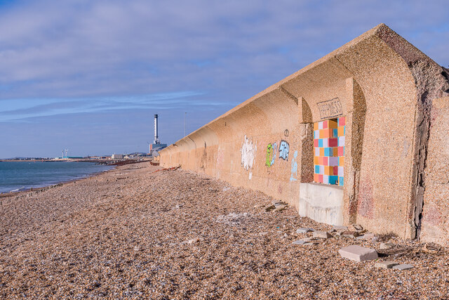
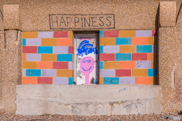
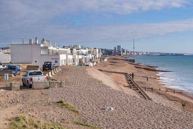
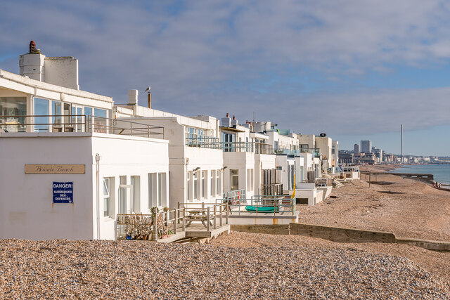
Southern Cross Images

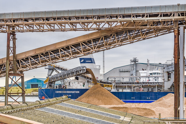
Images are sourced within 2km of 50.838079/-0.21419 or Grid Reference TQ2505. Thanks to Geograph Open Source API. All images are credited.

Shoreham Power Station A 420MW gas powered Power Station completed in 2000, on the site of the old Brighton 'B' coal fired Power Station, seen here from the entrance lock into Shoreham Harbour.
Shoreham Power Station
A 420MW gas powered Power Station completed in 2000, on the site of the old Brighton 'B' coal fired Power Station, seen here from the entrance lock into Shoreham Harbour.
City of Chichester A hopper dredger built in 1997, seen here about to enter Shoreham Harbour for unloading.
City of Chichester
A hopper dredger built in 1997, seen here about to enter Shoreham Harbour for unloading.
Southwick Beach Looking along Southwick Beach with the two wind turbines providing power to Shoreham Harbour in the right background and the East Breakwater at the entrance to the harbour beyond.
Southwick Beach
Looking along Southwick Beach with the two wind turbines providing power to Shoreham Harbour in the right background and the East Breakwater at the entrance to the harbour beyond.
Shoreham Power Station A 420MW gas powered Power Station completed in 2000, on the site of the old Brighton 'B' coal fired Power Station, seen here from Basin Road South.
Shoreham Power Station
A 420MW gas powered Power Station completed in 2000, on the site of the old Brighton 'B' coal fired Power Station, seen here from Basin Road South.
Shoreham Power Station outfall The outfall from Shoreham Power Station, seen here largely submerged at high tide.  In the far distance are wind turbines in the Rampion Offshore Wind Farm.
Shoreham Power Station outfall
The outfall from Shoreham Power Station, seen here largely submerged at high tide. In the far distance are wind turbines in the Rampion Offshore Wind Farm.
Sea wall Sea wall on the beach at Portslade-by-Sea, protecting Basin Road South and the warehouses beyond on Shoreham Harbour.  For a close up if the artwork on the right, see <a href="https://www.geograph.org.uk/photo/7077545">TQ2604 : Happiness</a>.  In the background is Shoreham Power Station.
Sea wall
Sea wall on the beach at Portslade-by-Sea, protecting Basin Road South and the warehouses beyond on Shoreham Harbour. For a close up if the artwork on the right, see TQ2604 : Happiness. In the background is Shoreham Power Station.
Happiness Artwork on the sea wall on the beach at Portslade-by-Sea (see <a href="https://www.geograph.org.uk/photo/7077537">TQ2604 : Sea wall</a>).
Happiness
Artwork on the sea wall on the beach at Portslade-by-Sea (see TQ2604 : Sea wall).
Western Esplanade Row of 12 houses (originally 11) with private beach on Western Esplanade, dubbed "Millionaire's Row" for the number of celebrities that have owned properties here over the years.  Initially called Aldrington Beach Bungalows, later Seaside Bungalows, and by the 1920s Hove Seaside Villas, they were built in 1908-10 with the architect being E J Holland.  In the distance is Brighton with the i360 tower prominent.
Western Esplanade
Row of 12 houses (originally 11) with private beach on Western Esplanade, dubbed "Millionaire's Row" for the number of celebrities that have owned properties here over the years. Initially called Aldrington Beach Bungalows, later Seaside Bungalows, and by the 1920s Hove Seaside Villas, they were built in 1908-10 with the architect being E J Holland. In the distance is Brighton with the i360 tower prominent.
Cemex Go Innovation A hopper dredger built in 2020, seen here unloading at Cemex's wharf in Shoreham Harbour.
Cemex Go Innovation
A hopper dredger built in 2020, seen here unloading at Cemex's wharf in Shoreham Harbour.
The Green Looking across the cricket square on The Green.
The Green
Looking across the cricket square on The Green.
The Green Looking across the cricket square on The Green.  The road leading away in the background is Albert Road.
The Green
Looking across the cricket square on The Green. The road leading away in the background is Albert Road.
War Memorial War memorial dating from 1922 to commemorate those from Southwick and Fishersgate who died in the First World War.  Grade II listed - see <span class="nowrap"><a title="https://historicengland.org.uk/listing/the-list/list-entry/1389099?section=official-listing" rel="nofollow ugc noopener" href="https://historicengland.org.uk/listing/the-list/list-entry/1389099?section=official-listing">Link</a><img style="margin-left:2px;" alt="External link" title="External link - shift click to open in new window" src="https://s1.geograph.org.uk/img/external.png" width="10" height="10"/></span>.
War Memorial
War memorial dating from 1922 to commemorate those from Southwick and Fishersgate who died in the First World War. Grade II listed - see LinkExternal link.
Coates Court Housing on Butts Road, facing on to Albion Street, part of the redevelopment of this area in the c.1960s.
Coates Court
Housing on Butts Road, facing on to Albion Street, part of the redevelopment of this area in the c.1960s.
Shoreham Harbour Offices of aggregates group Dudman alongside Shoreham Harbour.
Shoreham Harbour
Offices of aggregates group Dudman alongside Shoreham Harbour.
Shoreham Harbour Wharf on Shoreham Harbour, operated by the aggregates group Dudman.
Shoreham Harbour
Wharf on Shoreham Harbour, operated by the aggregates group Dudman.
Footpath Footpath connecting Albion Street with Basin Road South and Southwick Beach, utilising the lock across Shoreham Harbour.
Footpath
Footpath connecting Albion Street with Basin Road South and Southwick Beach, utilising the lock across Shoreham Harbour.
Southwick Marina Looking from the lock across Shoreham Harbour towards the marina on the north side of the harbour.
Southwick Marina
Looking from the lock across Shoreham Harbour towards the marina on the north side of the harbour.
Show me another place!

Southern Cross is located at Grid Ref: TQ2505 (Lat: 50.838079, Lng: -0.21419)

Unitary Authority: Brighton and Hove

Police Authority: Sussex

What 3 Words

///fork.buzz.marked. Near Portslade, East Sussex

Nearby Locations

Fishersgate Southern Cross

Related Wikis

Shri Swaminarayan Mandir, Brighton

Shri Swaminarayan Mandir, Brighton is a Swaminarayan Hindu Temple located in the Portslade area of the city of Brighton and Hove, on the south east coast...

Portslade Town Hall

Portslade Town Hall is a municipal building in Victoria Road in Portslade, East Sussex, England. The structure, which was the meeting place of Portslade...

Fishersgate railway station

Fishersgate railway station is a railway station in West Sussex, England, serving both the eastern part of Southwick, as well as the western part of Portslade...

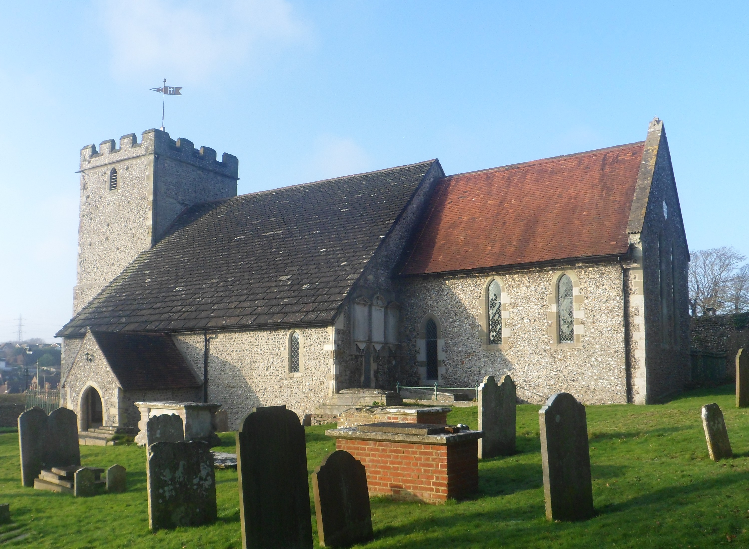
St Nicolas Church, Portslade

St Nicolas Church is an Anglican church in the Portslade area of the English city of Brighton and Hove. It has 12th-century origins, and serves the old...

Nearby Amenities

Located within 500m of 50.838079,-0.21419
Mini Roundabout
Direction: clockwise
Lat/Long: 50.8367299/-0.2164711
Traffic Signals
Lat/Long: 50.8386274/-0.2170643
Fuel
Texaco
Lat/Long: 50.838729/-0.2211178
Library
Portslade Library
Wikidata: Q55173316
Lat/Long: 50.8382369/-0.2115469
Doctors
Portslade County Clinic
Healthcare: doctor
Lat/Long: 50.8381968/-0.2110701
Mini Roundabout
Direction: clockwise
Lat/Long: 50.8355645/-0.2156125
Barrier: bollard
Lat/Long: 50.8351532/-0.2153745
Barrier: bollard
Lat/Long: 50.8365892/-0.21654
Pub
The Stanley Arms
Addr City: Portslade
Addr Housenumber: 47
Addr Postcode: BN41 1SS
Addr Street: Wolseley Road
Fhrs Id: 207364
Lat/Long: 50.8371614/-0.2201134
Post Box
Brand: Royal Mail
Brand Wikidata: Q638098
Brand Wikipedia: en:Royal Mail
Collection Plate: CP1
Collection Times: Mo-Fr 16:30; Sa 12:15
Operator: Royal Mail
Operator Wikidata: Q638098
Post Box Type: pillar
Ref: BN41 669
Royal Cypher: GR
Royal Cypher Wikidata: Q33102273
Lat/Long: 50.8367778/-0.2165996
Post Box
Brand: Royal Mail
Brand Wikidata: Q638098
Brand Wikipedia: en:Royal Mail
Collection Plate: CP7D
Collection Times: Mo-Fr 09:00; Sa 07:00
Operator: Royal Mail
Operator Wikidata: Q638098
Post Box Type: lamp
Ref: BN41 666D
Royal Cypher: EIIR
Royal Cypher Wikidata: Q33102113
Lat/Long: 50.8405208/-0.2173534
Crossing
Crossing: traffic_signals
Lat/Long: 50.8384981/-0.2120688
Bus Stop
Fishersgate Station
Bus: yes
Naptan AtcoCode: 4400AD0268
Naptan Bearing: E
Naptan CommonName: Fishersgate Station
Naptan Indicator: o/s 219
Naptan Landmark: Manor Close
Naptan NaptanCode: wsxadtgj
Naptan PlusbusZoneRef: BRGHTN
Naptan Street: Manor Hall Road
Naptan Verified: no
Public Transport: platform
Source: naptan_import
Lat/Long: 50.8356366/-0.2201551
Bus Stop
Shelldale Road
Bus: yes
Naptan AtcoCode: 149000006671
Naptan NaptanCode: brimatw
Physically Present: yes
Public Transport: platform
Shelter: no
Lat/Long: 50.8356031/-0.2170391
Barrier: bollard
Lat/Long: 50.8360339/-0.2160938
Bus Stop
Battle of Trafalgar
Bus: yes
Public Transport: platform
Lat/Long: 50.8370009/-0.2167622
Bus Stop
Battle of Trafalgar
Bus: yes
Naptan AtcoCode: 149000006471
Naptan NaptanCode: brijdmw
Public Transport: platform
Shelter: no
Lat/Long: 50.8369572/-0.2165598
Bus Stop
Portslade Health Centre
Bus: yes
Naptan AtcoCode: 149000007528
Naptan NaptanCode: briapaj
Public Transport: platform
Lat/Long: 50.8335982/-0.2142619
Bus Stop
Southern Cross
Public Transport: platform
Lat/Long: 50.8386969/-0.2186532
Bus Stop
Southern Cross
Naptan AtcoCode: 149000007146
Naptan NaptanCode: briagaj
Public Transport: platform
Lat/Long: 50.8384553/-0.2181012
Bus Stop
Romany Close
Public Transport: platform
Lat/Long: 50.8385115/-0.2128975
Crossing
Crossing: unmarked
Crossing Island: no
Kerb: flush
Tactile Paving: yes
Traffic Calming: hump
Lat/Long: 50.8345474/-0.2126706
Bus Stop
Southern Cross
Public Transport: platform
Lat/Long: 50.8393895/-0.217232
Bus Stop
Southern Cross
Naptan AtcoCode: 149000006470
Naptan NaptanCode: brijgda
Public Transport: platform
Lat/Long: 50.8395911/-0.2170928
Bus Stop
Battle of Trafalgar Pub
Bus: yes
Naptan AtcoCode: 149000006965
Public Transport: platform
Lat/Long: 50.8368385/-0.2156689
Bus Stop
Portslade Town Hall
Bus: yes
Public Transport: platform
Lat/Long: 50.8366108/-0.2108354
Turning Circle
Lat/Long: 50.8383449/-0.2159725
P.L. Terry
Shop: car_repair
Lat/Long: 50.8356542/-0.2160896
Bus Stop
Shelldale Road
Bus: yes
Naptan AtcoCode: 149000007671
Naptan NaptanCode: bridwtm
Public Transport: platform
Shelter: no
Lat/Long: 50.8354998/-0.2162588
Barrier: cycle_barrier
Lat/Long: 50.8355274/-0.2093849
Barrier: cycle_barrier
Lat/Long: 50.8352351/-0.2091945
Barrier: cycle_barrier
Lat/Long: 50.8344477/-0.212656
Waste Basket
Check Date: 2021-07-30
Lat/Long: 50.8344168/-0.2137306
Addr Housenumber: 46A
Addr Street: Vale Road
Lat/Long: 50.8346234/-0.2107439
Addr Housenumber: 48A
Addr Street: Vale Road
Lat/Long: 50.8346099/-0.2108994
Addr Housenumber: 34A
Addr Street: Vale Road
Lat/Long: 50.8347335/-0.2098668
Bench
Lat/Long: 50.8341661/-0.2121198
Bench
Lat/Long: 50.8340721/-0.2115109
Bench
Lat/Long: 50.8341864/-0.2126683
Bench
Lat/Long: 50.8341991/-0.2118382
Bench
Lat/Long: 50.8341254/-0.2114157
Bench
Lat/Long: 50.8340764/-0.2121104
Barrier: cycle_barrier
Lat/Long: 50.8343589/-0.2120669
Waste Basket
Lat/Long: 50.8339103/-0.2117523
Barrier: bollard
Lat/Long: 50.8357294/-0.2156096
Recycling
Operator: Brighton & Hove City Council
Operator Wikidata: Q16953725
Owner: Brighton & Hove City Council
Ownership: municipal
Recycling Books: yes
Recycling Cans: yes
Recycling Cardboard: yes
Recycling Cartons: yes
Recycling Clothes: yes
Recycling Glass: yes
Recycling Glass Bottles: yes
Recycling Magazines: yes
Recycling Newspaper: yes
Recycling Paper: yes
Recycling Paper Packaging: yes
Recycling Plastic: yes
Recycling Plastic Bottles: yes
Recycling Plastic Packaging: yes
Recycling Small Appliances: no
Recycling Type: container
Lat/Long: 50.8365908/-0.2119625
Addr Housenumber: 46A
Lat/Long: 50.8346221/-0.2107367
Addr Housenumber: 58A
Lat/Long: 50.8361016/-0.2163089
Bus Stop
Benfield Way
Bus: yes
Public Transport: platform
Lat/Long: 50.8382578/-0.2091822
Bus Stop
Highlands Road
Public Transport: platform
Shelter: yes
Lat/Long: 50.8400949/-0.211372
Bus Stop
Benfield Way
Bus: yes
Naptan AtcoCode: 149000007144
Naptan NaptanCode: bridgwg
Public Transport: platform
Lat/Long: 50.8381919/-0.2101693
Bus Stop
Highlands Road
Naptan AtcoCode: 149000006484
Naptan NaptanCode: bridpdp
Public Transport: platform
Lat/Long: 50.839945/-0.2112442
Bus Stop
Benfield Crescent
Public Transport: platform
Lat/Long: 50.8413388/-0.2111468
Bus Stop
Benfield Crescent
Naptan AtcoCode: 149000007485
Naptan NaptanCode: bridpdm
Public Transport: platform
Lat/Long: 50.8415036/-0.211379
Entrance: yes
Lat/Long: 50.8370979/-0.208723
Bench
Lat/Long: 50.8367954/-0.2137684
Bus Stop
Romany Close
Naptan AtcoCode: 149000006145
Naptan NaptanCode: briagag
Public Transport: platform
Lat/Long: 50.8386462/-0.2135805
Boulder Brighton
Addr City: Portslade
Addr Place: Victoria Road Trading Estate
Addr Postcode: BN41 1XQ
Addr Street: Victoria Road
Addr Unit: 7b-c
Leisure: sports_centre
Sport: climbing
Website: https://www.boulderbrighton.com/
Lat/Long: 50.8356413/-0.2115427
Traffic Signals
Traffic Signals: signal
Lat/Long: 50.838516/-0.2170749
Traffic Signals
Traffic Signals: signal
Lat/Long: 50.8382571/-0.2071295
Traffic Signals
Lat/Long: 50.8383894/-0.2072689
Noexit: yes
Lat/Long: 50.8378124/-0.210552
School
St Nicolas CE Primary School
Addr City: Portslade
Addr Street: Locks Hill
Wikidata: Q66223996
Lat/Long: 50.8398077/-0.2166003
Scullard & Prosser Insurance Brokers
Addr City: Portslade
Addr Housenumber: 112
Addr Street: Abinger Road
Contact Phone: +44 1273 421555
Note: This premises was established in 1949.
Office: insurance
Source: survey
Lat/Long: 50.8361266/-0.2177763
Post Box
Operator: Royal Mail
Operator Wikidata: Q638098
Ref: BN41 668D
Lat/Long: 50.8383254/-0.2086864
Post Box
Brand: Royal Mail
Brand Wikidata: Q638098
Collection Plate: CP7D
Collection Times: Mo-Fr 09:00; Sa 07:00
Last Checked: 2022-03-25
Operator: Royal Mail
Operator Wikidata: Q638098
Post Box Type: lamp
Ref: BN41 657D
Royal Cypher: EIIR
Royal Cypher Wikidata: Q33102113
Source: survey
Lat/Long: 50.8406654/-0.2111931
Mastertiles
Addr Street: Trafalgar Road
Shop: tiles
Lat/Long: 50.8383832/-0.2166095
Crossing
Crossing: traffic_signals
Crossing Ref: puffin
Lat/Long: 50.8384095/-0.207225
Bicycle Rental
Portslade Town Hall
Bicycle Rental: docking_station
Capacity: 10
Covered: no
Email: support@beryl.cc
Fee: yes
Network: btnbikeshare
Note: Hire scheme suspened in December 2022 and relaunched with new operator at end of March 2023, but with limited stations open, planned rollout until the summer when all stations will be open.
Payment App: yes
Phone: +44 020 3003 5044
Ref: 78
Website: https://beryl.cc/scheme/brighton
Lat/Long: 50.8366189/-0.2115887
Recycling
Operator: Brighton & Hove City Council
Owner: Brighton & Hove City Council
Ownership: municipal
Recycling Type: container
Lat/Long: 50.84037/-0.21918
Traffic Calming: island
Lat/Long: 50.8368095/-0.2165273
Crossing
Crossing: traffic_signals
Crossing Ref: puffin
Kerb: flush
Tactile Paving: yes
Lat/Long: 50.8386201/-0.2173944
Crossing
Crossing: traffic_signals
Crossing Ref: puffin
Kerb: flush
Tactile Paving: yes
Lat/Long: 50.8385045/-0.2174957
Crossing
Button Operated: yes
Crossing: traffic_signals
Crossing Island: yes
Crossing Ref: puffin
Kerb: flush
Tactile Paving: yes
Traffic Signals Sound: yes
Lat/Long: 50.838333/-0.2170635
Crossing
Crossing: uncontrolled
Crossing Island: yes
Kerb: lowered
Lat/Long: 50.8387318/-0.217076
Crossing
Crossing: unmarked
Crossing Island: no
Kerb: flush
Tactile Paving: yes
Traffic Calming: hump
Lat/Long: 50.8344608/-0.213758
Crossing
Crossing: traffic_signals
Crossing Island: no
Crossing Markings: yes
Crossing Signals: yes
Crossing Ref: puffin
Kerb: flush
Tactile Paving: yes
Lat/Long: 50.8338268/-0.2142294
Crossing
Crossing: uncontrolled
Crossing Markings: yes
Lat/Long: 50.8364545/-0.2102245
Traffic Calming: island
Lat/Long: 50.8367372/-0.2162701
Parking
Access: customers
Lat/Long: 50.836113/-0.2113148
Leisure: picnic_table
Lat/Long: 50.8358518/-0.2108909
The data included in this document is from www.openstreetmap.org. The data is made available under ODbL.

Have you been to Southern Cross?

Leave your review of Southern Cross below (or comments, questions and feedback).