Fisherstreet

Settlement in Sussex Chichester

England

Fisherstreet

Bluebells by lane bend, Hillgrove
Bluebells by lane bend, Hillgrove Credit: Robin Webster

Fisherstreet is a small village located in the county of Sussex, England. Situated in the heart of the picturesque South Downs National Park, this tranquil settlement offers a charming and idyllic escape from the hustle and bustle of modern life.

With a population of around 500 residents, Fisherstreet is known for its tight-knit community and friendly atmosphere. The village is characterized by its quaint cottages, many of which date back to the 18th century, and its well-manicured gardens that add to its overall charm.

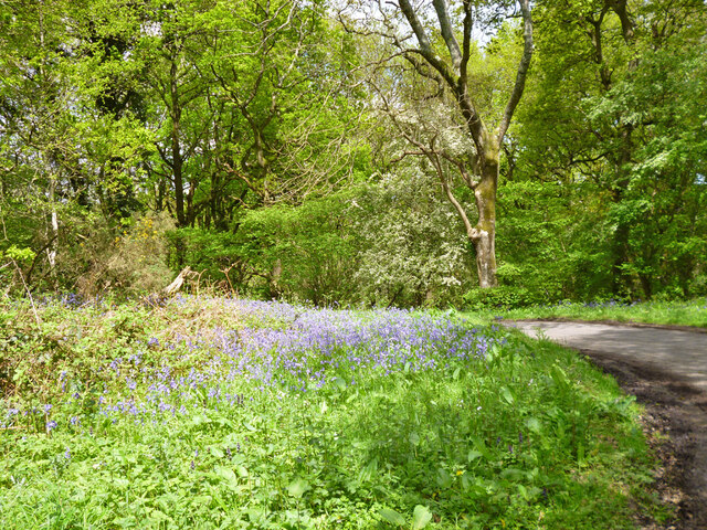
The surrounding natural beauty of Fisherstreet is a major draw for visitors and residents alike. The village is surrounded by rolling hills, lush green countryside, and breathtaking views. There are numerous walking trails and footpaths that wind through the area, providing ample opportunities for outdoor enthusiasts to explore and enjoy the stunning landscapes.

Although small, Fisherstreet is not lacking in amenities. The village boasts a local pub, The Rose and Crown, which serves as a popular gathering spot for locals and visitors to enjoy a pint of ale or a hearty meal. Additionally, there is a small convenience store that caters to the everyday needs of residents.

Fisherstreet is also conveniently located near several notable attractions. Just a short drive away is the historic town of Lewes, known for its medieval castle and charming independent shops. The vibrant city of Brighton is also within easy reach, offering a wealth of entertainment, shopping, and dining options.

Overall, Fisherstreet is a charming and picturesque village nestled in the beautiful Sussex countryside, offering a peaceful retreat for those looking to escape the hustle and bustle of city life.

If you have any feedback on the listing, please let us know in the comments section below.
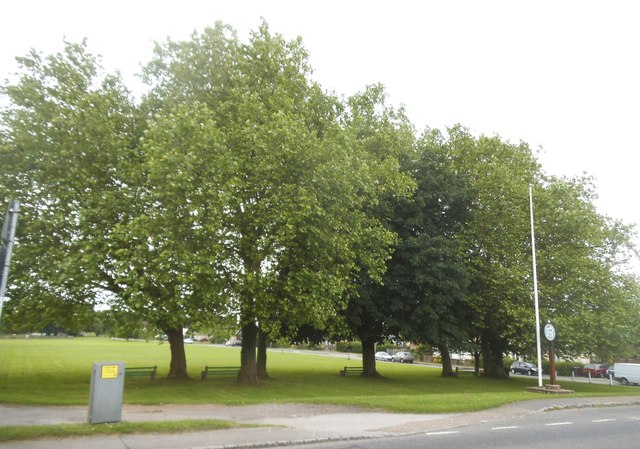
Fisherstreet Images

Images are sourced within 2km of 51.064495/-0.646637 or Grid Reference SU9430. Thanks to Geograph Open Source API. All images are credited.

Bluebells by lane bend, Hillgrove
Old Milestone plate by A283, The Toll House The Milestone plate is located on cottage wall on the East of the road.  Parish of Northchapel (Chichester District). Metal plaque, Petworth plaque design, erected by the Petworth turnpike trust in the 19th Century, was perhaps cemented over. 

Inscription reads:-  44 / MILES / FROM / LONDON / 5 / TO / PETWORTH 

Milestone Society National ID: SX_LMP44
Old Milestone plate by A283, The Toll House
The Milestone plate is located on cottage wall on the East of the road.  Parish of Northchapel (Chichester District). Metal plaque, Petworth plaque design, erected by the Petworth turnpike trust in the 19th Century, was perhaps cemented over. Inscription reads:- 44 / MILES / FROM / LONDON / 5 / TO / PETWORTH Milestone Society National ID: SX_LMP44
Signpost and Green, Northchapel
House by the road, Northchapel
House on Pipers Lane, Northchapel
Pipers Lane, Northchapel
The green in Northchapel
Northchapel Green
Northchapel Green
Northchapel Green
Northchapel Green
Pipers Lane, Northchapel
Field by Pipers Lane
Horses by Pipers Lane Two fields had pregnant mares, some with foals, the third had the others (see the photos taken nearby).
Horses by Pipers Lane
Two fields had pregnant mares, some with foals, the third had the others (see the photos taken nearby).
Northchapel village hall
Hillgrove Attractive clock tower in a hamlet west of Northchapel.
Hillgrove
Attractive clock tower in a hamlet west of Northchapel.
Northchapel - Petworth Road The Hillgrove road end at the southern end of Northchapel village.
Northchapel - Petworth Road
The Hillgrove road end at the southern end of Northchapel village.
Upper Diddlesfold Farm Goats make a welcome and rare appearance in the Sussex Weald.
Upper Diddlesfold Farm
Goats make a welcome and rare appearance in the Sussex Weald.
Wateredge Copse Sussex Weald west of Northchapel - mix of grassy fields and woodland.
Wateredge Copse
Sussex Weald west of Northchapel - mix of grassy fields and woodland.
Show me another place!

Fisherstreet is located at Grid Ref: SU9430 (Lat: 51.064495, Lng: -0.646637)

Administrative County: West Sussex

District: Chichester

Police Authority: Sussex

What 3 Words

///scrambles.easily.afford. Near Haslemere, Surrey

Related Wikis

Northchapel

Northchapel is a village and civil parish in Chichester District in West Sussex, England. It stands on the A283 road just south of the Surrey border, around...

Shillinglee Lake

Shillinglee Lake is a 17-hectare (42-acre) biological Site of Special Scientific Interest west of Plaistow in West Sussex. The lake has been designated...

Shillinglee

Shillinglee is an 18th-century house and estate in West Sussex, England near the Surrey border, in between the villages of Chiddingfold and Plaistow. It...

Ramster

Ramster Garden is an open garden, near Chiddingfold, Surrey, covering over 20 acres (81,000 m2). First landscaped and laid out in the 1890s by Gauntlett...

Nearby Amenities

Located within 500m of 51.064495,-0.646637
Copygrove Copse
Naptan AtcoCode: 4400MO0495
Naptan Bearing: N
Naptan BusStopType: CUS
Naptan CommonName: Copygrove Copse
Naptan Indicator: HAR
Naptan Landmark: Hail & Ride
Naptan NaptanCode: wsxgagpd
Naptan Street: A283
Naptan Verified: no
Source: naptan_import
Lat/Long: 51.0633424/-0.6442032
Copygrove Copse
Naptan AtcoCode: 4400MO0634
Naptan Bearing: S
Naptan BusStopType: CUS
Naptan CommonName: Copygrove Copse
Naptan Indicator: HAR
Naptan Landmark: Hail & Ride
Naptan Street: A283
Naptan Verified: no
Source: naptan_import
Lat/Long: 51.0633284/-0.6441061
Fisherstreet Copse
Natural: wood
Source: os_street_view
Lat/Long: 51.0647663/-0.6515149
The data included in this document is from www.openstreetmap.org. The data is made available under ODbL.

Have you been to Fisherstreet?

Leave your review of Fisherstreet below (or comments, questions and feedback).