Ketley Wood

Wood, Forest in Sussex Rother

England

Ketley Wood

Fields South Of Ticehurst, East Sussex A view across fields to Ticehurst, from a footpath from Pashley Road to the Cherry Tree pub in Ticehurst.
Fields South Of Ticehurst, East Sussex Credit: Tim Knight

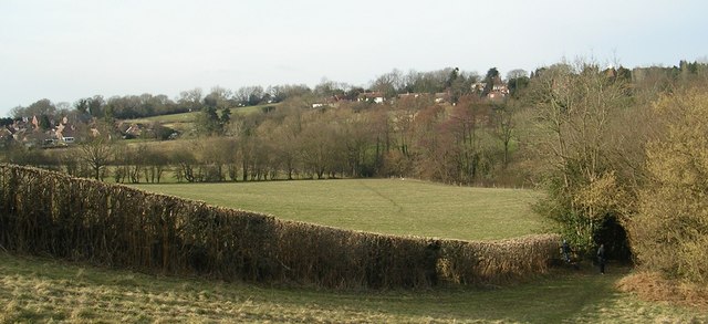
Ketley Wood is a beautiful forest located in Sussex, England. Spanning over a vast area, this woodland is known for its rich biodiversity and stunning natural landscapes. The forest is primarily composed of deciduous trees, such as oak, beech, and birch, which create a dense canopy that provides shade and shelter for a variety of wildlife.

One of the notable features of Ketley Wood is its network of walking trails that wind through the forest, offering visitors the opportunity to explore its hidden gems. These trails vary in difficulty, catering to both casual strollers and more adventurous hikers. Along the way, visitors can enjoy the peaceful ambiance of the woods and observe the diverse flora and fauna that call this forest home.

The forest is not only a haven for nature enthusiasts, but also a vital habitat for a range of wildlife species. Ketley Wood is home to a wide array of bird species, including woodpeckers, owls, and various songbirds. Small mammals, such as squirrels and rabbits, can also be spotted darting through the undergrowth.

In addition to its natural beauty, Ketley Wood holds historical significance. The forest has been used for centuries as a source of timber and has witnessed human activity dating back to ancient times. Today, remnants of old structures, such as charcoal kilns and stone walls, can still be found within the forest, offering visitors a glimpse into the area's past.

Overall, Ketley Wood is a remarkable woodland that showcases the beauty of Sussex's natural landscapes. With its diverse flora and fauna, picturesque trails, and historical remnants, it is a destination that offers both tranquility and a sense of connection to the land's rich heritage.

If you have any feedback on the listing, please let us know in the comments section below.
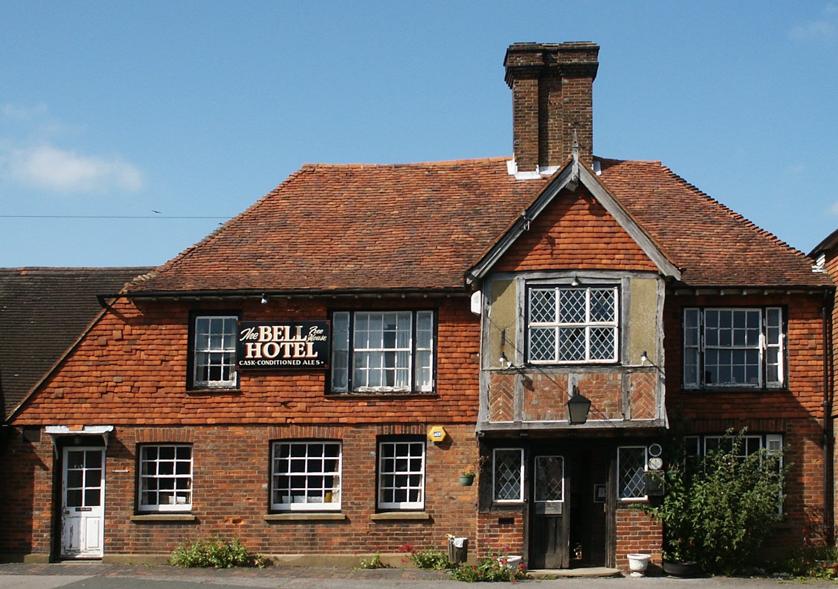
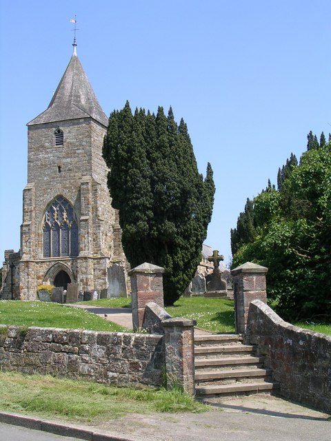
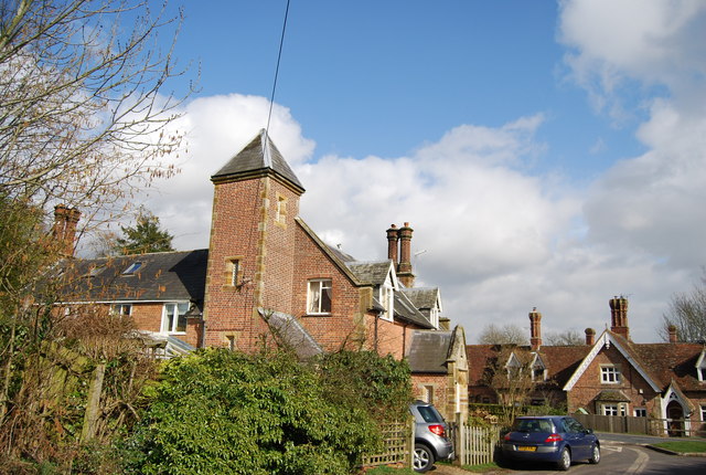
Ketley Wood Images

Images are sourced within 2km of 51.058578/0.43171117 or Grid Reference TQ7031. Thanks to Geograph Open Source API. All images are credited.

Fields South Of Ticehurst, East Sussex A view across fields to Ticehurst, from a footpath from Pashley Road to the Cherry Tree pub in Ticehurst.
Fields South Of Ticehurst, East Sussex
A view across fields to Ticehurst, from a footpath from Pashley Road to the Cherry Tree pub in Ticehurst.
Pashley Road Towards Ticehurst
Pashley Road
Towards Ticehurst
Oast House Single square kiln oast house.
Oast House
Single square kiln oast house.
Swallows Oast, Gibbs Reed Farm, Pashley Road, Ticehurst, East Sussex Twin round kiln oast house, missing original roofs and cowl. Used as a venue for wedding receptions.
Swallows Oast, Gibbs Reed Farm, Pashley Road, Ticehurst, East Sussex
Twin round kiln oast house, missing original roofs and cowl. Used as a venue for wedding receptions.
Footpath junction near Birchen Wood The Sussex Border Path (long distance path) heads into the wood to head towards Dale Hill Golf Course and Quedley Farm. It has come from the right via Roughfield Farm. The path heading left leads to Birchenwood Farm on the B2099
Footpath junction near Birchen Wood
The Sussex Border Path (long distance path) heads into the wood to head towards Dale Hill Golf Course and Quedley Farm. It has come from the right via Roughfield Farm. The path heading left leads to Birchenwood Farm on the B2099
Footbridge in Birchen Wood This bridge is on the Sussex Border Path (long distance path) heading through the wood towards Dale Hill Golf Course and Quedley Farm. The bridge crosses over a wide stream in the wood, that leads left towards the River Linden.
Footbridge in Birchen Wood
This bridge is on the Sussex Border Path (long distance path) heading through the wood towards Dale Hill Golf Course and Quedley Farm. The bridge crosses over a wide stream in the wood, that leads left towards the River Linden.
Farm bridge in Birchen Wood As seen from <a href="https://www.geograph.org.uk/photo/1818300">TQ7129 : Footbridge in Birchen Wood</a>. This bridge connects two fields (possibly of Birchenwood Farm). The bridge crosses over a wide stream in the wood, that leads towards the River Linden.
Farm bridge in Birchen Wood
As seen from TQ7129 : Footbridge in Birchen Wood. This bridge connects two fields (possibly of Birchenwood Farm). The bridge crosses over a wide stream in the wood, that leads towards the River Linden.
Sussex Border Path beside Roughfield The long distance path heads right towards Birchen Wood before heading towards Union Street near Flimwell. On the left is one of two new entrances to Roughfield (a large house). The entrances are being prepared to be plastered and then electric gates fitted.
Sussex Border Path beside Roughfield
The long distance path heads right towards Birchen Wood before heading towards Union Street near Flimwell. On the left is one of two new entrances to Roughfield (a large house). The entrances are being prepared to be plastered and then electric gates fitted.
Strumblett's Wood
Strumblett's Wood
Strumblett's Wood
Strumblett's Wood
Sussex Border Path, birchen Wood The Sussex Border Path is a footpath route nearly 150 miles long around the inland boundary of the county of Sussex. The county owes its origins to the kingdom of the South Saxons and can claim to have one of the longest inland county boundaries from Emsworth to Rye. The route was devised in 1983 and is well signed along most of the route. Website <span class="nowrap"><a title="http://www.sussexborderpath.co.uk/" rel="nofollow ugc noopener" href="http://www.sussexborderpath.co.uk/">Link</a><img style="margin-left:2px;" alt="External link" title="External link - shift click to open in new window" src="https://s1.geograph.org.uk/img/external.png" width="10" height="10"/></span> 
Map: <a title="https://www.geograph.org.uk/search.php?i=40140109&page=1&displayclass=map#i=40140109&page=1&displayclass=map&zoom=2&lat=51.03263&lon=-0.05427&layers=FTTB00000000000T" href="https://www.geograph.org.uk/search.php?i=40140109&page=1&displayclass=map#i=40140109&page=1&displayclass=map&zoom=2&lat=51.03263&lon=-0.05427&layers=FTTB00000000000T">Link</a>
Sussex Border Path, birchen Wood
The Sussex Border Path is a footpath route nearly 150 miles long around the inland boundary of the county of Sussex. The county owes its origins to the kingdom of the South Saxons and can claim to have one of the longest inland county boundaries from Emsworth to Rye. The route was devised in 1983 and is well signed along most of the route. Website LinkExternal link Map: Link
Roughfield Wood
Roughfield Wood
Stile, Sussex Border Path The Sussex Border Path is a footpath route nearly 150 miles long around the inland boundary of the county of Sussex. The county owes its origins to the kingdom of the South Saxons and can claim to have one of the longest inland county boundaries from Emsworth to Rye. The route was devised in 1983 and is well signed along most of the route. Website <span class="nowrap"><a title="http://www.sussexborderpath.co.uk/" rel="nofollow ugc noopener" href="http://www.sussexborderpath.co.uk/">Link</a><img style="margin-left:2px;" alt="External link" title="External link - shift click to open in new window" src="https://s1.geograph.org.uk/img/external.png" width="10" height="10"/></span> 
Map: <a title="https://www.geograph.org.uk/search.php?i=40140109&page=1&displayclass=map#i=40140109&page=1&displayclass=map&zoom=2&lat=51.03263&lon=-0.05427&layers=FTTB00000000000T" href="https://www.geograph.org.uk/search.php?i=40140109&page=1&displayclass=map#i=40140109&page=1&displayclass=map&zoom=2&lat=51.03263&lon=-0.05427&layers=FTTB00000000000T">Link</a>
Stile, Sussex Border Path
The Sussex Border Path is a footpath route nearly 150 miles long around the inland boundary of the county of Sussex. The county owes its origins to the kingdom of the South Saxons and can claim to have one of the longest inland county boundaries from Emsworth to Rye. The route was devised in 1983 and is well signed along most of the route. Website LinkExternal link Map: Link
Stream, Roughfield Wood
Sussex Border Path to Roughfield The Sussex Border Path is a footpath route nearly 150 miles long around the inland boundary of the county of Sussex. The county owes its origins to the kingdom of the South Saxons and can claim to have one of the longest inland county boundaries from Emsworth to Rye. The route was devised in 1983 and is well signed along most of the route. Website <span class="nowrap"><a title="http://www.sussexborderpath.co.uk/" rel="nofollow ugc noopener" href="http://www.sussexborderpath.co.uk/">Link</a><img style="margin-left:2px;" alt="External link" title="External link - shift click to open in new window" src="https://s1.geograph.org.uk/img/external.png" width="10" height="10"/></span> 
Map: <a title="https://www.geograph.org.uk/search.php?i=40140109&page=1&displayclass=map#i=40140109&page=1&displayclass=map&zoom=2&lat=51.03263&lon=-0.05427&layers=FTTB00000000000T" href="https://www.geograph.org.uk/search.php?i=40140109&page=1&displayclass=map#i=40140109&page=1&displayclass=map&zoom=2&lat=51.03263&lon=-0.05427&layers=FTTB00000000000T">Link</a>
Sussex Border Path to Roughfield
The Sussex Border Path is a footpath route nearly 150 miles long around the inland boundary of the county of Sussex. The county owes its origins to the kingdom of the South Saxons and can claim to have one of the longest inland county boundaries from Emsworth to Rye. The route was devised in 1983 and is well signed along most of the route. Website LinkExternal link Map: Link
Roughfield Wood
Roughfield Wood
Sussex Border Path near Roughfield The Sussex Border Path is a footpath route nearly 150 miles long around the inland boundary of the county of Sussex. The county owes its origins to the kingdom of the South Saxons and can claim to have one of the longest inland county boundaries from Emsworth to Rye. The route was devised in 1983 and is well signed along most of the route. Website <span class="nowrap"><a title="http://www.sussexborderpath.co.uk/" rel="nofollow ugc noopener" href="http://www.sussexborderpath.co.uk/">Link</a><img style="margin-left:2px;" alt="External link" title="External link - shift click to open in new window" src="https://s1.geograph.org.uk/img/external.png" width="10" height="10"/></span> 
Map: <a title="https://www.geograph.org.uk/search.php?i=40140109&page=1&displayclass=map#i=40140109&page=1&displayclass=map&zoom=2&lat=51.03263&lon=-0.05427&layers=FTTB00000000000T" href="https://www.geograph.org.uk/search.php?i=40140109&page=1&displayclass=map#i=40140109&page=1&displayclass=map&zoom=2&lat=51.03263&lon=-0.05427&layers=FTTB00000000000T">Link</a>
Sussex Border Path near Roughfield
The Sussex Border Path is a footpath route nearly 150 miles long around the inland boundary of the county of Sussex. The county owes its origins to the kingdom of the South Saxons and can claim to have one of the longest inland county boundaries from Emsworth to Rye. The route was devised in 1983 and is well signed along most of the route. Website LinkExternal link Map: Link
Sussex Border Path waymark, Roughfield Wood The Sussex Border Path is a footpath route nearly 150 miles long around the inland boundary of the county of Sussex. The county owes its origins to the kingdom of the South Saxons and can claim to have one of the longest inland county boundaries from Emsworth to Rye. The route was devised in 1983 and is well signed along most of the route. Website <span class="nowrap"><a title="http://www.sussexborderpath.co.uk/" rel="nofollow ugc noopener" href="http://www.sussexborderpath.co.uk/">Link</a><img style="margin-left:2px;" alt="External link" title="External link - shift click to open in new window" src="https://s1.geograph.org.uk/img/external.png" width="10" height="10"/></span> 
Map: <a title="https://www.geograph.org.uk/search.php?i=40140109&page=1&displayclass=map#i=40140109&page=1&displayclass=map&zoom=2&lat=51.03263&lon=-0.05427&layers=FTTB00000000000T" href="https://www.geograph.org.uk/search.php?i=40140109&page=1&displayclass=map#i=40140109&page=1&displayclass=map&zoom=2&lat=51.03263&lon=-0.05427&layers=FTTB00000000000T">Link</a>
Sussex Border Path waymark, Roughfield Wood
The Sussex Border Path is a footpath route nearly 150 miles long around the inland boundary of the county of Sussex. The county owes its origins to the kingdom of the South Saxons and can claim to have one of the longest inland county boundaries from Emsworth to Rye. The route was devised in 1983 and is well signed along most of the route. Website LinkExternal link Map: Link
Show me another place!

Ketley Wood is located at Grid Ref: TQ7031 (Lat: 51.058578, Lng: 0.43171117)

Administrative County: East Sussex

District: Rother

Police Authority: Sussex

What 3 Words

///reminder.senders.rainwater. Near Flimwell, East Sussex

Related Wikis

Flimwell

Flimwell is a village in the civil parish of Ticehurst, in the Rother district of East Sussex, England. It is located close to the border with Kent at...

Combwell Priory

Combwell Priory was a priory near Bedgebury Cross about 10 miles southeast of Tunbridge Wells in Kent, England. == History == This is a Grade II listed...

Ticehurst

Ticehurst is both a village and a large civil parish in the Rother district of East Sussex, England. The parish lies in the upper reaches of both the Bewl...

St Augustine's Church, Flimwell

St Augustine's Church is the Anglican parish church of Flimwell, a village in the Rother district of East Sussex, England. It was consecrated in 1839 after...

St Mary's Church, Ticehurst

St Mary's Church is a 14th-century parish church dedicated to St Mary the Virgin in Ticehurst, East Sussex, England. Part of the Diocese of Chichester...

Bedgebury Cross

Bedgebury Cross is a hamlet in the civil parish of Goudhurst. It is located, in the Bedgebury Forest area of Kent, England. It is located on the B2079...

Bedgebury Forest

Bedgebury Forest is a 10.5 square kilometres (2,600 acres) forest surrounding Bedgebury National Pinetum, near Flimwell in Kent. In contrast to the National...

Bedgebury National Pinetum

Bedgebury National Pinetum at Bedgebury, Kent, in the United Kingdom, is a recreational and conservational arboretum managed by Forestry England that was...

Nearby Amenities

Located within 500m of 51.058578,0.43171117
Barrier: stile
Lat/Long: 51.0602563/0.4317031
Post Box
Note: Its a new box but is sealed off?
Operator: Royal Mail
Operator Wikidata: Q638098
Post Box Type: lamp
Ref: TN5 316
Ref GB Uprn: 10015446763
Royal Cypher: EIIR
Royal Cypher Wikidata: Q33102113
Lat/Long: 51.0604016/0.4257806
Downash Court
Building: yes
Lat/Long: 51.0558126/0.4276004
Union Street
Place: hamlet
Source: OS_OpenData_StreetView
Lat/Long: 51.0558885/0.4362881
Power: pole
Lat/Long: 51.059798/0.4253474
Power: pole
Lat/Long: 51.0601604/0.4263934
Power: pole
Lat/Long: 51.0604925/0.4272303
Power: pole
Lat/Long: 51.0612191/0.4290891
Power: pole
Lat/Long: 51.0619473/0.4309317
Power: pole
Lat/Long: 51.0625761/0.4317445
Barrier: yes
Lat/Long: 51.054857/0.4342475
Generator Method: photovoltaic
Generator Output Electricity: yes
Generator Source: solar
Generator Type: solar_photovoltaic_panel
Location: roof
Power: generator
Lat/Long: 51.0553683/0.4365188
Generator Method: photovoltaic
Generator Output Electricity: yes
Generator Source: solar
Generator Type: solar_photovoltaic_panel
Location: roof
Power: generator
Lat/Long: 51.0553675/0.4365751
The data included in this document is from www.openstreetmap.org. The data is made available under ODbL.

Have you been to Ketley Wood?

Leave your review of Ketley Wood below (or comments, questions and feedback).