Astwith

Settlement in Derbyshire Bolsover

England

Astwith

Parking and industrial units in Holmewood Industrial Estate
Parking and industrial units in Holmewood Industrial Estate Credit: Bill Boaden

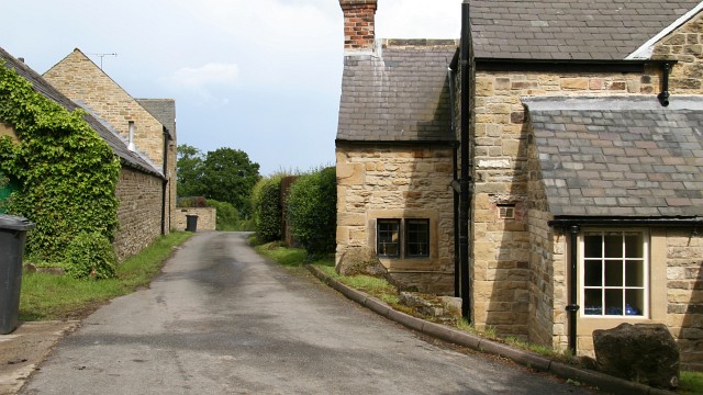
Astwith is a small village located in the county of Derbyshire, England. Situated approximately 4 miles northeast of the town of Chesterfield, Astwith is nestled in the picturesque countryside of the East Midlands. With a population of around 300 residents, the village exudes a close-knit community atmosphere.

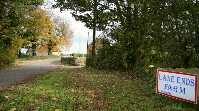
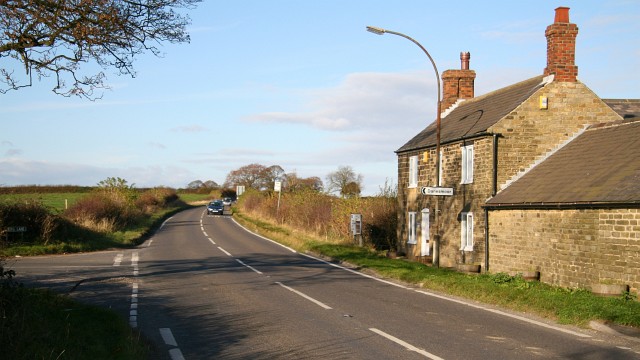
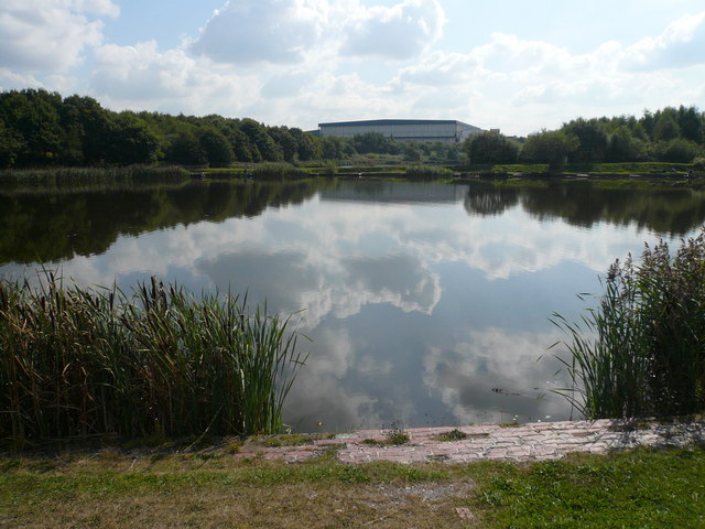
Astwith is known for its charming rural setting, with rolling hills, green pastures, and beautiful landscapes surrounding the village. The area is primarily agricultural, with farming playing a significant role in the local economy. The village is dotted with traditional stone-built houses, giving it a timeless and quintessentially English feel.

The village itself boasts a number of amenities for its residents and visitors alike. These include a village hall, a primary school, and a local pub, which serves as a hub for socializing and community events. Additionally, Astwith benefits from its proximity to Chesterfield, where residents can access a wider range of services, entertainment, and shopping options.

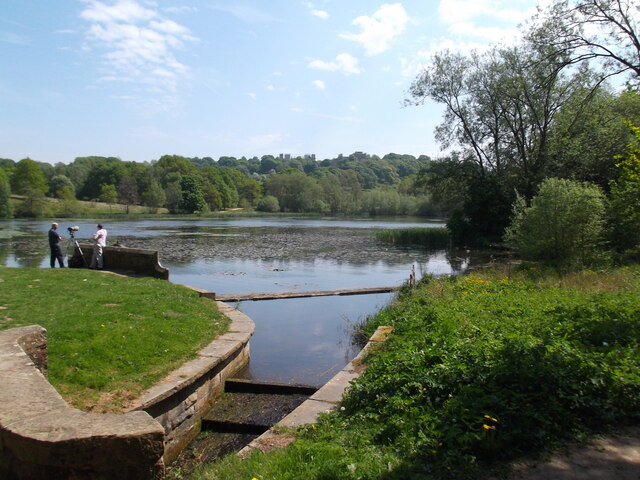
Nature enthusiasts will find plenty to explore in Astwith, with numerous walking and cycling trails nearby. The village is also situated close to the Peak District National Park, renowned for its stunning landscapes, hiking opportunities, and outdoor activities.

All in all, Astwith is a tranquil and idyllic village that offers a peaceful retreat from the hustle and bustle of city life. With its picturesque surroundings, friendly community, and easy access to both rural and urban amenities, it is a place that holds great appeal for those seeking a slower pace of life in the heart of the Derbyshire countryside.

If you have any feedback on the listing, please let us know in the comments section below.

Astwith Images

Images are sourced within 2km of 53.173359/-1.344386 or Grid Reference SK4364. Thanks to Geograph Open Source API. All images are credited.

Parking and industrial units in Holmewood Industrial Estate
Hardwick View Road A circular road providing access to Holmewood Industrial Estate.
Hardwick View Road
A circular road providing access to Holmewood Industrial Estate.
Hardwick View Road A circular road providing access to Holmewood Industrial Estate. Despite the name, Hardwick Hall cannot be seen from here.
Hardwick View Road
A circular road providing access to Holmewood Industrial Estate. Despite the name, Hardwick Hall cannot be seen from here.
The Great Pond, Hardwick Estate
M1 at Deep Lane overbridge
M1 near Stainsby
M1 near Stainsby
Great Pond Part of Hardwick Park, showing some autumn mellowness.
Great Pond
Part of Hardwick Park, showing some autumn mellowness.
Footbridge and culvert by the M1 A stream emerges from a culvert under the M1, where it is crossed by a footbridge, before flowing into the river Doe Lea.
Footbridge and culvert by the M1
A stream emerges from a culvert under the M1, where it is crossed by a footbridge, before flowing into the river Doe Lea.
Stainsby Mill, Mill Lane, Stainsby, Derbyshire Working Victorian watermill on the Hardwick Estate.
Stainsby Mill, Mill Lane, Stainsby, Derbyshire
Working Victorian watermill on the Hardwick Estate.
Cut Mark Toll Bar Cottage Hardstoft
Toll Bar Cottage Chesterfield Rd Hardstoft
M1, southbound The M1 is a north–south motorway connecting London to Leeds, where it joins the A1(M) near Aberford. It was the first motorway to be completed in the United Kingdom.
The motorway is 193 miles long and was constructed in four phases. Most of the motorway was opened between 1959 and 1968 but the southern end was extended in 1977 and the northern end was extended in 1999.
M1, southbound
The M1 is a north–south motorway connecting London to Leeds, where it joins the A1(M) near Aberford. It was the first motorway to be completed in the United Kingdom. The motorway is 193 miles long and was constructed in four phases. Most of the motorway was opened between 1959 and 1968 but the southern end was extended in 1977 and the northern end was extended in 1999.
Deep Lane Bridge, M1 The M1 is a north–south motorway connecting London to Leeds, where it joins the A1(M) near Aberford. It was the first motorway to be completed in the United Kingdom.
The motorway is 193 miles long and was constructed in four phases. Most of the motorway was opened between 1959 and 1968 but the southern end was extended in 1977 and the northern end was extended in 1999.
Deep Lane Bridge, M1
The M1 is a north–south motorway connecting London to Leeds, where it joins the A1(M) near Aberford. It was the first motorway to be completed in the United Kingdom. The motorway is 193 miles long and was constructed in four phases. Most of the motorway was opened between 1959 and 1968 but the southern end was extended in 1977 and the northern end was extended in 1999.
Holmewood - Henstocks Bakers Shop One of a set of shops located on the north side of Heath Road.  Henstocks is a local firm with a retail shop and bakery on Chatsworth Road in Chesterfield and retail shops at West Bars in Chesterfield, High Street in Clay Cross and here in Holmewood.
Holmewood - Henstocks Bakers Shop
One of a set of shops located on the north side of Heath Road. Henstocks is a local firm with a retail shop and bakery on Chatsworth Road in Chesterfield and retail shops at West Bars in Chesterfield, High Street in Clay Cross and here in Holmewood.
Holmewood - charity shop on Heath Road
Holmewood - Library on Heath Road
Holmewood - Economy Fabrics on Heath Road
Holmewood - Post Office On north side of Heath Road.
Holmewood - Post Office
On north side of Heath Road.
Show me another place!

Astwith is located at Grid Ref: SK4364 (Lat: 53.173359, Lng: -1.344386)

Administrative County: Derbyshire

District: Bolsover

Police Authority: Derbyshire

What 3 Words

///battle.logo.shredding. Near Pilsley, Derbyshire

Related Wikis

Blackwell Rural District

Blackwell was a rural district in Derbyshire, England from 1894 to 1974. It was created under the Local Government Act 1894 based on that part of the...

Astwith

Astwith is a village in Derbyshire, England. Astwith is in the parish of Ault Hucknall. For many decades it was a part of the manor of Stainsby, which...

Common End, Derbyshire

Common End is a place noted on an Ordnance Survey map of Derbyshire, England. It is located eight miles south-east of Chesterfield, and just north of Astwith...

Hardstoft

Hardstoft is a hamlet in Derbyshire, England. It is located four miles east of Clay Cross, on the B6039 road. The Mexican Eagle Petroleum Company found...

Heath and Holmewood

Heath and Holmewood, formerly just Heath is a civil parish forming part of the district of North East Derbyshire, in the county of Derbyshire, England...

Stainsby, Derbyshire

Stainsby is a small village in Derbyshire, England. It is near Chesterfield and Bolsover, and the villages of Heath and Doe Lea. The village population...

Stainsby Mill

Stainsby Mill is a 19th-century flour watermill in Doe Lea, Chesterfield, Derbyshire, England. The mill, which has been restored to full working order...

Holmewood

Holmewood is a village in the North East Derbyshire district of Derbyshire, England. Historically a coal mining village, it has close links to the villages...

Related Videos

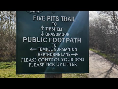
Derbyshire Walks - Hiking the Five Pits Trail

In this video I take in a Derbyshire walks around the Five Pits Trail, Silverhill Trail, Teversal Track and Hardwick Hall. The Five Pits ...

The Walk - EP 51 - Black Liquid Gold - UK's First Oilwell - Tibshelf, Derbyshire

First of all, big thank to Oilwell Nursery in Hardstoft for letting me film. Lovely people. I take a leisurely stroll along the five pits trail ...

Little Lily's Adventures #4 Five pits trail, Grassmoor to Williamthorpe ponds

Little Lily's Adventures #4. Five pits trail from Grassmoor to Williamthorpe nature reserve and ponds.

Motorhome shopping pt 2

Off we go again this time we are at Timberland Motorhome in Chesterfield https://www.timberlandmotorhomes.com/ Hope you ...

Nearby Amenities

Located within 500m of 53.173359,-1.344386
Passing Place
Lat/Long: 53.1737406/-1.3488554
Astwith
Is In: Derbyshire, England, UK
Place: village
Wikidata: Q4811792
Lat/Long: 53.1725362/-1.341916
Barrier: stile
Steps: 2
Stile: stepover
Lat/Long: 53.1741182/-1.3433224
Barrier: stile
Steps: 2
Stile: stepover
Lat/Long: 53.1742789/-1.3432607
Passing Place
Lat/Long: 53.174265/-1.3497986
Bench
Created By: Potlatch 0.10e
Lat/Long: 53.1729097/-1.3476195
Post Box
Collection Times: Mo-Fr 16:00; Sa 08:30
Post Box Type: lamp
Ref: S45 196
Royal Cypher: EIIR
Royal Cypher Wikidata: Q33102113
Lat/Long: 53.1719703/-1.342448
Bench
Lat/Long: 53.171959/-1.3424093
Ele: 158
Information: board
Tourism: information
Lat/Long: 53.1719484/-1.3423681
Barrier: stile
Steps: 1
Stile: stepover
Lat/Long: 53.1699261/-1.342612
Barrier: stile
Steps: 2
Stile: stepover
Lat/Long: 53.1749023/-1.3425247
Barrier: stile
Steps: 1
Stile: stepover
Lat/Long: 53.1712734/-1.3385446
Information: route_marker
Tourism: information
Lat/Long: 53.1730627/-1.3426722
Information: route_marker
Tourism: information
Lat/Long: 53.1716918/-1.342189
Information: route_marker
Tourism: information
Lat/Long: 53.174899/-1.342463
Information: route_marker
Tourism: information
Lat/Long: 53.1722478/-1.34214
Information: route_marker
Tourism: information
Lat/Long: 53.1742579/-1.3432474
Information: route_marker
Tourism: information
Lat/Long: 53.1740534/-1.3433607
The data included in this document is from www.openstreetmap.org. The data is made available under ODbL.

Have you been to Astwith?

Leave your review of Astwith below (or comments, questions and feedback).