Common End

Settlement in Derbyshire Bolsover

England

Common End

Parking and industrial units in Holmewood Industrial Estate
Parking and industrial units in Holmewood Industrial Estate Credit: Bill Boaden

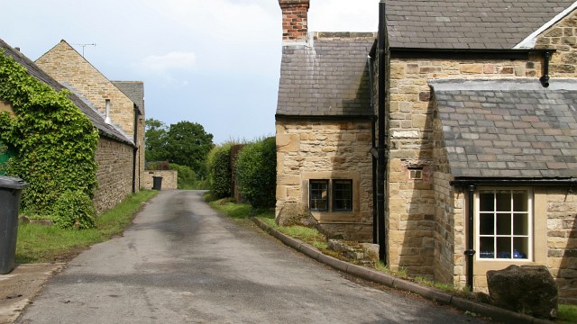
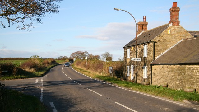
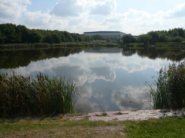
Common End is a small village located in Derbyshire, England. Situated in the heart of the Peak District National Park, it is surrounded by picturesque landscapes and offers a tranquil retreat for nature enthusiasts and outdoor adventurers alike. With a population of around 300 residents, Common End is known for its close-knit community and friendly atmosphere.

The village features an array of traditional stone cottages, giving it a charming and timeless appeal. Its rural location provides residents and visitors with stunning views of rolling hills, lush green meadows, and dense woodlands. It is not uncommon to spot various wildlife species such as deer, rabbits, and a variety of birdlife in the area.

Common End is a haven for hikers, cyclists, and horse riders, as it boasts an extensive network of trails and paths that traverse the surrounding countryside. The village is also within close proximity to several popular tourist attractions, including Chatsworth House, Haddon Hall, and Bakewell, making it a convenient base for exploring the wider Derbyshire area.

While Common End does not have its own shops or amenities, the nearby town of Bakewell is easily accessible and offers a range of services and facilities. Additionally, the village is well-connected via public transport, with regular bus services operating to and from neighboring towns and cities.

Overall, Common End offers a peaceful and idyllic setting for those seeking a rural retreat, surrounded by natural beauty and a strong sense of community.

If you have any feedback on the listing, please let us know in the comments section below.
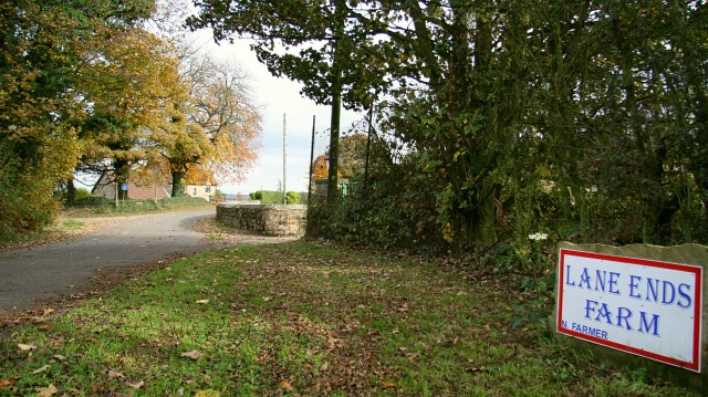
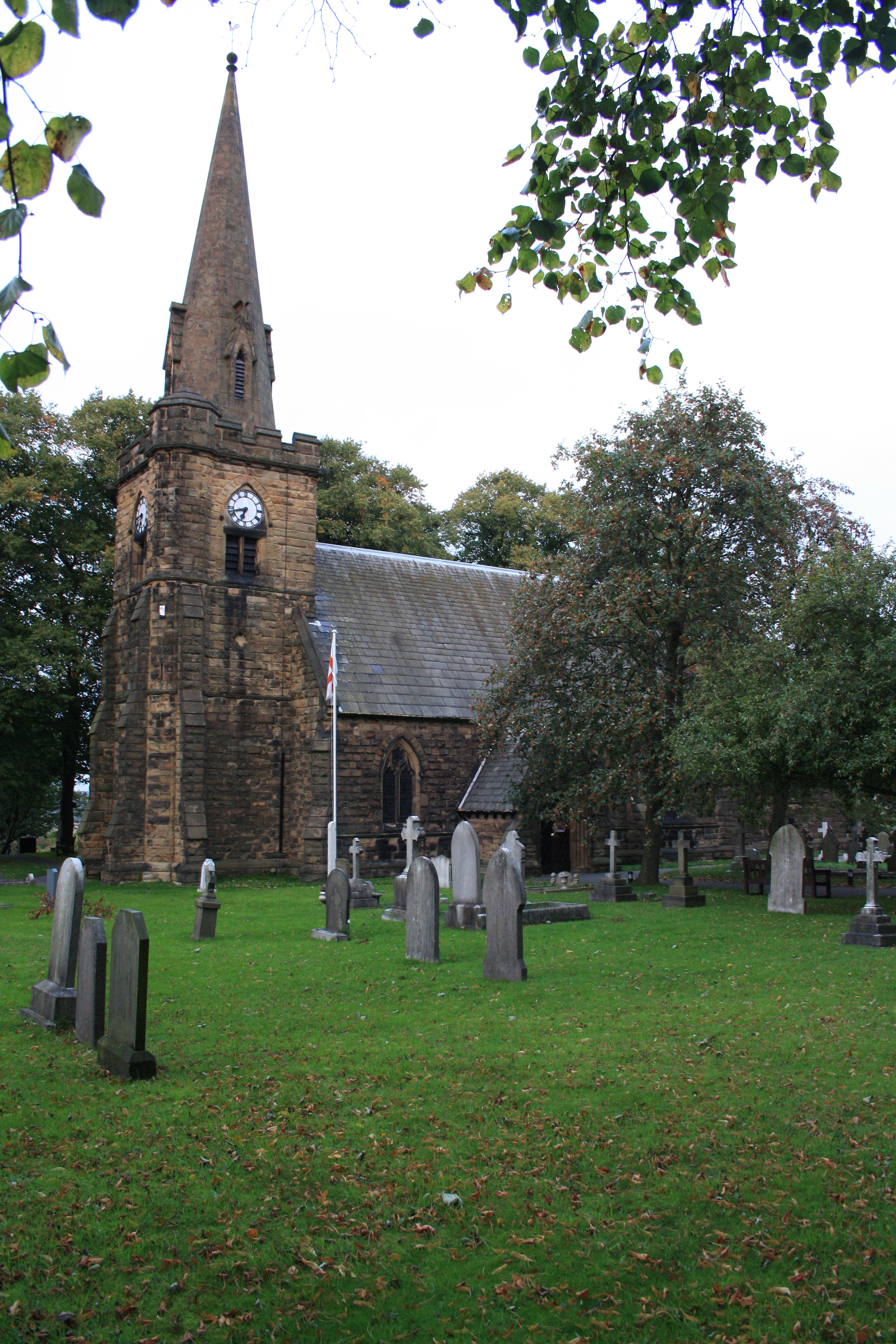
Common End Images

Images are sourced within 2km of 53.171383/-1.3581853 or Grid Reference SK4364. Thanks to Geograph Open Source API. All images are credited.

Parking and industrial units in Holmewood Industrial Estate
Hardwick View Road A circular road providing access to Holmewood Industrial Estate.
Hardwick View Road
A circular road providing access to Holmewood Industrial Estate.
Hardwick View Road A circular road providing access to Holmewood Industrial Estate. Despite the name, Hardwick Hall cannot be seen from here.
Hardwick View Road
A circular road providing access to Holmewood Industrial Estate. Despite the name, Hardwick Hall cannot be seen from here.
Cut Mark Toll Bar Cottage Hardstoft
Toll Bar Cottage Chesterfield Rd Hardstoft
Cut Mark Pilsley Primary School Pilsley
Cut Mark Rupert St Pilsley
Paths from Hallgate Lane
Bus stop on Rupert Street, Pilsley
"The Star Inn", Lower Pilsley
Cottages at Lower Pilsley Opposite the primary school.
Cottages at Lower Pilsley
Opposite the primary school.
Pond at Seanor Farm
Pond at Seanor Farm
Wary heron at Seanor Farm
Storing straw at Seanor Farm
Approaching a smallholding near North Wingfield
On Williamthorpe Road, North Wingfield
Gifts and Tarot Reading Shop in Pilsley It seemed incongruous from both points of view - fortune telling and gift buying - in the heart of a former pit village. The same shop was spotted by Alan Walker in 2007. See <a title="https://www.geograph.org.uk/photo/314097" href="https://www.geograph.org.uk/photo/314097">Link</a>
Gifts and Tarot Reading Shop in Pilsley
It seemed incongruous from both points of view - fortune telling and gift buying - in the heart of a former pit village. The same shop was spotted by Alan Walker in 2007. See Link
Remembering... in Pilsley Two pit wheels remind passers by that like many other villages in north east Derbyshire, Pilsley was built on coal. Erected by the parish council the inscription on the accompanying plaque reads touchingly, "Thank you for the warmth and the light". Opened in 1866, at its peak Pilsley Colliery comprised six shafts, employed 945 men and produced 1,200 tons of coal per shift. The colliery was closed in 1957 but many village men continued to work in the coal industry up to the 1980's.
Remembering... in Pilsley
Two pit wheels remind passers by that like many other villages in north east Derbyshire, Pilsley was built on coal. Erected by the parish council the inscription on the accompanying plaque reads touchingly, "Thank you for the warmth and the light". Opened in 1866, at its peak Pilsley Colliery comprised six shafts, employed 945 men and produced 1,200 tons of coal per shift. The colliery was closed in 1957 but many village men continued to work in the coal industry up to the 1980's.
Show me another place!

Common End is located at Grid Ref: SK4364 (Lat: 53.171383, Lng: -1.3581853)

Administrative County: Derbyshire

District: Bolsover

Police Authority: Derbyshire

What 3 Words

///lights.emulated.sushi. Near Pilsley, Derbyshire

Related Wikis

Blackwell Rural District

Blackwell was a rural district in Derbyshire, England from 1894 to 1974. It was created under the Local Government Act 1894 based on that part of the...

Astwith

Astwith is a village in Derbyshire, England. Astwith is in the parish of Ault Hucknall. For many decades it was a part of the manor of Stainsby, which...

Hardstoft

Hardstoft is a hamlet in Derbyshire, England. It is located four miles east of Clay Cross, on the B6039 road. The Mexican Eagle Petroleum Company found...

Common End, Derbyshire

Common End is a place noted on an Ordnance Survey map of Derbyshire, England. It is located eight miles south-east of Chesterfield, and just north of Astwith...

Heath and Holmewood

Heath and Holmewood, formerly just Heath is a civil parish forming part of the district of North East Derbyshire, in the county of Derbyshire, England...

Pilsley railway station

Pilsley railway station is a disused station which served the village of Pilsley in Derbyshire, England. It was on the Great Central Main Line. The station...

Pilsley, North East Derbyshire

Pilsley is a village and civil parish in the district of North East Derbyshire in the county of Derbyshire, England. It is located near to the town of...

Holmewood

Holmewood is a village in the North East Derbyshire district of Derbyshire, England. Historically a coal mining village, it has close links to the villages...

Nearby Amenities

Located within 500m of 53.171383,-1.3581853
Barrier: stile
Steps: 2
Stile: stepover
Lat/Long: 53.1730401/-1.3542804
Barrier: stile
Lat/Long: 53.167601/-1.3558256
Barrier: stile
Lat/Long: 53.1676008/-1.3560198
Barrier: stile
Lat/Long: 53.1728113/-1.3613686
Barrier: stile
Steps: 2
Stile: stepover
Lat/Long: 53.1729477/-1.3641612
Bench
Created By: Potlatch 0.10e
Lat/Long: 53.1727339/-1.3617215
Bench
Created By: Potlatch 0.10e
Lat/Long: 53.1706245/-1.362906
Barrier: stile
Steps: 2
Stile: stepover
Lat/Long: 53.1696828/-1.3630403
Barrier: stile
Steps: 1
Stile: stepover
Lat/Long: 53.1695542/-1.3632154
Barrier: stile
Lat/Long: 53.173666/-1.3613696
Barrier: stile
Lat/Long: 53.171427/-1.3596295
Barrier: stile
Steps: 2
Stile: stepover
Lat/Long: 53.1726597/-1.3524093
Bench
Created By: Potlatch 0.10e
Lat/Long: 53.1739562/-1.361581
Bench
Created By: Potlatch 0.10e
Lat/Long: 53.1741054/-1.3616582
Note: No longer a 3rd bench here
Lat/Long: 53.1742082/-1.3615466
Barrier: stile
Lat/Long: 53.16794/-1.3564633
Board Title: Five Pits Trail
Board Type: nature
Ele: 155
Information: board
Tourism: information
Lat/Long: 53.1742836/-1.3612244
Ele: 155
Lat/Long: 53.1743652/-1.3612926
Ele: 164
Lat/Long: 53.1747364/-1.3583475
Ele: 166
Lat/Long: 53.1748987/-1.3577137
Ele: 168
Lat/Long: 53.174981/-1.3565625
Ele: 165
Lat/Long: 53.1747605/-1.3582428
Ele: 162
Lat/Long: 53.1742894/-1.3592393
Ele: 167
Lat/Long: 53.1748666/-1.3572625
Passing Place
Lat/Long: 53.1745376/-1.3545728
Ele: 162
Lat/Long: 53.1743875/-1.3591535
Ele: 147
Lat/Long: 53.1742572/-1.3611696
Barrier: cycle_barrier
Lat/Long: 53.1737312/-1.3614404
Barrier: stile
Lat/Long: 53.1728714/-1.3533347
Barrier: stile
Steps: 2
Stile: stepover
Lat/Long: 53.1728529/-1.3532206
Parking
Access: unknown
Lat/Long: 53.1729085/-1.3520482
Information: guidepost
Note: No BOAT or Restricted Byway signage here
Tourism: information
Lat/Long: 53.17366/-1.3614916
Information: route_marker
Tourism: information
Lat/Long: 53.1743415/-1.3611984
Information: guidepost
Tourism: information
Lat/Long: 53.173689/-1.3613587
Information: route_marker
Tourism: information
Lat/Long: 53.1727941/-1.3614152
Information: route_marker
Tourism: information
Lat/Long: 53.1693264/-1.3577182
Information: route_marker
Tourism: information
Lat/Long: 53.1679179/-1.3565152
Information: route_marker
Tourism: information
Lat/Long: 53.1714167/-1.3596845
Information: route_marker
Tourism: information
Lat/Long: 53.1675785/-1.3560232
Information: route_marker
Tourism: information
Lat/Long: 53.1742346/-1.3611659
Information: audioguide
Tourism: information
Lat/Long: 53.1742855/-1.3611991
Guidepost Type: PROW
Information: guidepost
Note: I think that the PF direction signage is more sane now?
Tourism: information
Lat/Long: 53.1742977/-1.3609865
Guidepost Type: PROW
Information: guidepost
Note: Public right of way sign only. Currently signs Public Footpath north guidepost itself says "bridleway" on it.
Tourism: information
Lat/Long: 53.1742335/-1.3610693
The data included in this document is from www.openstreetmap.org. The data is made available under ODbL.

Have you been to Common End?

Leave your review of Common End below (or comments, questions and feedback).