Cottage Plantation

Wood, Forest in Norfolk King's Lynn and West Norfolk

England

Cottage Plantation

Small weir on Babingley River Once one of many weirs on the Babingley, this is one of the few that can be accessed properly and remains to this day.  The structure appears to be metal on either side - many similar to it have been taken out in recent years for rewilding.
Small weir on Babingley River Credit: Carl Bramham

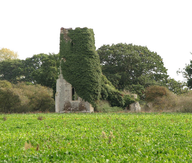
Cottage Plantation, located in Norfolk, England, is a charming woodland area known for its serene atmosphere and lush greenery. Situated within a dense forest, this idyllic plantation offers a quiet retreat for nature enthusiasts and those seeking tranquility away from the bustling city.

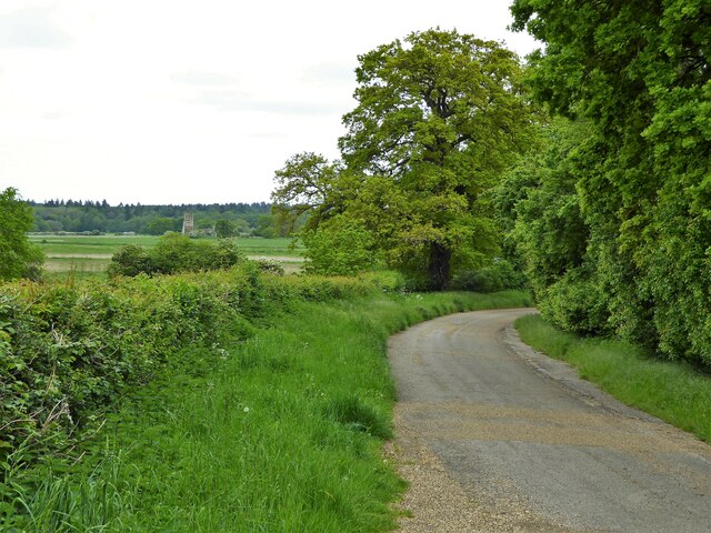
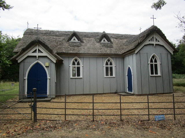
The plantation is characterized by its picturesque cottages, which are nestled amidst tall trees and vibrant flora. These cottages, made of wood, blend harmoniously with the natural surroundings, giving visitors a sense of rustic charm. The architecture reflects traditional English countryside aesthetics, with thatched roofs and quaint, colorful facades.

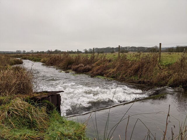
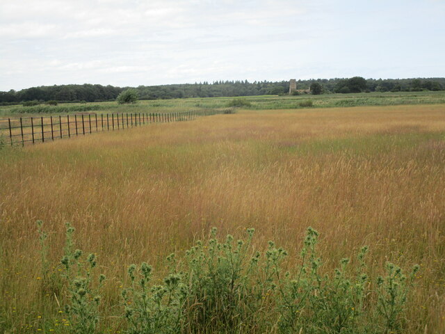
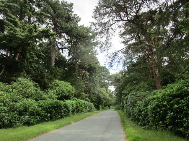
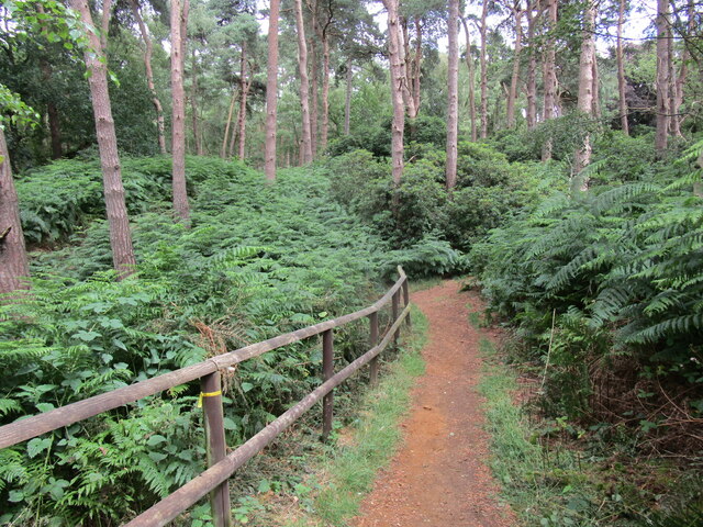
The forest surrounding Cottage Plantation is home to a diverse range of plant and animal species, providing an enchanting experience for nature lovers. Towering oak, beech, and pine trees dominate the landscape, creating a canopy of shade and shelter. The forest floor is carpeted with a variety of wildflowers, ferns, and mosses, adding a touch of vibrancy to the scenery.

Walking trails wind through the woodland, allowing visitors to explore the plantation at their own pace. These trails lead to hidden clearings, babbling brooks, and tranquil ponds, offering opportunities for picnics, birdwatching, and photography. The plantation is also home to numerous species of birds, including woodpeckers, owls, and songbirds, making it a popular spot for birdwatching enthusiasts.

Overall, Cottage Plantation in Norfolk offers a peaceful and immersive experience in the heart of nature. Its charming cottages, dense forest, and diverse wildlife make it an ideal destination for those seeking solace and a deeper connection with the natural world.

If you have any feedback on the listing, please let us know in the comments section below.

Cottage Plantation Images

Images are sourced within 2km of 52.809317/0.48817425 or Grid Reference TF6726. Thanks to Geograph Open Source API. All images are credited.

Small weir on Babingley River Once one of many weirs on the Babingley, this is one of the few that can be accessed properly and remains to this day.  The structure appears to be metal on either side - many similar to it have been taken out in recent years for rewilding.
Small weir on Babingley River
Once one of many weirs on the Babingley, this is one of the few that can be accessed properly and remains to this day. The structure appears to be metal on either side - many similar to it have been taken out in recent years for rewilding.
St Lawrence's Churchyard
Old Hunstanton Road On the now private road on the Castle Rising Estate with a view far across the fields to the ruined church of St Felix
Old Hunstanton Road
On the now private road on the Castle Rising Estate with a view far across the fields to the ruined church of St Felix
Old Milestone by A149, roadside The Milestone is located on the verge on the East of the road.  Parish of Sandringham (Kings Lynn and West Norfolk District). Metal plate attached to stone post, Lynn metal number design, erected by the Lynn - East Gate (Dersingham & Hillington) turnpike trust in the 19th Century, metal number rusty. An earlier photograph can be found here: <a title="https://www.geograph.org.uk/photo/6044415" href="https://www.geograph.org.uk/photo/6044415">Link</a> 

Inscription reads:-  
6  

Milestone Society National ID: NO_KLW06
Old Milestone by A149, roadside
The Milestone is located on the verge on the East of the road.  Parish of Sandringham (Kings Lynn and West Norfolk District). Metal plate attached to stone post, Lynn metal number design, erected by the Lynn - East Gate (Dersingham & Hillington) turnpike trust in the 19th Century, metal number rusty. An earlier photograph can be found here: Link  Inscription reads:- 6 Milestone Society National ID: NO_KLW06
Night Marsh Looking towards the remains of St Felix's church, Babingley.
Night Marsh
Looking towards the remains of St Felix's church, Babingley.
St Felix Chapel, Babingley Part of the British Orthodox Church. Dates from 1880 <span class="nowrap"><a title="http://www.norfolkchurches.co.uk/babingley/babingley.htm" rel="nofollow ugc noopener" href="http://www.norfolkchurches.co.uk/babingley/babingley.htm">Link</a><img style="margin-left:2px;" alt="External link" title="External link - shift click to open in new window" src="https://s1.geograph.org.uk/img/external.png" width="10" height="10"/></span>
St Felix Chapel, Babingley
Part of the British Orthodox Church. Dates from 1880 LinkExternal link
Road through Edinburgh Plantation
Footpath to Dersingham Bog Nature Reserve
Cottages, Castle Rising
West front, St Lawrence's church, Castle Rising Norman west front partly rebuilt in the nineteenth century <span class="nowrap"><a title="https://historicengland.org.uk/listing/the-list/list-entry/1077602?section=official-list-entry" rel="nofollow ugc noopener" href="https://historicengland.org.uk/listing/the-list/list-entry/1077602?section=official-list-entry">Link</a><img style="margin-left:2px;" alt="External link" title="External link - shift click to open in new window" src="https://s1.geograph.org.uk/img/external.png" width="10" height="10"/></span>
West front, St Lawrence's church, Castle Rising
Norman west front partly rebuilt in the nineteenth century LinkExternal link
St Lawrence's church, Castle Rising Norman church, restored and partly rebuilt in the nineteenth century <span class="nowrap"><a title="https://historicengland.org.uk/listing/the-list/list-entry/1077602?section=official-list-entry" rel="nofollow ugc noopener" href="https://historicengland.org.uk/listing/the-list/list-entry/1077602?section=official-list-entry">Link</a><img style="margin-left:2px;" alt="External link" title="External link - shift click to open in new window" src="https://s1.geograph.org.uk/img/external.png" width="10" height="10"/></span>
St Lawrence's church, Castle Rising
Norman church, restored and partly rebuilt in the nineteenth century LinkExternal link
Trinity Hospital, Castle Rising Dated 1609 - 15 <span class="nowrap"><a title="https://historicengland.org.uk/listing/the-list/list-entry/1342436?section=official-list-entry" rel="nofollow ugc noopener" href="https://historicengland.org.uk/listing/the-list/list-entry/1342436?section=official-list-entry">Link</a><img style="margin-left:2px;" alt="External link" title="External link - shift click to open in new window" src="https://s1.geograph.org.uk/img/external.png" width="10" height="10"/></span>
Trinity Hospital, Castle Rising
Dated 1609 - 15 LinkExternal link
Old Hunstanton Road, Castle Rising Now a bridleway.
Old Hunstanton Road, Castle Rising
Now a bridleway.
Footpath along the edge of Night Marsh
20 and 21 Low Road, Castle Rising Seventeenth century cottages <span class="nowrap"><a title="https://historicengland.org.uk/listing/the-list/list-entry/1168544?section=official-list-entry" rel="nofollow ugc noopener" href="https://historicengland.org.uk/listing/the-list/list-entry/1168544?section=official-list-entry">Link</a><img style="margin-left:2px;" alt="External link" title="External link - shift click to open in new window" src="https://s1.geograph.org.uk/img/external.png" width="10" height="10"/></span>
20 and 21 Low Road, Castle Rising
Seventeenth century cottages LinkExternal link
St Felix Chapel, Babingley Part of the British Orthodox Church. Dates from 1880. <span class="nowrap"><a title="http://www.norfolkchurches.co.uk/babingley/babingley.htm" rel="nofollow ugc noopener" href="http://www.norfolkchurches.co.uk/babingley/babingley.htm">Link</a><img style="margin-left:2px;" alt="External link" title="External link - shift click to open in new window" src="https://s1.geograph.org.uk/img/external.png" width="10" height="10"/></span>
St Felix Chapel, Babingley
Part of the British Orthodox Church. Dates from 1880. LinkExternal link
Field and shelter belt, Babingley
Show me another place!

Cottage Plantation is located at Grid Ref: TF6726 (Lat: 52.809317, Lng: 0.48817425)

Administrative County: Norfolk

District: King's Lynn and West Norfolk

Police Authority: Norfolk

What 3 Words

///purchaser.reassured.auctioned. Near Dersingham, Norfolk

Related Wikis

Babingley

Babingley is a village and former civil parish, now in the parish of Sandringham, in the King's Lynn and West Norfolk district, in the county of Norfolk...

West Newton, Norfolk

West Newton is a village and former civil parish, now in the parish of Sandringham, in the King's Lynn and West Norfolk district, in the north of the county...

Castle Rising

Castle Rising is a village and civil parish in the English county of Norfolk. The village is situated some 8 kilometres (5 mi) north-east of the town of...

Castle Rising Castle

Castle Rising is a ruined medieval fortification in the village of Castle Rising, Norfolk, England. It was built soon after 1138 by William d'Aubigny II...

Dersingham Bog

Dersingham Bog is a 159.1-hectare (393-acre) biological and geological Site of Special Scientific Interest in Norfolk, England. It is a Nature Conservation...

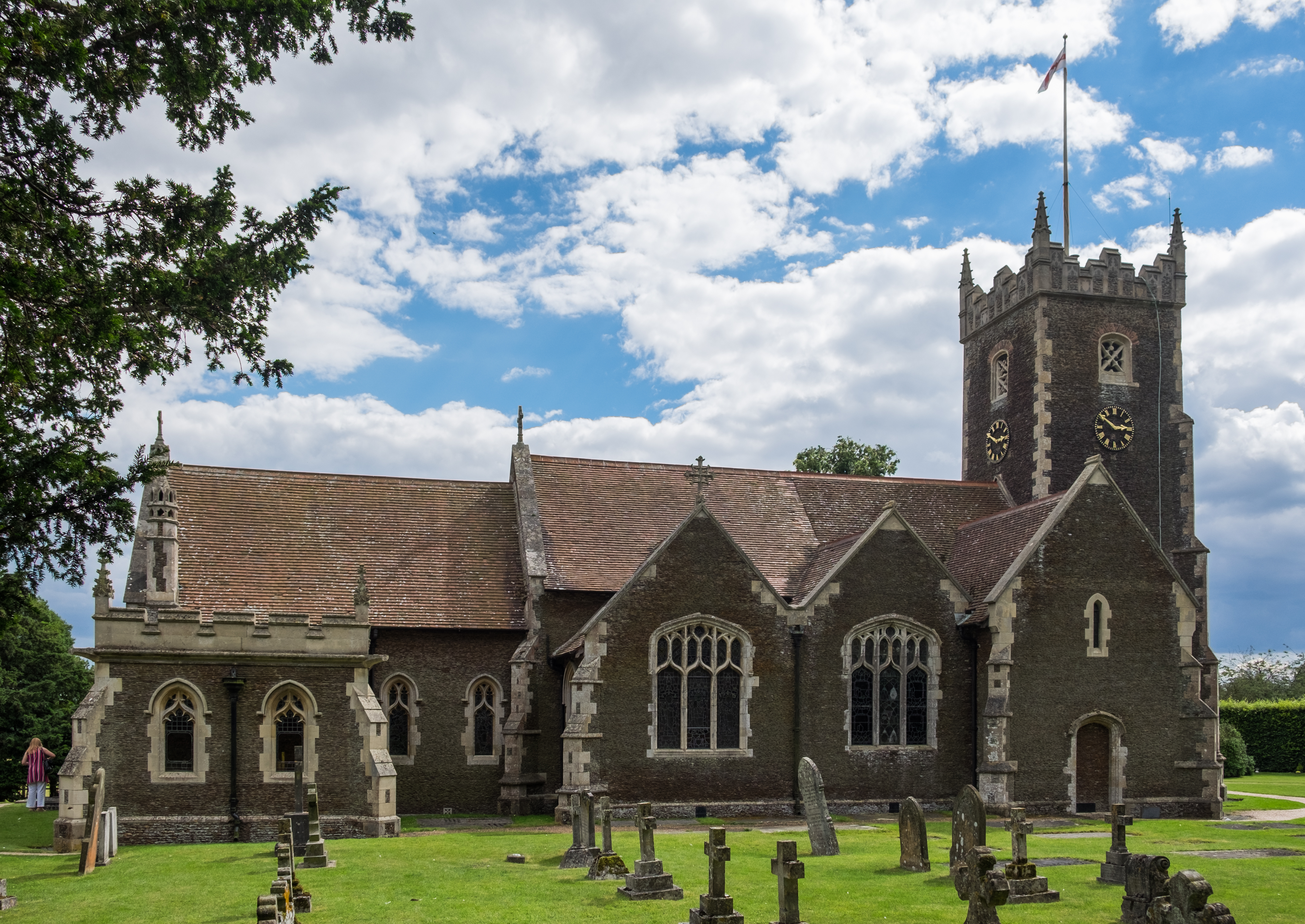
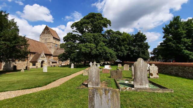
St Mary Magdalene Church, Sandringham

St Mary Magdalene Church is a church in Sandringham, Norfolk, England, located just to the southwest of Sandringham House. Members of the British Royal...

Wood Farm

Wood Farm is a farmhouse on the British Royal Family's Sandringham Estate in Norfolk, England. Historically occupied by members of the Royal Family and...

York Cottage

York Cottage is a house in the grounds of Sandringham House in Norfolk, England. == History == The cottage was originally called the Bachelor's Cottage...

Nearby Amenities

Located within 500m of 52.809317,0.48817425
Bus Stop
Post Box, opp
Naptan AtcoCode: 2900S0511
Naptan Bearing: N
Naptan CommonName: Post Box
Naptan Indicator: opp
Naptan Landmark: Babingley Cross Cottages
Naptan Locality: Sandringham
Naptan NaptanCode: nfodtadj
Naptan Street: A149
Naptan Verified: no
Source: naptan_import
Lat/Long: 52.8093373/0.4845088
Village Sign, opp
Naptan AtcoCode: 2900S0512
Naptan Bearing: SW
Naptan BusStopType: CUS
Naptan CommonName: Village Sign
Naptan Indicator: opp
Naptan Landmark: Village Sign
Naptan Locality: Sandringham
Naptan NaptanCode: nfodtadm
Naptan Street: B1439
Naptan Verified: no
Source: naptan_import
Lat/Long: 52.8091338/0.4858175
Village Sign, adj
Naptan AtcoCode: 2900S0513
Naptan Bearing: NE
Naptan BusStopType: CUS
Naptan CommonName: Village Sign
Naptan Indicator: adj
Naptan Landmark: Rac Box
Naptan Locality: Sandringham
Naptan NaptanCode: nfodtadp
Naptan Street: A1439
Naptan Verified: no
Source: naptan_import
Lat/Long: 52.8092586/0.4856914
Post Box
Operator: Royal Mail
Post Box Mounting: pier
Post Box Type: lamp
Lat/Long: 52.809385/0.4848063
Millennium Milepost Babingley
Description: 1) Kings's Lynn 7 2) Sandringham 2
Image: https://www.cyclestreets.net/location/186500/cyclestreets186500-size640.jpg
Information: guidepost
Ncn Milepost: mills
Sustrans Ref: MP 218
Tourism: information
Lat/Long: 52.8117615/0.4838614
Babingley
Note: Abandoned village
Place: hamlet
Wikidata: Q4837911
Lat/Long: 52.8088743/0.4811239
Cross Cottages, adj
Naptan AtcoCode: 2900S058
Naptan Bearing: S
Naptan BusStopType: CUS
Naptan CommonName: Cross Cottages
Naptan Indicator: adj
Naptan Landmark: Cross Cottages
Naptan Locality: Sandringham
Naptan NaptanCode: nfogmgap
Naptan Street: A149
Naptan Verified: no
Source: naptan_import
Lat/Long: 52.8093519/0.4848093
Babingley
Colour: brown
Inscription: Pastores Sancti Subveniunt Fragio Nau Maeles Babinglienses
Man Made: village_sign
Material: wood
Lat/Long: 52.809248/0.4848441
Give Way
Lat/Long: 52.8088838/0.4849179
Give Way
Lat/Long: 52.8090324/0.4851762
Give Way
Lat/Long: 52.8090877/0.4848439
Power: pole
Transformer: distribution
Lat/Long: 52.8080571/0.4830739
Power: pole
Lat/Long: 52.8069546/0.484069
Power: pole
Lat/Long: 52.807475/0.4835808
Power: pole
Lat/Long: 52.8062314/0.4847234
The data included in this document is from www.openstreetmap.org. The data is made available under ODbL.

Have you been to Cottage Plantation?

Leave your review of Cottage Plantation below (or comments, questions and feedback).