Marlborough Wood

Wood, Forest in Kent Tunbridge Wells

England

Marlborough Wood

Dundale Farm As seen from a footpath from Pembury to Dundale Road.
In the middle is Dundale Oast house.
In the background is Furnace Wood.
Dundale Farm Credit: David Anstiss

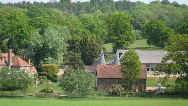
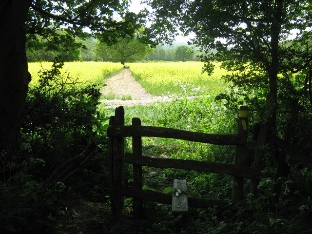
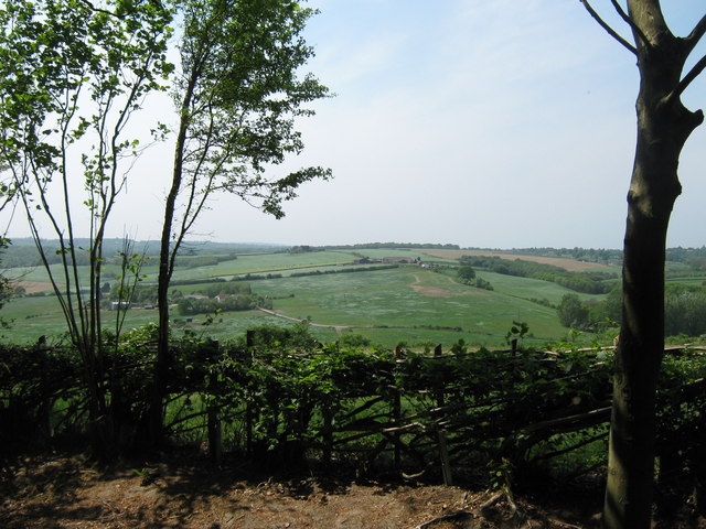
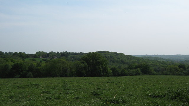
Marlborough Wood, located in Kent, England, is a charming and serene woodland area that spans over a vast expanse of approximately 100 hectares. It is nestled in the heart of the picturesque county, near the village of Marlborough, and attracts nature enthusiasts and visitors seeking tranquility.

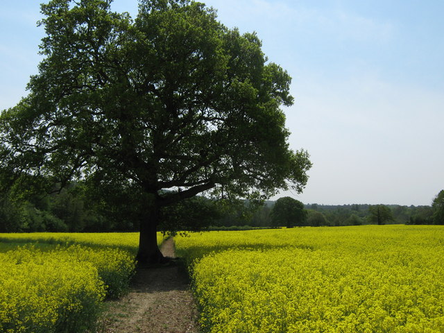
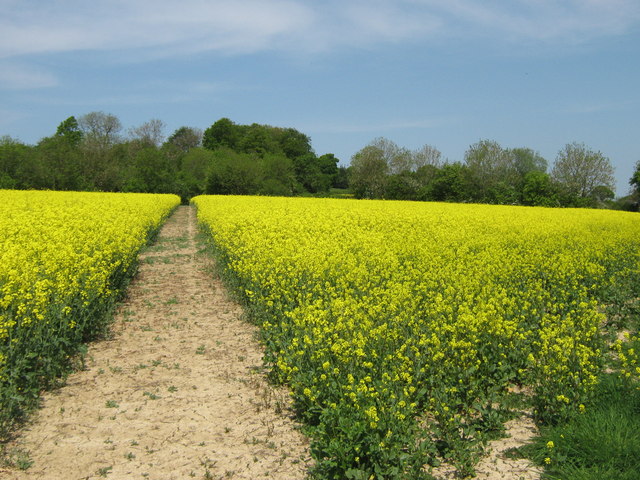
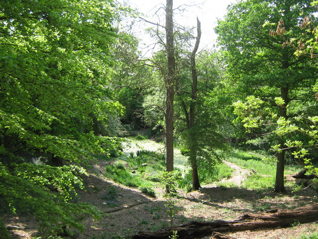
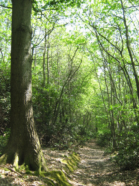
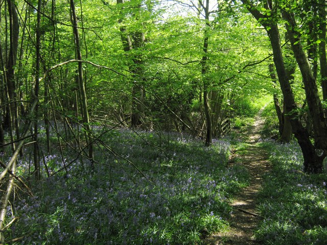
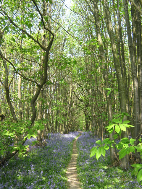
This woodland is a thriving ecosystem, boasting an impressive variety of tree species. Ancient oaks, majestic beeches, and graceful silver birches dominate the landscape, creating a captivating canopy that provides shelter to an array of wildlife. The forest floor is adorned with a rich tapestry of flora, including bluebells, wild garlic, and ferns, which paint the forest in vibrant hues during the spring and summer months.

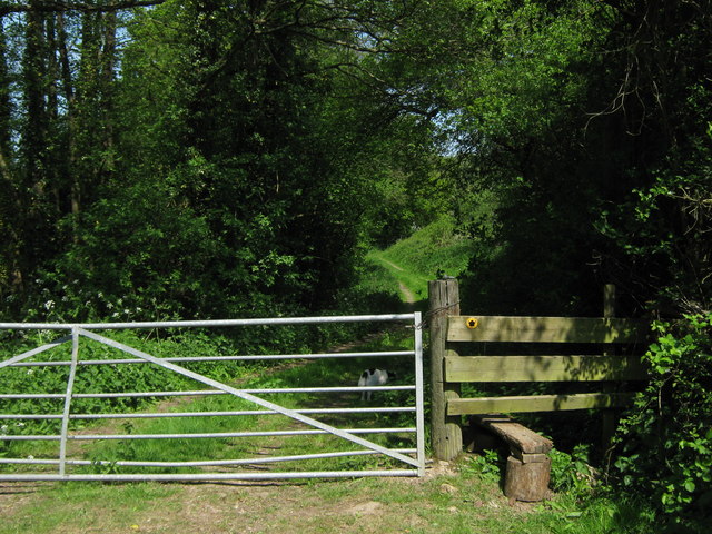
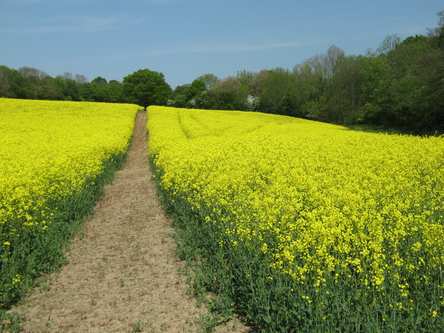
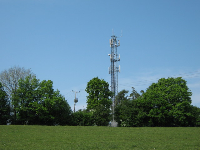
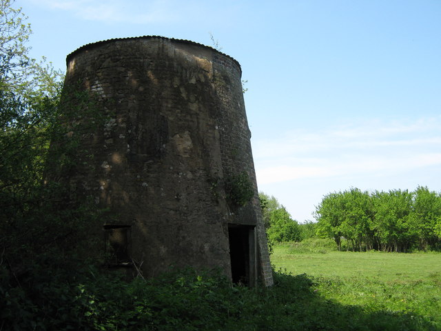
Marlborough Wood offers a network of well-maintained footpaths and trails, allowing visitors to explore its natural wonders at their own pace. These paths wind their way through the woods, offering glimpses of hidden glades, babbling brooks, and peaceful ponds. The tranquil atmosphere is perfect for leisurely strolls, birdwatching, or even picnicking amidst the dappled sunlight.

The woodland is also home to a diverse range of wildlife, making it a popular destination for nature lovers and photographers. Visitors may catch a glimpse of deer, foxes, badgers, and an array of bird species, including woodpeckers, owls, and songbirds. The forest's natural habitat provides a safe haven for these creatures, ensuring their continued presence and conservation.

Marlborough Wood, with its enchanting beauty and rich biodiversity, offers visitors a chance to connect with nature and escape the hustle and bustle of everyday life. Whether it is a peaceful walk, a wildlife encounter, or simply soaking in the tranquil ambiance, this woodland is a true gem in the Kent countryside.

If you have any feedback on the listing, please let us know in the comments section below.

Marlborough Wood Images

Images are sourced within 2km of 51.135323/0.34226684 or Grid Reference TQ6339. Thanks to Geograph Open Source API. All images are credited.

Dundale Farm As seen from a footpath from Pembury to Dundale Road.
In the middle is Dundale Oast house.
In the background is Furnace Wood.
Dundale Farm
As seen from a footpath from Pembury to Dundale Road. In the middle is Dundale Oast house. In the background is Furnace Wood.
Footpath to Pembury A farm track leads from Dundale Road, opposite Dundale Farm towards the village near Tunbridge Wells.
Footpath to Pembury
A farm track leads from Dundale Road, opposite Dundale Farm towards the village near Tunbridge Wells.
Stile and gate near Dundale Farm A farm track leads from Dundale Road, opposite Dundale Farm towards the village near Tunbridge Wells. Gate leads towards more fields.
Stile and gate near Dundale Farm
A farm track leads from Dundale Road, opposite Dundale Farm towards the village near Tunbridge Wells. Gate leads towards more fields.
Footpath to Pembury This path through an oil seed rape field on its way from Dundale Road towards Hastings Road.
Footpath to Pembury
This path through an oil seed rape field on its way from Dundale Road towards Hastings Road.
Oak on footpath to Dundale Road This field path leads from Hastings Road, Pembury towards the road near Dundale Farm.
In the background is an unnamed wood beside the River Teise.
Oak on footpath to Dundale Road
This field path leads from Hastings Road, Pembury towards the road near Dundale Farm. In the background is an unnamed wood beside the River Teise.
Stile near Great Bayhall Farm This stile is on a footpath leading from Hastings Road, Pembury towards Dundale Road.
Stile near Great Bayhall Farm
This stile is on a footpath leading from Hastings Road, Pembury towards Dundale Road.
Footpath to Dundale Road This field path is part of a long path leading from Hastings Road, Pembury towards the road near Dundale Farm.
Footpath to Dundale Road
This field path is part of a long path leading from Hastings Road, Pembury towards the road near Dundale Farm.
Small pond near Great Bayhall Farm This pond is beside a footpath from Hastings Road, Pembury heading down to Dundale Farm. Overlooked by two picnic tables.  See <a href="https://www.geograph.org.uk/photo/1409246">TQ6239 : Picnic Bench beside footpath</a>.
Small pond near Great Bayhall Farm
This pond is beside a footpath from Hastings Road, Pembury heading down to Dundale Farm. Overlooked by two picnic tables. See TQ6239 : Picnic Bench beside footpath.
Layered hedge near Great Bayhall Farm As seen from a footpath towards Pembury.
Layered hedge near Great Bayhall Farm
As seen from a footpath towards Pembury.
Footpath in Marlborough Wood A footpath leads from the A21 near Pastheap Farm through the wood, towards Dundale Road near Elmhurst Farm.
Footpath in Marlborough Wood
A footpath leads from the A21 near Pastheap Farm through the wood, towards Dundale Road near Elmhurst Farm.
Footpath in Marlborough Wood A footpath leads from the A21 near Pastheap Farm through the wood, towards Dundale Road near Elmhurst Farm. In the background is a footbridge leading over a stream beside the wood.
Footpath in Marlborough Wood
A footpath leads from the A21 near Pastheap Farm through the wood, towards Dundale Road near Elmhurst Farm. In the background is a footbridge leading over a stream beside the wood.
Unused stile near Elmhurst Farm A footpath leads from Dundale Road near Elmhurst Farm, towards Marlborough Wood (in the background) and then through the wood towards the A21 near Pastheap Farm.
Unused stile near Elmhurst Farm
A footpath leads from Dundale Road near Elmhurst Farm, towards Marlborough Wood (in the background) and then through the wood towards the A21 near Pastheap Farm.
The Stables, Elmhurst Farm On Dundale Road, opposite the farm. Stables been converted into housing.
The Stables, Elmhurst Farm
On Dundale Road, opposite the farm. Stables been converted into housing.
Stile towards Elmhurst Farm A footpath leads from the A21 near Key's Green towards Dundale Road and Elmhurst Farm (seen in the background).
Stile towards Elmhurst Farm
A footpath leads from the A21 near Key's Green towards Dundale Road and Elmhurst Farm (seen in the background).
View of Great Sandhurst Wood As seen from a footpath near Brecknock Clump, looking across Ambleford Wood to the larger wood.
View of Great Sandhurst Wood
As seen from a footpath near Brecknock Clump, looking across Ambleford Wood to the larger wood.
Mobile Phone Mast near Pembury This large phone mast is beside two large covered water reservoirs on hill near Key's Green.
Mobile Phone Mast near Pembury
This large phone mast is beside two large covered water reservoirs on hill near Key's Green.
Kippings Cross Windmill As seen from a footpath near the A21 near Key's Green.
Kippings Cross Windmill
As seen from a footpath near the A21 near Key's Green.
Footpath in Beech Wood This path leads from the A21 near Key's Green towards Cryals Road.
Wood has masses of bluebells.
Footpath in Beech Wood
This path leads from the A21 near Key's Green towards Cryals Road. Wood has masses of bluebells.
Show me another place!

Marlborough Wood is located at Grid Ref: TQ6339 (Lat: 51.135323, Lng: 0.34226684)

Administrative County: Kent

District: Tunbridge Wells

Police Authority: Kent

What 3 Words

///talkers.circulate.stylist. Near Pembury, Kent

Related Wikis

St Luke's Church, Matfield

St Luke's Church is a parish church in the village of Matfield, Kent, England. It is a Grade II listed building.The church is dedicated to Luke the Evangelist...

Pembury

Pembury is a large village in Kent, in the south east of England, with a population of 6,128 at the 2011 Census. It lies just to the north-east of Royal...

Tunbridge Wells (UK Parliament constituency)

Tunbridge Wells is a constituency in Kent represented in the House of Commons of the UK Parliament since 2005 by Greg Clark, a Conservative who served...

Matfield

Matfield is a small village, part of the civil parish of Brenchley and Matfield, in the Tunbridge Wells borough of Kent, England. Matfield was awarded...

Lamberhurst Quarter

Lamberhurst Quarter is a hamlet on the A21 road, in the English county of Kent. It is near the village of Lamberhurst. == References == http://getamap...

Brenchley Wood

Brenchley Wood is a 15-hectare (37-acre) nature reserve south of Paddock Wood in Kent. It is managed by the Kent Wildlife Trust, and it is part of the...

Brookland Wood

Brookland Wood is a 10.9-hectare (27-acre) biological Site of Special Scientific Interest east of Tunbridge Wells in Kent.This site has diverse types of...

Matfield House

Matfield House is a Grade I listed Georgian house in the village of Matfield, Kent, England.The house was built in 1728 in the Queen Anne style for Thomas...

Nearby Amenities

Located within 500m of 51.135323,0.34226684
Bus Stop
Roundabout
Bench: no
Bin: no
Bus: yes
Lit: no
Local Ref: W-bound
Naptan AtcoCode: 2400A037680A
Naptan Bearing: W
Naptan BusStopType: MKD
Naptan CommonName: Roundabout
Naptan Indicator: W-bound
Naptan Landmark: Kipping's Cross Farm
Naptan NaptanCode: kntdpatw
Naptan RevisionNumber: 4
Naptan Status: act
Naptan Street: A21
Naptan Verified: no
Public Transport: platform
Ref: kntdpatw
Shelter: no
Source: naptan_import
Source Date: 2018-05-24
Tactile Paving: no
Lat/Long: 51.135766/0.3484933
Barrier: swing_gate
Motor Vehicle: private
Lat/Long: 51.1361344/0.3482384
Barrier: swing_gate
Lat/Long: 51.1377141/0.3389465
Give Way
Direction: forward
Lat/Long: 51.1380387/0.3389717
The data included in this document is from www.openstreetmap.org. The data is made available under ODbL.

Have you been to Marlborough Wood?

Leave your review of Marlborough Wood below (or comments, questions and feedback).