Saltmans Shaw

Wood, Forest in Kent Tunbridge Wells

England

Saltmans Shaw

Dundale Farm As seen from a footpath from Pembury to Dundale Road.
In the middle is Dundale Oast house.
In the background is Furnace Wood.
Dundale Farm Credit: David Anstiss

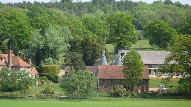
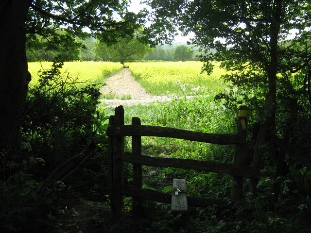
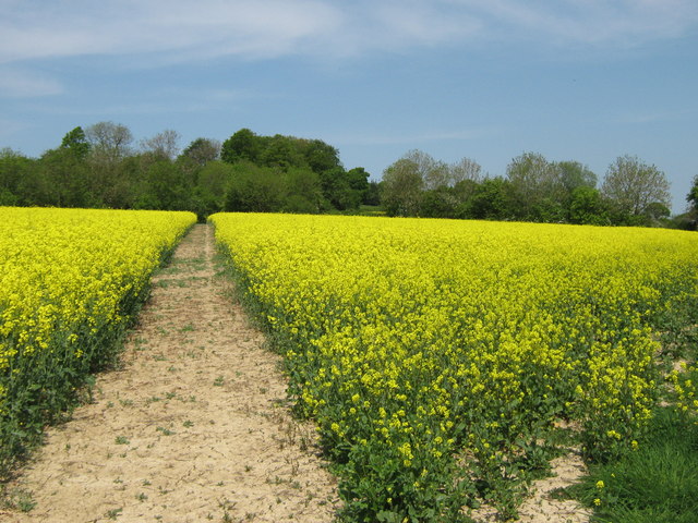
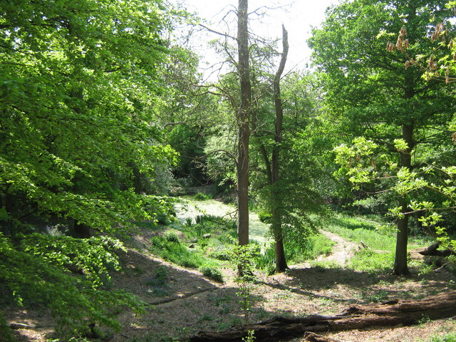
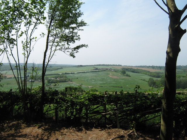
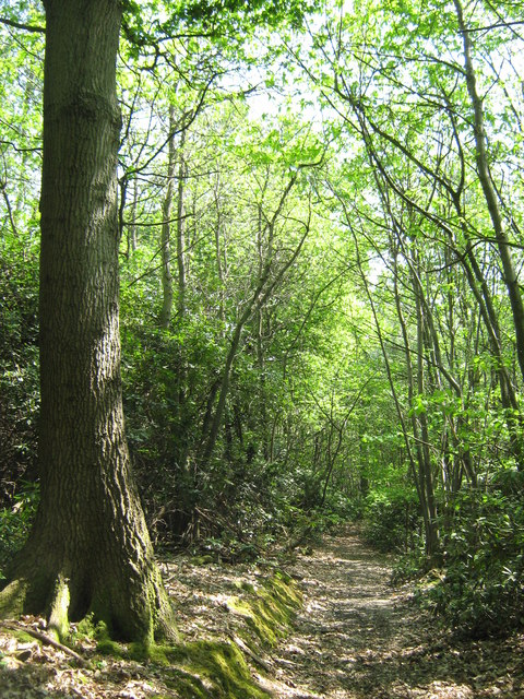
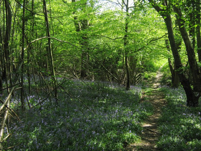
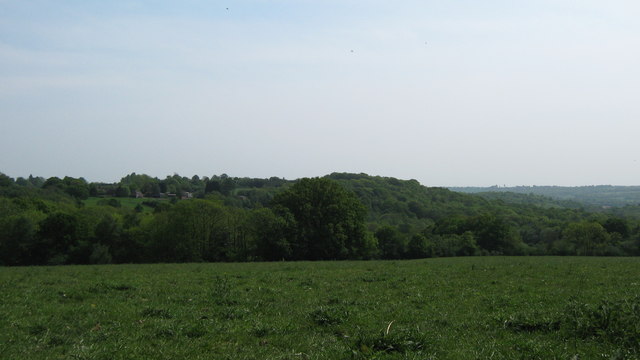
Saltmans Shaw, located in Kent, England, is a picturesque wood situated within a dense forest. Spread across an area of approximately 50 acres, this enchanting woodland is known for its natural beauty and tranquility.

The wood is characterized by its diverse range of tree species, including oak, ash, beech, and birch, which create a dense canopy overhead. This lush vegetation provides a haven for an array of wildlife, making it a popular spot for nature enthusiasts and birdwatchers. Visitors can expect to spot various species of birds, such as woodpeckers, owls, and songbirds, as well as small mammals like squirrels and rabbits.

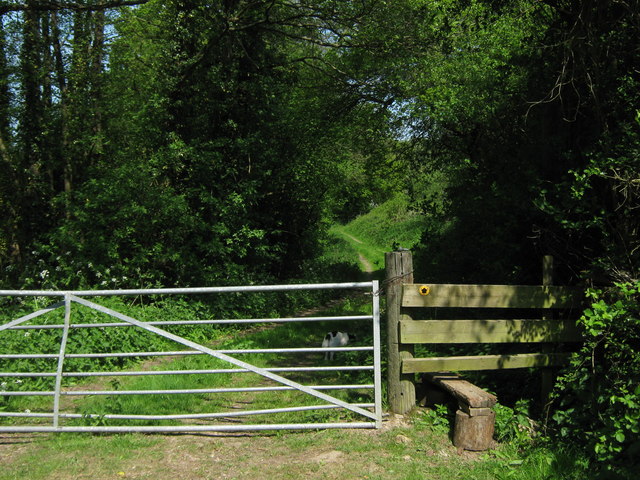
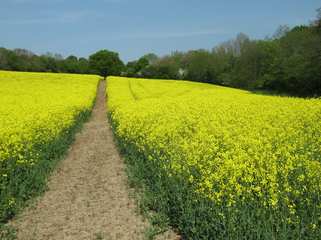
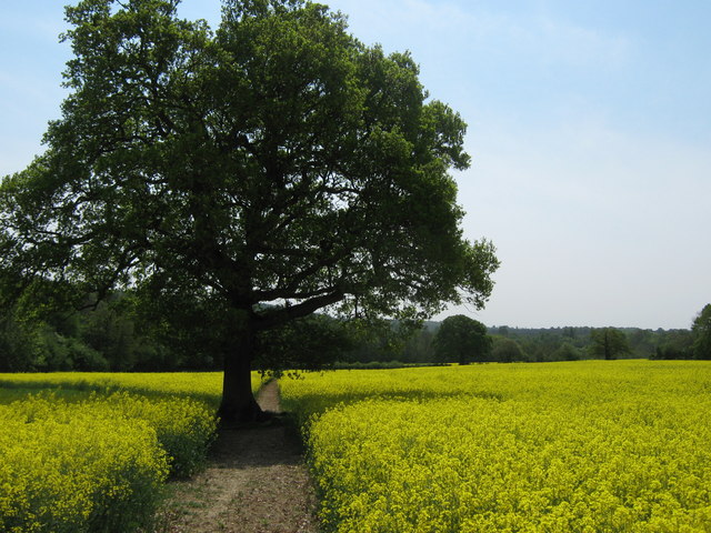
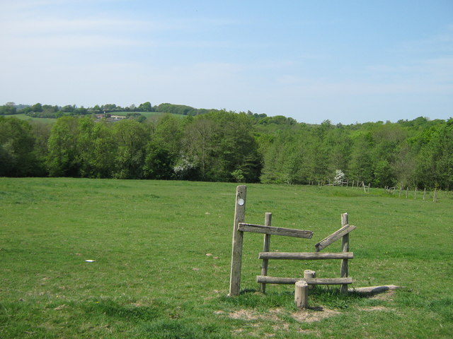
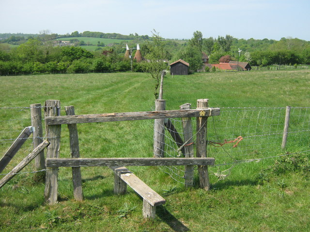
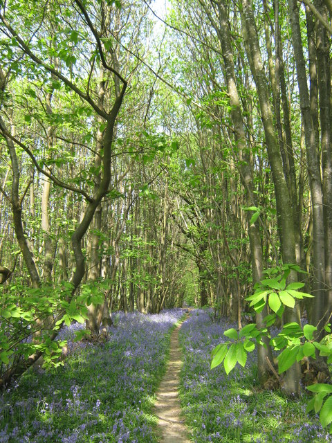
A network of well-maintained footpaths and trails meander through the wood, allowing visitors to explore and immerse themselves in the peaceful surroundings. The paths take visitors through different sections of the wood, each offering its own unique charm and scenic views. One can find secluded clearings, babbling brooks, and even a small pond, adding to the overall allure of the area.

Saltmans Shaw is a popular destination for those seeking outdoor activities such as hiking, jogging, and picnicking. The wood offers a serene escape from the hustle and bustle of everyday life, providing an opportunity to reconnect with nature and enjoy the simple pleasures it has to offer.

Overall, Saltmans Shaw in Kent is a captivating woodland that offers a delightful retreat for nature lovers. Its stunning scenery, diverse wildlife, and peaceful ambiance make it an ideal destination for anyone seeking solace in the beauty of the natural world.

If you have any feedback on the listing, please let us know in the comments section below.

Saltmans Shaw Images

Images are sourced within 2km of 51.135528/0.33786008 or Grid Reference TQ6339. Thanks to Geograph Open Source API. All images are credited.

Dundale Farm As seen from a footpath from Pembury to Dundale Road.
In the middle is Dundale Oast house.
In the background is Furnace Wood.
Dundale Farm
As seen from a footpath from Pembury to Dundale Road. In the middle is Dundale Oast house. In the background is Furnace Wood.
Footpath to Pembury A farm track leads from Dundale Road, opposite Dundale Farm towards the village near Tunbridge Wells.
Footpath to Pembury
A farm track leads from Dundale Road, opposite Dundale Farm towards the village near Tunbridge Wells.
Stile and gate near Dundale Farm A farm track leads from Dundale Road, opposite Dundale Farm towards the village near Tunbridge Wells. Gate leads towards more fields.
Stile and gate near Dundale Farm
A farm track leads from Dundale Road, opposite Dundale Farm towards the village near Tunbridge Wells. Gate leads towards more fields.
Footpath to Pembury This path through an oil seed rape field on its way from Dundale Road towards Hastings Road.
Footpath to Pembury
This path through an oil seed rape field on its way from Dundale Road towards Hastings Road.
Oak on footpath to Dundale Road This field path leads from Hastings Road, Pembury towards the road near Dundale Farm.
In the background is an unnamed wood beside the River Teise.
Oak on footpath to Dundale Road
This field path leads from Hastings Road, Pembury towards the road near Dundale Farm. In the background is an unnamed wood beside the River Teise.
Stile near Great Bayhall Farm This stile is on a footpath leading from Hastings Road, Pembury towards Dundale Road.
Stile near Great Bayhall Farm
This stile is on a footpath leading from Hastings Road, Pembury towards Dundale Road.
Footpath to Dundale Road This field path is part of a long path leading from Hastings Road, Pembury towards the road near Dundale Farm.
Footpath to Dundale Road
This field path is part of a long path leading from Hastings Road, Pembury towards the road near Dundale Farm.
Small pond near Great Bayhall Farm This pond is beside a footpath from Hastings Road, Pembury heading down to Dundale Farm. Overlooked by two picnic tables.  See <a href="https://www.geograph.org.uk/photo/1409246">TQ6239 : Picnic Bench beside footpath</a>.
Small pond near Great Bayhall Farm
This pond is beside a footpath from Hastings Road, Pembury heading down to Dundale Farm. Overlooked by two picnic tables. See TQ6239 : Picnic Bench beside footpath.
Layered hedge near Great Bayhall Farm As seen from a footpath towards Pembury.
Layered hedge near Great Bayhall Farm
As seen from a footpath towards Pembury.
Footpath in Marlborough Wood A footpath leads from the A21 near Pastheap Farm through the wood, towards Dundale Road near Elmhurst Farm.
Footpath in Marlborough Wood
A footpath leads from the A21 near Pastheap Farm through the wood, towards Dundale Road near Elmhurst Farm.
Footpath in Marlborough Wood A footpath leads from the A21 near Pastheap Farm through the wood, towards Dundale Road near Elmhurst Farm. In the background is a footbridge leading over a stream beside the wood.
Footpath in Marlborough Wood
A footpath leads from the A21 near Pastheap Farm through the wood, towards Dundale Road near Elmhurst Farm. In the background is a footbridge leading over a stream beside the wood.
Unused stile near Elmhurst Farm A footpath leads from Dundale Road near Elmhurst Farm, towards Marlborough Wood (in the background) and then through the wood towards the A21 near Pastheap Farm.
Unused stile near Elmhurst Farm
A footpath leads from Dundale Road near Elmhurst Farm, towards Marlborough Wood (in the background) and then through the wood towards the A21 near Pastheap Farm.
The Stables, Elmhurst Farm On Dundale Road, opposite the farm. Stables been converted into housing.
The Stables, Elmhurst Farm
On Dundale Road, opposite the farm. Stables been converted into housing.
Stile towards Elmhurst Farm A footpath leads from the A21 near Key's Green towards Dundale Road and Elmhurst Farm (seen in the background).
Stile towards Elmhurst Farm
A footpath leads from the A21 near Key's Green towards Dundale Road and Elmhurst Farm (seen in the background).
View of Great Sandhurst Wood As seen from a footpath near Brecknock Clump, looking across Ambleford Wood to the larger wood.
View of Great Sandhurst Wood
As seen from a footpath near Brecknock Clump, looking across Ambleford Wood to the larger wood.
Mobile Phone Mast near Pembury This large phone mast is beside two large covered water reservoirs on hill near Key's Green.
Mobile Phone Mast near Pembury
This large phone mast is beside two large covered water reservoirs on hill near Key's Green.
Kippings Cross Windmill As seen from a footpath near the A21 near Key's Green.
Kippings Cross Windmill
As seen from a footpath near the A21 near Key's Green.
Footpath in Beech Wood This path leads from the A21 near Key's Green towards Cryals Road.
Wood has masses of bluebells.
Footpath in Beech Wood
This path leads from the A21 near Key's Green towards Cryals Road. Wood has masses of bluebells.
Show me another place!

Saltmans Shaw is located at Grid Ref: TQ6339 (Lat: 51.135528, Lng: 0.33786008)

Administrative County: Kent

District: Tunbridge Wells

Police Authority: Kent

What 3 Words

///overhead.camcorder.uptake. Near Pembury, Kent

Related Wikis

Pembury

Pembury is a large village in Kent, in the south east of England, with a population of 6,128 at the 2011 Census. It lies just to the north-east of Royal...

St Luke's Church, Matfield

St Luke's Church is a parish church in the village of Matfield, Kent, England. It is a Grade II listed building.The church is dedicated to Luke the Evangelist...

Tunbridge Wells (UK Parliament constituency)

Tunbridge Wells is a constituency in Kent represented in the House of Commons of the UK Parliament since 2005 by Greg Clark, a Conservative who served...

Brenchley Wood

Brenchley Wood is a 15-hectare (37-acre) nature reserve south of Paddock Wood in Kent. It is managed by the Kent Wildlife Trust, and it is part of the...

Matfield

Matfield is a small village, part of the civil parish of Brenchley and Matfield, in the Tunbridge Wells borough of Kent, England. Matfield was awarded...

Lamberhurst Quarter

Lamberhurst Quarter is a hamlet on the A21 road, in the English county of Kent. It is near the village of Lamberhurst. == References == http://getamap...

Tunbridge Wells Hospital

Tunbridge Wells Hospital is a large district general hospital in Pembury near Royal Tunbridge Wells, Kent, England, run by the Maidstone and Tunbridge...

Brookland Wood

Brookland Wood is a 10.9-hectare (27-acre) biological Site of Special Scientific Interest east of Tunbridge Wells in Kent.This site has diverse types of...

Nearby Amenities

Located within 500m of 51.135528,0.33786008
Barrier: stile
Lat/Long: 51.1396221/0.3383151
Barrier: stile
Material: wood
Step Count: 2
Stile: stepover
Lat/Long: 51.1387855/0.3363896
Barrier: stile
Lat/Long: 51.1396079/0.3382558
Give Way
Direction: forward
Lat/Long: 51.1386273/0.3354283
Give Way
Direction: forward
Lat/Long: 51.1388186/0.3353156
Barrier: swing_gate
Lat/Long: 51.1377141/0.3389465
Give Way
Direction: forward
Lat/Long: 51.1386608/0.3360244
Give Way
Direction: forward
Lat/Long: 51.1388866/0.3356487
Give Way
Direction: forward
Lat/Long: 51.1380387/0.3389717
The data included in this document is from www.openstreetmap.org. The data is made available under ODbL.

Have you been to Saltmans Shaw?

Leave your review of Saltmans Shaw below (or comments, questions and feedback).