Farnham

Settlement in Suffolk East Suffolk

England

Farnham

Farmland and pylons Near burnt House Farm.
Farmland and pylons Credit: JThomas

Farnham is a small village located in the county of Suffolk, England. Situated approximately 5 miles northeast of the town of Saxmundham, Farnham is nestled amidst the picturesque countryside of the East Anglian region. The village is surrounded by lush green fields and rolling hills, providing residents and visitors with a tranquil and scenic environment.

Farnham is known for its charming and traditional architecture, with many of its buildings dating back several centuries. The village features a mix of thatched-roof cottages, timber-framed houses, and red-brick structures, all adding to its distinctive character and historical charm.

Despite its small size, Farnham offers a range of amenities for its residents. These include a village hall, a local pub, and a primary school, providing a close-knit community atmosphere. The village is well-connected to nearby towns and cities through a network of roads, making it easily accessible for those commuting or exploring the area.

Nature enthusiasts will find plenty to enjoy in Farnham, as the village is surrounded by beautiful countryside and walking trails. The nearby Farnham Wood, a designated Site of Special Scientific Interest, offers an opportunity to explore a diverse range of flora and fauna.

In summary, Farnham is a charming village in Suffolk that offers a peaceful and idyllic setting. With its historic architecture, amenities, and natural beauty, the village provides a delightful place to live or visit for those seeking a slice of rural England.

If you have any feedback on the listing, please let us know in the comments section below.
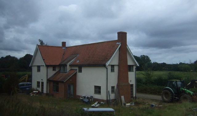
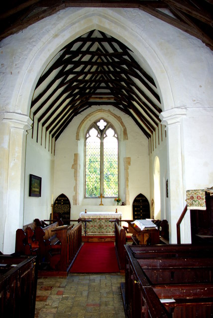
Farnham Images

Images are sourced within 2km of 52.188465/1.455546 or Grid Reference TM3660. Thanks to Geograph Open Source API. All images are credited.

Farmland and pylons Near burnt House Farm.
Farmland and pylons
Near burnt House Farm.
Grazing near Gorse Farm
House, Botany Farm
House, Botany Farm
St Mary's Church The west tower is of brick with the lower stages faced in stone.  The huge buttresses (obscuring a small Norman window) were added in the 18th century to counter the outward lean of the south wall due to subsidence on the hilltop site, the dramatic effect of which can be seen inside the church.
St Mary's Church
The west tower is of brick with the lower stages faced in stone. The huge buttresses (obscuring a small Norman window) were added in the 18th century to counter the outward lean of the south wall due to subsidence on the hilltop site, the dramatic effect of which can be seen inside the church.
Fragment of a rood screen Two panels of tracery from the upper part of the medieval screen are displayed on the wall of St Mary's Church.
Fragment of a rood screen
Two panels of tracery from the upper part of the medieval screen are displayed on the wall of St Mary's Church.
Inside St Mary's Church Looking west down the nave, the tremendous outward lean of the south wall is obvious.  The central window is Norman and is matched by a similar one on the north side.  Between the windows huge external buttresses counteract the outward thrust of the walls.  The roof has a scissor truss construction and the Georgian box pews are richly varnished.
Inside St Mary's Church
Looking west down the nave, the tremendous outward lean of the south wall is obvious. The central window is Norman and is matched by a similar one on the north side. Between the windows huge external buttresses counteract the outward thrust of the walls. The roof has a scissor truss construction and the Georgian box pews are richly varnished.
Chancel of St Mary's Church Pevsner, visiting in 1961, commented that this end of the church "seems all renewed".  The roof trusses echo those of the nave on a smaller scale.  The altar is flanked by Victorian decalogue boards.
Chancel of St Mary's Church
Pevsner, visiting in 1961, commented that this end of the church "seems all renewed". The roof trusses echo those of the nave on a smaller scale. The altar is flanked by Victorian decalogue boards.
Dead tree in Glemham Hall Grounds Seen from the car park of the FolkEast festival 2016
Dead tree in Glemham Hall Grounds
Seen from the car park of the FolkEast festival 2016
FolkEast 2016, Glemham Hall Grounds Looking to the sunset stage.

FolkEast festival website: <span class="nowrap"><a title="http://www.folkeast.co.uk/" rel="nofollow ugc noopener" href="http://www.folkeast.co.uk/">Link</a><img style="margin-left:2px;" alt="External link" title="External link - shift click to open in new window" src="https://s1.geograph.org.uk/img/external.png" width="10" height="10"/></span>
FolkEast 2016, Glemham Hall Grounds
Looking to the sunset stage. FolkEast festival website: LinkExternal link
Morris men at FolkEast 2016, Glemham Hall Grounds What appear to be the Hageneth Morris Men <span class="nowrap"><a title="http://hageneth.org.uk/" rel="nofollow ugc noopener" href="http://hageneth.org.uk/">Link</a><img style="margin-left:2px;" alt="External link" title="External link - shift click to open in new window" src="https://s1.geograph.org.uk/img/external.png" width="10" height="10"/></span> at the FolkEast festival 2016.

FolkEast festival website: <span class="nowrap"><a title="http://www.folkeast.co.uk/" rel="nofollow ugc noopener" href="http://www.folkeast.co.uk/">Link</a><img style="margin-left:2px;" alt="External link" title="External link - shift click to open in new window" src="https://s1.geograph.org.uk/img/external.png" width="10" height="10"/></span>
Morris men at FolkEast 2016, Glemham Hall Grounds
What appear to be the Hageneth Morris Men LinkExternal link at the FolkEast festival 2016. FolkEast festival website: LinkExternal link
Flush Bracket OSBM G1530 Stratford St Andrew Long Row Flush Bracket OSBM G1530 Stratford St Andrew Long Row, NW face.
Flush Bracket OSBM G1530 Stratford St Andrew Long Row
Flush Bracket OSBM G1530 Stratford St Andrew Long Row, NW face.
Houses on the A12, Stratford St Andrew
Parkgate Farm from the A12
Mill Lane at the A12 end
Field by Mill Lane
Field by Mill Lane
Late afternoon clouds from Mill Lane
St Mary's church noticeboard, Farnham
View across fields from St Mary's churchyard, Farnham Looking towards the River Alde
View across fields from St Mary's churchyard, Farnham
Looking towards the River Alde
Show me another place!

Farnham is located at Grid Ref: TM3660 (Lat: 52.188465, Lng: 1.455546)

Administrative County: Suffolk

District: East Suffolk

Police Authority: Suffolk

What 3 Words

///appointed.emperor.snippet. Near Saxmundham, Suffolk

Nearby Locations

Butcher's Hole Farnham

Related Wikis

Nearby Amenities

Located within 500m of 52.188465,1.455546
Stratford St Andrew
Place: village
Wikidata: Q7621992
Wikipedia: en:Stratford St Andrew
Lat/Long: 52.1889306/1.4484353
Farnham
Name Lt: Farnamas
Place: village
Source: NPE
Wikidata: Q2165754
Wikipedia: en:Farnham, Suffolk
Lat/Long: 52.1888268/1.45462
Bus Stop
David Hope Caravans
Bus: yes
Layby: yes
Naptan AtcoCode: 390060194
Naptan Bearing: E
Naptan CommonName: David Hope Caravans
Naptan Indicator: opp
Naptan Landmark: David Hope Caravans
Naptan NaptanCode: sufgmwmw
Naptan Street: A12
Public Transport: platform
Shelter: yes
Source: naptan_import;Bing
Lat/Long: 52.1886883/1.4538416
Bus Stop
David Hope Caravans
Naptan AtcoCode: 390060195
Naptan Bearing: W
Naptan BusStopType: CUS
Naptan CommonName: David Hope Caravans
Naptan Indicator: adj
Naptan Landmark: David Hope Caravans
Naptan NaptanCode: sufgmwpa
Naptan Street: A12
Source: naptan_import;survey
Lat/Long: 52.1885689/1.4537921
Bus Stop
The Shelter
Layby: yes
Naptan AtcoCode: 390060196
Naptan Bearing: SW
Naptan CommonName: The Shelter
Naptan Indicator: o/s
Naptan Landmark: The Shelter
Naptan NaptanCode: sufgmwpd
Naptan Street: A12
Shelter: yes
Source: naptan_import
Timetable Case: yes
Lat/Long: 52.1884805/1.4486175
Bus Stop
The Shelter
Layby: yes
Naptan AtcoCode: 390060197
Naptan Bearing: NE
Naptan CommonName: The Shelter
Naptan Indicator: opp
Naptan Landmark: The Shelter
Naptan NaptanCode: sufgmwpg
Naptan Street: A12
Source: naptan_import
Timetable Case: yes
Lat/Long: 52.1886646/1.4487033
Bus Stop
Riverside Centre
Naptan AtcoCode: 390060981
Naptan Bearing: SE
Naptan CommonName: Riverside Centre
Naptan Indicator: adj
Naptan Landmark: Riverside Centre
Naptan NaptanCode: sufjmdjw
Naptan Street: Mill Lane
Naptan Verified: no
Source: naptan_import
Lat/Long: 52.1891119/1.4492354
Bus Stop
Riverside Centre
Naptan AtcoCode: 390060982
Naptan Bearing: NW
Naptan BusStopType: CUS
Naptan CommonName: Riverside Centre
Naptan Indicator: opp
Naptan Landmark: Riverside Centre
Naptan NaptanCode: sufjmdma
Naptan Street: Mill Lane
Naptan Verified: no
Source: naptan_import
Lat/Long: 52.1890851/1.4490711
Post Box
Ref: IP17 4616
Lat/Long: 52.1888719/1.4491648
Post Box
Operator: Royal Mail
Post Box Mounting: pier
Post Box Type: lamp
Ref: IP17 4660
Royal Cypher: EIIR
Lat/Long: 52.1886652/1.4541286
Farnham
Man Made: village_sign
Lat/Long: 52.1886955/1.4535373
Stratford St Andrew
Man Made: village_sign
Lat/Long: 52.1888911/1.4492565
Molletts Farm B&B
Addr Postcode: IP17 1JY
Tourism: guest_house
Url: http://molletts.com/
Lat/Long: 52.189598/1.4617069
Events Venue
Everyman Folk Club
Phone: +44 1449 615523
Website: http://www.wheatstone.co.uk/everyman/
Lat/Long: 52.1895523/1.4493496
The data included in this document is from www.openstreetmap.org. The data is made available under ODbL.

Have you been to Farnham?

Leave your review of Farnham below (or comments, questions and feedback).