Shortgate Common Wood

Wood, Forest in Sussex Wealden

England

Shortgate Common Wood

Line of Trees on historic Boundary bank Old Beech and Hornbeam trees on woodbank at Rowlands Wood, Park Corner.
Line of Trees on historic Boundary bank Credit: David Saunders

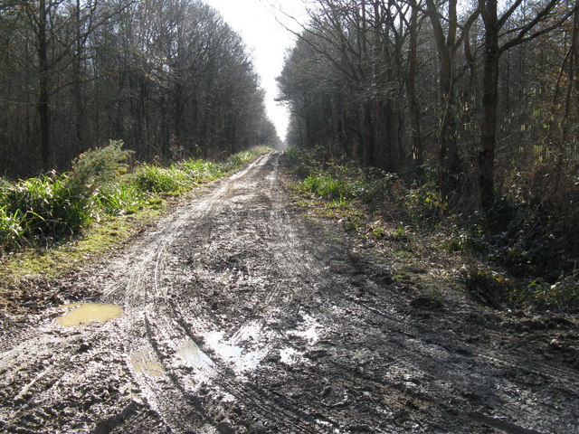
Shortgate Common Wood is a charming woodland located in the county of Sussex, England. Spanning across an area of approximately 12 hectares, this forest is a popular destination for nature enthusiasts and those seeking a tranquil escape from the bustling city life.

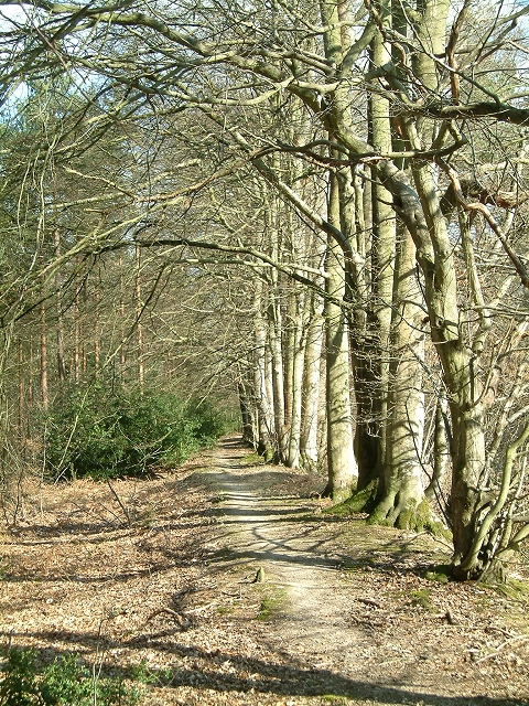
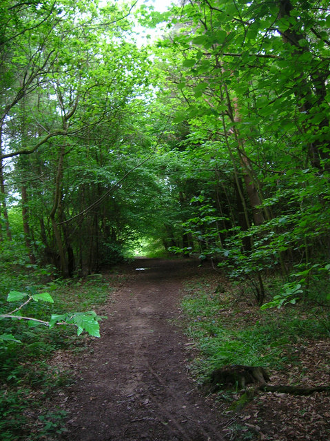
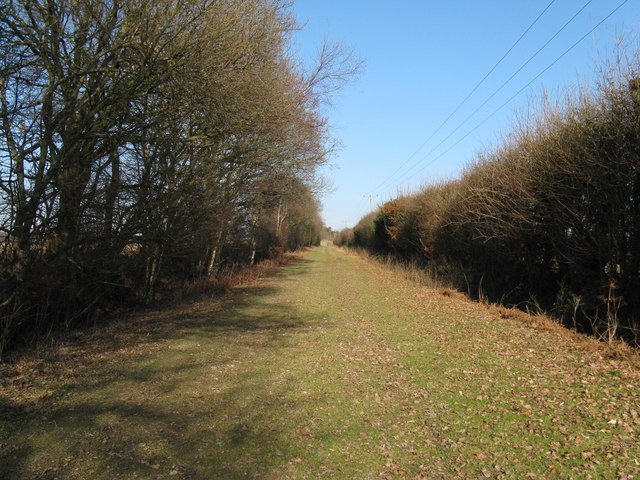
The woodland is primarily composed of oak and birch trees, which create a dense canopy overhead, allowing only dappled sunlight to filter through. The forest floor is covered in a thick carpet of moss, ferns, and wildflowers, creating a vibrant and enchanting atmosphere. The diverse range of plant species in Shortgate Common Wood attracts a variety of wildlife, including birds, butterflies, and small mammals.

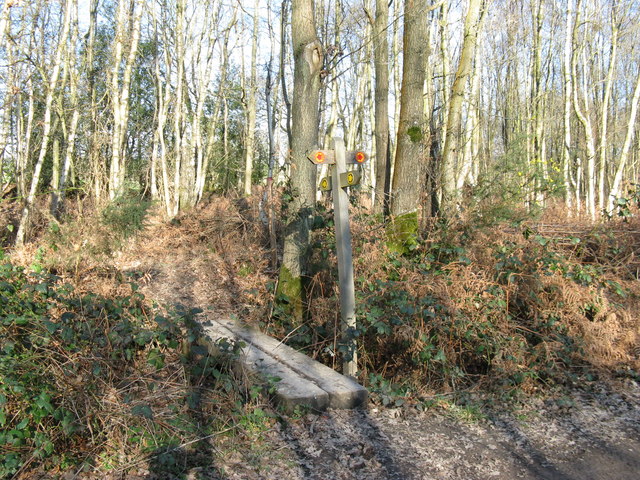
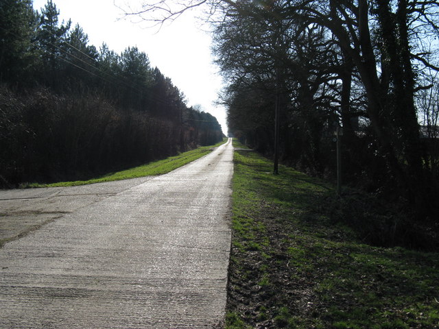
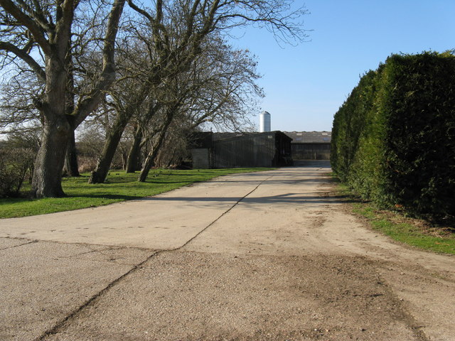
The wood is crisscrossed with a network of well-maintained trails, making it an ideal spot for hikers, joggers, and dog walkers. These paths lead visitors through the heart of the woodland, passing by ancient trees, babbling brooks, and peaceful meadows. The peacefulness and serenity of the surroundings make it a perfect setting for photography or simply a leisurely stroll.

Shortgate Common Wood is not only a haven for wildlife and a recreational area for visitors, but it also serves as an important ecological site. The woodland is a designated Site of Nature Conservation Interest due to its rich biodiversity and the presence of rare plant species.

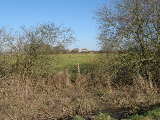
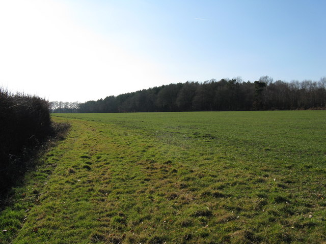
Overall, Shortgate Common Wood is a natural gem in Sussex, offering a unique opportunity to connect with nature and explore the beauty of the English countryside.

If you have any feedback on the listing, please let us know in the comments section below.

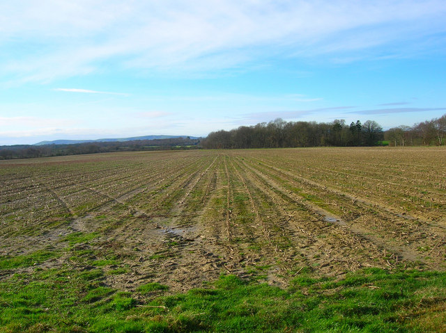
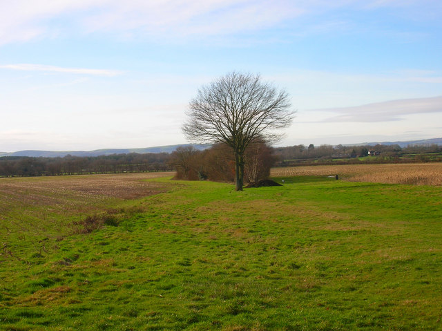
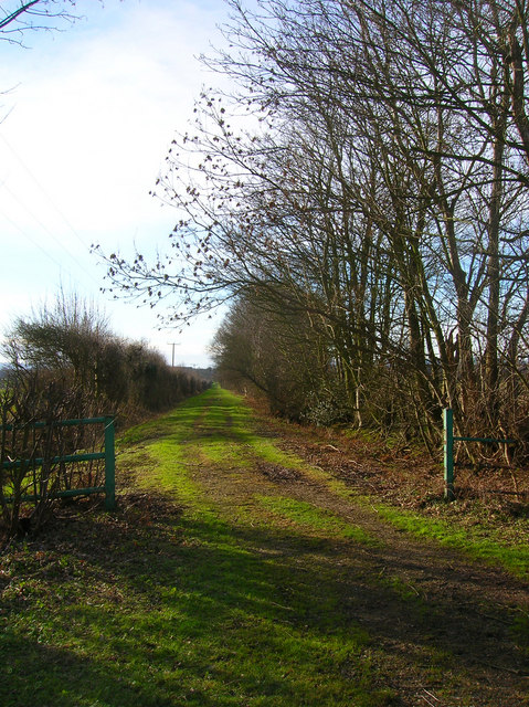
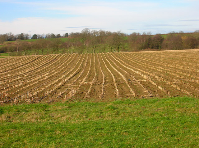
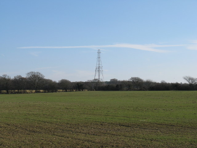
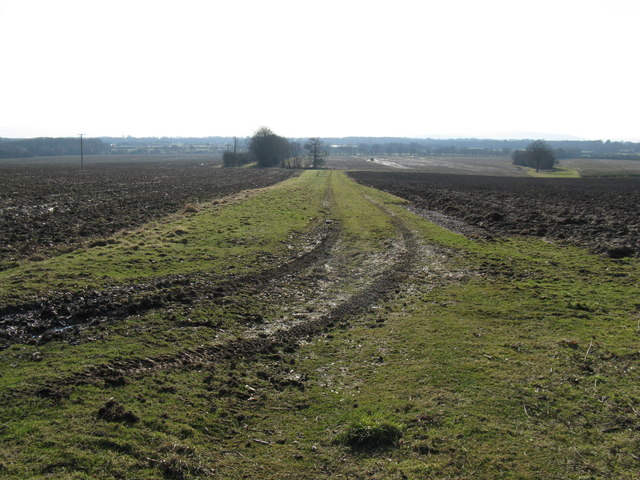
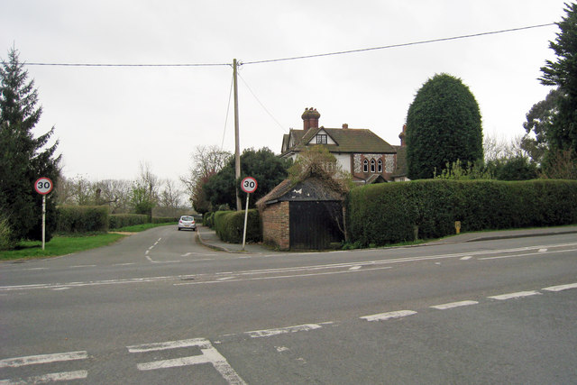
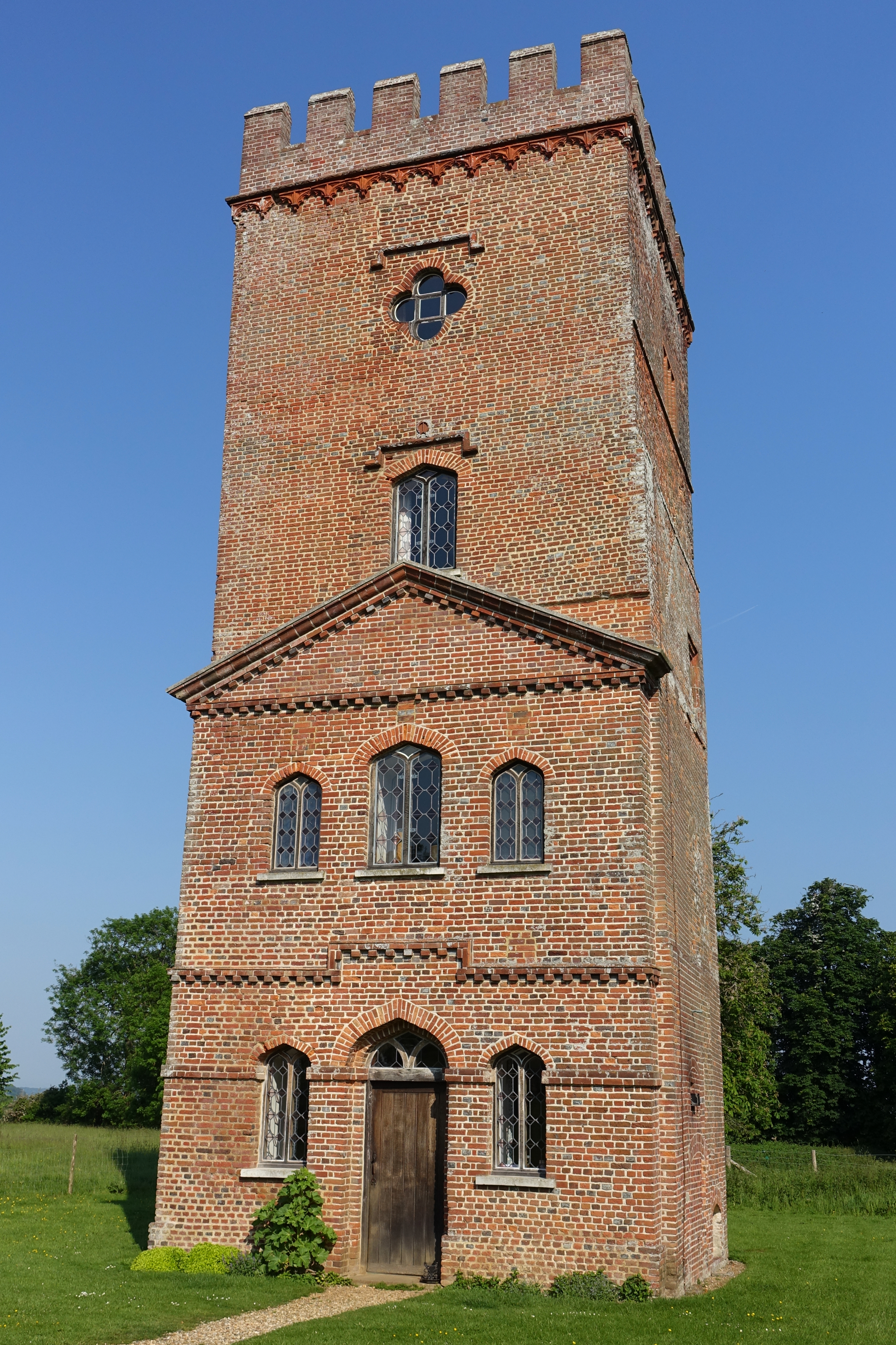
Shortgate Common Wood Images

Images are sourced within 2km of 50.913032/0.1236947 or Grid Reference TQ4914. Thanks to Geograph Open Source API. All images are credited.

Line of Trees on historic Boundary bank Old Beech and Hornbeam trees on woodbank at Rowlands Wood, Park Corner.
Line of Trees on historic Boundary bank
Old Beech and Hornbeam trees on woodbank at Rowlands Wood, Park Corner.
Laughton Village Stores On the junction of the B2124 Lewes Road and Pound Lane.
Laughton Village Stores
On the junction of the B2124 Lewes Road and Pound Lane.
Laughton Common Wood Taken from Pound Lane track.
Laughton Common Wood
Taken from Pound Lane track.
Communications Mast near Laughton The building is Walls Farm. Taken from the track that links Laughton Common with Whitesmith.
Communications Mast near Laughton
The building is Walls Farm. Taken from the track that links Laughton Common with Whitesmith.
Looking Towards Bog Shaw Taken from the footpath that links Halland with Rowlands Wood. The South Downs can be seen in the background.
Looking Towards Bog Shaw
Taken from the footpath that links Halland with Rowlands Wood. The South Downs can be seen in the background.
Footpath to Shortgate Taken from its junction with the Halland-Rowlands Wood footpath.
Footpath to Shortgate
Taken from its junction with the Halland-Rowlands Wood footpath.
Footpath to Laughton Park Farm The footpath follows an old lane between two field boundaries on its way to Halland Park Farm.
Footpath to Laughton Park Farm
The footpath follows an old lane between two field boundaries on its way to Halland Park Farm.
Field of Stalks near Halland Park Farm Looking back towards Halland, the trees to the right hide the pond in the next grid square. The building on the hill is Hartfield Farm.
Field of Stalks near Halland Park Farm
Looking back towards Halland, the trees to the right hide the pond in the next grid square. The building on the hill is Hartfield Farm.
Two byways converge Laughton Common Wood on the left, Brickhurst Wood on the right
Two byways converge
Laughton Common Wood on the left, Brickhurst Wood on the right
Path junction in Brickhurst Wood
Walls Farm
Walls Farm
Wood beside footpath to Laughton Park Farm
Footpath heading SW towards Laughton House The concrete road (footpath) continues NE until just past Laughton Park Farm where it becomes a grass path <a href="https://www.geograph.org.uk/photo/1175466">TQ5015 : Footpath to Halland Park Farm</a>.
Footpath heading SW towards Laughton House
The concrete road (footpath) continues NE until just past Laughton Park Farm where it becomes a grass path TQ5015 : Footpath to Halland Park Farm.
Farm buildings on Laughton Park Farm
Mast near Walls farm
Footpath to Halland Park Farm This is the continuation of concrete path in <a href="https://www.geograph.org.uk/photo/1174498">TQ5014 : Footpath heading SW towards Laughton House</a>
Footpath to Halland Park Farm
This is the continuation of concrete path in TQ5014 : Footpath heading SW towards Laughton House
View across fields Near Halland Park Farm
View across fields
Near Halland Park Farm
Junction of Shortgate Road, Laughton Road & Church Lane
Show me another place!

Shortgate Common Wood is located at Grid Ref: TQ4914 (Lat: 50.913032, Lng: 0.1236947)

Administrative County: East Sussex

District: Wealden

Police Authority: Sussex

What 3 Words

///scream.composed.blog. Near Ringmer, East Sussex

Related Wikis

Bentley Wildfowl and Motor Museum

The Bentley Wildfowl and Motor Museum was a visitor attraction near Halland, East Sussex, England. As of October 2018, it is closed to the public. ��2...

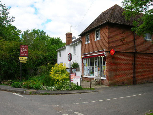
Laughton, East Sussex

Laughton is a village and civil parish in the Wealden district of East Sussex, England. The village is located five miles (8 km) east of Lewes, at a junction...

Park Corner Heath

Park Corner Heath is a 2.9-hectare (7.2-acre) biological Site of Special Scientific Interest about 1.2 miles (2 km) south of East Hoathly, adjacent to...

Broyle Place

Broyle Place is a historic house in Sussex, England. It is a Grade II listed Elizabethan manor house. In the 12th century, it belonged to Theobald, Archbishop...

East Hoathly with Halland

East Hoathly with Halland is a civil parish in the Wealden District of East Sussex, England. The parish contains the two villages of East Hoathly and...

Plashett Park Wood

Plashett Park Wood is a 157.6-hectare (389-acre) biological Site of Special Scientific Interest between Lewes and Uckfield in East Sussex.This ancient...

Laughton Place

Laughton Place is a historic building near Lewes, Sussex owned by the Landmark Trust. The Pelham family bought Laughton Place, an old fortified manor,...

East Sussex National Golf Club

East Sussex National Golf Club is a golf course located near to Uckfield in East Sussex. It is considered one of the finer golf courses in the British...

Related Videos

fair at laughton showground 2023

laughton summer fun fair 2023.

FUN FAIR at laughton

FUN FAIR at laughton tomorrow is the last day.

FUN FAIR at laughton

old fun fair ride.

Nearby Amenities

Located within 500m of 50.913032,0.1236947
Post Box
Collection Times: Mo-Fr 16:15; Sa 09:30
Operator: Royal Mail
Post Box Type: lamp
Ref: BN8 535
Royal Cypher: EIIR
Royal Cypher Wikidata: Q33102113
Lat/Long: 50.9152735/0.1219304
Shortgate
Place: locality
Source Name: OS_OpenData_Streetview
Lat/Long: 50.9171716/0.124433
Shortgate Manor Farm
Place: farm
Source Name: OS_OpenData_StreetView
Lat/Long: 50.9171411/0.1265627
Pub
The Bluebell
Addr City: Laugton
Addr Postcode: BN8 6PH
Addr Street: The Broyle
Building: yes
Cuisine: chinese
Opening Hours: Mo-Th 12:00-14:30;17:00-22:00,Fr-Sa 12:00-14:30;17:00-23:00,Su 12:00-16:00;17:00-22:00
Phone: +44 1825 840888
Takeaway: yes
Website: https://www.wokinn.org/
Lat/Long: 50.91519/0.122236
Parkside Farm
Place: farm
Source Name: OS_OpenData_StreetView
Lat/Long: 50.9118616/0.1276624
Barrier: bollard
Lat/Long: 50.9096211/0.1234836
Bus Stop
The Wok Inn
Public Transport: platform
Lat/Long: 50.9153567/0.122011
Bus Stop
The Wok Inn
Public Transport: platform
Lat/Long: 50.9152488/0.1215529
The data included in this document is from www.openstreetmap.org. The data is made available under ODbL.

Have you been to Shortgate Common Wood?

Leave your review of Shortgate Common Wood below (or comments, questions and feedback).