Olivespit Wood

Wood, Forest in Sussex Wealden

England

Olivespit Wood

Rocky bank on Fowly Lane An Ardingly Sandstone exposure by the lane which passes though a sunken section on the hill up from a stream valley.
Rocky bank on Fowly Lane Credit: Robin Webster

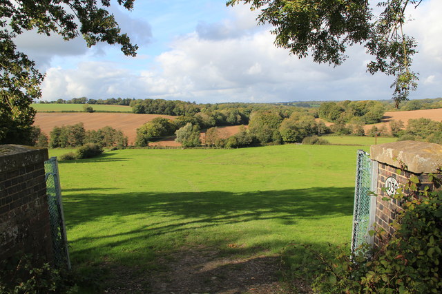
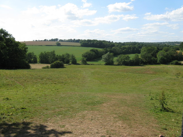
Olivespit Wood is a picturesque woodland located in Sussex, England. Covering an area of approximately 200 acres, it is situated in the heart of the South Downs National Park. The wood is renowned for its natural beauty and diverse range of flora and fauna.

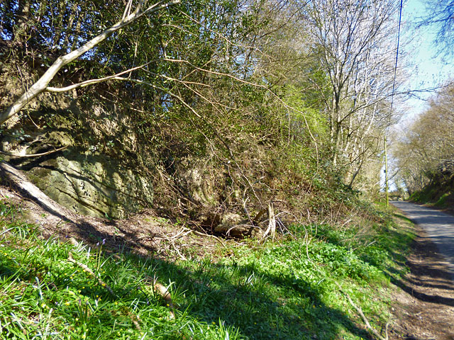
Upon entering Olivespit Wood, visitors are greeted by a dense canopy of towering oak trees, providing a cool and shaded environment even on the hottest of summer days. The woodland floor is covered in a rich carpet of wildflowers, including bluebells, primroses, and wood anemones, creating a vibrant and colorful display during the spring months.

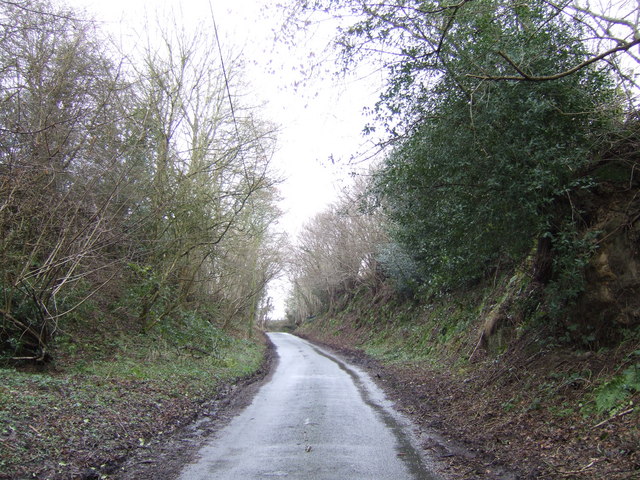
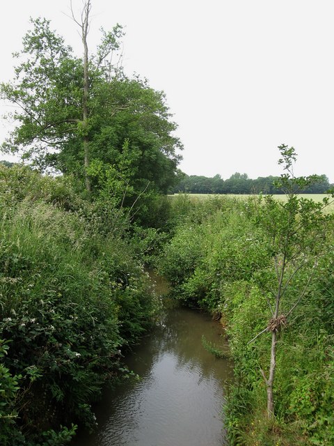
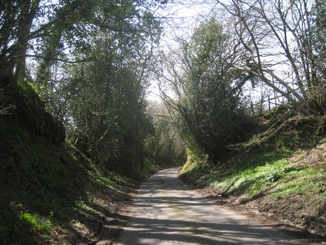
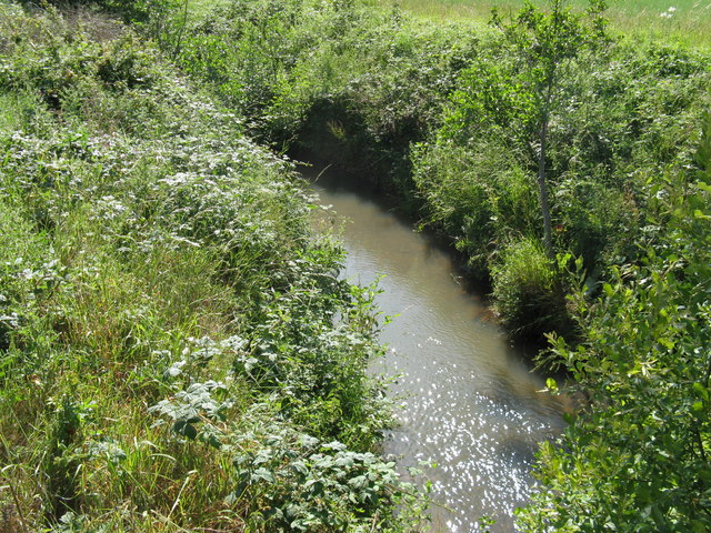
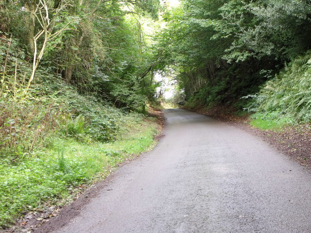
The wood is intersected by a network of well-maintained footpaths, allowing visitors to explore the area at their leisure. These paths lead to several scenic spots, such as a tranquil pond home to a variety of aquatic species and a small clearing where visitors can enjoy a picnic surrounded by nature.

Wildlife enthusiasts will be delighted by the abundance of creatures that call Olivespit Wood their home. The wood is home to a diverse range of bird species, including woodpeckers, owls, and various songbirds. On occasion, lucky visitors may even catch a glimpse of a deer or fox darting through the undergrowth.

Olivespit Wood offers a peaceful retreat for nature lovers and provides an opportunity to connect with the natural world. Its unspoiled beauty and tranquil atmosphere make it a popular destination for walking, birdwatching, and simply enjoying the serenity of the great outdoors.

If you have any feedback on the listing, please let us know in the comments section below.

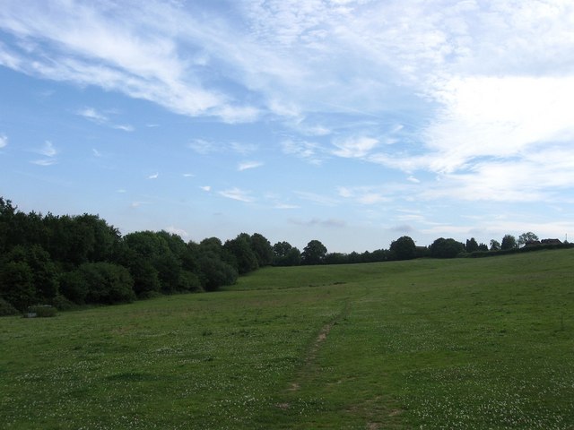
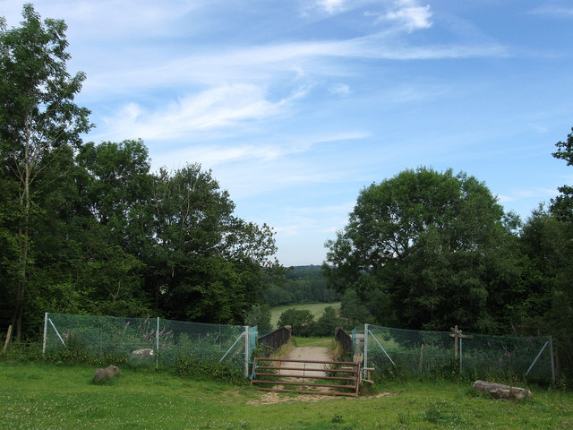
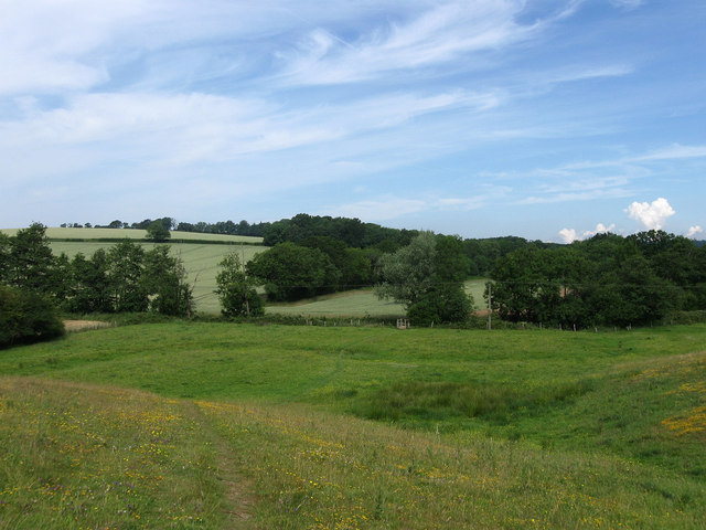
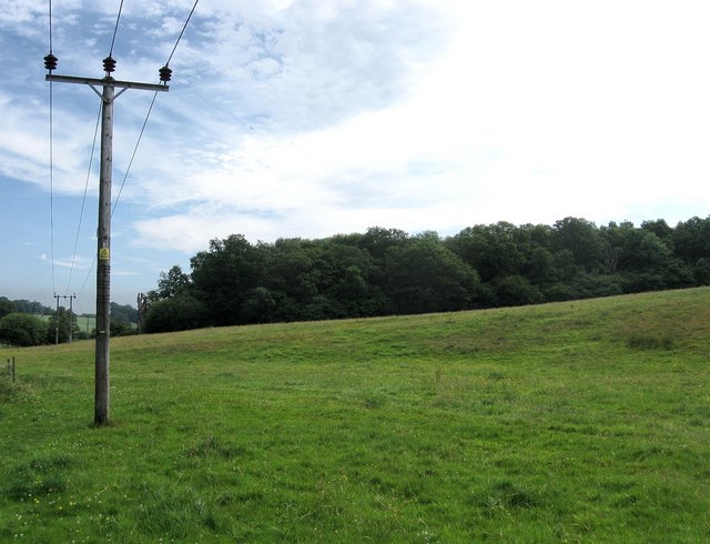
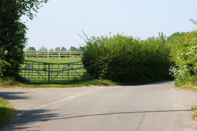
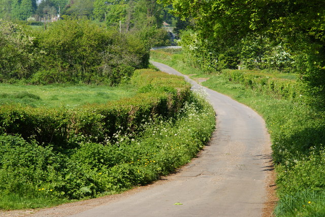
Olivespit Wood Images

Images are sourced within 2km of 50.998765/0.11244256 or Grid Reference TQ4824. Thanks to Geograph Open Source API. All images are credited.

Rocky bank on Fowly Lane An Ardingly Sandstone exposure by the lane which passes though a sunken section on the hill up from a stream valley.
Rocky bank on Fowly Lane
An Ardingly Sandstone exposure by the lane which passes though a sunken section on the hill up from a stream valley.
View from rail bridge near Buxted Another version of previously published photographs looking northwest with the rail bridge walls in the foreground.
View from rail bridge near Buxted
Another version of previously published photographs looking northwest with the rail bridge walls in the foreground.
Fowly Lane This deeply banked section of the lane is the only stretch within the gridsquare.
Fowly Lane
This deeply banked section of the lane is the only stretch within the gridsquare.
Barn near St Margarets Cottage Rather dilapidated corrugated iron structure next to the footpath from Church Road to the railway bridge.
Barn near St Margarets Cottage
Rather dilapidated corrugated iron structure next to the footpath from Church Road to the railway bridge.
Field next to the Railway The bushes on the left mask the Uckfield branch line.
Field next to the Railway
The bushes on the left mask the Uckfield branch line.
Railway Bridge Taking a farm track and a footpath over the Uckfield branch line. There is also a footpath junction this side of the bridge; go right to continue following the railway before heading to Fowly Lane; left to St Margarets Cottage and Church Road; behind the photographer the path has come from Church Lane; whilst over the bridge to descend towards the River Uck and head off to Fowly Lane.
Railway Bridge
Taking a farm track and a footpath over the Uckfield branch line. There is also a footpath junction this side of the bridge; go right to continue following the railway before heading to Fowly Lane; left to St Margarets Cottage and Church Road; behind the photographer the path has come from Church Lane; whilst over the bridge to descend towards the River Uck and head off to Fowly Lane.
Heading to the River Uck Descending into the valley towards the River Uck marked by the vegetation and footbridge in the middle distance
Heading to the River Uck
Descending into the valley towards the River Uck marked by the vegetation and footbridge in the middle distance
Coes Rough Small wood on the eastern side of the River Uck valley.
Coes Rough
Small wood on the eastern side of the River Uck valley.
River Uck A tributary of the River Ouse rising near Five Ashes. The fast flowing Wealden river was used to power many of the furnaces of the Iron industry that sprang up in the 16th century.
River Uck
A tributary of the River Ouse rising near Five Ashes. The fast flowing Wealden river was used to power many of the furnaces of the Iron industry that sprang up in the 16th century.
Gordon Road The eastern part of the road was added in the 1950s.
Gordon Road
The eastern part of the road was added in the 1950s.
Fowly Lane This narrow lane clips the corner of TQ5054.
Fowly Lane
This narrow lane clips the corner of TQ5054.
Downstream on the River Uck to Uckfield
View NW across the River Uck valley
SW on the Uckfield line to Uckfield
Fowly Lane near Huggett's Farm, High Hurstwood
World War Two Pillbox just to the west of Buxted
Junction of Nursery Lane and Burrells Lane, Sussex The location is just north of the Maresfield Park estate.
Junction of Nursery Lane and Burrells Lane, Sussex
The location is just north of the Maresfield Park estate.
Nursery Lane, Maresfield, Sussex Photograph taken from beside Nightingale Wood, looking north.
Nursery Lane, Maresfield, Sussex
Photograph taken from beside Nightingale Wood, looking north.
Show me another place!

Olivespit Wood is located at Grid Ref: TQ4824 (Lat: 50.998765, Lng: 0.11244256)

Administrative County: East Sussex

District: Wealden

Police Authority: Sussex

What 3 Words

///organic.spilled.amending. Near Buxted, East Sussex

Related Wikis

Five Ash Down

Five Ash Down is a small village within the civil parish of Buxted, in the Wealden district of East Sussex, England. Its nearest town is Uckfield, which...

Cooper's Green

Cooper's Green is a village in the civil parish of Buxted in the Wealden district of East Sussex, England. Its nearest town is Uckfield, which lies approximately...

Buxted Park

Buxted Park is an 84.7 hectare (206.16 acre) biological Site of Special Scientific Interest, located near the village of Buxted, East Sussex, England....

St Margaret the Queen, Buxted

The Church of St Margaret the Queen is a grade I listed building in Buxted Park, East Sussex, England. It is dedicated to Saint Margaret of Scotland, an...

Related Videos

Walking Around my Local Area During Lockdown

Walking around my local area. I went to my local area and made myself a cup of coffee using the Jetboil Flash. My Channel: ...

Zempire Aero TXL Pro For Sale

For sale in East Sussex, great family tent. Reluctantly selling as have bought a Caravan.

Christmas Tree Festival

Every year the Holy Cross Church in the Sussex Village of Uckfield has a festival of Christmas trees. They are decorated by local ...

Nearby Amenities

Located within 500m of 50.998765,0.11244256
Barrier: stile
Lat/Long: 50.9965645/0.1166044
The Oast Farm
Addr City: Uckfield
Addr Country: GB
Addr Postcode: TN22 4AU
Addr Street: Buxted Road
Addr Suburb: Coopers Green
Fhrs Id: 182699
Place: farm
Source: OS_OpenData_StreetView
Source Addr: FHRS Open Data
Lat/Long: 50.9947904/0.1104748
Public Footpath
Information: guidepost
Tourism: information
Lat/Long: 50.9998225/0.1058762
Addr City: Five Ash Down
Addr Housename: West Riding
Addr Postcode: TN22 3AP
Addr Street: Five Ash Down
Building: house
Lat/Long: 50.9989745/0.1067832
Bus Stop
Cobdown Lane
Bench: yes
Bin: yes
Bus: yes
Public Transport: platform
Shelter: yes
Tactile Paving: no
Lat/Long: 50.9989764/0.1053864
Addr Housename: Greenshutters
Building: house
Lat/Long: 50.9991328/0.107391
Addr City: Five Ash Down
Addr Housename: Culverley
Addr Postcode: TN22 3AP
Addr Street: Five Ash Down
Building: house
Lat/Long: 50.9988763/0.1065774
Bus Stop
Cobdown Lane
Bench: yes
Bus: yes
Naptan AtcoCode: 1400WE0468
Naptan NaptanCode: esudagmj
Public Transport: platform
Shelter: yes
Lat/Long: 50.9993907/0.1058105
Barrier: stile
Lat/Long: 50.9978765/0.1164215
Barrier: stile
Lat/Long: 50.9977914/0.1164322
The data included in this document is from www.openstreetmap.org. The data is made available under ODbL.

Have you been to Olivespit Wood?

Leave your review of Olivespit Wood below (or comments, questions and feedback).