Pratt's Bottom Wood

Wood, Forest in Kent

England

Pratt's Bottom Wood

Snag Lane
Snag Lane Credit: N Chadwick

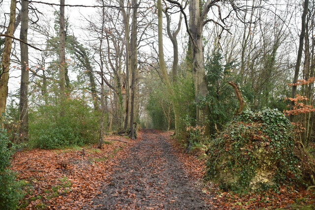
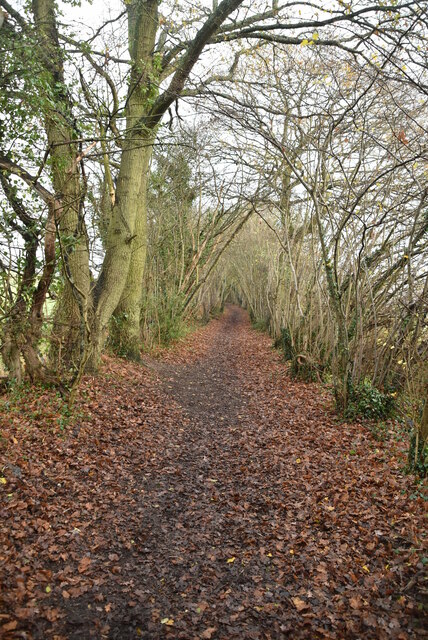
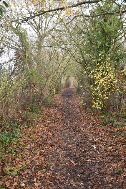
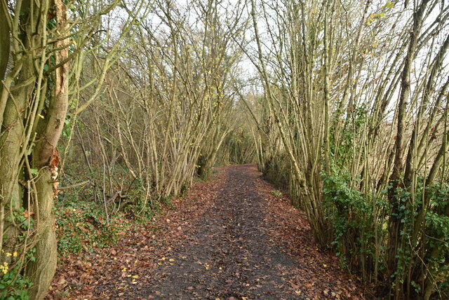
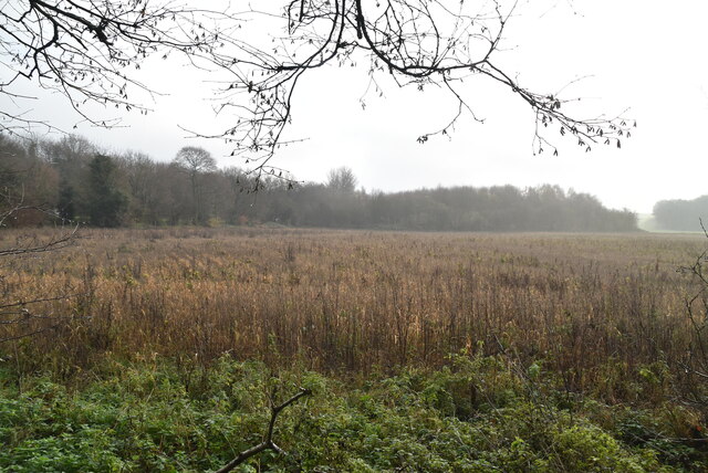
Pratt's Bottom Wood is a picturesque woodland located in the county of Kent, England. Situated in the village of Pratt's Bottom, this woodland is known for its natural beauty and tranquil surroundings. Covering an area of approximately 40 acres, it is a popular destination for nature lovers and outdoor enthusiasts.

The wood is primarily composed of native broadleaf trees such as oak, beech, and ash, creating a diverse and visually stunning landscape. The dense canopy provides shade and shelter, creating a peaceful and serene atmosphere. The forest floor is adorned with a carpet of bluebells during the spring season, adding a burst of color to the woodland.

Pratt's Bottom Wood is home to a variety of wildlife, including deer, foxes, and a wide range of bird species. It serves as an important habitat for these animals, providing them with shelter and food sources. Visitors may be lucky enough to catch a glimpse of these creatures as they explore the woodland trails.

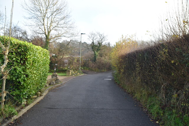
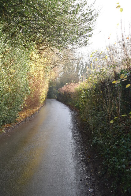
The wood offers several well-maintained walking paths, allowing visitors to fully immerse themselves in the natural beauty of the surroundings. These paths wind through the trees and offer stunning views of the woodland. Many visitors choose to bring a picnic and enjoy the peaceful ambiance of the wood.

Overall, Pratt's Bottom Wood is a hidden gem in Kent, offering a haven for nature enthusiasts seeking a peaceful retreat. With its diverse ecosystem, scenic beauty, and abundant wildlife, it provides a memorable experience for all who visit.

If you have any feedback on the listing, please let us know in the comments section below.

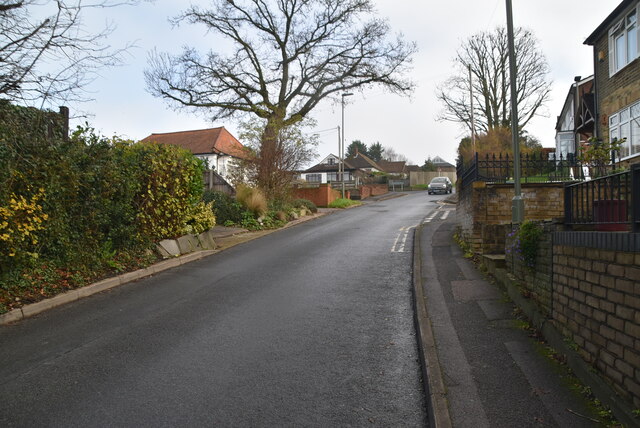
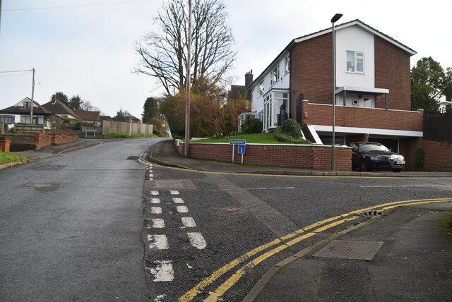
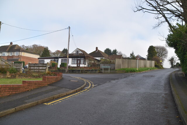
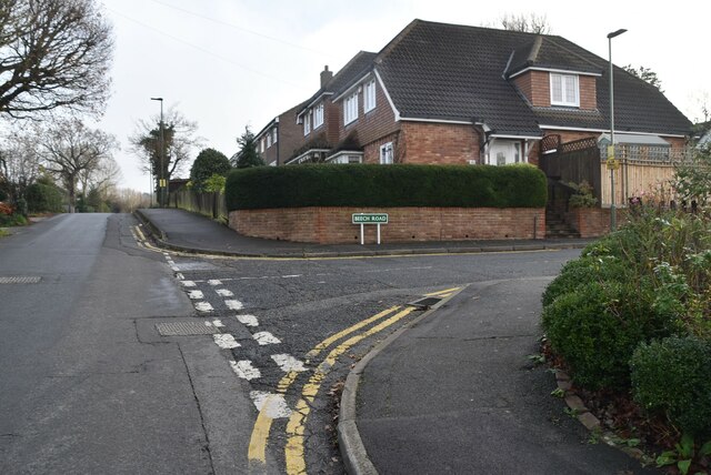
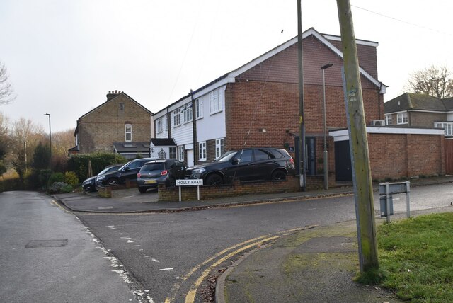
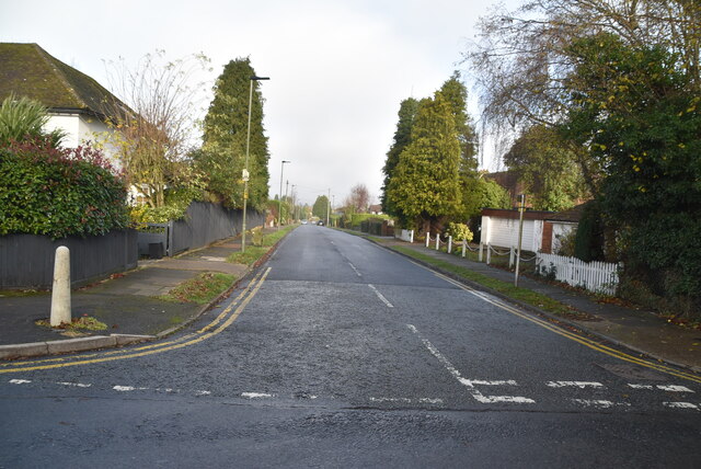
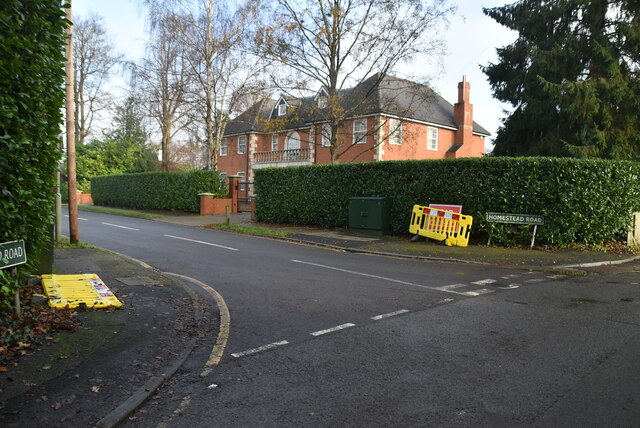
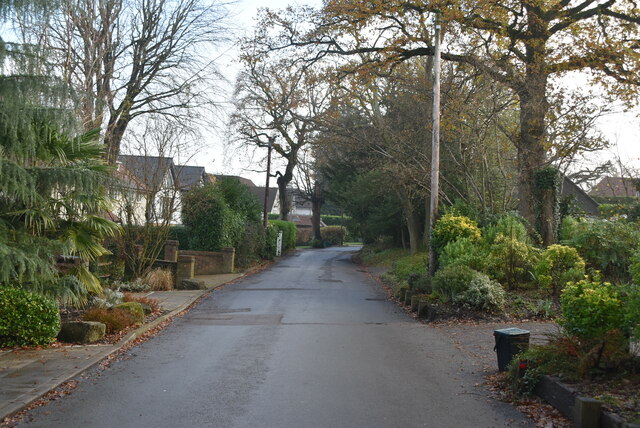
Pratt's Bottom Wood Images

Images are sourced within 2km of 51.337006/0.11273739 or Grid Reference TQ4761. Thanks to Geograph Open Source API. All images are credited.

Snag Lane
Snag Lane
Snag Lane
Snag Lane
Snag Lane
Snag Lane
Snag Lane
Snag Lane
Field by Sevenoaks Rd
Corner of World's End Rd, Ash Rd Green Street Green is an area of the borough of Bromley, historically in Kent.
Wikipedia: <span class="nowrap"><a title="https://en.wikipedia.org/wiki/Green_Street_Green" rel="nofollow ugc noopener" href="https://en.wikipedia.org/wiki/Green_Street_Green">Link</a><img style="margin-left:2px;" alt="External link" title="External link - shift click to open in new window" src="https://s1.geograph.org.uk/img/external.png" width="10" height="10"/></span>
Corner of World's End Rd, Ash Rd
Green Street Green is an area of the borough of Bromley, historically in Kent. Wikipedia: LinkExternal link
Ash Rd Green Street Green is an area of the borough of Bromley, historically in Kent.
Wikipedia: <span class="nowrap"><a title="https://en.wikipedia.org/wiki/Green_Street_Green" rel="nofollow ugc noopener" href="https://en.wikipedia.org/wiki/Green_Street_Green">Link</a><img style="margin-left:2px;" alt="External link" title="External link - shift click to open in new window" src="https://s1.geograph.org.uk/img/external.png" width="10" height="10"/></span>
Ash Rd
Green Street Green is an area of the borough of Bromley, historically in Kent. Wikipedia: LinkExternal link
Elm Rd Green Street Green is an area of the borough of Bromley, historically in Kent.
Wikipedia: <span class="nowrap"><a title="https://en.wikipedia.org/wiki/Green_Street_Green" rel="nofollow ugc noopener" href="https://en.wikipedia.org/wiki/Green_Street_Green">Link</a><img style="margin-left:2px;" alt="External link" title="External link - shift click to open in new window" src="https://s1.geograph.org.uk/img/external.png" width="10" height="10"/></span>
Elm Rd
Green Street Green is an area of the borough of Bromley, historically in Kent. Wikipedia: LinkExternal link
World's End Lane Green Street Green is an area of the borough of Bromley, historically in Kent.
Wikipedia: <span class="nowrap"><a title="https://en.wikipedia.org/wiki/Green_Street_Green" rel="nofollow ugc noopener" href="https://en.wikipedia.org/wiki/Green_Street_Green">Link</a><img style="margin-left:2px;" alt="External link" title="External link - shift click to open in new window" src="https://s1.geograph.org.uk/img/external.png" width="10" height="10"/></span>
World's End Lane
Green Street Green is an area of the borough of Bromley, historically in Kent. Wikipedia: LinkExternal link
Oak Rd Green Street Green is an area of the borough of Bromley, historically in Kent.
Wikipedia: <span class="nowrap"><a title="https://en.wikipedia.org/wiki/Green_Street_Green" rel="nofollow ugc noopener" href="https://en.wikipedia.org/wiki/Green_Street_Green">Link</a><img style="margin-left:2px;" alt="External link" title="External link - shift click to open in new window" src="https://s1.geograph.org.uk/img/external.png" width="10" height="10"/></span>
Oak Rd
Green Street Green is an area of the borough of Bromley, historically in Kent. Wikipedia: LinkExternal link
Woodlands Rd Green Street Green is an area of the borough of Bromley, historically in Kent.
Wikipedia: <span class="nowrap"><a title="https://en.wikipedia.org/wiki/Green_Street_Green" rel="nofollow ugc noopener" href="https://en.wikipedia.org/wiki/Green_Street_Green">Link</a><img style="margin-left:2px;" alt="External link" title="External link - shift click to open in new window" src="https://s1.geograph.org.uk/img/external.png" width="10" height="10"/></span>
Woodlands Rd
Green Street Green is an area of the borough of Bromley, historically in Kent. Wikipedia: LinkExternal link
Beech Rd Green Street Green is an area of the borough of Bromley, historically in Kent.
Wikipedia: <span class="nowrap"><a title="https://en.wikipedia.org/wiki/Green_Street_Green" rel="nofollow ugc noopener" href="https://en.wikipedia.org/wiki/Green_Street_Green">Link</a><img style="margin-left:2px;" alt="External link" title="External link - shift click to open in new window" src="https://s1.geograph.org.uk/img/external.png" width="10" height="10"/></span>
Beech Rd
Green Street Green is an area of the borough of Bromley, historically in Kent. Wikipedia: LinkExternal link
Holly Rd Green Street Green is an area of the borough of Bromley, historically in Kent.
Wikipedia: <span class="nowrap"><a title="https://en.wikipedia.org/wiki/Green_Street_Green" rel="nofollow ugc noopener" href="https://en.wikipedia.org/wiki/Green_Street_Green">Link</a><img style="margin-left:2px;" alt="External link" title="External link - shift click to open in new window" src="https://s1.geograph.org.uk/img/external.png" width="10" height="10"/></span>
Holly Rd
Green Street Green is an area of the borough of Bromley, historically in Kent. Wikipedia: LinkExternal link
Julian Rd Green Street Green is an area of the borough of Bromley, historically in Kent.
Wikipedia: <span class="nowrap"><a title="https://en.wikipedia.org/wiki/Green_Street_Green" rel="nofollow ugc noopener" href="https://en.wikipedia.org/wiki/Green_Street_Green">Link</a><img style="margin-left:2px;" alt="External link" title="External link - shift click to open in new window" src="https://s1.geograph.org.uk/img/external.png" width="10" height="10"/></span>
Julian Rd
Green Street Green is an area of the borough of Bromley, historically in Kent. Wikipedia: LinkExternal link
World's End Lane
World's End Lane
World's End Lane
World's End Lane
Homestead Rd
Homestead Rd
World's End Lane
World's End Lane
Show me another place!

Pratt's Bottom Wood is located at Grid Ref: TQ4761 (Lat: 51.337006, Lng: 0.11273739)

Unitary Authority: Bromley

Police Authority: Metropolitan

What 3 Words

///burst.hugs.sends. Near Farnborough, London

Related Wikis

Pratt's Bottom

Pratt's Bottom is a village in Greater London, England, within the London Borough of Bromley and, prior to 1965, within the historic county of Kent. It...

St Margaret's Church, Halstead

St Margaret's Church is an Anglican parish church in the village of Halstead and the Sevenoaks deanery, although the church also serves the village of...

Hewitt's Chalk Bank

Hewitt's Chalk Bank is a 4-hectare (10-acre) nature reserve north-east of Pratt's Bottom in the London Borough of Bromley. It is managed by the Kent Wildlife...

Halstead, Kent

Halstead is a village and civil parish in the Sevenoaks District of Kent, England. It is located 4.7 miles south east of Orpington & 6.1 miles north west...

Knockholt railway station

Knockholt railway station is on the South Eastern Main Line, located in the London Borough of Bromley, Greater London. It is 16 miles 44 chains (26.6 km...

London Borough of Bromley

The London Borough of Bromley ( ) is the largest and southeasternmost of the London boroughs that make up Greater London, bordering the county of Kent...

Chelsfield railway station

Chelsfield railway station is on the South Eastern Main Line, serving the Chelsfield and Green Street Green areas south of Orpington, in the London Borough...

Green Street Green

Green Street Green is an area in south-east London, located in the London Borough of Bromley and, prior to 1965, in the historic county of Kent. It is...

Nearby Amenities

Located within 500m of 51.337006,0.11273739
Bus Stop
Hail & Ride Pratts Bottom / The Green
Bus: yes
Naptan AtcoCode: 490000430Y
Naptan Bearing: N
Naptan CommonName: Pratts Bottom Rushmore Hill
Naptan Indicator: Stop
Naptan Street: RUSHMORE HILL
Naptan Verified: no
Physically Present: no
Public Transport: platform
Lat/Long: 51.3398245/0.1116486
Pratt's Bottom
Place: village
Population: 500
Source Name: OS_OpenData_StreetView
Wikidata: Q122384
Lat/Long: 51.3408843/0.1114591
Bus Stop
Hail & Ride Pratts Bottom Primary School
Bus: yes
Naptan AtcoCode: 490000431Y
Naptan Bearing: N
Physically Present: no
Public Transport: platform
Lat/Long: 51.3373848/0.1140733
Bus Stop
Hail & Ride Pratts Bottom Primary School
Bus: yes
Naptan AtcoCode: 490000341Z
Naptan Bearing: S
Physically Present: no
Public Transport: platform
Lat/Long: 51.3375792/0.1141052
Bus Stop
Hail & Ride Pratts Bottom / The Green
Bus: yes
Naptan AtcoCode: 490000340Z
Naptan Bearing: S
Physically Present: no
Public Transport: platform
Lat/Long: 51.3398044/0.1118629
Pratts Bottom Roundabout
Playground: roundabout
Lat/Long: 51.3378572/0.113595
Pratts Bottom Climbing Frame
Playground: climbingframe
Lat/Long: 51.3379402/0.1134705
Pratts Bottom Swings
Capacity: 2
Playground: swing
Lat/Long: 51.3380151/0.1133453
Playground: swing
Lat/Long: 51.3380317/0.113425
Place Of Worship
Pratt's Bottom Free Church
Node Id: 5872712424
Religion: christian
Source Name: OS Open Local Important Buildings Layer
Lat/Long: 51.3393/0.112452
Bomb Crater
Historic: bomb_crater
Lat/Long: 51.3345278/0.1183217
Pratts Bottom Village Sign
Information: board
Tourism: information
Lat/Long: 51.3399522/0.1115805
Bulls Head information Board
Information: board
Tourism: information
Lat/Long: 51.3394211/0.1122296
Pratts Bottom Village Notice Board
Information: board
Tourism: information
Lat/Long: 51.338973/0.1123472
Playground: climbingframe
Lat/Long: 51.3371133/0.1134987
Grit Bin
Lat/Long: 51.339617/0.1134474
Grit Bin
Lat/Long: 51.34066/0.1126735
Grit Bin
Lat/Long: 51.3402757/0.1123015
Wally McPherson Memorial Bench
Description: Wally McPherson Memorial Bench
Historic: memorial
Memorial: bench
Lat/Long: 51.3393863/0.1115193
Basil & Mavis Huett Memorial Bench
Description: Memorial Bench
Historic: memorial
Memorial: bench
Lat/Long: 51.3392735/0.1116625
Kathleen Wootton Memorial Bench
Description: Memorial Bench
Historic: memorial
Inscription: 1918 - 2005
Memorial: bench
Lat/Long: 51.3391465/0.1117417
Christine Boniface Memorial Bench
Backrest: yes
Description: Christine Boniface 1949 - 2014 Memorial Bench
Historic: memorial
Inscription: 1949 - 2014
Memorial: bench
Lat/Long: 51.3396877/0.1117135
Post Box
Pratts Bottom Post Box
Post Box Type: pillar
Lat/Long: 51.3403839/0.1112847
Pratts Bottom Outhouses
Building: yes
Lat/Long: 51.3387354/0.1121904
Bulls Head Climbing Frame
Playground: climbingframe
Lat/Long: 51.3396226/0.1122557
Alan Dimbleby Memorial Bench
Historic: memorial
Memorial: bench
Lat/Long: 51.3393209/0.1116168
Bird Bath of the Ages
Historic: monument
Lat/Long: 51.3387588/0.1103918
Barrier: stile
Bicycle: no
Foot: yes
Horse: no
Material: wood
Motor Vehicle: no
Stile: stepover
Lat/Long: 51.3394887/0.1142203
Barrier: stile
Bicycle: no
Foot: yes
Horse: no
Material: wood
Motor Vehicle: no
Stile: stepover
Lat/Long: 51.3385426/0.1167622
The data included in this document is from www.openstreetmap.org. The data is made available under ODbL.

Have you been to Pratt's Bottom Wood?

Leave your review of Pratt's Bottom Wood below (or comments, questions and feedback).