Brakeland Wood

Wood, Forest in Sussex Wealden

England

Brakeland Wood

Pooh Sticks Bridge, Ashdown Forest AA Milne's famous bridge.
Pooh Sticks Bridge, Ashdown Forest Credit: David BROOKER

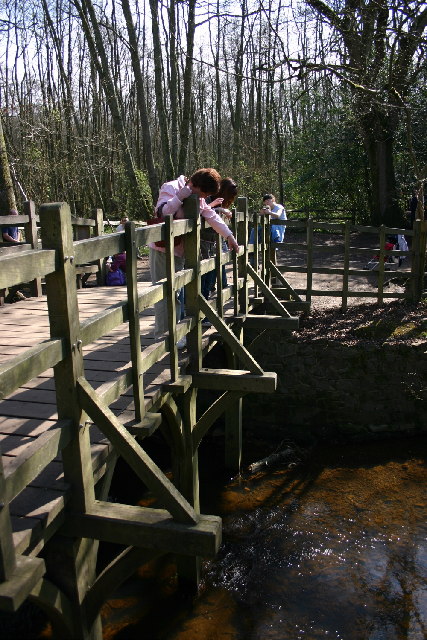
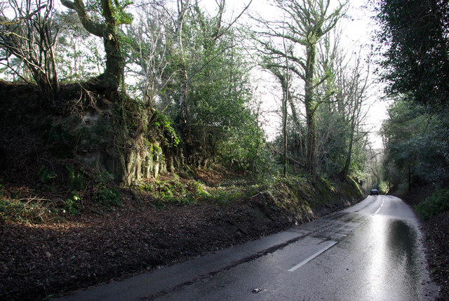
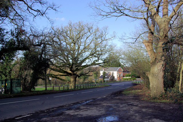
Brakeland Wood is a picturesque woodland located in the county of Sussex, England. Covering an area of approximately 100 acres, it is a popular destination for nature enthusiasts and outdoor enthusiasts alike. The wood is situated near the village of Brakeland and is easily accessible by road.

The woodland is characterized by its diverse range of trees, including oak, birch, and beech, which provide a stunning display of colors throughout the year. The forest floor is adorned with a variety of wildflowers, creating a vibrant and enchanting atmosphere. Brakeland Wood is also home to an array of wildlife, including deer, foxes, and a wide variety of bird species, making it a haven for birdwatchers and animal lovers.

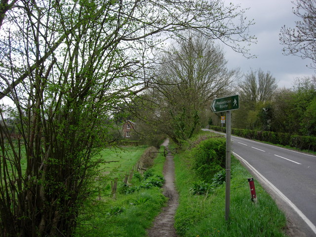
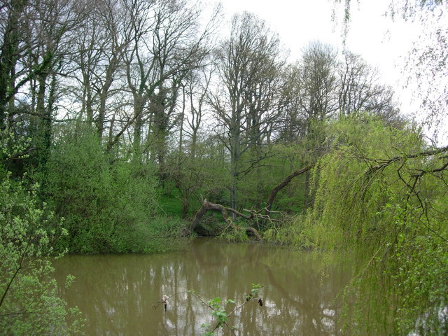
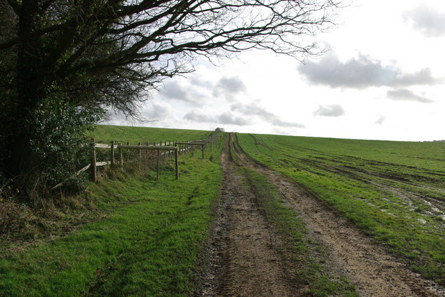
A network of well-maintained trails and footpaths crisscrosses the woodland, offering visitors the opportunity to explore its beauty at their leisure. These pathways lead to hidden clearings, tranquil ponds, and breathtaking viewpoints, providing an immersive experience in nature. The wood is also home to a small picnic area where visitors can relax and enjoy a packed lunch surrounded by the peaceful sounds of the forest.

Brakeland Wood is managed by the Sussex Wildlife Trust, ensuring its preservation and conservation for future generations. The trust organizes educational events and guided walks within the wood, allowing visitors to learn more about the local flora and fauna.

Overall, Brakeland Wood is a captivating and serene woodland, offering a tranquil retreat from the hustle and bustle of everyday life. Its natural beauty, diverse wildlife, and well-maintained trails make it a must-visit destination for nature lovers and those seeking solace in the heart of Sussex.

If you have any feedback on the listing, please let us know in the comments section below.

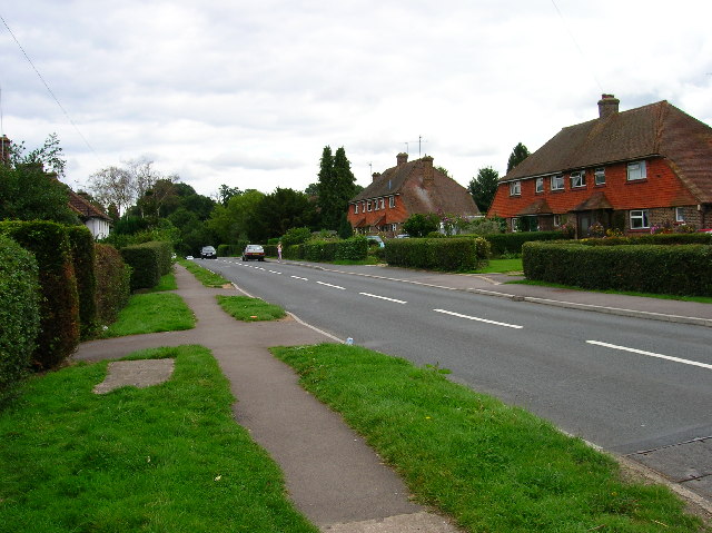
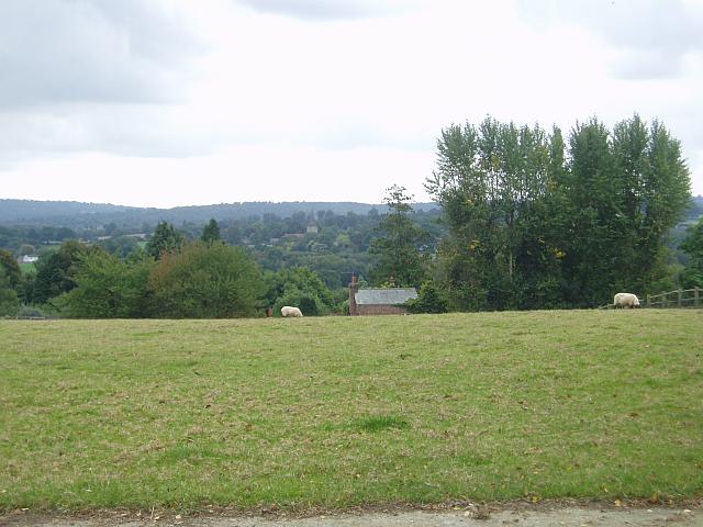
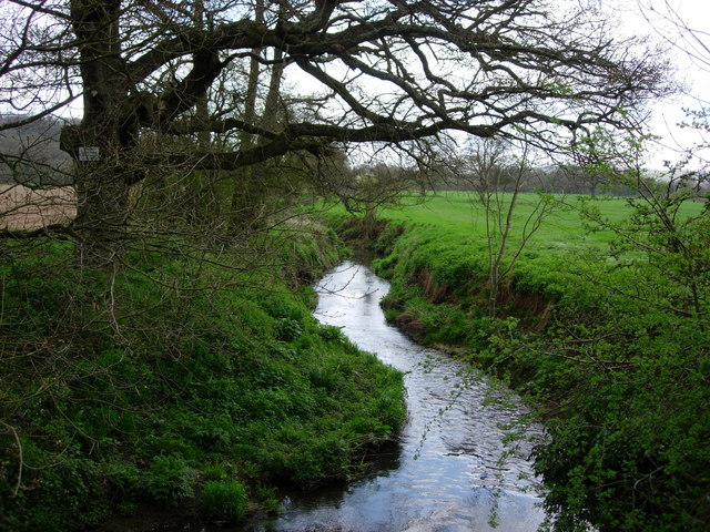
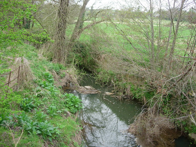
Brakeland Wood Images

Images are sourced within 2km of 51.099169/0.098376502 or Grid Reference TQ4735. Thanks to Geograph Open Source API. All images are credited.

Pooh Sticks Bridge, Ashdown Forest AA Milne's famous bridge.
Pooh Sticks Bridge, Ashdown Forest
AA Milne's famous bridge.
Sawpit Wood From Forest Way
Sawpit Wood
From Forest Way
Former Hartfield Station Now a nursery just off the Edenbridge Road.
Former Hartfield Station
Now a nursery just off the Edenbridge Road.
Hartfield village View of the Church from over the green.
Hartfield village
View of the Church from over the green.
Motte and Bailey earthwork, Castlefields, Hartfield Looking north
Motte and Bailey earthwork, Castlefields, Hartfield
Looking north
Castlefields, Hartfield The B2110 heads east out of the village
Castlefields, Hartfield
The B2110 heads east out of the village
Bassett's Manor Looking northwards from the road/path towards Bassett's Manor farm buildings. Cattle in the far field.
Bassett's Manor
Looking northwards from the road/path towards Bassett's Manor farm buildings. Cattle in the far field.
Towards Hartfield From Butcherfield Lane looking south towards Hartfield. You can just make out the spire at St Mary the Virgin Parish Church
Towards Hartfield
From Butcherfield Lane looking south towards Hartfield. You can just make out the spire at St Mary the Virgin Parish Church
River Medway - Hartfield This is the River Medway looking east from a bridge in Hartfield

This is the River Medway looking east from a road bridge in Hartfield.
River Medway - Hartfield
This is the River Medway looking east from a bridge in Hartfield This is the River Medway looking east from a road bridge in Hartfield.
The River Medway - Hartfield A tiny River Medway looking west from a road bridge in Hartfield.
The River Medway - Hartfield
A tiny River Medway looking west from a road bridge in Hartfield.
Footpath  -Hartfield A footpath leading to the old station in Hartfield, now a nursery school
Footpath -Hartfield
A footpath leading to the old station in Hartfield, now a nursery school
A Pond in Parrock Lane, Upper Hartfield A pretty pond by the roadside.
A Pond in Parrock Lane, Upper Hartfield
A pretty pond by the roadside.
Sand school and horse paddocks
Track up the Hill A private track on the Buckhurst Estate.
Track up the Hill
A private track on the Buckhurst Estate.
B2026 South of Hartfield Looking north. Rock of the Ashdown Beds exposed on left.
B2026 South of Hartfield
Looking north. Rock of the Ashdown Beds exposed on left.
Cotchford Lane Looking towards Upper Hartfield.
Cotchford Lane
Looking towards Upper Hartfield.
Kilnwood Farm Entrance On Cotchford Lane, Hartfield.
Kilnwood Farm Entrance
On Cotchford Lane, Hartfield.
B2110/B2026 Junction, Hartfield. This is the junction south of Hartfield, the B2026 is in the foreground, the B2110 behind the tree.
B2110/B2026 Junction, Hartfield.
This is the junction south of Hartfield, the B2026 is in the foreground, the B2110 behind the tree.
Show me another place!

Brakeland Wood is located at Grid Ref: TQ4735 (Lat: 51.099169, Lng: 0.098376502)

Administrative County: East Sussex

District: Wealden

Police Authority: Sussex

What 3 Words

///humidity.upward.ambition. Near Forest Row, East Sussex

Related Wikis

Upper Hartfield

Upper Hartfield is a small village slightly west of Hartfield in East Sussex, England. The Tudor house "Apedroc" in Upper Hartfield is the former home...
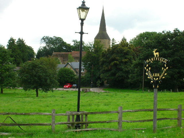
Hartfield

Hartfield is a village and civil parish in the Wealden district of East Sussex, England. The parish also includes the settlements of Colemans Hatch, Hammerwood...

Cotchford Farm

Cotchford Farm is a farmhouse building to the southwest of the village of Hartfield, East Sussex, in the High Weald Area of Outstanding Natural Beauty...

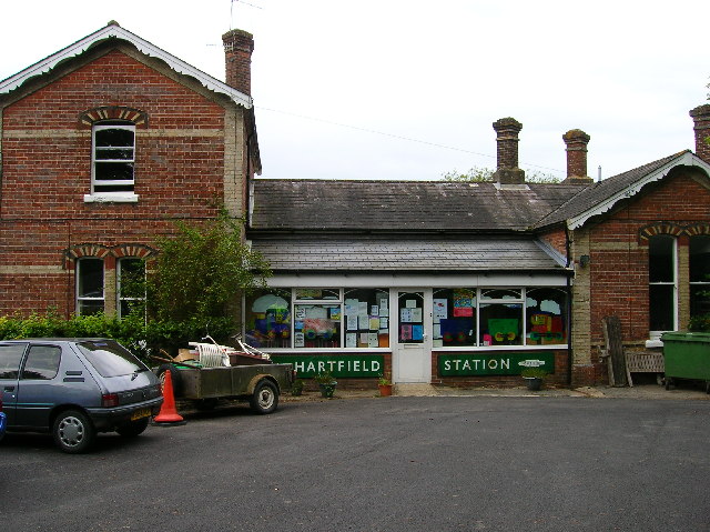
Hartfield railway station

Hartfield was a railway station serving Hartfield, England, on the Three Bridges to Tunbridge Wells Central Line which closed in 1967, a casualty of the...

Withyham Priory

Withyham Priory was a Benedictine monastic house in East Sussex, extant in 1086 and dissolved in 1413. == History == Robert, Count of Mortain, some time...

Mills Rocks

Mills Rocks is a 1.9-hectare (4.7-acre) biological Site of Special Scientific Interest south-east of East Grinstead in West Sussex.This site has rock outcrops...

Bolebroke Castle Miniature Railway

The Bolebroke Castle Miniature Railway or Bolebroke Castle and Lakes Railway (often abbreviated to BC&LR) was a 7+1⁄4 inches (180 mm) railway that ran...

Withyham

Withyham is a village and large civil parish in the Wealden district of East Sussex, England. The village is situated 7 miles south west of Royal Tunbridge...

Nearby Amenities

Located within 500m of 51.099169,0.098376502
Gallypot Street
Place: village
Source: OS 1:25k
Lat/Long: 51.0961588/0.0992614
Post Box
Operator: Royal Mail
Post Box Type: lamp
Ref: TN7 263D
Royal Cypher: EIIR
Royal Cypher Wikidata: Q33102113
Lat/Long: 51.0968383/0.1013209
Bus Stop
Gallipot Inn
Bus: yes
Naptan AtcoCode: 1400WE1431
Naptan NaptanCode: esudmgat
Public Transport: platform
Lat/Long: 51.0956995/0.0985337
Bus Stop
Gallipot Inn
Bus: yes
Naptan AtcoCode: 1400WE1432
Naptan NaptanCode: esudmgaw
Public Transport: platform
Lat/Long: 51.0955279/0.0984831
Action Hardware Ltd
Addr City: Hartfield
Addr Postcode: TN7 4AR
Addr Street: Parrock Lane
Addr Suburb: Upper Hartfield
Phone: +44 (0) 1892 771 206
Shop: electrical
Lat/Long: 51.1003958/0.094757
C M Engineering
Addr City: Hartfield
Addr Postcode: TN7 4AR
Addr Street: Parrock Lane
Addr Suburb: Upper Hartfield
Phone: +44 (0) 1892 770 308
Phone 1: +44 (0) 7985 553 584
Shop: car_repair
Website: http://www.first4landrovers.com
Lat/Long: 51.1006763/0.0951236
Competition Classics
Addr City: Hartfield
Addr Postcode: TN7 4AR
Addr Street: Parrock Lane
Addr Suburb: Upper Hartfield
Phone: +44 (0) 1892 771 293
Shop: car_repair
Website: https://www.competitionclassics.co.uk/
Lat/Long: 51.1005882/0.0950218
Early 911
Addr City: Hartfield
Addr Postcode: TN7 4AR
Addr Street: Parrock Lane
Addr Suburb: Upper Hartfield
Engineer: Alloy refurbishment
Office: engineer
Phone: +44 (0) 7980 017 994
Website: www.early911.co.uk
Lat/Long: 51.1003467/0.0951775
Barrier: stile
Material: wood
Stile: stepover
Lat/Long: 51.0973478/0.1039107
The data included in this document is from www.openstreetmap.org. The data is made available under ODbL.

Have you been to Brakeland Wood?

Leave your review of Brakeland Wood below (or comments, questions and feedback).