Downlands Wood

Wood, Forest in Sussex Wealden

England

Downlands Wood

Track in Isfield
Track in Isfield Credit: N Chadwick

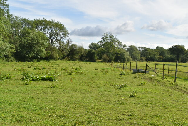
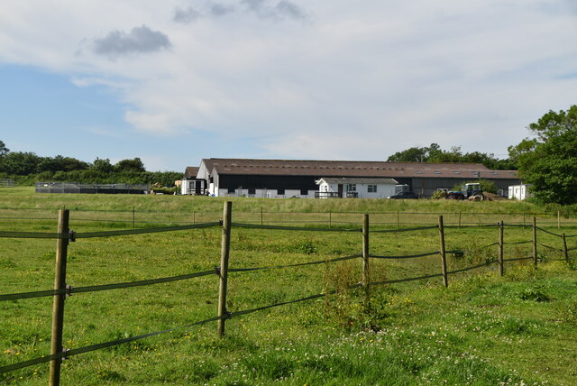
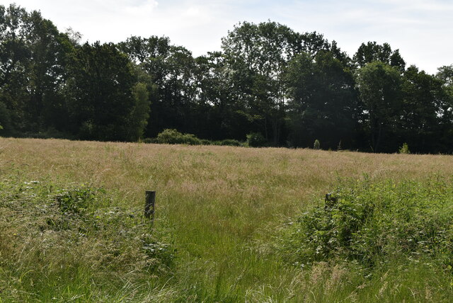
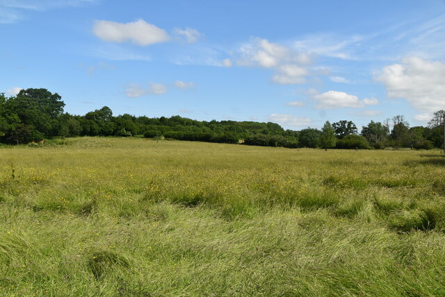
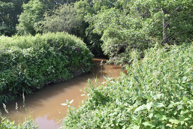
Downlands Wood is a picturesque woodland located in the county of Sussex, England. It spans an area of approximately 100 acres and is nestled within the South Downs National Park, offering visitors a tranquil and scenic escape from the hustle and bustle of everyday life.

The woodland is predominantly composed of native broadleaf trees such as oak, beech, and ash, creating a diverse and rich habitat for a wide range of flora and fauna. Bluebells carpet the forest floor in the spring, creating a stunning display of vibrant colors, while ferns and mosses thrive in the cool and damp conditions.

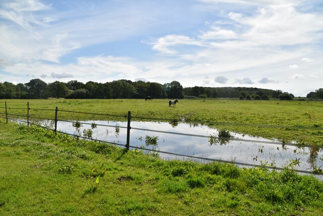
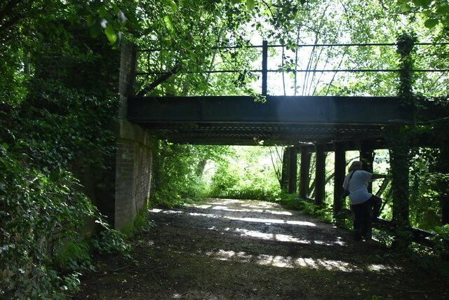
Visitors to Downlands Wood can explore a network of well-maintained paths and trails, allowing them to fully immerse themselves in the natural beauty of the area. The wood provides ample opportunities for walking, birdwatching, and wildlife spotting, with species such as deer, foxes, and a variety of bird species commonly spotted.

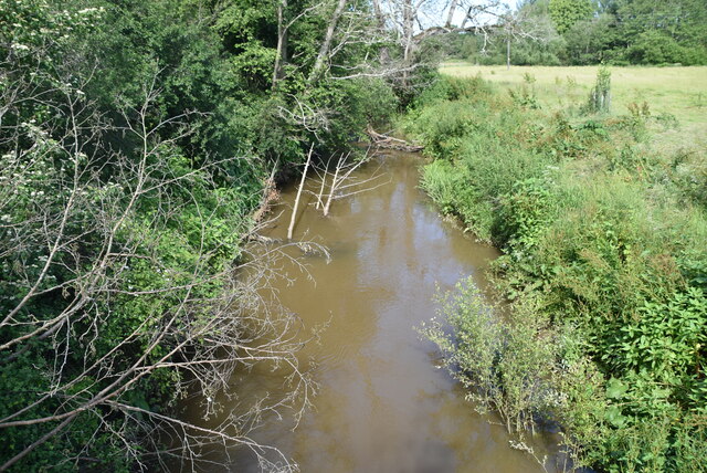
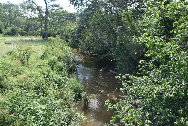
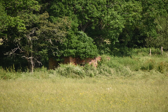
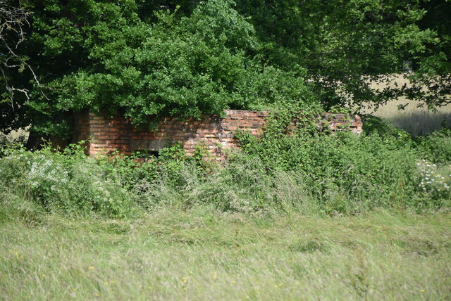
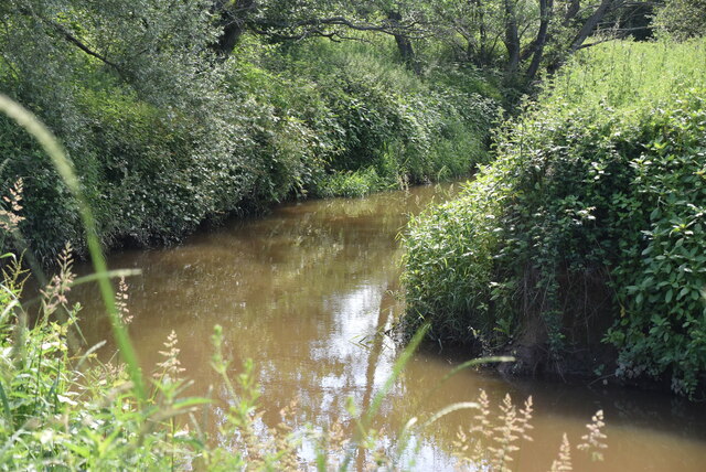
The wood is also home to a small pond, which serves as a watering hole for local wildlife and adds to the overall charm of the area. Additionally, there are picnic areas scattered throughout the wood, providing a perfect spot for visitors to relax and enjoy a picnic surrounded by nature.

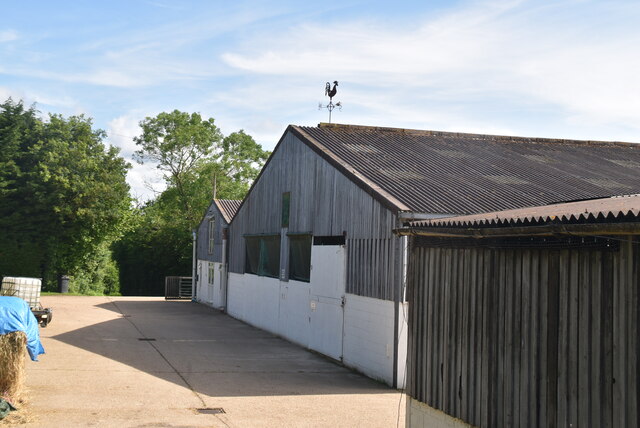
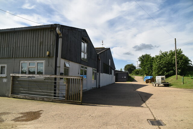
Downlands Wood is managed by the local forestry commission, ensuring that it is well-preserved and accessible to the public. It is a popular destination for nature enthusiasts, photographers, and families seeking a peaceful and enjoyable day out in the heart of Sussex's natural beauty.

If you have any feedback on the listing, please let us know in the comments section below.

Downlands Wood Images

Images are sourced within 2km of 50.931828/0.085825822 or Grid Reference TQ4616. Thanks to Geograph Open Source API. All images are credited.

Track in Isfield
Track in Isfield
Tile Barn Farmhouse
Tile Barn Farmhouse
Tile Barn Farm
Tile Barn Farm
Tile Barn Farm
Tile Barn Farm
A green lane
A green lane
Grassy footpath
Grassy footpath
A small pond
A small pond
Tile Barn Farm
Tile Barn Farm
Meadow
Meadow
Meadow
Meadow
River Uck The River Uck is a river in East Sussex, which drains a catchment starting near Crowborough in the North, Hadlow Down to the East and Laughton Common to the South.It flows through the town of Uckfield and into the river Ouse about 3 miles north of Lewes. The river Uck also has a scenic walk alongside it. The river burst its banks in 2000, flooding much of Uckfield and the surrounding countryside.
River Uck
The River Uck is a river in East Sussex, which drains a catchment starting near Crowborough in the North, Hadlow Down to the East and Laughton Common to the South.It flows through the town of Uckfield and into the river Ouse about 3 miles north of Lewes. The river Uck also has a scenic walk alongside it. The river burst its banks in 2000, flooding much of Uckfield and the surrounding countryside.
Meadow by the River Uck
Pillbox In 1940 a network of defences was hastily built all over Britain to prevent an expected German invasion. The most common of these defences were called “pillboxes”, squat concrete forts that were sited at road junctions, canals and other strategic points.

With the passage of time it is estimated that fewer than 6,000 of a total of 28,000 pillboxes built still survive. They remain as permanent monuments and a silent tribute to the courage and tenacity of the British people during the dark days of 1940 when Britain stood alone against Nazi Germany.

More detail see <span class="nowrap"><a title="www.pillboxesuk.co.uk" rel="nofollow ugc noopener" href="http://www.pillboxesuk.co.uk">Link</a><img style="margin-left:2px;" alt="External link" title="External link - shift click to open in new window" src="https://s1.geograph.org.uk/img/external.png" width="10" height="10"/></span>
Pillbox
In 1940 a network of defences was hastily built all over Britain to prevent an expected German invasion. The most common of these defences were called “pillboxes”, squat concrete forts that were sited at road junctions, canals and other strategic points. With the passage of time it is estimated that fewer than 6,000 of a total of 28,000 pillboxes built still survive. They remain as permanent monuments and a silent tribute to the courage and tenacity of the British people during the dark days of 1940 when Britain stood alone against Nazi Germany. More detail see LinkExternal link
River Uck The River Uck is a river in East Sussex, which drains a catchment starting near Crowborough in the North, Hadlow Down to the East and Laughton Common to the South.It flows through the town of Uckfield and into the river Ouse about 3 miles north of Lewes. The river Uck also has a scenic walk alongside it. The river burst its banks in 2000, flooding much of Uckfield and the surrounding countryside.
River Uck
The River Uck is a river in East Sussex, which drains a catchment starting near Crowborough in the North, Hadlow Down to the East and Laughton Common to the South.It flows through the town of Uckfield and into the river Ouse about 3 miles north of Lewes. The river Uck also has a scenic walk alongside it. The river burst its banks in 2000, flooding much of Uckfield and the surrounding countryside.
Old railway bridge
Old railway bridge
Show me another place!

Downlands Wood is located at Grid Ref: TQ4616 (Lat: 50.931828, Lng: 0.085825822)

Administrative County: East Sussex

District: Wealden

Police Authority: Sussex

What 3 Words

///eclipses.flaking.ruffling. Near Uckfield, East Sussex

Related Wikis

Plashett Park Wood

Plashett Park Wood is a 157.6-hectare (389-acre) biological Site of Special Scientific Interest between Lewes and Uckfield in East Sussex.This ancient...

East Sussex National Golf Club

East Sussex National Golf Club is a golf course located near to Uckfield in East Sussex. It is considered one of the finer golf courses in the British...

Lavender Line

The Lavender Line is a heritage railway based at Isfield Station, near Uckfield in East Sussex, England. == History == The Lavender Line was originally...

Isfield railway station

Isfield is a preserved railway station on the closed section of the Wealden Line which served the East Sussex village of Isfield near Uckfield. Originally...

Horsted Place

Horsted Place is a Tudor Revival country house, now a hotel, in Little Horsted, East Sussex, England. The current building dates to 1850, when it was built...

Isfield

Isfield is a small village and civil parish in the Wealden District of East Sussex in England, located north-east of Lewes. == History == The village of...

Bentley Wildfowl and Motor Museum

The Bentley Wildfowl and Motor Museum was a visitor attraction near Halland, East Sussex, England. As of October 2018, it is closed to the public. ��2...

Little Horsted

Little Horsted (also known as Horsted Parva) is a village and civil parish in the Wealden district of East Sussex, England. It is located two miles (3...

Nearby Amenities

Located within 500m of 50.931828,0.085825822
Material: wood
Power: pole
Source: bing
Lat/Long: 50.9289634/0.0815607
Material: wood
Power: pole
Source: bing
Lat/Long: 50.9298744/0.0815874
Material: wood
Power: pole
Source: bing
Lat/Long: 50.9308078/0.0816209
Material: wood
Power: pole
Source: bing
Lat/Long: 50.9334503/0.0916452
Material: wood
Power: pole
Source: bing
Lat/Long: 50.9336024/0.0912951
Material: wood
Power: pole
Source: bing
Lat/Long: 50.933678/0.0816936
Material: wood
Power: pole
Source: bing
Lat/Long: 50.9340288/0.0902589
Material: wood
Power: pole
Source: bing
Lat/Long: 50.9344602/0.0887717
Material: wood
Power: pole
Source: bing
Lat/Long: 50.9348398/0.0874233
Material: wood
Power: pole
Source: bing
Lat/Long: 50.9352066/0.0860575
Material: wood
Power: pole
Source: bing
Lat/Long: 50.9353149/0.0827598
Material: wood
Power: pole
Source: bing
Lat/Long: 50.9353855/0.0845151
Material: wood
Power: pole
Source: bing
Lat/Long: 50.9355614/0.0829758
South Brockwells Farm
Addr City: Uckfield
Addr Postcode: TN22 5QS
Addr Street: Bradfords Lane
Addr Village: Little Horsted
Phone: +44 1825 750466
Place: farm
Lat/Long: 50.9334315/0.0864709
Barrier: stile
Stile: stepover
Lat/Long: 50.9333041/0.0892639
Barrier: stile
Lat/Long: 50.932435/0.0886363
The data included in this document is from www.openstreetmap.org. The data is made available under ODbL.

Have you been to Downlands Wood?

Leave your review of Downlands Wood below (or comments, questions and feedback).