Chelsfield Hill Wood

Wood, Forest in Kent

England

Chelsfield Hill Wood

Woodland by Snag Lane
Woodland by Snag Lane Credit: N Chadwick

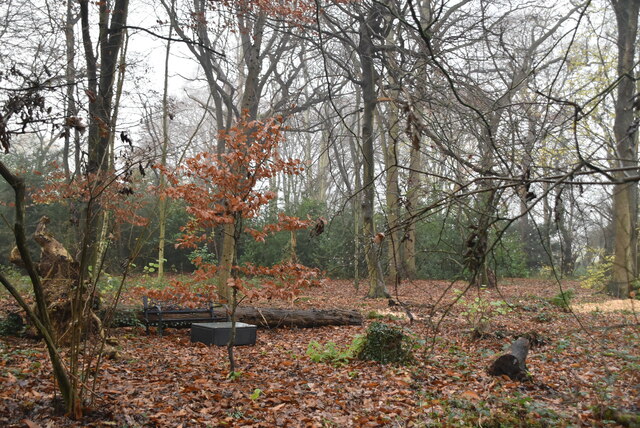
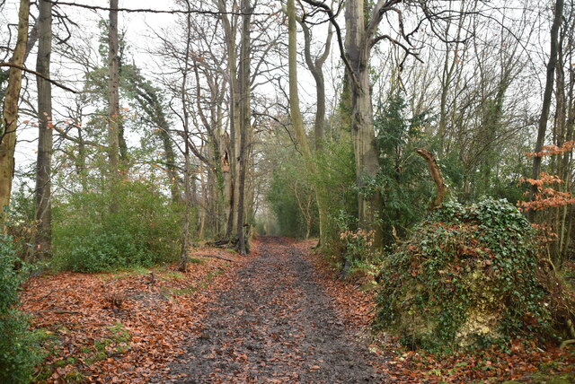
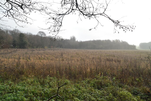
Chelsfield Hill Wood is a beautiful and picturesque woodland located in the county of Kent, England. Situated on the eastern slope of Chelsfield Hill, it covers an area of approximately 50 acres. The woodland is part of the larger Chelsfield Village Conservation Area.

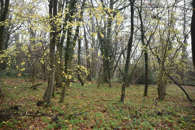
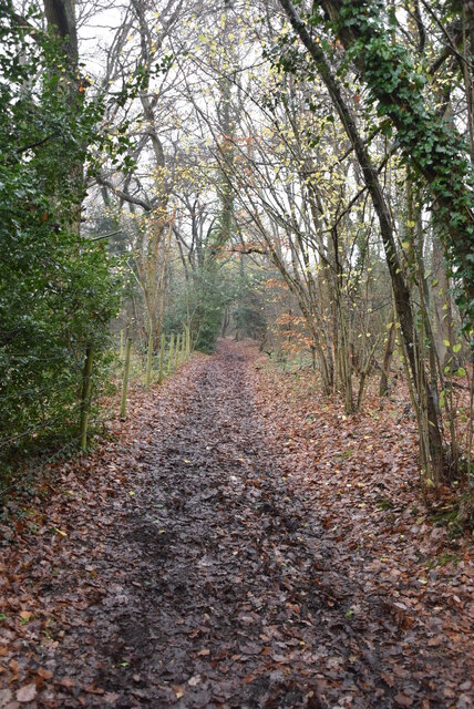
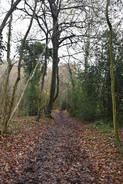
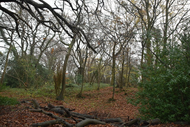
The wood is predominantly made up of ancient broadleaf trees, including oak, beech, and chestnut. These towering trees create a dense and lush canopy, providing a haven for a diverse range of wildlife. Chelsfield Hill Wood is home to numerous bird species, including woodpeckers, thrushes, and owls. Additionally, it is a habitat for small mammals such as squirrels, foxes, and bats.

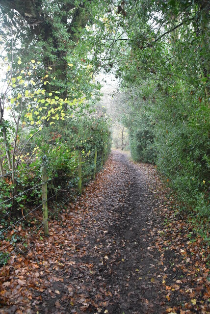
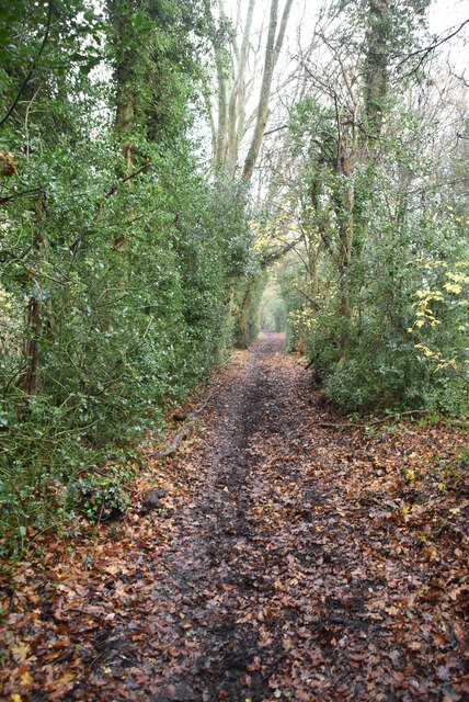
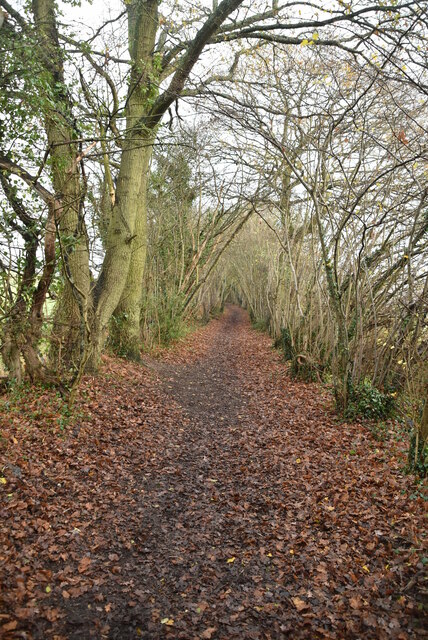
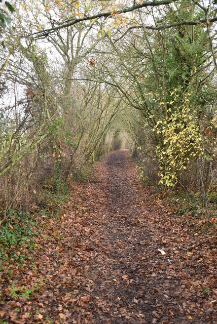
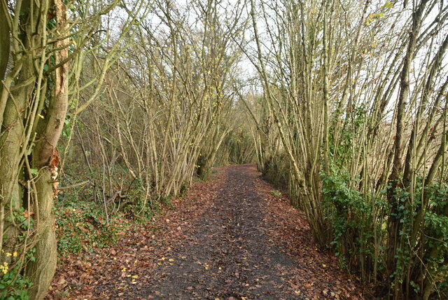
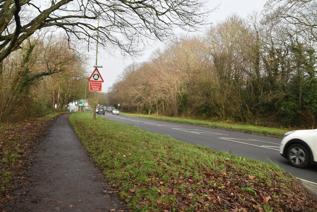
This enchanting woodland offers a variety of walking trails, allowing visitors to explore its natural beauty. The paths wind through the trees, creating a tranquil and peaceful atmosphere. The wood is well-maintained, with clear signposts and benches for visitors to rest and take in the scenery.

Chelsfield Hill Wood is a popular destination for nature enthusiasts, walkers, and families seeking a peaceful retreat from the bustle of everyday life. It provides an opportunity to immerse oneself in nature, breathe in the fresh woodland air, and experience the calming effect of being surrounded by ancient trees.

Overall, Chelsfield Hill Wood is a hidden gem in the heart of Kent, offering a unique and serene woodland experience for all who visit.

If you have any feedback on the listing, please let us know in the comments section below.

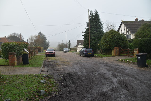
Chelsfield Hill Wood Images

Images are sourced within 2km of 51.348314/0.10451189 or Grid Reference TQ4663. Thanks to Geograph Open Source API. All images are credited.

Woodland by Snag Lane
Cudham Park Rd
Cudham Park Rd
Snag Lane
Snag Lane
Great Molloms Wood
Great Molloms Wood
Snag Lane
Snag Lane
Snag Lane
Snag Lane
Great Molloms Wood
Great Molloms Wood
Snag Lane
Snag Lane
Snag Lane
Snag Lane
Snag Lane
Snag Lane
Snag Lane
Snag Lane
Snag Lane
Snag Lane
Field by Sevenoaks Rd
Sevenoaks Rd, A21 The A21 is a 63 mile major trunk road running  from Lewisham in Greater London to Hastings, East Sussex. The road is broken up by the M25 motorway between junction 4 and 5.
Wikipedia <span class="nowrap"><a title="http://en.wikipedia.org/wiki/A21_road_(England)" rel="nofollow ugc noopener" href="http://en.wikipedia.org/wiki/A21_road_(England)">Link</a><img style="margin-left:2px;" alt="External link" title="External link - shift click to open in new window" src="https://s1.geograph.org.uk/img/external.png" width="10" height="10"/></span>
Sevenoaks Rd, A21
The A21 is a 63 mile major trunk road running from Lewisham in Greater London to Hastings, East Sussex. The road is broken up by the M25 motorway between junction 4 and 5. Wikipedia LinkExternal link
The Larches Listed buildings and structures are officially designated as being of special architectural, historical or cultural significance. There are over half a million listed structures in the United Kingdom, covered by around 375,000 listings.
Listed status is more commonly associated with buildings or groups of buildings, however it can cover many other structures, including bridges, headstones, steps, ponds, monuments, walls, phone boxes, wrecks, parks, and heritage sites, and in more recent times a road crossing (Abbey Road) and graffiti art (Banksy 'Spy-booth') have been included.

In England and Wales there are three main listing designations;
Grade I (2.5%) - exceptional interest, sometimes considered to be internationally important.
Grade II* (5.5%) - particularly important buildings of more than special interest. 
Grade II (92%) - nationally important and of special interest. 

There are also locally listed structures (at the discretion of local authorities) using A, B and C designations.

In Scotland three classifications are also used but the criteria are different. There are around 47,500 Listed buildings.
Category A (8%)- generally equivalent to Grade I and II* in England and Wales
Category B (51%)- this appears generally to cover the ground of Grade II, recognising national importance.
Category C (41%)- buildings of local importance, probably with some overlap with English Grade II.

In Northern Ireland the criteria are similar to Scotland, but the classifications are:
Grade A (2.3%)
Grade B+ (4.7%)
Grade B (93%)

Read more at Wikipedia <span class="nowrap"><a title="http://en.wikipedia.org/wiki/Listed_building" rel="nofollow ugc noopener" href="http://en.wikipedia.org/wiki/Listed_building">Link</a><img style="margin-left:2px;" alt="External link" title="External link - shift click to open in new window" src="https://s1.geograph.org.uk/img/external.png" width="10" height="10"/></span>
The Larches
Listed buildings and structures are officially designated as being of special architectural, historical or cultural significance. There are over half a million listed structures in the United Kingdom, covered by around 375,000 listings. Listed status is more commonly associated with buildings or groups of buildings, however it can cover many other structures, including bridges, headstones, steps, ponds, monuments, walls, phone boxes, wrecks, parks, and heritage sites, and in more recent times a road crossing (Abbey Road) and graffiti art (Banksy 'Spy-booth') have been included. In England and Wales there are three main listing designations; Grade I (2.5%) - exceptional interest, sometimes considered to be internationally important. Grade II* (5.5%) - particularly important buildings of more than special interest. Grade II (92%) - nationally important and of special interest. There are also locally listed structures (at the discretion of local authorities) using A, B and C designations. In Scotland three classifications are also used but the criteria are different. There are around 47,500 Listed buildings. Category A (8%)- generally equivalent to Grade I and II* in England and Wales Category B (51%)- this appears generally to cover the ground of Grade II, recognising national importance. Category C (41%)- buildings of local importance, probably with some overlap with English Grade II. In Northern Ireland the criteria are similar to Scotland, but the classifications are: Grade A (2.3%) Grade B+ (4.7%) Grade B (93%) Read more at Wikipedia LinkExternal link
Rose & Crown Green Street Green is an area of the borough of Bromley, historically in Kent.
Wikipedia: <span class="nowrap"><a title="https://en.wikipedia.org/wiki/Green_Street_Green" rel="nofollow ugc noopener" href="https://en.wikipedia.org/wiki/Green_Street_Green">Link</a><img style="margin-left:2px;" alt="External link" title="External link - shift click to open in new window" src="https://s1.geograph.org.uk/img/external.png" width="10" height="10"/></span>
Rose & Crown
Green Street Green is an area of the borough of Bromley, historically in Kent. Wikipedia: LinkExternal link
Entering Green Street Green Green Street Green is an area of the borough of Bromley, historically in Kent.
Wikipedia: <span class="nowrap"><a title="https://en.wikipedia.org/wiki/Green_Street_Green" rel="nofollow ugc noopener" href="https://en.wikipedia.org/wiki/Green_Street_Green">Link</a><img style="margin-left:2px;" alt="External link" title="External link - shift click to open in new window" src="https://s1.geograph.org.uk/img/external.png" width="10" height="10"/></span>
Entering Green Street Green
Green Street Green is an area of the borough of Bromley, historically in Kent. Wikipedia: LinkExternal link
Not an Oast house Buildings made to look like oast houses.
Not an Oast house
Buildings made to look like oast houses.
Show me another place!

Chelsfield Hill Wood is located at Grid Ref: TQ4663 (Lat: 51.348314, Lng: 0.10451189)

Unitary Authority: Bromley

Police Authority: Metropolitan

What 3 Words

///legal.chin.descended. Near Farnborough, London

Related Wikis

Chelsfield railway station

Chelsfield railway station is on the South Eastern Main Line, serving the Chelsfield and Green Street Green areas south of Orpington, in the London Borough...

Pratt's Bottom

Pratt's Bottom is a village in Greater London, England, within the London Borough of Bromley and, prior to 1965, within the historic county of Kent. It...

Green Street Green

Green Street Green is an area in south-east London, located in the London Borough of Bromley and, prior to 1965, in the historic county of Kent. It is...

Hewitt's Chalk Bank

Hewitt's Chalk Bank is a 4-hectare (10-acre) nature reserve north-east of Pratt's Bottom in the London Borough of Bromley. It is managed by the Kent Wildlife...

Orpington (UK Parliament constituency)

Orpington is a constituency created in 1945 and represented in the House of Commons of the UK Parliament since 2019 by Gareth Bacon, a Conservative. It...

Orpington Hospital

Orpington Hospital is an acute general hospital in Orpington, London. It is managed by the King's College Hospital NHS Foundation Trust. == History... ==

Knockholt railway station

Knockholt railway station is on the South Eastern Main Line, located in the London Borough of Bromley, Greater London. It is 16 miles 44 chains (26.6 km...

Chelsfield

Chelsfield is an area in south-east London, England, within the London Borough of Bromley and, prior to 1965, in the historic county of Kent. It lies south...

Nearby Amenities

Located within 500m of 51.348314,0.10451189
Created By: YahooApplet 1.0
Lat/Long: 51.3491349/0.1098159
Turning Circle
Lat/Long: 51.3493194/0.0995965
Turning Circle
Lat/Long: 51.3467653/0.1026891
Bus Stop
Charmwood Lane
Naptan AtcoCode: 490005017W
Naptan Bearing: N
Naptan CommonName: Charmwood Lane
Naptan Street: SEVENOAKS ROAD
Naptan Verified: no
Public Transport: platform
Shelter: no
Lat/Long: 51.3443702/0.1016609
Bus Stop
The Hillside
Bench: no
Bin: no
Naptan AtcoCode: 490013420E
Naptan Bearing: E
Naptan CommonName: The Hillside
Naptan Street: SEVENOAKS ROAD
Naptan Verified: no
Public Transport: platform
Shelter: no
Lat/Long: 51.3447004/0.103409
The data included in this document is from www.openstreetmap.org. The data is made available under ODbL.

Have you been to Chelsfield Hill Wood?

Leave your review of Chelsfield Hill Wood below (or comments, questions and feedback).