High Beeches

Wood, Forest in Kent

England

High Beeches

Snag Lane
Snag Lane Credit: N Chadwick

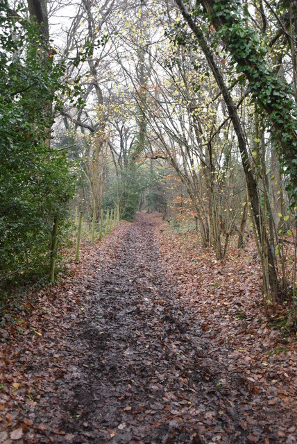
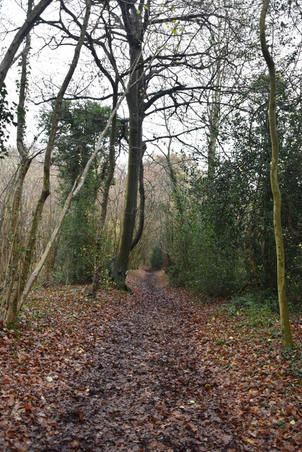
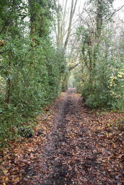
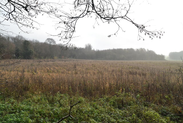
High Beeches is a picturesque woodland area located in the county of Kent, England. Situated in the High Weald Area of Outstanding Natural Beauty, it covers an area of approximately 100 acres and is known for its rich biodiversity and stunning natural landscapes.

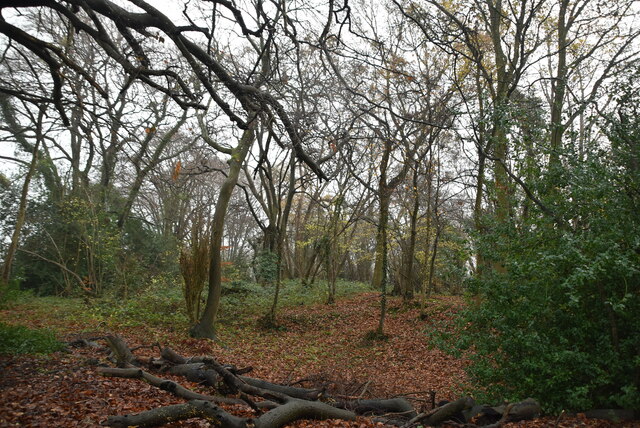
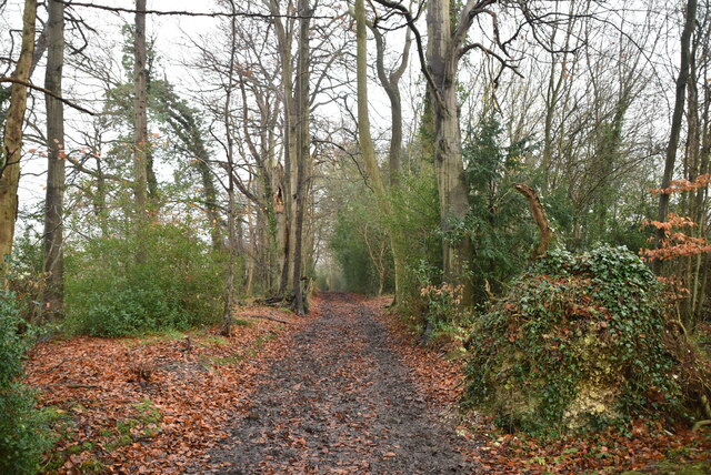
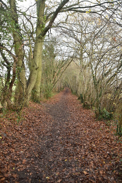
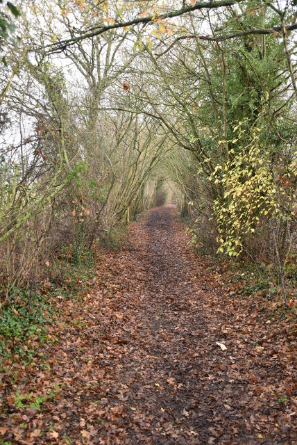
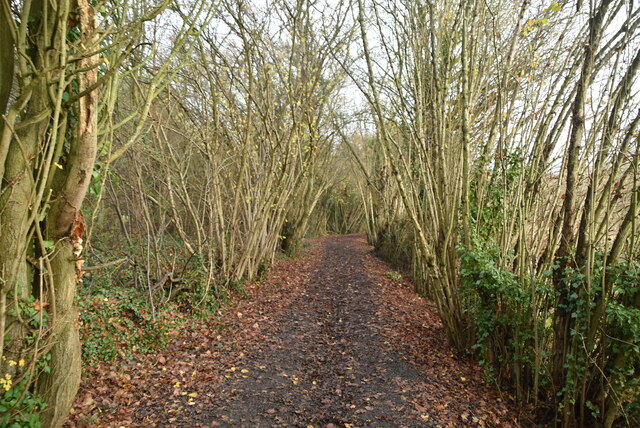
The woodland is predominantly made up of a mix of broadleaf trees, including oak, beech, and chestnut, which create a dense canopy that provides a habitat for a wide variety of flora and fauna. The forest floor is adorned with vibrant wildflowers, ferns, and mosses, adding to the enchanting atmosphere of the area.

High Beeches is a popular destination for nature lovers and outdoor enthusiasts. It offers a network of well-maintained trails that wind through the woodland, allowing visitors to explore its beauty at their own pace. The paths are suitable for both walking and cycling, making it a versatile destination for people of all ages and abilities.

In addition to its natural beauty, High Beeches is also home to a renowned collection of rare and exotic plants. The High Beeches Gardens, located within the woodland, boast an impressive display of rhododendrons, azaleas, and other unique species. These gardens attract visitors from far and wide, especially during the spring when the vibrant colors of the flowers are in full bloom.

Overall, High Beeches in Kent offers a tranquil escape from the hustle and bustle of everyday life. With its stunning woodlands, diverse wildlife, and exceptional gardens, it provides a truly enchanting experience for anyone seeking a connection with nature.

If you have any feedback on the listing, please let us know in the comments section below.
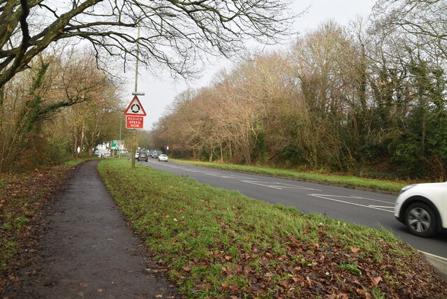
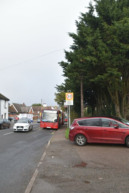
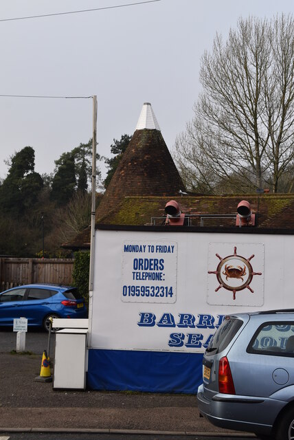
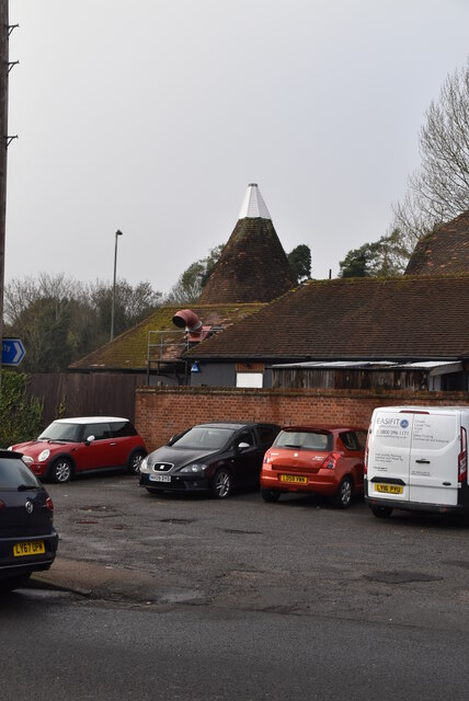
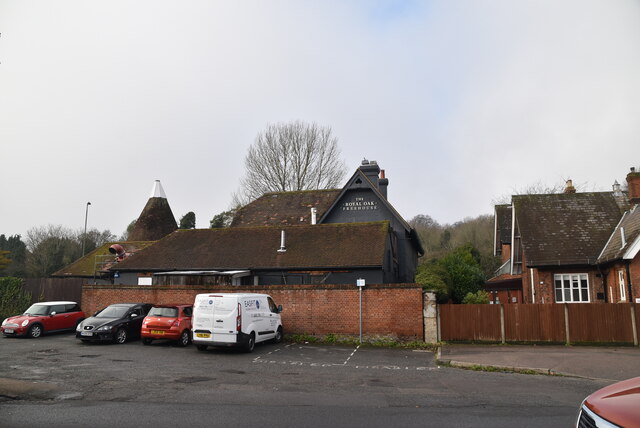
High Beeches Images

Images are sourced within 2km of 51.353193/0.10375884 or Grid Reference TQ4663. Thanks to Geograph Open Source API. All images are credited.

Snag Lane
Snag Lane
Snag Lane
Snag Lane
Great Molloms Wood
Great Molloms Wood
Snag Lane
Snag Lane
Snag Lane
Snag Lane
Snag Lane
Snag Lane
Snag Lane
Snag Lane
Snag Lane
Snag Lane
Field by Sevenoaks Rd
Sevenoaks Rd, A21 The A21 is a 63 mile major trunk road running  from Lewisham in Greater London to Hastings, East Sussex. The road is broken up by the M25 motorway between junction 4 and 5.
Wikipedia <span class="nowrap"><a title="http://en.wikipedia.org/wiki/A21_road_(England)" rel="nofollow ugc noopener" href="http://en.wikipedia.org/wiki/A21_road_(England)">Link</a><img style="margin-left:2px;" alt="External link" title="External link - shift click to open in new window" src="https://s1.geograph.org.uk/img/external.png" width="10" height="10"/></span>
Sevenoaks Rd, A21
The A21 is a 63 mile major trunk road running from Lewisham in Greater London to Hastings, East Sussex. The road is broken up by the M25 motorway between junction 4 and 5. Wikipedia LinkExternal link
The Larches Listed buildings and structures are officially designated as being of special architectural, historical or cultural significance. There are over half a million listed structures in the United Kingdom, covered by around 375,000 listings.
Listed status is more commonly associated with buildings or groups of buildings, however it can cover many other structures, including bridges, headstones, steps, ponds, monuments, walls, phone boxes, wrecks, parks, and heritage sites, and in more recent times a road crossing (Abbey Road) and graffiti art (Banksy 'Spy-booth') have been included.

In England and Wales there are three main listing designations;
Grade I (2.5%) - exceptional interest, sometimes considered to be internationally important.
Grade II* (5.5%) - particularly important buildings of more than special interest. 
Grade II (92%) - nationally important and of special interest. 

There are also locally listed structures (at the discretion of local authorities) using A, B and C designations.

In Scotland three classifications are also used but the criteria are different. There are around 47,500 Listed buildings.
Category A (8%)- generally equivalent to Grade I and II* in England and Wales
Category B (51%)- this appears generally to cover the ground of Grade II, recognising national importance.
Category C (41%)- buildings of local importance, probably with some overlap with English Grade II.

In Northern Ireland the criteria are similar to Scotland, but the classifications are:
Grade A (2.3%)
Grade B+ (4.7%)
Grade B (93%)

Read more at Wikipedia <span class="nowrap"><a title="http://en.wikipedia.org/wiki/Listed_building" rel="nofollow ugc noopener" href="http://en.wikipedia.org/wiki/Listed_building">Link</a><img style="margin-left:2px;" alt="External link" title="External link - shift click to open in new window" src="https://s1.geograph.org.uk/img/external.png" width="10" height="10"/></span>
The Larches
Listed buildings and structures are officially designated as being of special architectural, historical or cultural significance. There are over half a million listed structures in the United Kingdom, covered by around 375,000 listings. Listed status is more commonly associated with buildings or groups of buildings, however it can cover many other structures, including bridges, headstones, steps, ponds, monuments, walls, phone boxes, wrecks, parks, and heritage sites, and in more recent times a road crossing (Abbey Road) and graffiti art (Banksy 'Spy-booth') have been included. In England and Wales there are three main listing designations; Grade I (2.5%) - exceptional interest, sometimes considered to be internationally important. Grade II* (5.5%) - particularly important buildings of more than special interest. Grade II (92%) - nationally important and of special interest. There are also locally listed structures (at the discretion of local authorities) using A, B and C designations. In Scotland three classifications are also used but the criteria are different. There are around 47,500 Listed buildings. Category A (8%)- generally equivalent to Grade I and II* in England and Wales Category B (51%)- this appears generally to cover the ground of Grade II, recognising national importance. Category C (41%)- buildings of local importance, probably with some overlap with English Grade II. In Northern Ireland the criteria are similar to Scotland, but the classifications are: Grade A (2.3%) Grade B+ (4.7%) Grade B (93%) Read more at Wikipedia LinkExternal link
Rose & Crown Green Street Green is an area of the borough of Bromley, historically in Kent.
Wikipedia: <span class="nowrap"><a title="https://en.wikipedia.org/wiki/Green_Street_Green" rel="nofollow ugc noopener" href="https://en.wikipedia.org/wiki/Green_Street_Green">Link</a><img style="margin-left:2px;" alt="External link" title="External link - shift click to open in new window" src="https://s1.geograph.org.uk/img/external.png" width="10" height="10"/></span>
Rose & Crown
Green Street Green is an area of the borough of Bromley, historically in Kent. Wikipedia: LinkExternal link
Entering Green Street Green Green Street Green is an area of the borough of Bromley, historically in Kent.
Wikipedia: <span class="nowrap"><a title="https://en.wikipedia.org/wiki/Green_Street_Green" rel="nofollow ugc noopener" href="https://en.wikipedia.org/wiki/Green_Street_Green">Link</a><img style="margin-left:2px;" alt="External link" title="External link - shift click to open in new window" src="https://s1.geograph.org.uk/img/external.png" width="10" height="10"/></span>
Entering Green Street Green
Green Street Green is an area of the borough of Bromley, historically in Kent. Wikipedia: LinkExternal link
Not an Oast house Buildings made to look like oast houses.
Not an Oast house
Buildings made to look like oast houses.
Fake Oast Buildings made to look like oast houses.
Fake Oast
Buildings made to look like oast houses.
The Royal Oak The third most popular pub name, it became popular after Charles II escaped during the English Civil War by hiding behind an Oak tree.
The Royal Oak
The third most popular pub name, it became popular after Charles II escaped during the English Civil War by hiding behind an Oak tree.
Queens Head Green Street Green is an area of the borough of Bromley, historically in Kent.
Wikipedia: <span class="nowrap"><a title="https://en.wikipedia.org/wiki/Green_Street_Green" rel="nofollow ugc noopener" href="https://en.wikipedia.org/wiki/Green_Street_Green">Link</a><img style="margin-left:2px;" alt="External link" title="External link - shift click to open in new window" src="https://s1.geograph.org.uk/img/external.png" width="10" height="10"/></span>
Queens Head
Green Street Green is an area of the borough of Bromley, historically in Kent. Wikipedia: LinkExternal link
Church, Green Street Green Green Street Green is an area of the borough of Bromley, historically in Kent.
Wikipedia: <span class="nowrap"><a title="https://en.wikipedia.org/wiki/Green_Street_Green" rel="nofollow ugc noopener" href="https://en.wikipedia.org/wiki/Green_Street_Green">Link</a><img style="margin-left:2px;" alt="External link" title="External link - shift click to open in new window" src="https://s1.geograph.org.uk/img/external.png" width="10" height="10"/></span>
Church, Green Street Green
Green Street Green is an area of the borough of Bromley, historically in Kent. Wikipedia: LinkExternal link
Show me another place!

High Beeches is located at Grid Ref: TQ4663 (Lat: 51.353193, Lng: 0.10375884)

Unitary Authority: Bromley

Police Authority: Metropolitan

What 3 Words

///panels.plant.hits. Near Orpington, London

Related Wikis

Chelsfield railway station

Chelsfield railway station is on the South Eastern Main Line, serving the Chelsfield and Green Street Green areas south of Orpington, in the London Borough...

Green Street Green

Green Street Green is an area in south-east London, located in the London Borough of Bromley and, prior to 1965, in the historic county of Kent. It is...

Orpington Hospital

Orpington Hospital is an acute general hospital in Orpington, London. It is managed by the King's College Hospital NHS Foundation Trust. == History... ==

Orpington (UK Parliament constituency)

Orpington is a constituency created in 1945 and represented in the House of Commons of the UK Parliament since 2019 by Gareth Bacon, a Conservative. It...

Goddington

Goddington is an area in south-east London, located in the London Borough of Bromley. It is situated south of Ramsden, south-east of Orpington town centre...

St Olave's Grammar School

St. Olave's Grammar School (formally St. Olave's and St. Saviour's Church of England Grammar School) ( or ) is a selective secondary school for boys in...

Hewitt's Chalk Bank

Hewitt's Chalk Bank is a 4-hectare (10-acre) nature reserve north-east of Pratt's Bottom in the London Borough of Bromley. It is managed by the Kent Wildlife...

Pratt's Bottom

Pratt's Bottom is a village in Greater London, England, within the London Borough of Bromley and, prior to 1965, within the historic county of Kent. It...

Nearby Amenities

Located within 500m of 51.353193,0.10375884
Chelsfield
Public Transport: stop_position
Train: yes
Lat/Long: 51.3566007/0.1083048
Created By: YahooApplet 1.0
Lat/Long: 51.3547935/0.1034323
Turning Circle
Lat/Long: 51.3539656/0.1032112
Turning Circle
Lat/Long: 51.355526/0.1004093
Created By: YahooApplet 1.0
Lat/Long: 51.3517817/0.0976816
Created By: YahooApplet 1.0
Lat/Long: 51.3533094/0.0999561
Turning Circle
Lat/Long: 51.3526469/0.0999532
Created By: YahooApplet 1.0
Lat/Long: 51.3527935/0.0966517
Recycling
Location: overground
Recycling Type: container
Lat/Long: 51.3570097/0.1056349
Place Of Worship
Chelsfield Methodist Church
Denomination: methodist
Religion: christian
Lat/Long: 51.3566344/0.1048905
Post Box
Lat/Long: 51.3565382/0.1054111
Post Office
Meadway Post Office
Addr City: Orpington
Addr Housenumber: 11
Addr Postcode: BR6 6EY
Addr Street: Windsor Drive
Brand: Post Office
Brand Wikidata: Q1783168
Opening Hours: Mo-Sa 06:00-20:00; Su 07:00-19:00
Ref Pol Id: 128474
Website: https://www.postoffice.co.uk/branch-finder/1220128/meadway
Lat/Long: 51.3566156/0.1057622
Post Box
Lat/Long: 51.3541746/0.0991648
Bus Stop
Chelsfield Station
Local Ref: A
Naptan AtcoCode: 490001060A
Naptan Bearing: N
Naptan CommonName: Chelsfield
Naptan Indicator: A
Naptan Street: WARREN ROAD
Naptan Verified: no
Public Transport: platform
Shelter: no
Lat/Long: 51.35733/0.1064305
Bus Stop
Chelsfield Station
Local Ref: B
Naptan AtcoCode: 490001060B
Naptan Bearing: W
Naptan CommonName: Chelsfield
Naptan Indicator: B
Naptan Street: WARREN ROAD
Naptan Verified: no
Public Transport: platform
Lat/Long: 51.3572233/0.1062517
Bus Stop
Chelsfield Centre
Local Ref: C
Naptan AtcoCode: 490005079E
Naptan Bearing: E
Naptan CommonName: Chelsfield Centre
Naptan Indicator: Stop
Naptan Street: WINDSOR DRIVE
Naptan Verified: no
Public Transport: platform
Lat/Long: 51.3563182/0.1044993
Bus Stop
Chelsfield Centre
Local Ref: N
Naptan AtcoCode: 490005079N
Naptan Bearing: N
Naptan CommonName: Chelsfield Centre
Naptan Indicator: Stop
Naptan Street: WINDSOR DRIVE
Naptan Verified: no
Public Transport: platform
Lat/Long: 51.3558521/0.1038294
Bus Stop
High Beeches
Naptan AtcoCode: 490008139E
Naptan Bearing: N
Naptan CommonName: High Beeches (BR6)
Naptan Street: WINDSOR DRIVE
Public Transport: platform
Shelter: yes
Lat/Long: 51.3549341/0.1011395
Bus Stop
High Beeches
Naptan AtcoCode: 490008139W
Naptan Bearing: N
Naptan CommonName: High Beeches (BR6)
Naptan Street: WINDSOR DRIVE
Naptan Verified: no
Public Transport: platform
Lat/Long: 51.3541594/0.0994692
Bus Stop
Woodlands Road
Naptan AtcoCode: 490014865E
Naptan Bearing: E
Naptan CommonName: Woodlands Road Windsor Drive
Naptan Street: WINDSOR DRIVE
Naptan Verified: no
Public Transport: platform
Lat/Long: 51.3537285/0.0980289
Bicycle Parking
Covered: yes
Lat/Long: 51.3565575/0.1080742
Chelsfield
Public Transport: stop_position
Train: yes
Lat/Long: 51.3566177/0.1083553
McColl's
Addr Housenumber: 11
Addr Postcode: BR6 6EY
Addr Street: Windsor Drive
Brand: McColl's
Brand Wikidata: Q16997477
Brand Wikipedia: en:McColl's
Fhrs Id: 357931
Shop: convenience
Website: https://my.morrisons.com/storefinder/66320/mccolls-orpington-chelsfield
Lat/Long: 51.3566371/0.1058154
Post Box
Lat/Long: 51.3541122/0.0990118
Veterinary
All Creatures Clinic
Website: https://www.allcreaturesclinic.co.uk/
Lat/Long: 51.356074/0.1046215
Gents
Shop: hairdresser
Lat/Long: 51.3561193/0.1047234
Langford Rae Van Bergen
Shop: estate_agent
Lat/Long: 51.356097/0.1046865
Londis
Addr Housenumber: 37
Addr Postcode: BR6 6EY
Addr Street: Windsor Drive
Brand: Londis
Brand Wikidata: Q21008564
Fhrs Id: 432969
Shop: convenience
Lat/Long: 51.3561817/0.1048616
Restaurant
Saffron
Cuisine: indian
Website: http://www.saffronorpington.co.uk
Lat/Long: 51.3561424/0.1047846
Fast Food
Windsor Fish Bar
Addr Housenumber: 33
Addr Postcode: BR6 6EY
Addr Street: Windsor Drive
Cuisine: fish_and_chips
Fhrs Id: 357932
Lat/Long: 51.3562374/0.1049711
Extent Ltd
Addr City: Orpington
Addr Housename: The Castle
Addr Housenumber: 24
Addr Postcode: BR6 6EF
Addr Street: High Beeches
Office: it
Opening Hours: 09:00-17:30
Website: http://www.extentsoftware.co.uk
Lat/Long: 51.3543598/0.1021151
Chelsfield
Naptan AtcoCode: 9100CHLSFLD
Network: National Rail
Network Website: https://www.nationalrail.co.uk/stations/cld/
Network Wikidata: Q26334
Operator: Southeastern
Operator Website: https://www.southeasternrailway.co.uk/travel-information/more-travel-help/station-information/stations/chelsfield
Operator Wikidata: Q1696490
Public Transport: station
Railway: station
Ref Crs: CLD
Source: NPE
Source Ref: http://en.wikipedia.org/wiki/List_of_London_railway_stations
Wheelchair: limited
Wheelchair Description: Step free access to platform 1 from Station Approach Rd. Steep ramp to access Platform 2 from Warren Road. Step free interchange via road and steep paths is in excess of 400metres.
Wikidata: Q1846494
Wikipedia: en:Chelsfield railway station
Lat/Long: 51.3566115/0.1083284
Bicycle Parking
Bicycle Parking: stands
Capacity: 6
Ref GB Tflcid: RWG197935
Lat/Long: 51.3562655/0.104824
Bicycle Parking
Bicycle Parking: stands
Capacity: 6
Ref GB Tflcid: RWG197936
Lat/Long: 51.3564199/0.1051532
Bicycle Parking
Bicycle Parking: stands
Capacity: 6
Ref GB Tflcid: RWG197937
Lat/Long: 51.3565155/0.105356
Cafe
Dudleys
Lat/Long: 51.3563121/0.1051297
The data included in this document is from www.openstreetmap.org. The data is made available under ODbL.

Have you been to High Beeches?

Leave your review of High Beeches below (or comments, questions and feedback).