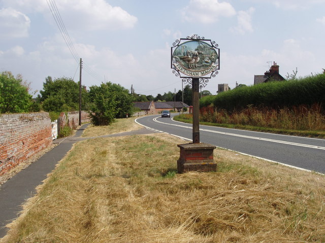
Fakenham Magna

Settlement in Suffolk West Suffolk

England

Fakenham Magna

Thetford Road entering Fakenham Magna
Thetford Road entering Fakenham Magna Credit: David Howard

Fakenham Magna is a small rural village located in the county of Suffolk, England. Situated on the eastern edge of the county, it is part of the Mid Suffolk district. Fakenham Magna is approximately 12 miles northeast of the town of Bury St Edmunds and around 20 miles southwest of the city of Norwich.

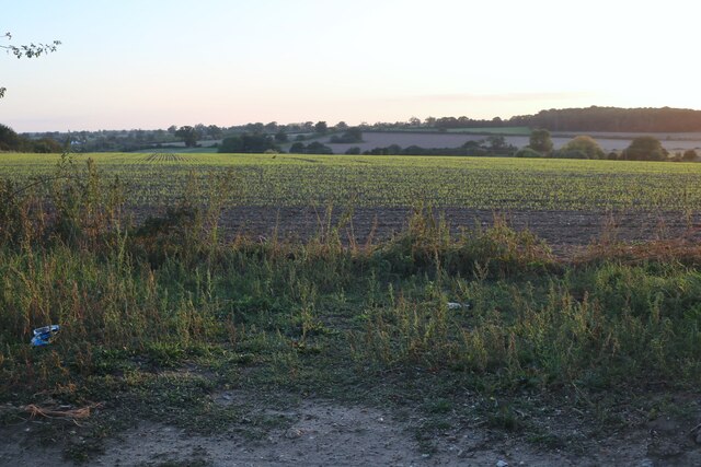
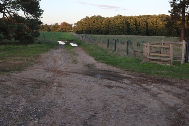
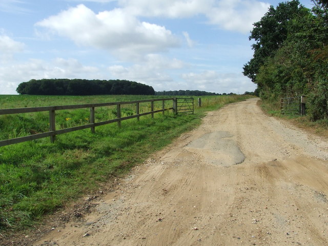
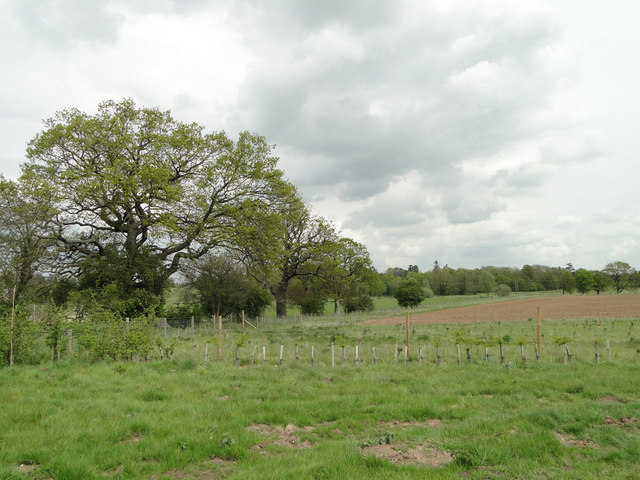
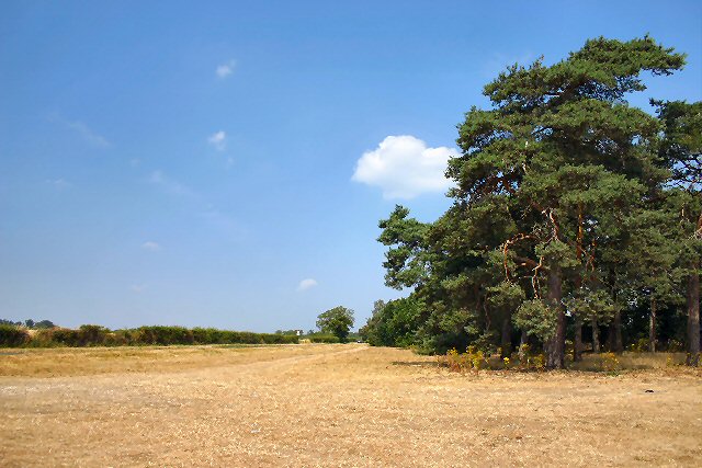
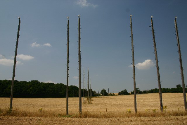
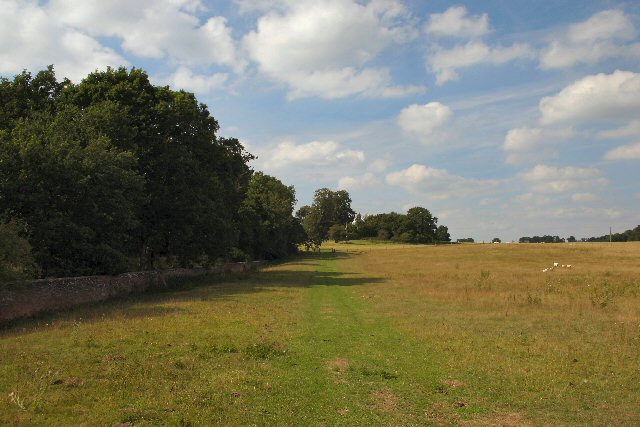
The village is surrounded by picturesque countryside, characterized by rolling hills, farmland, and charming country lanes. Fakenham Magna has a peaceful and tranquil atmosphere, making it an attractive destination for those seeking a quiet rural retreat.

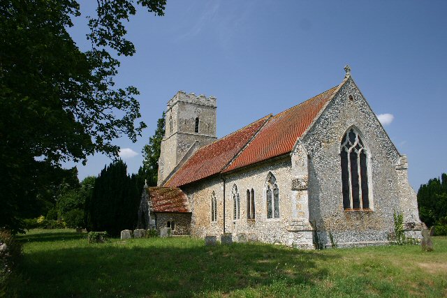
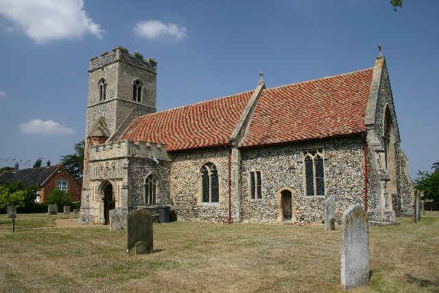
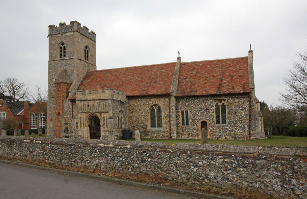
Despite its small size, Fakenham Magna has a rich history dating back several centuries. The village is mentioned in the Domesday Book of 1086, and there are still remnants of its medieval past, including an ancient church dedicated to St. Peter.

In terms of amenities, Fakenham Magna has limited facilities. There is a village hall which hosts various community events, and a primary school serving the local children. The nearest shops, supermarkets, and other amenities can be found in nearby towns such as Bury St Edmunds and Thetford.

Fakenham Magna offers an idyllic setting for outdoor activities, with numerous footpaths and bridleways crisscrossing the surrounding countryside, providing opportunities for walking, cycling, and horse riding.

Overall, Fakenham Magna is a charming and historic village, offering a peaceful and rural lifestyle amidst the scenic beauty of Suffolk's countryside.

If you have any feedback on the listing, please let us know in the comments section below.

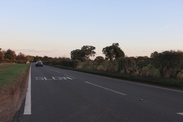
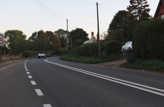
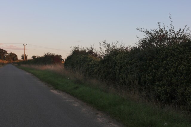
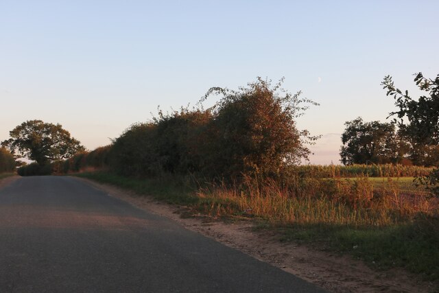
Fakenham Magna Images

Images are sourced within 2km of 52.352988/0.8037841 or Grid Reference TL9176. Thanks to Geograph Open Source API. All images are credited.

Thetford Road entering Fakenham Magna
Thetford Road, Fakenham Magna
Bardwell Road, Fakenham Magna
Fields by Bardwell Road, Fakenham Magna
Fields and woods in Fakenham Magna Off Thetford Road
Fields and woods in Fakenham Magna
Off Thetford Road
Heath Road, Sapiston
Track Track off the A.1088 leading to Willowmere House with the wood Fakenham Spinney to the left.
Track
Track off the A.1088 leading to Willowmere House with the wood Fakenham Spinney to the left.
Newly planted trees around the field perimeter
A1088 south of Euston The track leading off to the right leads to a disused quarry but is firmly gated off.
A1088 south of Euston
The track leading off to the right leads to a disused quarry but is firmly gated off.
Thetford Road, between Fakenham Magna and Euston A wide strip of land borders the east side of the road, which runs alongside the hedgerow to the left.
Thetford Road, between Fakenham Magna and Euston
A wide strip of land borders the east side of the road, which runs alongside the hedgerow to the left.
Fakenham Magna Church St Peter's Church has a 14th century tower.
Fakenham Magna Church
St Peter's Church has a 14th century tower.
Landing lights Marking the approach to RAF Honington (which is no longer used by fixed-wing aircraft).
Landing lights
Marking the approach to RAF Honington (which is no longer used by fixed-wing aircraft).
Honington Church All Saints' Church is in the centre of the village of Honington, over a mile away from the RAF base of the same name.
Honington Church
All Saints' Church is in the centre of the village of Honington, over a mile away from the RAF base of the same name.
Suffolk Village The village sign greets the motorists who pass through Fakenham Magna in Suffolk.  It takes less than a minute to drive through the village!
Suffolk Village
The village sign greets the motorists who pass through Fakenham Magna in Suffolk. It takes less than a minute to drive through the village!
Clint Foot Barn, Sapiston Shown on both old and modern maps as Grove Farm, these buildings appear to have been re-named.
Clint Foot Barn, Sapiston
Shown on both old and modern maps as Grove Farm, these buildings appear to have been re-named.
Footpath to Fakenham Magna This public footpath leads north west from Sapiston along the Black Bourn river.
Footpath to Fakenham Magna
This public footpath leads north west from Sapiston along the Black Bourn river.
Euston Park A seasonal permissive path (open February to September inclusive) runs alongside this wall, which delineates the grounds of Euston Hall.
Euston Park
A seasonal permissive path (open February to September inclusive) runs alongside this wall, which delineates the grounds of Euston Hall.
Show me another place!

Fakenham Magna is located at Grid Ref: TL9176 (Lat: 52.352988, Lng: 0.8037841)

Administrative County: Suffolk

District: West Suffolk

Police Authority: Suffolk

What 3 Words

///objective.swift.film. Near Ixworth, Suffolk

Related Wikis

Fakenham Magna

Fakenham Magna (or Great Fakenham) is a village and civil parish in the West Suffolk district of Suffolk in eastern England. The meaning of the word 'Fakenham...

Sapiston

Sapiston is a small village and civil parish in the West Suffolk district of Suffolk in eastern England, located near the Suffolk-Norfolk border. It is...

Honington, Suffolk

Honington is a village and civil parish located in Bardwell Ward and Pakenham and Troston Wards of West Suffolk District Council, Suffolk in eastern England...

Fakenham Wood and Sapiston Great Grove

Fakenham Wood and Sapiston Great Grove is a 200.7-hectare (496-acre) biological Site of Special Scientific Interest north of Sapiston in Suffolk. These...

Nearby Amenities

Located within 500m of 52.352988,0.8037841
Bus Stop
St Peters Church
Naptan AtcoCode: 390050622
Naptan Bearing: SE
Naptan CommonName: St Peters Church
Naptan Indicator: adj
Naptan Landmark: St Peters Church
Naptan NaptanCode: sufgjdtp
Naptan Street: Thetford Road
Shelter: no
Source: naptan_import;survey
Lat/Long: 52.3545013/0.8033567
Bus Stop
St Peters Church
Naptan AtcoCode: 390050623
Naptan Bearing: NW
Naptan CommonName: St Peters Church
Naptan Indicator: opp
Naptan Landmark: St Peters Church
Naptan NaptanCode: sufgjdtw
Naptan Street: Thetford Road
Shelter: no
Source: naptan_import;survey
Lat/Long: 52.3546892/0.8030382
Fakenham Magna
Place: village
Wikidata: Q5431509
Lat/Long: 52.3548546/0.803906
Ford: yes
Lat/Long: 52.3489168/0.8043455
Post Box
Collection Times: Mo-Fr 16:00; Sa 09:30
Post Box Type: lamp
Ref: IP24 3358
Ref GB Uprn: 10015432623
Royal Cypher: EIIR
Royal Cypher Wikidata: Q33102113
Lat/Long: 52.3508908/0.8004949
Barrier: stile
Lat/Long: 52.3487472/0.8043196
Barrier: lych_gate
Lat/Long: 52.3543884/0.8034778
Telephone
Booth: K6
Covered: booth
Listed Status: Grade II
Phone: +44 1359 269511
Lat/Long: 52.3551831/0.8025092
Barrier: stile
Lat/Long: 52.3525949/0.8048515
Fakenham Magna
Man Made: village_sign
Lat/Long: 52.3557766/0.8011614
Grit Bin
Lat/Long: 52.3507326/0.7999633
Barrier: kissing_gate
Lat/Long: 52.3502719/0.8006574
Chalk Farm
Place: farm
Lat/Long: 52.3513478/0.8015622
Give Way
Lat/Long: 52.3532217/0.8036262
Give Way
Lat/Long: 52.3529937/0.803461
Give Way
Lat/Long: 52.3529897/0.8037331
Power: pole
Lat/Long: 52.3574297/0.802694
Power: pole
Lat/Long: 52.3567826/0.8042094
Power: pole
Lat/Long: 52.355495/0.8029139
Power: pole
Lat/Long: 52.3558292/0.8040726
Power: pole
Lat/Long: 52.3563256/0.8049229
Power: pole
Lat/Long: 52.3557096/0.8058992
Power: pole
Lat/Long: 52.355033/0.8069774
Power: pole
Lat/Long: 52.354399/0.8080342
Power: pole
Lat/Long: 52.3526576/0.8080745
Power: pole
Lat/Long: 52.3517483/0.8082113
Power: pole
Lat/Long: 52.350921/0.8082837
Power: pole
Lat/Long: 52.3500903/0.8083266
Power: pole
Lat/Long: 52.3503213/0.8084339
Power: pole
Lat/Long: 52.3514026/0.8083642
Power: pole
Lat/Long: 52.3524364/0.8082649
Power: pole
Lat/Long: 52.3544138/0.8081362
Power: pole
Lat/Long: 52.3550068/0.8072028
Power: pole
Lat/Long: 52.3562224/0.8052528
Power: pole
Lat/Long: 52.3568137/0.8043033
Power: pole
Lat/Long: 52.3572413/0.8033377
Grit Bin
Lat/Long: 52.3530721/0.803673
The data included in this document is from www.openstreetmap.org. The data is made available under ODbL.

Have you been to Fakenham Magna?

Leave your review of Fakenham Magna below (or comments, questions and feedback).