Knockholt Wood

Wood, Forest in Kent Sevenoaks

England

Knockholt Wood

New Years Lane
New Years Lane Credit: N Chadwick

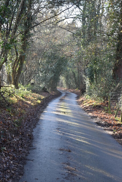
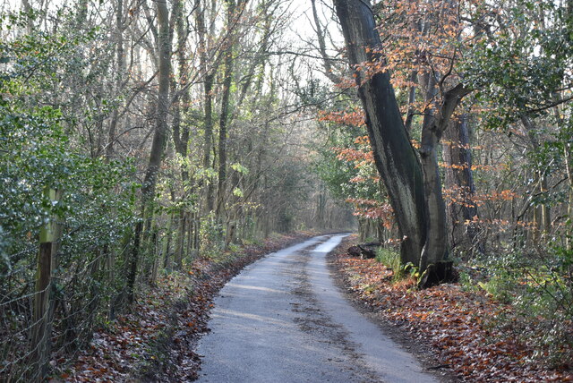
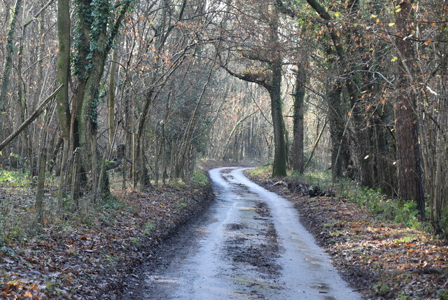
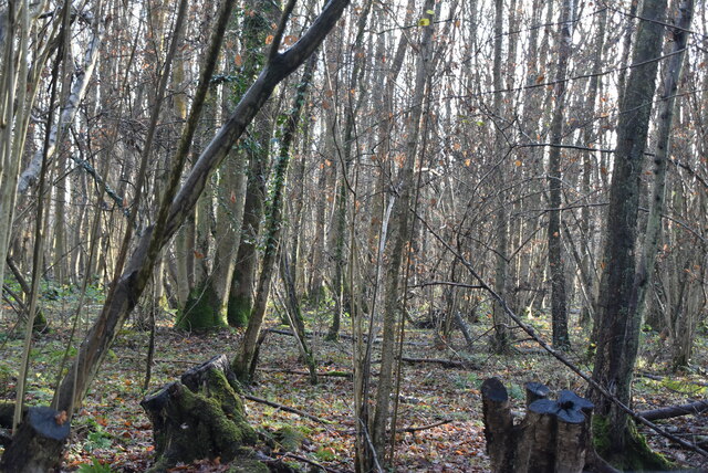
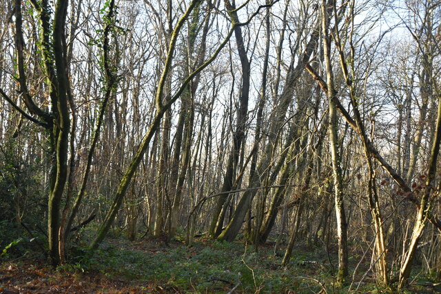
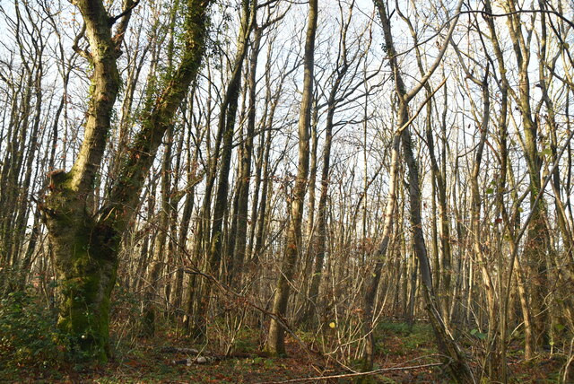
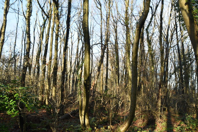
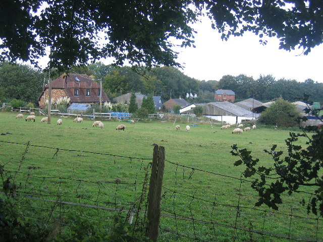
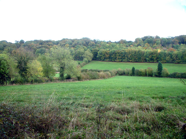
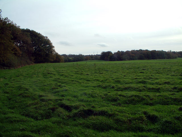
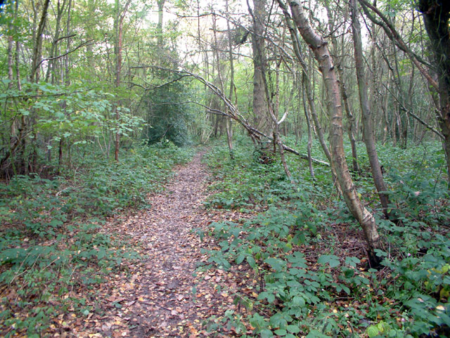
Knockholt Wood is a picturesque woodland located in the county of Kent, England. Covering an area of approximately 400 acres, this stunning forest is a popular destination for nature enthusiasts, hikers, and wildlife photographers.

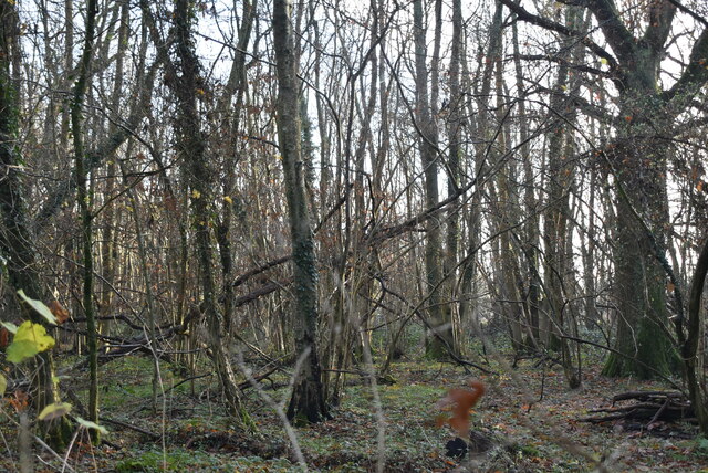
Situated near the village of Knockholt, the wood is characterized by its diverse range of tree species, including oak, beech, ash, and chestnut. These trees create a dense canopy, providing shade and shelter for a rich variety of flora and fauna. Bluebells, wild garlic, and wood anemones carpet the forest floor during spring, creating a colorful and enchanting display.

The wood is crisscrossed by a network of well-maintained footpaths, making it easily accessible for visitors of all ages. Several hiking trails meander through the forest, offering breathtaking views and opportunities to spot wildlife such as deer, foxes, badgers, and a plethora of bird species.

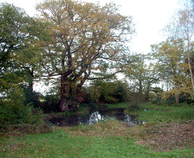
Knockholt Wood also boasts a small pond, which serves as a habitat for amphibians and insects. The tranquil atmosphere of the pond makes it an ideal spot for quiet contemplation or birdwatching.

The wood is managed by a local conservation group, ensuring its preservation and protection. The dedication of these volunteers has resulted in the establishment of a sustainable ecosystem, where the natural beauty of the woodland thrives.

Overall, Knockholt Wood is a haven for nature lovers, providing a serene escape from the bustle of everyday life. Its idyllic setting, diverse flora and fauna, and well-maintained trails make it a must-visit destination for anyone seeking to immerse themselves in the beauty of the Kentish countryside.

If you have any feedback on the listing, please let us know in the comments section below.

Knockholt Wood Images

Images are sourced within 2km of 51.30644/0.093154766 or Grid Reference TQ4658. Thanks to Geograph Open Source API. All images are credited.

New Years Lane
New Years Lane
New Years Lane, Newlands Wood
Newlands Wood
Newlands Wood
New Years Lane
New Years Lane
New Years Wood
New Years Wood
New Years Wood
New Years Wood
New Years Wood
New Years Wood
New Years Wood
New Years Wood
Meadow near Scott's Lodge
Blacksmiths Arms, Cudham TN14 Built 1628 and a pub for nearly 300 years - see <span class="nowrap"><a title="http://www.bigginhill.co.uk/bsmithsarms.htm" rel="nofollow ugc noopener" href="http://www.bigginhill.co.uk/bsmithsarms.htm">Link</a><img style="margin-left:2px;" alt="External link" title="External link - shift click to open in new window" src="https://s1.geograph.org.uk/img/external.png" width="10" height="10"/></span>
Blacksmiths Arms, Cudham TN14
Built 1628 and a pub for nearly 300 years - see LinkExternal link
Cudham Recreation Ground TN14
The Manor, New Barn Lane, TN16 Shown on the OS map as New Barn Farm - but the old farm buildings have been demolished, only the stables remaining (at the right of the photo).
The Manor, New Barn Lane, TN16
Shown on the OS map as New Barn Farm - but the old farm buildings have been demolished, only the stables remaining (at the right of the photo).
The Grove, TN14 A wooded hillside between New Barn Lane and Cudham Lane South
The Grove, TN14
A wooded hillside between New Barn Lane and Cudham Lane South
Cacket's Farm, Cacket's Lane, Cudham TN14
Letts Green crossroads, Knockholt TN14 Cackets Lane (behind the camera, to the left) comes from Cudham, to the west. Burlings Lane goes south towards Brasted. Away from the camera to the right, Shelleys Lane leads eastwards towards Knockholt. Northwards to the left is News Years Lane, leading northwards towards Green Street Green.
Letts Green crossroads, Knockholt TN14
Cackets Lane (behind the camera, to the left) comes from Cudham, to the west. Burlings Lane goes south towards Brasted. Away from the camera to the right, Shelleys Lane leads eastwards towards Knockholt. Northwards to the left is News Years Lane, leading northwards towards Green Street Green.
Letts Green Pond, Knockholt TN14 Just north of the crossroads.
Letts Green Pond, Knockholt TN14
Just north of the crossroads.
Jockey's Wood, Knockholt TN14 Birches Croft is on the left, Jockey's Wood right of centre.
Jockey's Wood, Knockholt TN14
Birches Croft is on the left, Jockey's Wood right of centre.
Footpath through Birches Croft, Knockholt TN14 Leading south east from New Year Cottage, on New Years Lane.
Footpath through Birches Croft, Knockholt TN14
Leading south east from New Year Cottage, on New Years Lane.
Show me another place!

Knockholt Wood is located at Grid Ref: TQ4658 (Lat: 51.30644, Lng: 0.093154766)

Administrative County: Kent

District: Sevenoaks

Police Authority: Kent

What 3 Words

///hung.recall.bags. Near Sundridge, Kent

Related Wikis

Horns Green

Horns Green is an area in the London Borough of Bromley located to the south of Cudham near the boundary with Kent. == References ==

St Katharine's Church, Knockholt

St Katharine's Church is an Anglican parish church in the village of Knockholt and the Sevenoaks deanery. St Katharine's and St Margaret's came together...

Knockholt

Knockholt is a village and civil parish in the Sevenoaks District of Kent, England. It is located 5 mi (8 km) north west of Sevenoaks & 5.7 mi (9.2 km...

Cudham

Cudham is a village in Greater London, England, located within the London Borough of Bromley and beyond London's urban sprawl. It is located on the Greater...

Berry's Green

Berry's Green a small hamlet in the London Borough of Bromley in Greater London, UK, situated outside of London's contiguous built-up area. It is a fairly...

Brasted railway station

Brasted is a disused intermediate railway station in Brasted, Kent on the closed Westerham Valley branch line. The station closed in 1961 and the site...

Old Jail, Biggin Hill

The Old Jail was a pub in Jail Lane, Biggin Hill, Westerham, Kent, in the London Borough of Bromley. At this time of writing, (February 2023), it is permanently...

Chevening

Chevening House () is a large country house in the parish of Chevening in Kent, England. Built between 1617 and 1630 to a design reputedly by Inigo Jones...

Nearby Amenities

Located within 500m of 51.30644,0.093154766
Bus Stop
Hail & Ride Burlings Lane
Naptan AtcoCode: 2400A008580A
Naptan Bearing: NE
Naptan CommonName: Burlings Lane
Naptan Indicator: adj
Naptan Landmark: Letts Green
Naptan NaptanCode: kntajtpm
Naptan Street: Main Road
Naptan Verified: no
Public Transport: platform
Source: naptan_import
Lat/Long: 51.3031313/0.0897561
Pub
Tally Ho
Addr Postcode: TN14 7NT
Addr Street: Main Road
Fhrs Id: 940495
Source: survey
Source Addr: FHRS open data
Lat/Long: 51.3035676/0.0904301
Bus Stop
Hail & Ride Tally Ho
Naptan AtcoCode: 2400107801
Public Transport: platform
Lat/Long: 51.3035306/0.0908987
Bus Stop
Hail & Ride Tally Ho
Naptan AtcoCode: 2400107803
Public Transport: platform
Lat/Long: 51.3037664/0.0913463
Bus Stop
Hail & Ride Main Road
Naptan AtcoCode: 2400102383
Public Transport: platform
Lat/Long: 51.3055809/0.0960938
Power: pole
Lat/Long: 51.3026181/0.0928286
Communication: pole
Lat/Long: 51.3055563/0.0992841
Communication: pole
Lat/Long: 51.3062488/0.0970468
Communication: pole
Lat/Long: 51.3043503/0.0981349
Power: pole
Lat/Long: 51.3039922/0.0930524
Communication: pole
Lat/Long: 51.3051793/0.0971493
Power: pole
Lat/Long: 51.3054711/0.0931182
Material: wood
Power: pole
Lat/Long: 51.3081405/0.0942153
Power: pole
Lat/Long: 51.3097569/0.09642
The data included in this document is from www.openstreetmap.org. The data is made available under ODbL.

Have you been to Knockholt Wood?

Leave your review of Knockholt Wood below (or comments, questions and feedback).