Owlsbury Wood

Wood, Forest in Sussex Wealden

England

Owlsbury Wood

Meadow
Meadow Credit: N Chadwick

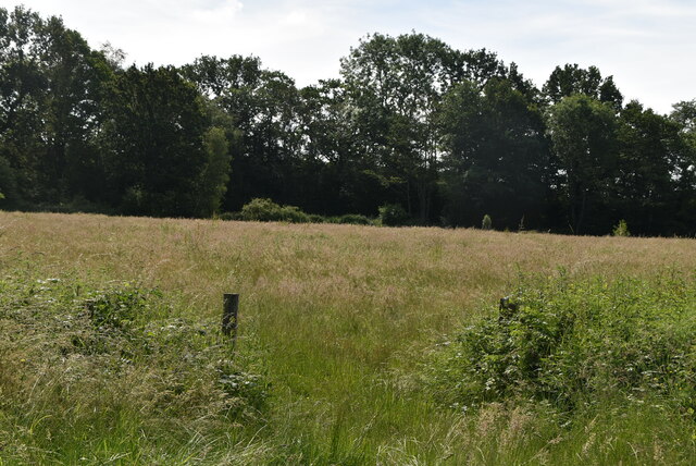
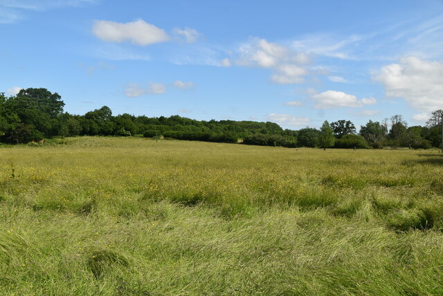
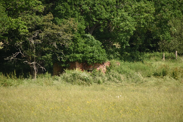
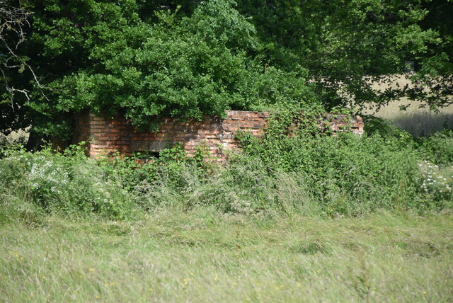
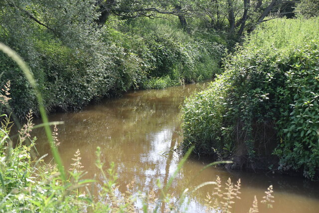
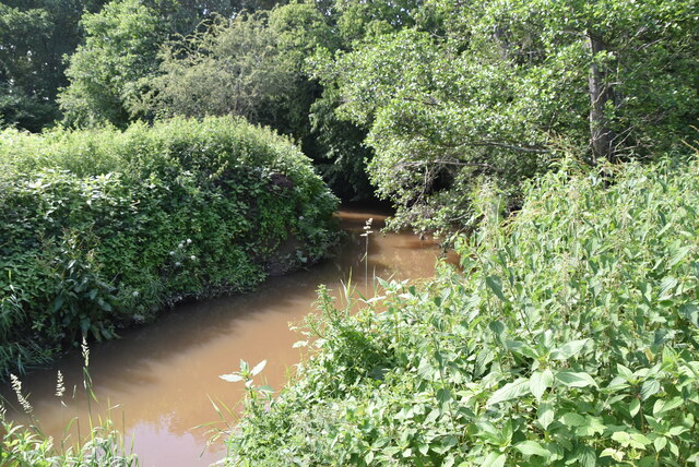
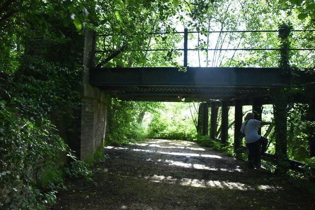
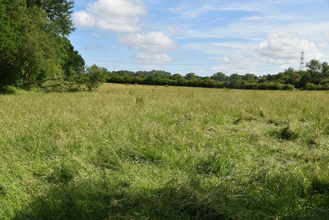
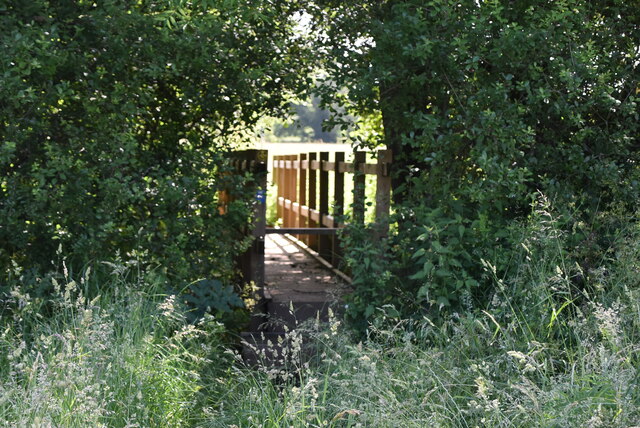
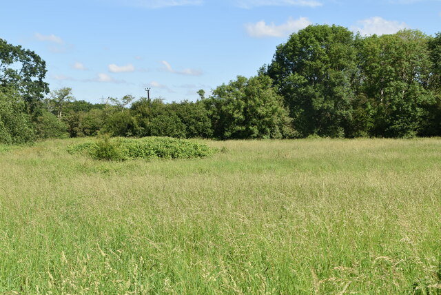
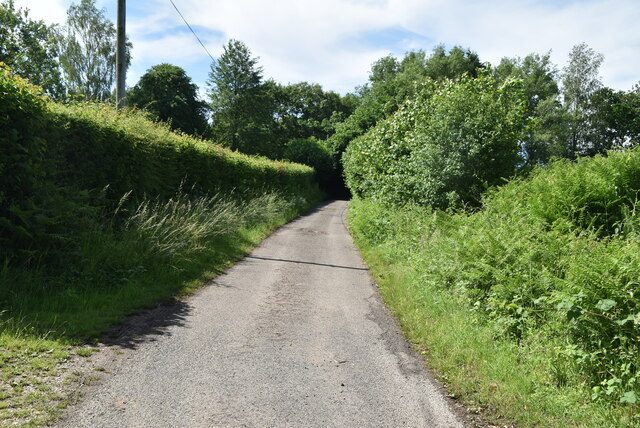
Owlsbury Wood is a stunning forest located in Sussex, England. Spanning over a vast area, it covers several acres of land and is known for its breathtaking natural beauty. The wood is situated in a rural area, surrounded by picturesque countryside and rolling hills.

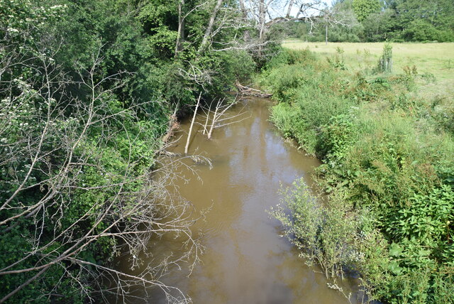
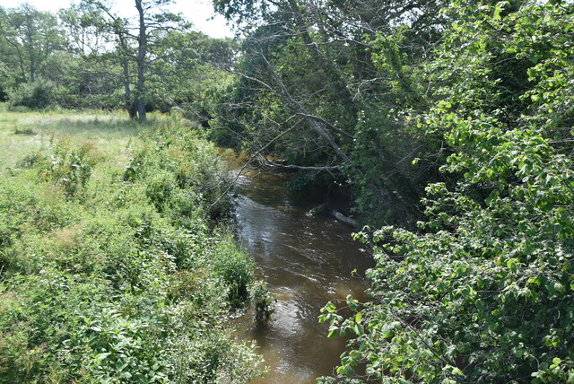
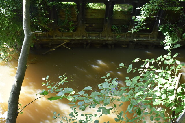
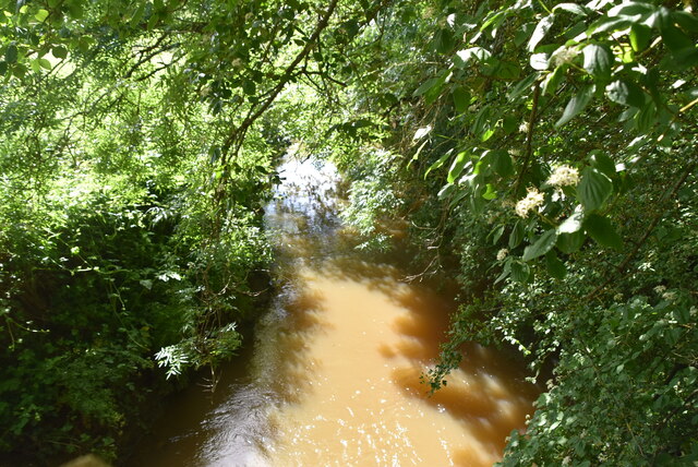
This ancient woodland is home to a diverse range of flora and fauna, providing a haven for wildlife enthusiasts and nature lovers alike. The wood boasts an impressive variety of tree species, including oak, beech, and birch, creating a rich and vibrant ecosystem. The canopy formed by the towering trees casts dappled sunlight on the forest floor, enhancing its ethereal charm.

Visitors to Owlsbury Wood can expect to encounter a plethora of wildlife. The forest is a habitat for numerous bird species, including the iconic tawny owl, which is known for its distinct hooting sound that echoes throughout the woodland. Other bird species that can be spotted here include woodpeckers, jays, and various songbirds.

Aside from the avian inhabitants, Owlsbury Wood is also home to a diverse array of mammals. Squirrels can be seen darting through the branches, while deer and foxes roam the forest floor. The wood offers an excellent opportunity for wildlife observation and photography.

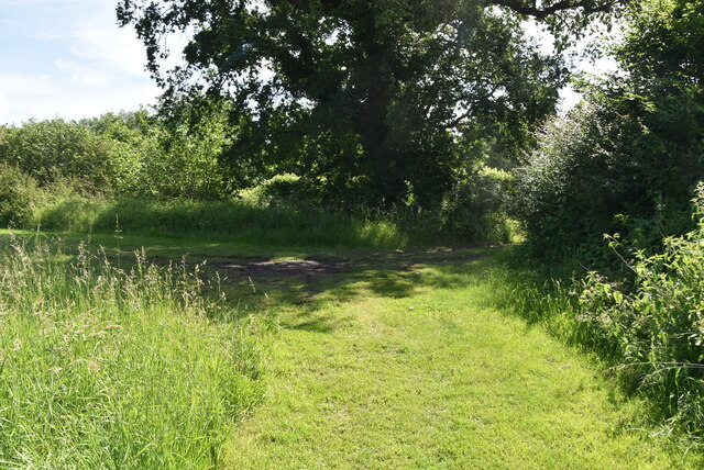
For outdoor enthusiasts, Owlsbury Wood provides a network of well-maintained trails, allowing visitors to explore its natural wonders. Whether it's a leisurely stroll or a more challenging hike, there is something for everyone. The wood also offers picnic areas, making it an ideal spot for families to enjoy a day out in nature.

Overall, Owlsbury Wood is a captivating forest that showcases the beauty of Sussex's natural landscape. With its lush vegetation, diverse wildlife, and tranquil atmosphere, it is a must-visit destination for anyone seeking a peaceful retreat in nature.

If you have any feedback on the listing, please let us know in the comments section below.

Owlsbury Wood Images

Images are sourced within 2km of 50.959676/0.077517479 or Grid Reference TQ4519. Thanks to Geograph Open Source API. All images are credited.

Meadow
Meadow
Meadow
Meadow
River Uck The River Uck is a river in East Sussex, which drains a catchment starting near Crowborough in the North, Hadlow Down to the East and Laughton Common to the South.It flows through the town of Uckfield and into the river Ouse about 3 miles north of Lewes. The river Uck also has a scenic walk alongside it. The river burst its banks in 2000, flooding much of Uckfield and the surrounding countryside.
River Uck
The River Uck is a river in East Sussex, which drains a catchment starting near Crowborough in the North, Hadlow Down to the East and Laughton Common to the South.It flows through the town of Uckfield and into the river Ouse about 3 miles north of Lewes. The river Uck also has a scenic walk alongside it. The river burst its banks in 2000, flooding much of Uckfield and the surrounding countryside.
Meadow by the River Uck
Pillbox In 1940 a network of defences was hastily built all over Britain to prevent an expected German invasion. The most common of these defences were called “pillboxes”, squat concrete forts that were sited at road junctions, canals and other strategic points.

With the passage of time it is estimated that fewer than 6,000 of a total of 28,000 pillboxes built still survive. They remain as permanent monuments and a silent tribute to the courage and tenacity of the British people during the dark days of 1940 when Britain stood alone against Nazi Germany.

More detail see <span class="nowrap"><a title="www.pillboxesuk.co.uk" rel="nofollow ugc noopener" href="http://www.pillboxesuk.co.uk">Link</a><img style="margin-left:2px;" alt="External link" title="External link - shift click to open in new window" src="https://s1.geograph.org.uk/img/external.png" width="10" height="10"/></span>
Pillbox
In 1940 a network of defences was hastily built all over Britain to prevent an expected German invasion. The most common of these defences were called “pillboxes”, squat concrete forts that were sited at road junctions, canals and other strategic points. With the passage of time it is estimated that fewer than 6,000 of a total of 28,000 pillboxes built still survive. They remain as permanent monuments and a silent tribute to the courage and tenacity of the British people during the dark days of 1940 when Britain stood alone against Nazi Germany. More detail see LinkExternal link
River Uck The River Uck is a river in East Sussex, which drains a catchment starting near Crowborough in the North, Hadlow Down to the East and Laughton Common to the South.It flows through the town of Uckfield and into the river Ouse about 3 miles north of Lewes. The river Uck also has a scenic walk alongside it. The river burst its banks in 2000, flooding much of Uckfield and the surrounding countryside.
River Uck
The River Uck is a river in East Sussex, which drains a catchment starting near Crowborough in the North, Hadlow Down to the East and Laughton Common to the South.It flows through the town of Uckfield and into the river Ouse about 3 miles north of Lewes. The river Uck also has a scenic walk alongside it. The river burst its banks in 2000, flooding much of Uckfield and the surrounding countryside.
Old railway bridge
Old railway bridge
River Uck The River Uck is a river in East Sussex, which drains a catchment starting near Crowborough in the North, Hadlow Down to the East and Laughton Common to the South.It flows through the town of Uckfield and into the river Ouse about 3 miles north of Lewes. The river Uck also has a scenic walk alongside it. The river burst its banks in 2000, flooding much of Uckfield and the surrounding countryside.
River Uck
The River Uck is a river in East Sussex, which drains a catchment starting near Crowborough in the North, Hadlow Down to the East and Laughton Common to the South.It flows through the town of Uckfield and into the river Ouse about 3 miles north of Lewes. The river Uck also has a scenic walk alongside it. The river burst its banks in 2000, flooding much of Uckfield and the surrounding countryside.
Meadow by River Uck
Meadow by River Uck
Pillbox In 1940 a network of defences was hastily built all over Britain to prevent an expected German invasion. The most common of these defences were called “pillboxes”, squat concrete forts that were sited at road junctions, canals and other strategic points.

With the passage of time it is estimated that fewer than 6,000 of a total of 28,000 pillboxes built still survive. They remain as permanent monuments and a silent tribute to the courage and tenacity of the British people during the dark days of 1940 when Britain stood alone against Nazi Germany.

More detail see <span class="nowrap"><a title="www.pillboxesuk.co.uk" rel="nofollow ugc noopener" href="http://www.pillboxesuk.co.uk">Link</a><img style="margin-left:2px;" alt="External link" title="External link - shift click to open in new window" src="https://s1.geograph.org.uk/img/external.png" width="10" height="10"/></span>
Pillbox
In 1940 a network of defences was hastily built all over Britain to prevent an expected German invasion. The most common of these defences were called “pillboxes”, squat concrete forts that were sited at road junctions, canals and other strategic points. With the passage of time it is estimated that fewer than 6,000 of a total of 28,000 pillboxes built still survive. They remain as permanent monuments and a silent tribute to the courage and tenacity of the British people during the dark days of 1940 when Britain stood alone against Nazi Germany. More detail see LinkExternal link
Footbridge, River Uck
River Uck The River Uck is a river in East Sussex, which drains a catchment starting near Crowborough in the North, Hadlow Down to the East and Laughton Common to the South.It flows through the town of Uckfield and into the river Ouse about 3 miles north of Lewes. The river Uck also has a scenic walk alongside it. The river burst its banks in 2000, flooding much of Uckfield and the surrounding countryside.
River Uck
The River Uck is a river in East Sussex, which drains a catchment starting near Crowborough in the North, Hadlow Down to the East and Laughton Common to the South.It flows through the town of Uckfield and into the river Ouse about 3 miles north of Lewes. The river Uck also has a scenic walk alongside it. The river burst its banks in 2000, flooding much of Uckfield and the surrounding countryside.
Meadow by River Uck
Meadow by River Uck
Grassy footpath
Grassy footpath
Worth Lane
Worth Lane
Show me another place!

Owlsbury Wood is located at Grid Ref: TQ4519 (Lat: 50.959676, Lng: 0.077517479)

Administrative County: East Sussex

District: Wealden

Police Authority: Sussex

What 3 Words

///drags.transcribes.berated. Near Uckfield, East Sussex

Nearby Locations

Owlsbury Wood Bean's Wood

Related Wikis

Uckfield Town F.C.

Uckfield Town F.C. was a football club based in Uckfield, East Sussex, England. For their final season, 2013–14, they were members of the Sussex County...

Little Horsted

Little Horsted (also known as Horsted Parva) is a village and civil parish in the Wealden district of East Sussex, England. It is located two miles (3...

West Park, Uckfield

West Park is a 10.5-hectare (26-acre) Local Nature Reserve on the western outskirts of Uckfield in East Sussex. It is owned and managed by Uckfield Town...

Uckfield railway station

Uckfield railway station is the southern terminus of a branch of the Oxted Line in England, serving the town of Uckfield, East Sussex. It is 46 miles 8...

Horsted Place

Horsted Place is a Tudor Revival country house, now a hotel, in Little Horsted, East Sussex, England. The current building dates to 1850, when it was built...

Hempstead Meadow

Hempstead Meadow is a 1.6-hectare (4.0-acre) Local Nature Reserve in Uckfield in East Sussex. It is owned and managed by Uckfield Town Council.The site...

Uckfield

Uckfield () is a town in the Wealden District of East Sussex in South East England. The town is on the River Uck, one of the tributaries of the River Ouse...

Copping Hall

Copping Hall is a Grade II* listed house in Uckfield, East Sussex, England. It is located at 1 Pudding Cake Lane, Uckfield, East Sussex TN22 1BT. Built...

Nearby Amenities

Located within 500m of 50.959676,0.077517479
Material: wood
Power: pole
Source: bing
Lat/Long: 50.9564471/0.0817259
Material: wood
Power: pole
Source: bing
Lat/Long: 50.9564886/0.0812453
Material: wood
Power: pole
Source: bing
Lat/Long: 50.9571646/0.0822512
Material: wood
Power: pole
Source: bing
Lat/Long: 50.9577757/0.0803793
Material: wood
Power: pole
Source: bing
Lat/Long: 50.9591481/0.0793433
Material: wood
Power: pole
Source: bing
Lat/Long: 50.9593588/0.0838783
Material: wood
Power: pole
Source: bing
Lat/Long: 50.9600043/0.078702
Material: wood
Power: pole
Source: bing
Lat/Long: 50.9602523/0.0845353
Barrier: stile
Lat/Long: 50.9598027/0.0767603
Owlsbury Poultry Farm
Place: farm
Source Name: OS_OpenData_Streetview
Lat/Long: 50.9570692/0.0797649
Owlsbury Farm
Place: farm
Source Name: OS_OpenData_Streetview
Wikidata: Q26279304
Lat/Long: 50.9611446/0.0782012
Barrier: stile
Lat/Long: 50.9611797/0.0808966
Barrier: stile
Lat/Long: 50.9624761/0.0734738
Barrier: stile
Lat/Long: 50.9603337/0.0759939
Barrier: stile
Lat/Long: 50.9592479/0.078021
Barrier: stile
Lat/Long: 50.959079/0.0782047
The data included in this document is from www.openstreetmap.org. The data is made available under ODbL.

Have you been to Owlsbury Wood?

Leave your review of Owlsbury Wood below (or comments, questions and feedback).