Lane Wood

Wood, Forest in Sussex Wealden

England

Lane Wood

Danehill Lane
Danehill Lane Credit: N Chadwick

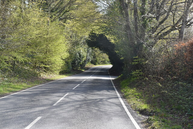
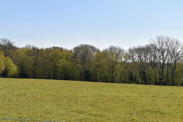
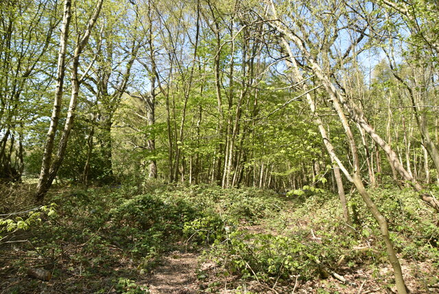
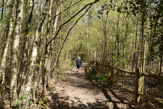
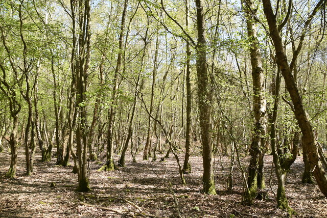
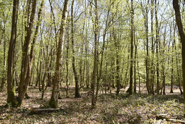
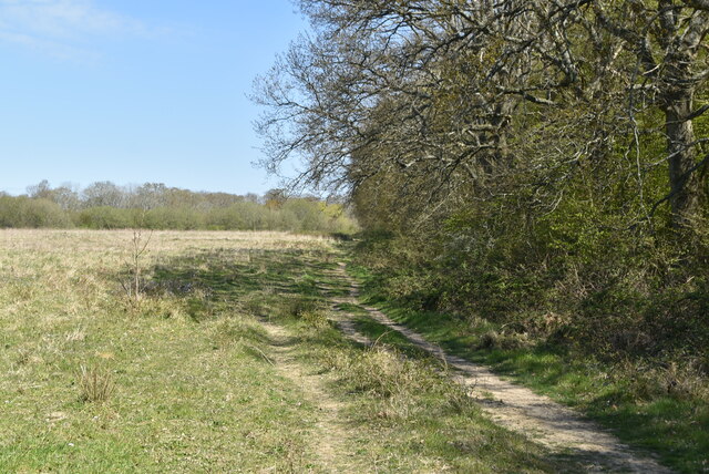
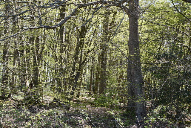
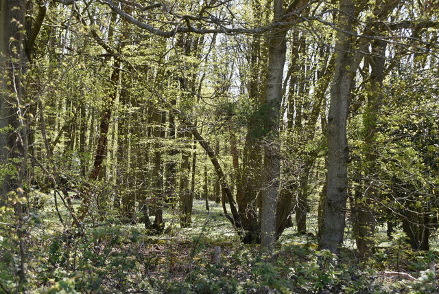
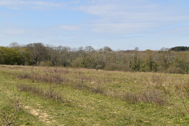
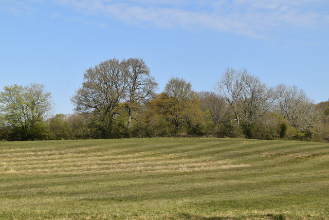
Lane Wood is a picturesque forest located in the county of Sussex, England. Situated near the town of Wood, this woodland area covers a vast expanse of approximately 100 acres. With its dense tree cover and diverse ecosystem, Lane Wood is a haven for nature enthusiasts and a popular destination for outdoor activities.

The forest is predominantly composed of various species of broad-leaved trees, including oak, beech, and ash, creating a vibrant and dynamic landscape. The presence of these trees supports a rich diversity of flora and fauna, including wildflowers, ferns, and various woodland creatures.

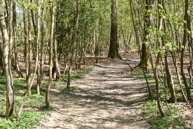
The woodland offers a range of well-maintained trails and paths that wind through its lush surroundings, making it ideal for hikers, joggers, and dog walkers. These paths also provide access to several viewpoints, offering visitors breathtaking panoramas of the surrounding countryside.

Lane Wood is particularly renowned for its birdlife, attracting birdwatchers from near and far. The forest is home to a plethora of avian species, including woodpeckers, owls, and various songbirds. The tranquil atmosphere of the forest allows for peaceful birdwatching experiences.

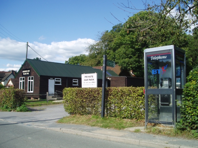
Additionally, Lane Wood boasts a designated picnic area, complete with tables and benches, where visitors can relax and enjoy the tranquil ambiance of the forest. The area is well-maintained, with regular clean-ups and litter bins provided to ensure its pristine condition.

Overall, Lane Wood is a treasured natural gem in Sussex, offering visitors a peaceful retreat into the heart of nature. Its scenic beauty, diverse wildlife, and recreational opportunities make it a must-visit destination for nature lovers and outdoor enthusiasts alike.

If you have any feedback on the listing, please let us know in the comments section below.
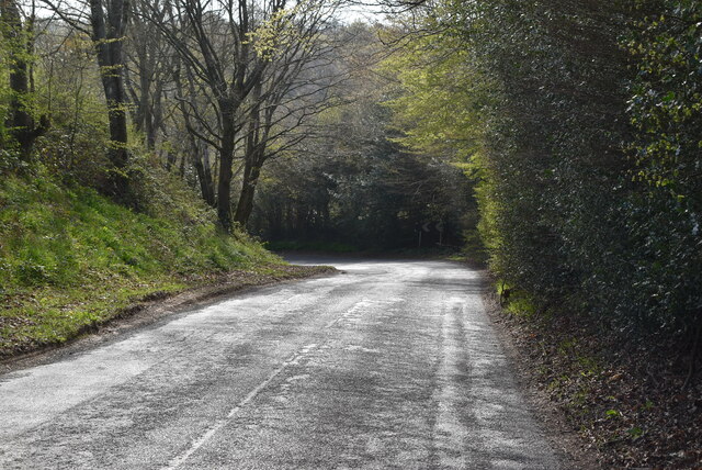
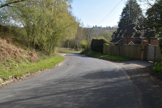
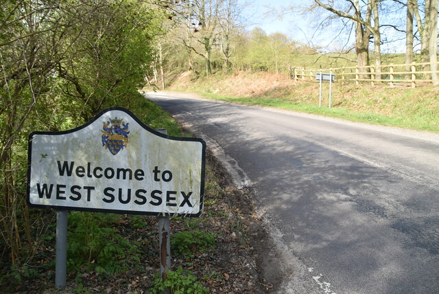
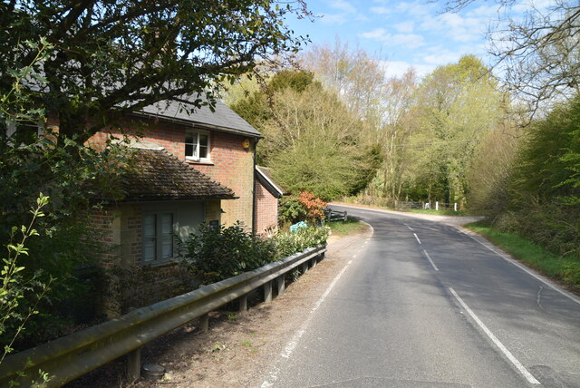
Lane Wood Images

Images are sourced within 2km of 51.024346/0.014468729 or Grid Reference TQ4126. Thanks to Geograph Open Source API. All images are credited.

Danehill Lane
Danehill Lane
Danehill Lane
Danehill Lane
Welcome to West Sussex
Horsted Lane
Horsted Lane
Horsted Lane
Horsted Lane
Farmland and Northland Wood
Northland Wood
Northland Wood
Sussex Border Path, Northland Wood The Sussex Border Path is a footpath route nearly 150 miles long around the inland boundary of the county of Sussex. The county owes its origins to the kingdom of the South Saxons and can claim to have one of the longest inland county boundaries from Emsworth to Rye. The route was devised in 1983 and is well signed along most of the route. Website <span class="nowrap"><a title="http://www.sussexborderpath.co.uk/" rel="nofollow ugc noopener" href="http://www.sussexborderpath.co.uk/">Link</a><img style="margin-left:2px;" alt="External link" title="External link - shift click to open in new window" src="https://s1.geograph.org.uk/img/external.png" width="10" height="10"/></span> 
Map: <a title="https://www.geograph.org.uk/search.php?i=40140109&page=1&displayclass=map#i=40140109&page=1&displayclass=map&zoom=2&lat=51.03263&lon=-0.05427&layers=FTTB00000000000T" href="https://www.geograph.org.uk/search.php?i=40140109&page=1&displayclass=map#i=40140109&page=1&displayclass=map&zoom=2&lat=51.03263&lon=-0.05427&layers=FTTB00000000000T">Link</a>
Sussex Border Path, Northland Wood
The Sussex Border Path is a footpath route nearly 150 miles long around the inland boundary of the county of Sussex. The county owes its origins to the kingdom of the South Saxons and can claim to have one of the longest inland county boundaries from Emsworth to Rye. The route was devised in 1983 and is well signed along most of the route. Website LinkExternal link Map: Link
Northland Wood
Northland Wood
Sussex Border Path, Northland Wood The Sussex Border Path is a footpath route nearly 150 miles long around the inland boundary of the county of Sussex. The county owes its origins to the kingdom of the South Saxons and can claim to have one of the longest inland county boundaries from Emsworth to Rye. The route was devised in 1983 and is well signed along most of the route. Website <span class="nowrap"><a title="http://www.sussexborderpath.co.uk/" rel="nofollow ugc noopener" href="http://www.sussexborderpath.co.uk/">Link</a><img style="margin-left:2px;" alt="External link" title="External link - shift click to open in new window" src="https://s1.geograph.org.uk/img/external.png" width="10" height="10"/></span> 
Map: <a title="https://www.geograph.org.uk/search.php?i=40140109&page=1&displayclass=map#i=40140109&page=1&displayclass=map&zoom=2&lat=51.03263&lon=-0.05427&layers=FTTB00000000000T" href="https://www.geograph.org.uk/search.php?i=40140109&page=1&displayclass=map#i=40140109&page=1&displayclass=map&zoom=2&lat=51.03263&lon=-0.05427&layers=FTTB00000000000T">Link</a>
Sussex Border Path, Northland Wood
The Sussex Border Path is a footpath route nearly 150 miles long around the inland boundary of the county of Sussex. The county owes its origins to the kingdom of the South Saxons and can claim to have one of the longest inland county boundaries from Emsworth to Rye. The route was devised in 1983 and is well signed along most of the route. Website LinkExternal link Map: Link
Field by Sussex Border Path
Sussex Border Path The Sussex Border Path is a footpath route nearly 150 miles long around the inland boundary of the county of Sussex. The county owes its origins to the kingdom of the South Saxons and can claim to have one of the longest inland county boundaries from Emsworth to Rye. The route was devised in 1983 and is well signed along most of the route. Website <span class="nowrap"><a title="http://www.sussexborderpath.co.uk/" rel="nofollow ugc noopener" href="http://www.sussexborderpath.co.uk/">Link</a><img style="margin-left:2px;" alt="External link" title="External link - shift click to open in new window" src="https://s1.geograph.org.uk/img/external.png" width="10" height="10"/></span> 
Map: <a title="https://www.geograph.org.uk/search.php?i=40140109&page=1&displayclass=map#i=40140109&page=1&displayclass=map&zoom=2&lat=51.03263&lon=-0.05427&layers=FTTB00000000000T" href="https://www.geograph.org.uk/search.php?i=40140109&page=1&displayclass=map#i=40140109&page=1&displayclass=map&zoom=2&lat=51.03263&lon=-0.05427&layers=FTTB00000000000T">Link</a>
Sussex Border Path
The Sussex Border Path is a footpath route nearly 150 miles long around the inland boundary of the county of Sussex. The county owes its origins to the kingdom of the South Saxons and can claim to have one of the longest inland county boundaries from Emsworth to Rye. The route was devised in 1983 and is well signed along most of the route. Website LinkExternal link Map: Link
Heaven Wood
Heaven Wood
Heaven Wood
Heaven Wood
Grassland by Sussex Border Path
Mown field
Mown field
Show me another place!

Lane Wood is located at Grid Ref: TQ4126 (Lat: 51.024346, Lng: 0.014468729)

Administrative County: East Sussex

District: Wealden

Police Authority: Sussex

What 3 Words

///width.workers.asleep. Near Horsted Keynes, West Sussex

Nearby Locations

Brookers Rough Lane Wood

Related Wikis

Furner's Green

Furner's Green is a hamlet in the civil parish of Danehill in East Sussex, England. == Geography == Furner's Green lies on the Greenwich Meridian about...

Danehill, East Sussex

Danehill is a village in East Sussex, England. == Religious sites == There are two Anglican churches in the parish: one at Danehill (dedicated to All Saints...

Chelwood Gate

Chelwood Gate is a small village within the civil parish of Danehill in the Wealden district of East Sussex, England. Its nearest town is Uckfield, which...

Sheffield Park and Garden

Sheffield Park and Garden is an informal landscape garden five miles east of Haywards Heath, in East Sussex, England. It was originally laid out in the...

Sussex

Sussex (; from the Old English Sūþsēaxe; lit. 'South Saxons') is a historic county in South East England that is bounded to the west by Hampshire, north...

Sussex Wildlife Trust

The Sussex Wildlife Trust (SWT) is a conservation charity which aims to protect natural life in Sussex. It was founded in 1961 and is one of 46 wildlife...

Nutley, East Sussex

Nutley is a village in the Wealden District of East Sussex, England. It lies about 5 mi (8.0 km) north-west of Uckfield, the main road being the A22. Nutley...

Freshfield Lane

Freshfield Lane is a 17-hectare (42-acre) geological Site of Special Scientific Interest east of Haywards Heath in West Sussex. It is a Geological Conservation...

Nearby Amenities

Located within 500m of 51.024346,0.014468729
Barrier: stile
Lat/Long: 51.0214816/0.0134949
Barrier: stile
Lat/Long: 51.0228109/0.0122269
Barrier: stile
Lat/Long: 51.0271441/0.0187221
Barrier: stile
Lat/Long: 51.0251246/0.0172816
Barrier: stile
Lat/Long: 51.025469/0.0167255
Colin Godmans Farm
Addr City: Furners Green
Addr Postcode: TN22 3RR
Addr Street: Perrymans Lane
Place: farm
Lat/Long: 51.02594/0.0199073
Barrier: stile
Lat/Long: 51.0221032/0.008651
Barrier: stile
Lat/Long: 51.0242273/0.0138196
Barrier: stile
Lat/Long: 51.0254337/0.0155286
Power: pole
Lat/Long: 51.0274112/0.0102302
Power: pole
Lat/Long: 51.0267821/0.008612
Power: pole
Lat/Long: 51.0258275/0.0077347
The data included in this document is from www.openstreetmap.org. The data is made available under ODbL.

Have you been to Lane Wood?

Leave your review of Lane Wood below (or comments, questions and feedback).