Dexthorpe Plantation

Wood, Forest in Lincolnshire East Lindsey

England

Dexthorpe Plantation

The Hills of the Slain: Spellow Hills Long Barrow, near Langton-by-Partney, aerial 2021
The Hills of the Slain: Spellow Hills Long Barrow, near Langton-by-Partney, aerial 2021 Credit: Simon Tomson

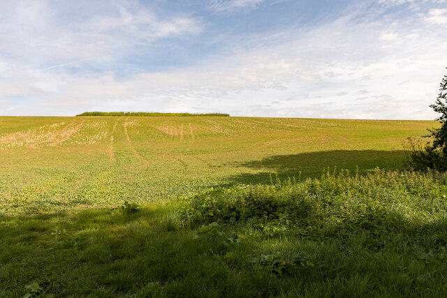
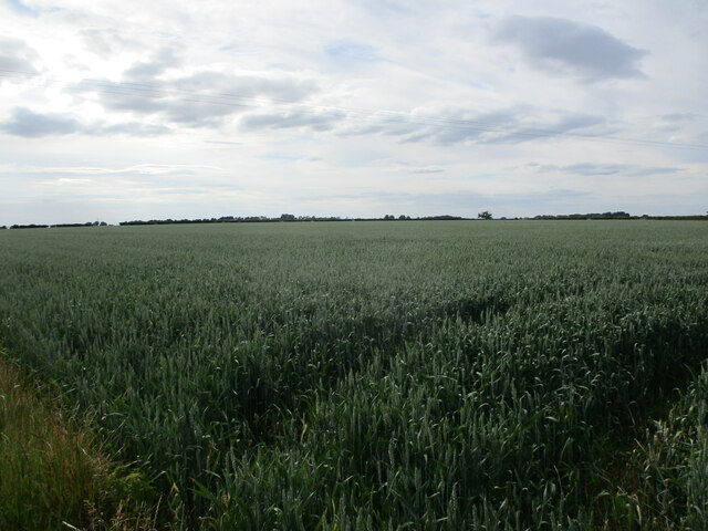
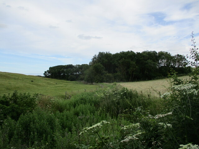
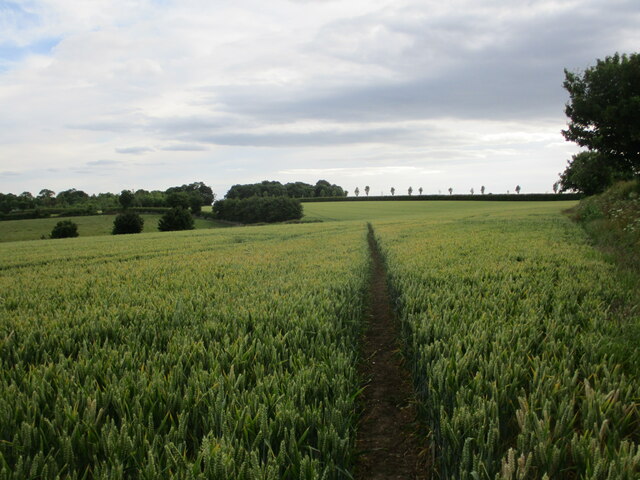
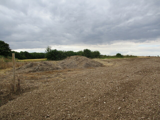
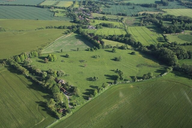
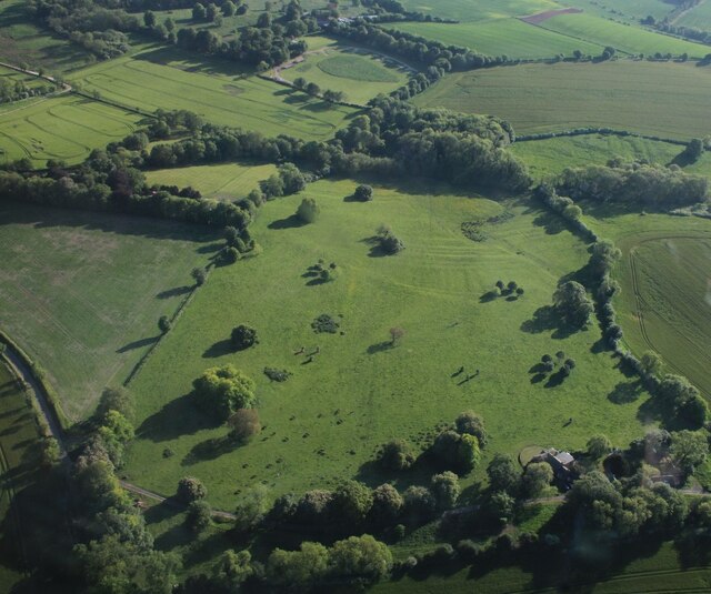
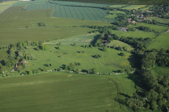
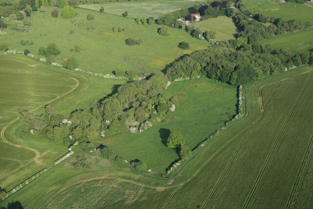
Dexthorpe Plantation is a picturesque woodland located in Lincolnshire, England. Situated in the heart of the county, this plantation covers an area of approximately 100 acres and is known for its thriving ecosystem and natural beauty.

The plantation predominantly consists of a mixture of deciduous and coniferous trees, creating a diverse and enchanting environment. Tall oak, beech, and birch trees dominate the landscape, providing a dense canopy that offers shade and shelter for a wide variety of plant and animal species.

The woodland floor is adorned with a rich carpet of ferns, mosses, and wildflowers, adding to the charm and tranquility of the plantation. A network of well-maintained footpaths winds its way through the plantation, allowing visitors to explore its hidden corners and discover its hidden treasures.

Dexthorpe Plantation is not only a haven for nature enthusiasts but also a valuable habitat for a range of wildlife. Numerous bird species, including woodpeckers, owls, and songbirds, can be spotted throughout the year. The plantation is also home to small mammals such as squirrels, rabbits, and hedgehogs, as well as a diverse array of insects and butterflies.

The plantation is open to the public, and visitors can enjoy leisurely walks, birdwatching, and photography. It offers a peaceful retreat from the bustling city life, allowing visitors to immerse themselves in the beauty of nature and experience the serenity that the woodlands have to offer. Dexthorpe Plantation truly is a hidden gem in the heart of Lincolnshire.

If you have any feedback on the listing, please let us know in the comments section below.

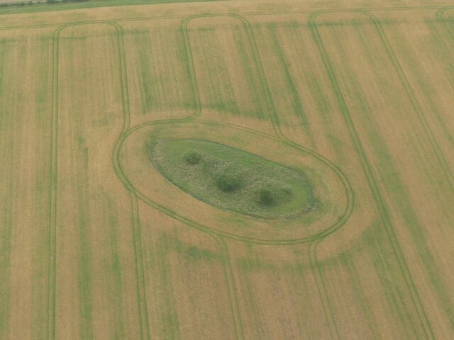
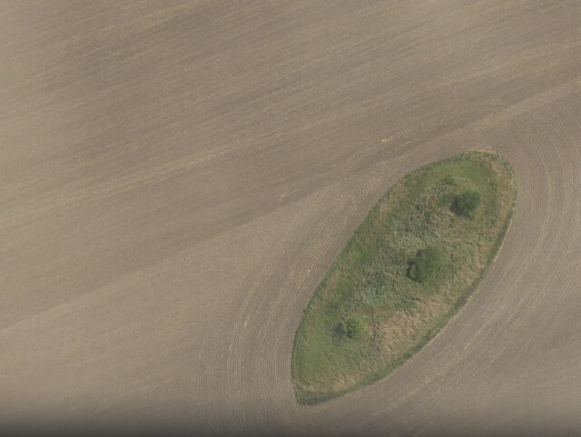
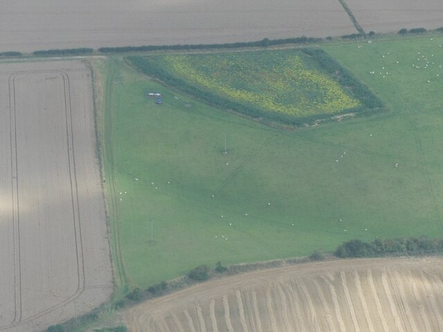
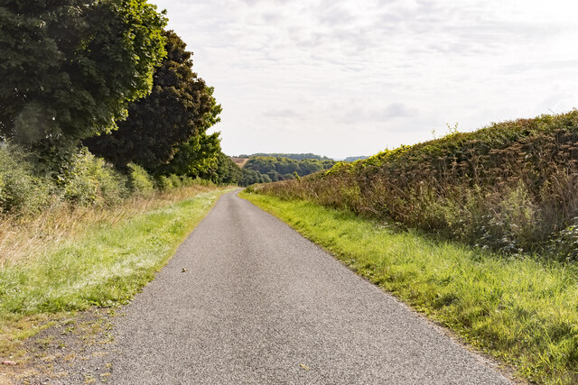
Dexthorpe Plantation Images

Images are sourced within 2km of 53.2209/0.11604272 or Grid Reference TF4171. Thanks to Geograph Open Source API. All images are credited.

The Hills of the Slain: Spellow Hills Long Barrow, near Langton-by-Partney, aerial 2021
Spellow Hills Long Barrow, aka the Hills of the Slain: aerial 2021 See also <a href="https://www.geograph.org.uk/photo/5466404">TF4072 : Spellow Hills, near Langton-by-Partney: aerial 2017</a> and <a href="https://www.geograph.org.uk/photo/5466428">TF4072 : Spellow Hills long barrow, looking towards Langton: aerial 2017</a>.

Badly mutilated by antiquarian investigations of the nineteenth century, and was thus previously mistaken for a group of round barrows. 

The name 'Spellow Hills' is derived from the Old English 'spel' and 'hlaw' or 'haugr' which means 'assembly mound'. The earliest recorded instance of the name is in the early twelfth century. The barrow lies just below the crest of a gentle rise 200m to the west of the A16 which marks the boundary with Dalby parish. The land rises gently to a point 1.2km north where the wapentakes of Hill, Calcewath and Candleshoe and the parishes of Langton, Driby, Ulceby and Dalby meet <a href="https://www.geograph.org.uk/gridref/TF+406+733">TF 406 733</a>. From here there is an extensive view in all directions. It seems highly likely that this was a meeting place for the people from all three wapentakes rather than that of a single unit. 

See <span class="nowrap"><a title="https://www.heritagegateway.org.uk/Gateway/Results_Single.aspx?uid=MLI43619&resourceID=1006" rel="nofollow ugc noopener" href="https://www.heritagegateway.org.uk/Gateway/Results_Single.aspx?uid=MLI43619&resourceID=1006">Link</a><img style="margin-left:2px;" alt="External link" title="External link - shift click to open in new window" src="https://s1.geograph.org.uk/img/external.png" width="10" height="10"/></span>
Spellow Hills Long Barrow, aka the Hills of the Slain: aerial 2021
See also TF4072 : Spellow Hills, near Langton-by-Partney: aerial 2017 and TF4072 : Spellow Hills long barrow, looking towards Langton: aerial 2017. Badly mutilated by antiquarian investigations of the nineteenth century, and was thus previously mistaken for a group of round barrows. The name 'Spellow Hills' is derived from the Old English 'spel' and 'hlaw' or 'haugr' which means 'assembly mound'. The earliest recorded instance of the name is in the early twelfth century. The barrow lies just below the crest of a gentle rise 200m to the west of the A16 which marks the boundary with Dalby parish. The land rises gently to a point 1.2km north where the wapentakes of Hill, Calcewath and Candleshoe and the parishes of Langton, Driby, Ulceby and Dalby meet TF 406 733. From here there is an extensive view in all directions. It seems highly likely that this was a meeting place for the people from all three wapentakes rather than that of a single unit. See LinkExternal link
Farmland between Ulceby and Fordington: aerial 2021
Road near Ulceby Heading down to Skendelby Psalter.
Road near Ulceby
Heading down to Skendelby Psalter.
Hillside near Skendelby Psalter
Farm buildings. Ulceby Grange
Maize amidst the plastic The plastic will have protected the young plants.
Maize amidst the plastic
The plastic will have protected the young plants.
Wheat field near Ulceby
Overgrown drain and Low Plantation
Bridleway to Dalby The route is kept clear but not to the required width for a bridleway.
Bridleway to Dalby
The route is kept clear but not to the required width for a bridleway.
Route of the Viking Link Work here is complete after the installation of the Viking Link Interconnector joining the British and Danish electricity grids. <span class="nowrap"><a title="https://viking-link.com/" rel="nofollow ugc noopener" href="https://viking-link.com/">Link</a><img style="margin-left:2px;" alt="External link" title="External link - shift click to open in new window" src="https://s1.geograph.org.uk/img/external.png" width="10" height="10"/></span>
Route of the Viking Link
Work here is complete after the installation of the Viking Link Interconnector joining the British and Danish electricity grids. LinkExternal link
Dalby Hall: aerial 2023
Spellow Hills Long Barrow: aerial 2023 (1) The Hills of the Slain: see <span class="nowrap"><a title="https://www.heritagegateway.org.uk/Gateway/Results_Single.aspx?uid=MLI43619&resourceID=1006" rel="nofollow ugc noopener" href="https://www.heritagegateway.org.uk/Gateway/Results_Single.aspx?uid=MLI43619&resourceID=1006">Link</a><img style="margin-left:2px;" alt="External link" title="External link - shift click to open in new window" src="https://s1.geograph.org.uk/img/external.png" width="10" height="10"/></span> and 
<a href="https://www.geograph.org.uk/photo/5466404">TF4072 : Spellow Hills, near Langton-by-Partney: aerial 2017</a>.
Spellow Hills Long Barrow: aerial 2023 (1)
Spellow Hills Long Barrow: aerial 2023 (2) The Hills of the Slain: see <span class="nowrap"><a title="https://www.heritagegateway.org.uk/Gateway/Results_Single.aspx?uid=MLI43619&resourceID=1006" rel="nofollow ugc noopener" href="https://www.heritagegateway.org.uk/Gateway/Results_Single.aspx?uid=MLI43619&resourceID=1006">Link</a><img style="margin-left:2px;" alt="External link" title="External link - shift click to open in new window" src="https://s1.geograph.org.uk/img/external.png" width="10" height="10"/></span> and 
<a href="https://www.geograph.org.uk/photo/5466404">TF4072 : Spellow Hills, near Langton-by-Partney: aerial 2017</a>.
Spellow Hills Long Barrow: aerial 2023 (2)
Ridge and furrow north of Skendleby: aerial 2023 (1)
Ridge and furrow north of Skendleby: aerial 2023 (2)
Ridge and furrow north of Skendleby: aerial 2023 (3)
Fields north of Skendleby: aerial 2023
Show me another place!

Dexthorpe Plantation is located at Grid Ref: TF4171 (Lat: 53.2209, Lng: 0.11604272)

Administrative County: Lincolnshire

District: East Lindsey

Police Authority: Lincolnshire

What 3 Words

///irrigated.ulterior.litigate. Near Spilsby, Lincolnshire

Related Wikis

Fordington, Lincolnshire

Fordington is a hamlet in the East Lindsey district of Lincolnshire in England. It is situated within Ulceby with Fordington civil parish. == References... ==

Dexthorpe

Dexthorpe is a deserted medieval village in the East Lindsey district of Lincolnshire, England. It is in the parish of Dalby, and 3.5 miles (5.6 km) north...

Dalby, Lincolnshire

Dalby is a village and civil parish in the East Lindsey district of Lincolnshire, England. It is situated approximately 3 miles (5 km) north from the town...

Ulceby, East Lindsey

Ulceby is a village in the East Lindsey district of Lincolnshire in England. It is situated next to the A1028 road, 11 miles (18 km) east from Horncastle...

Ulceby with Fordington

Ulceby with Fordington is a civil parish in the East Lindsey district of Lincolnshire, England. The parish is situated 27 miles (43 km) east from the city...

Langton by Spilsby

Langton by Spilsby, sometimes called Langton by Partney, is a village and civil parish in the East Lindsey district of Lincolnshire, England. It is situated...

Skendleby

Skendleby is a small village and civil parish in the East Lindsey district of Lincolnshire, England. It is situated near to the A158 and lies 35 miles...

Skendleby Priory

Skendleby Priory was a priory in the village of Skendleby, Lincolnshire, England. The believed remains of St James Chapel, Skendleby Priory, were uncovered...

Nearby Amenities

Located within 500m of 53.2209,0.11604272
Bus Stop
Dalby Grange
Naptan AtcoCode: 270000009114
Naptan Bearing: NE
Naptan CommonName: Dalby Grange
Naptan Indicator: adj
Naptan Landmark: Dalby Grange
Naptan NaptanCode: lingwtpg
Naptan Street: Bluestone Heath Road
Naptan Verified: no
Source: naptan_import
Lat/Long: 53.217118/0.1133748
Bus Stop
Dalby Grange
Naptan AtcoCode: 270002700922
Naptan Bearing: SW
Naptan CommonName: Dalby Grange
Naptan Indicator: opp
Naptan Landmark: Dalby Grange
Naptan Street: Bluestone Heath Road
Naptan Verified: no
Source: naptan_import
Lat/Long: 53.2170448/0.113446
Fordington
Place: hamlet
Source: Bing
Lat/Long: 53.2221653/0.1228997
Dalby Grange
Place: farm
Lat/Long: 53.219447/0.1138826
Turning Circle
Lat/Long: 53.2199642/0.1140649
The data included in this document is from www.openstreetmap.org. The data is made available under ODbL.

Have you been to Dexthorpe Plantation?

Leave your review of Dexthorpe Plantation below (or comments, questions and feedback).