Gill Wood

Wood, Forest in Sussex Wealden

England

Gill Wood

Danehill Lane
Danehill Lane Credit: N Chadwick

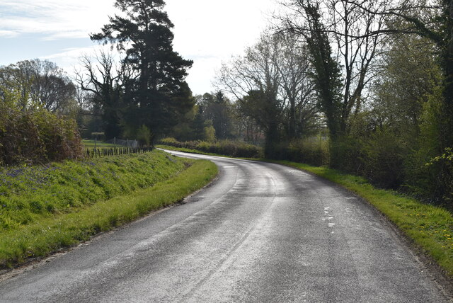
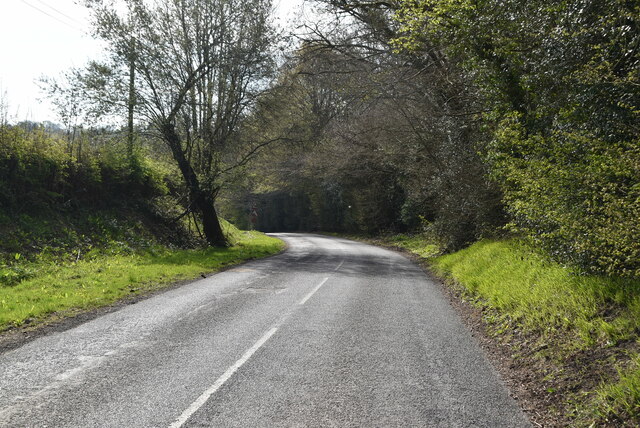
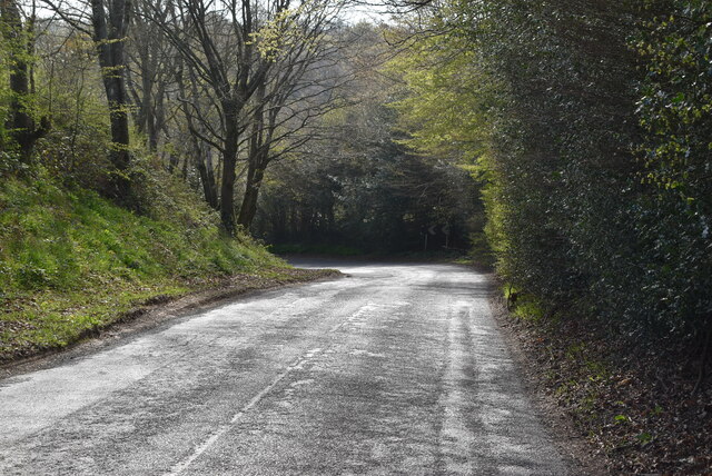
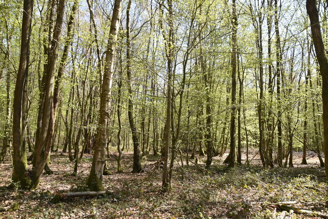
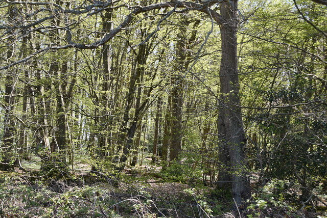
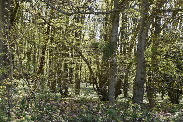
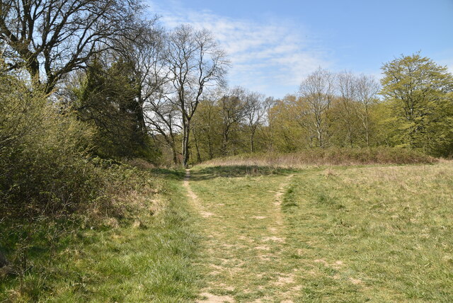
Gill Wood is a serene and captivating forest located in Sussex, England. Nestled within the South Downs National Park, it covers an area of approximately 100 acres and is a popular destination for nature enthusiasts and hikers alike.

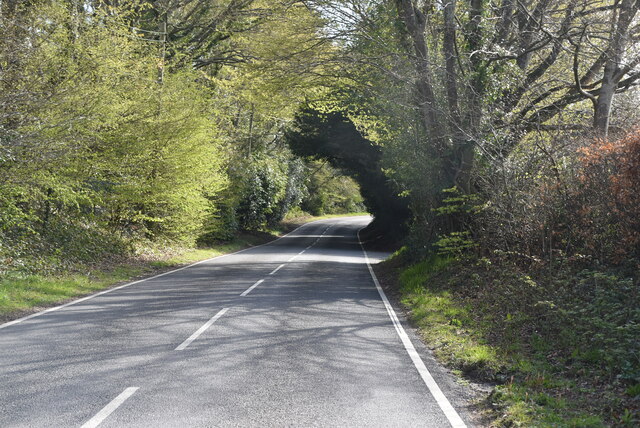
The wood is characterized by its diverse range of flora and fauna, with ancient oak and beech trees dominating the landscape. These towering giants provide a lush canopy that creates a cool and tranquil atmosphere, perfect for escaping the hustle and bustle of everyday life.

Walking through Gill Wood, visitors can expect to encounter a variety of wildlife, including deer, foxes, and a myriad of bird species. The wood is also home to several protected species, such as the rare purple emperor butterfly, which adds to its ecological significance.

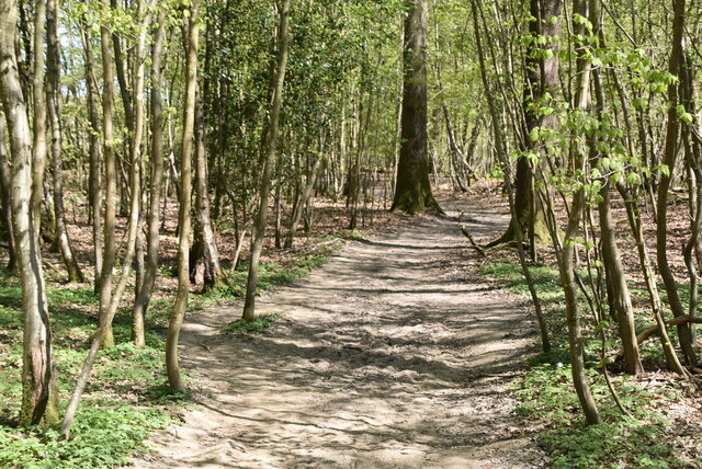
A network of well-maintained footpaths and trails crisscross the wood, offering visitors the opportunity to explore its natural wonders at their own pace. Whether strolling along the woodland floor or embarking on a more challenging hike up the nearby South Downs, there is something for everyone to enjoy.

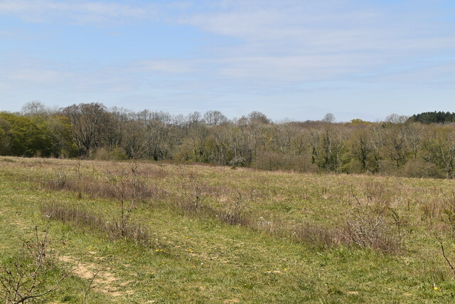
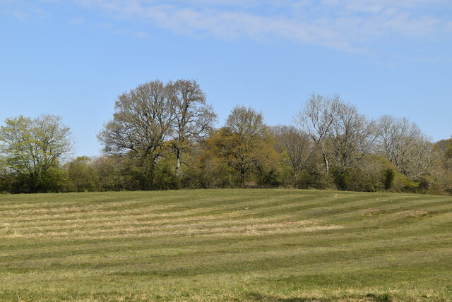
The wood is open to the public year-round and is particularly picturesque during the spring and autumn seasons when it bursts into a riot of colors. Bluebells carpet the forest floor in spring, while the changing leaves create a breathtaking display of golds and reds in autumn.

Gill Wood is not only a haven for nature lovers but also a valuable resource for research and education. Its conservation efforts and dedication to preserving the beauty of the wood make it a cherished and protected area for generations to come.

If you have any feedback on the listing, please let us know in the comments section below.
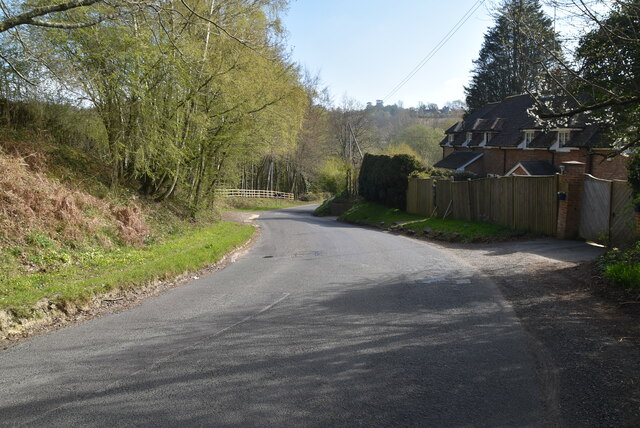
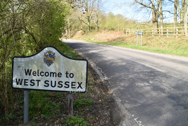
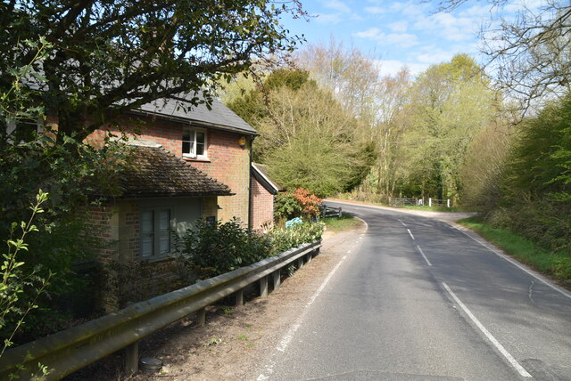
Gill Wood Images

Images are sourced within 2km of 51.028336/0.012602326 or Grid Reference TQ4127. Thanks to Geograph Open Source API. All images are credited.

Danehill Lane
Danehill Lane
Swithewood
Swithewood
Danehill Lane
Danehill Lane
Danehill Lane
Danehill Lane
Danehill Lane
Danehill Lane
Welcome to West Sussex
Horsted Lane
Horsted Lane
Horsted Lane
Horsted Lane
Sussex Border Path, Northland Wood The Sussex Border Path is a footpath route nearly 150 miles long around the inland boundary of the county of Sussex. The county owes its origins to the kingdom of the South Saxons and can claim to have one of the longest inland county boundaries from Emsworth to Rye. The route was devised in 1983 and is well signed along most of the route. Website <span class="nowrap"><a title="http://www.sussexborderpath.co.uk/" rel="nofollow ugc noopener" href="http://www.sussexborderpath.co.uk/">Link</a><img style="margin-left:2px;" alt="External link" title="External link - shift click to open in new window" src="https://s1.geograph.org.uk/img/external.png" width="10" height="10"/></span> 
Map: <a title="https://www.geograph.org.uk/search.php?i=40140109&page=1&displayclass=map#i=40140109&page=1&displayclass=map&zoom=2&lat=51.03263&lon=-0.05427&layers=FTTB00000000000T" href="https://www.geograph.org.uk/search.php?i=40140109&page=1&displayclass=map#i=40140109&page=1&displayclass=map&zoom=2&lat=51.03263&lon=-0.05427&layers=FTTB00000000000T">Link</a>
Sussex Border Path, Northland Wood
The Sussex Border Path is a footpath route nearly 150 miles long around the inland boundary of the county of Sussex. The county owes its origins to the kingdom of the South Saxons and can claim to have one of the longest inland county boundaries from Emsworth to Rye. The route was devised in 1983 and is well signed along most of the route. Website LinkExternal link Map: Link
Northland Wood
Northland Wood
Sussex Border Path, Northland Wood The Sussex Border Path is a footpath route nearly 150 miles long around the inland boundary of the county of Sussex. The county owes its origins to the kingdom of the South Saxons and can claim to have one of the longest inland county boundaries from Emsworth to Rye. The route was devised in 1983 and is well signed along most of the route. Website <span class="nowrap"><a title="http://www.sussexborderpath.co.uk/" rel="nofollow ugc noopener" href="http://www.sussexborderpath.co.uk/">Link</a><img style="margin-left:2px;" alt="External link" title="External link - shift click to open in new window" src="https://s1.geograph.org.uk/img/external.png" width="10" height="10"/></span> 
Map: <a title="https://www.geograph.org.uk/search.php?i=40140109&page=1&displayclass=map#i=40140109&page=1&displayclass=map&zoom=2&lat=51.03263&lon=-0.05427&layers=FTTB00000000000T" href="https://www.geograph.org.uk/search.php?i=40140109&page=1&displayclass=map#i=40140109&page=1&displayclass=map&zoom=2&lat=51.03263&lon=-0.05427&layers=FTTB00000000000T">Link</a>
Sussex Border Path, Northland Wood
The Sussex Border Path is a footpath route nearly 150 miles long around the inland boundary of the county of Sussex. The county owes its origins to the kingdom of the South Saxons and can claim to have one of the longest inland county boundaries from Emsworth to Rye. The route was devised in 1983 and is well signed along most of the route. Website LinkExternal link Map: Link
Field by Sussex Border Path
Sussex Border Path The Sussex Border Path is a footpath route nearly 150 miles long around the inland boundary of the county of Sussex. The county owes its origins to the kingdom of the South Saxons and can claim to have one of the longest inland county boundaries from Emsworth to Rye. The route was devised in 1983 and is well signed along most of the route. Website <span class="nowrap"><a title="http://www.sussexborderpath.co.uk/" rel="nofollow ugc noopener" href="http://www.sussexborderpath.co.uk/">Link</a><img style="margin-left:2px;" alt="External link" title="External link - shift click to open in new window" src="https://s1.geograph.org.uk/img/external.png" width="10" height="10"/></span> 
Map: <a title="https://www.geograph.org.uk/search.php?i=40140109&page=1&displayclass=map#i=40140109&page=1&displayclass=map&zoom=2&lat=51.03263&lon=-0.05427&layers=FTTB00000000000T" href="https://www.geograph.org.uk/search.php?i=40140109&page=1&displayclass=map#i=40140109&page=1&displayclass=map&zoom=2&lat=51.03263&lon=-0.05427&layers=FTTB00000000000T">Link</a>
Sussex Border Path
The Sussex Border Path is a footpath route nearly 150 miles long around the inland boundary of the county of Sussex. The county owes its origins to the kingdom of the South Saxons and can claim to have one of the longest inland county boundaries from Emsworth to Rye. The route was devised in 1983 and is well signed along most of the route. Website LinkExternal link Map: Link
Heaven Wood
Heaven Wood
Heaven Wood
Heaven Wood
Grassland by Sussex Border Path
Mown field
Mown field
Sussex Border Path The Sussex Border Path is a footpath route nearly 150 miles long around the inland boundary of the county of Sussex. The county owes its origins to the kingdom of the South Saxons and can claim to have one of the longest inland county boundaries from Emsworth to Rye. The route was devised in 1983 and is well signed along most of the route. Website <span class="nowrap"><a title="http://www.sussexborderpath.co.uk/" rel="nofollow ugc noopener" href="http://www.sussexborderpath.co.uk/">Link</a><img style="margin-left:2px;" alt="External link" title="External link - shift click to open in new window" src="https://s1.geograph.org.uk/img/external.png" width="10" height="10"/></span> 
Map: <a title="https://www.geograph.org.uk/search.php?i=40140109&page=1&displayclass=map#i=40140109&page=1&displayclass=map&zoom=2&lat=51.03263&lon=-0.05427&layers=FTTB00000000000T" href="https://www.geograph.org.uk/search.php?i=40140109&page=1&displayclass=map#i=40140109&page=1&displayclass=map&zoom=2&lat=51.03263&lon=-0.05427&layers=FTTB00000000000T">Link</a>
Sussex Border Path
The Sussex Border Path is a footpath route nearly 150 miles long around the inland boundary of the county of Sussex. The county owes its origins to the kingdom of the South Saxons and can claim to have one of the longest inland county boundaries from Emsworth to Rye. The route was devised in 1983 and is well signed along most of the route. Website LinkExternal link Map: Link
Show me another place!

Gill Wood is located at Grid Ref: TQ4127 (Lat: 51.028336, Lng: 0.012602326)

Administrative County: East Sussex

District: Wealden

Police Authority: Sussex

What 3 Words

///cookie.seagulls.with. Near Horsted Keynes, West Sussex

Related Wikis

Danehill, East Sussex

Danehill is a village in East Sussex, England. == Religious sites == There are two Anglican churches in the parish: one at Danehill (dedicated to All Saints...

Furner's Green

Furner's Green is a hamlet in the civil parish of Danehill in East Sussex, England. == Geography == Furner's Green lies on the Greenwich Meridian about...

Chelwood Gate

Chelwood Gate is a small village within the civil parish of Danehill in the Wealden district of East Sussex, England. Its nearest town is Uckfield, which...

Isaac Roberts' Observatory

Isaac Roberts' Observatory was an observatory, installed in the private home of the British astronomer Isaac Roberts. It was in Crowborough, Sussex, and...

Horsted Keynes

Horsted Keynes KAYNZ is a village and civil parish in the Mid Sussex District of West Sussex, England. The village is about 5 miles (8 km) north east...

Freshfield Lane

Freshfield Lane is a 17-hectare (42-acre) geological Site of Special Scientific Interest east of Haywards Heath in West Sussex. It is a Geological Conservation...

Nutley, East Sussex

Nutley is a village in the Wealden District of East Sussex, England. It lies about 5 mi (8.0 km) north-west of Uckfield, the main road being the A22. Nutley...

Birch Grove

Birch Grove, Horsted Keynes, West Sussex, England is a country house dating from 1926. It was the family home of the British prime minister Harold Macmillan...

Nearby Amenities

Located within 500m of 51.028336,0.012602326
Barrier: stile
Lat/Long: 51.0271441/0.0187221
Barrier: stile
Lat/Long: 51.0251246/0.0172816
Barrier: stile
Lat/Long: 51.025469/0.0167255
Barrier: stile
Lat/Long: 51.0242273/0.0138196
Barrier: stile
Lat/Long: 51.0254337/0.0155286
Power: pole
Lat/Long: 51.0287595/0.0190584
Power: pole
Lat/Long: 51.0295098/0.0063982
Power: pole
Lat/Long: 51.0292031/0.0074232
Power: pole
Lat/Long: 51.0287723/0.0080834
Power: pole
Lat/Long: 51.0283032/0.0087845
Power: pole
Lat/Long: 51.0277913/0.0095452
Power: pole
Lat/Long: 51.0274112/0.0102302
Power: pole
Lat/Long: 51.0275306/0.0093144
Power: pole
Lat/Long: 51.0267821/0.008612
Power: pole
Lat/Long: 51.0258275/0.0077347
Ford: yes
Lat/Long: 51.0304175/0.0165733
The data included in this document is from www.openstreetmap.org. The data is made available under ODbL.

Have you been to Gill Wood?

Leave your review of Gill Wood below (or comments, questions and feedback).