Ewood

Settlement in Lancashire

England

Ewood

Ewood Park, Blackburn The corner of the Blackburn End (left) and Jack Walker Stand (right) at Ewood Park, home of Blackburn Rovers Football Club.
Ewood Park, Blackburn Credit: Greum

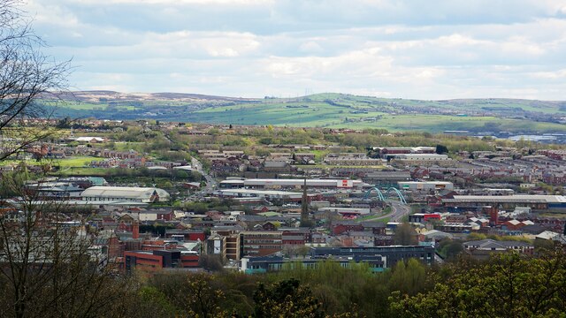
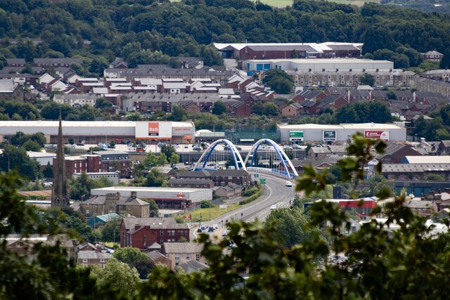
Ewood is a small area located in the borough of Blackburn with Darwen in Lancashire, England. It is situated approximately 2 miles southeast of the town center of Blackburn. Historically, Ewood was a rural farming community, but it has undergone significant urban development in recent decades.

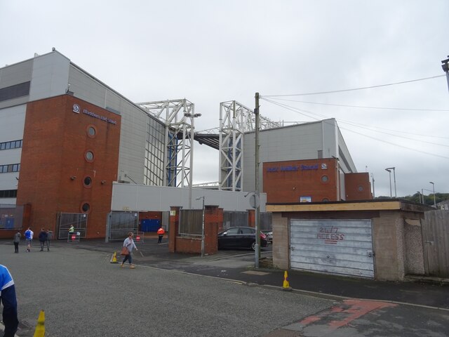
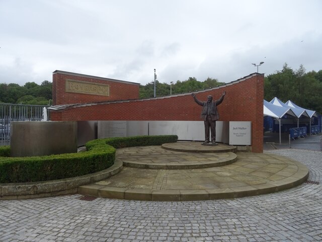
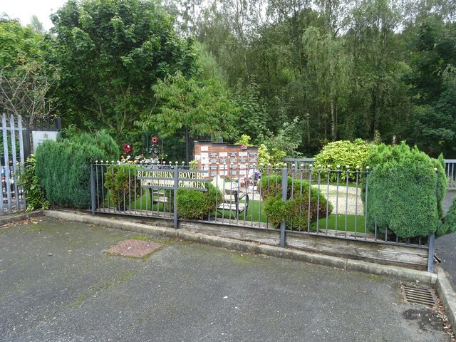
Ewood is perhaps best known for being the home of Ewood Park, the stadium of Blackburn Rovers Football Club. The stadium has a capacity of over 31,000 spectators and has been the venue for numerous football matches, including Premier League games. It is also a popular venue for other events and concerts.

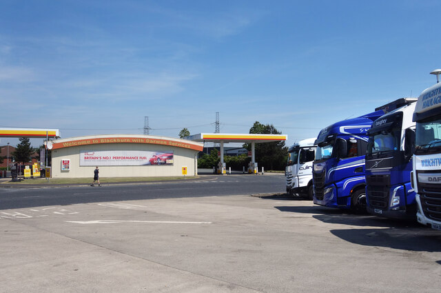
The area surrounding Ewood Park has seen commercial growth, with retail parks and leisure facilities being established. This has attracted visitors from both the local area and further afield. Additionally, Ewood is well-connected to major transportation routes, with the M65 motorway passing nearby, providing easy access to other parts of Lancashire and beyond.

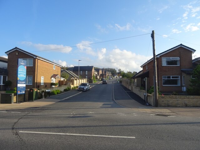
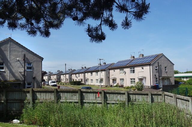
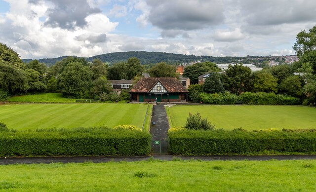
Residentially, Ewood features a mix of housing types, including both terraced and semi-detached properties. The area is predominantly residential, with local amenities including schools, shops, and parks. Ewood also benefits from its proximity to the larger town of Blackburn, which offers a wider range of services and facilities.

Overall, Ewood is a vibrant and evolving area that combines its historical roots with modern development. With its sporting and recreational facilities, as well as its convenient location, it continues to be an attractive place to live, work, and visit in Lancashire.

If you have any feedback on the listing, please let us know in the comments section below.
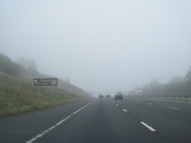
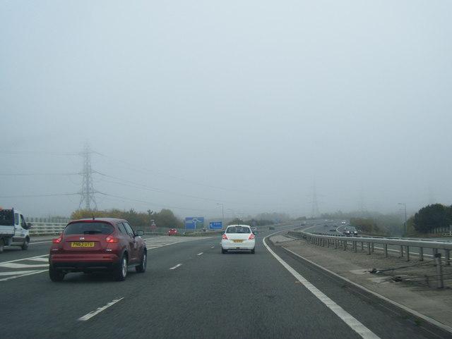
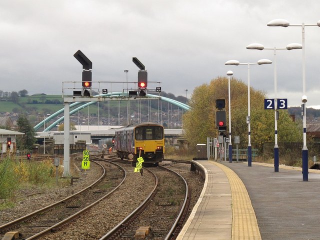
Ewood Images

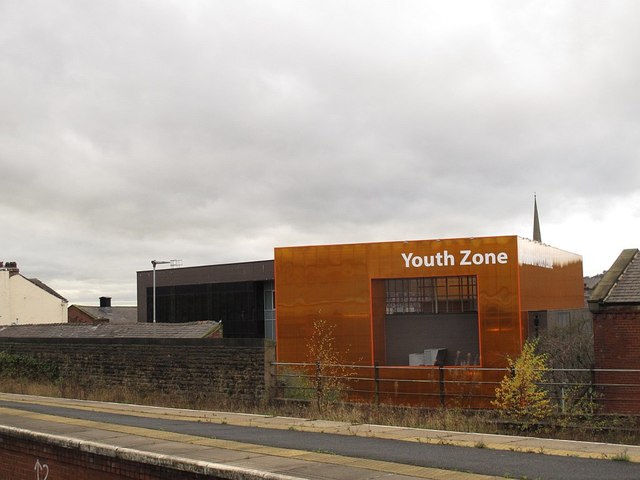
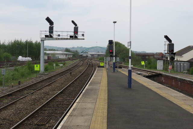
Images are sourced within 2km of 53.728843/-2.492122 or Grid Reference SD6725. Thanks to Geograph Open Source API. All images are credited.

Ewood Park, Blackburn The corner of the Blackburn End (left) and Jack Walker Stand (right) at Ewood Park, home of Blackburn Rovers Football Club.
Ewood Park, Blackburn
The corner of the Blackburn End (left) and Jack Walker Stand (right) at Ewood Park, home of Blackburn Rovers Football Club.
Jack Walker statue, Ewood Park
Blackburn Rovers Memorial Garden, Ewood Park
Footbridge over the River Darwen by Ewood Park
Moorland Drive, Green Hills, Livesey Looking up Moorland Drive, entrance to the recently-built Green Hills estate.
Moorland Drive, Green Hills, Livesey
Looking up Moorland Drive, entrance to the recently-built Green Hills estate.
Blackburn Panorama From the Colourfields Panopticon in Corporation Park
Blackburn Panorama
From the Colourfields Panopticon in Corporation Park
Old Milestone, A674, Preston Old Road, Blackburn The milestone is located against the wall at the back of the pavement, outside Mambo’s Tanning Centre, no. 434, on the north west side of the road. Parish of Livesey (Blackburn with Darwen District). Carved stone post, erected by the Bolton & Blackburn turnpike trust (Livesey branch) in the 19th century. 

Inscription reads:-
9 MILES / TO PRESTON / 2 TO / BLACKBURN 

Milestone Society National ID: LA_PSBB09
Old Milestone, A674, Preston Old Road, Blackburn
The milestone is located against the wall at the back of the pavement, outside Mambo’s Tanning Centre, no. 434, on the north west side of the road. Parish of Livesey (Blackburn with Darwen District). Carved stone post, erected by the Bolton & Blackburn turnpike trust (Livesey branch) in the 19th century. Inscription reads:- 9 MILES / TO PRESTON / 2 TO / BLACKBURN Milestone Society National ID: LA_PSBB09
Redvers Road, Darwen Solar power on all the houses along here.
Redvers Road, Darwen
Solar power on all the houses along here.
Trucks at the Services Another picture taken during a leg stretch around Blackburn & Darwen Services after a long drive.
Trucks at the Services
Another picture taken during a leg stretch around Blackburn & Darwen Services after a long drive.
Green Park Bowling Green Green Park Bowling Green seen from the Leeds & Liverpool Canal.
Green Park Bowling Green
Green Park Bowling Green seen from the Leeds & Liverpool Canal.
River Darwen Path running between the River Darwen and River Mill in Blackburn.
River Darwen
Path running between the River Darwen and River Mill in Blackburn.
Wainwright Bridge The Wainwright Bridge in Blackburn seen from <a href="https://www.geograph.org.uk/photo/7558910">SD6729 : The Battery</a>.
Wainwright Bridge
The Wainwright Bridge in Blackburn seen from SD6729 : The Battery.
Rusty Cyclist! Artwork alongside the Leeds & Liverpool Canal.
Rusty Cyclist!
Artwork alongside the Leeds & Liverpool Canal.
M65 eastbound nears Junction 4
M65 eastbound exit at Junction 4
Sprinter leaving Blackburn station 150103 on a service from Clitheroe to Manchester.
Sprinter leaving Blackburn station
150103 on a service from Clitheroe to Manchester.
The Youth Zone, Blackburn  Seen from the railway station. Aerial imagery shows that this building has a football pith on the roof (behind a high parapet!).
The Youth Zone, Blackburn
Seen from the railway station. Aerial imagery shows that this building has a football pith on the roof (behind a high parapet!).
View west from Blackburn railway station
Show me another place!

Ewood is located at Grid Ref: SD6725 (Lat: 53.728843, Lng: -2.492122)

Unitary Authority: Blackburn with Darwen

Police Authority: Lancashire

What 3 Words

///paused.tests.proud. Near Blackburn, Lancashire

Related Wikis

Blackburn Rovers F.C.

Blackburn Rovers Football Club is a professional football club, based in Blackburn, Lancashire, England, which competes in the EFL Championship, the second...

Ewood Park

Ewood Park () is a football stadium in Blackburn, Lancashire, England, and the home of Blackburn Rovers F.C., founding members of the Football League and...

Radio Rovers

Radio Rovers was the official radio station of the English Championship football side Blackburn Rovers FC. It was launched at Ewood Park on 30 October...

Ewood Aqueduct

Ewood Aqueduct is a high embankment carrying the Leeds and Liverpool Canal over the River Darwen and the B6447 road near Blackburn, Lancashire, England...

Nearby Amenities

Located within 500m of 53.728843,-2.492122
Mini Roundabout
Lat/Long: 53.7288624/-2.4985025
Mini Roundabout
Direction: clockwise
Lat/Long: 53.7286574/-2.4993759
Traffic Signals
Traffic Signals: signal
Lat/Long: 53.7317307/-2.4919869
Access: yes
Barrier: bollard
Motor Vehicle: no
Lat/Long: 53.7315276/-2.4965134
Ewood
Place: suburb
Source: npe
Lat/Long: 53.7275394/-2.4932543
Cycleway: asl
Direction: forward
Lat/Long: 53.7321866/-2.4917176
Ewood Arms
Disused: yes
Disused Amenity: pub
Lat/Long: 53.7307645/-2.4915302
Pub
Fox and Hounds
Addr City: Blackburn
Addr Housenumber: 1
Addr Postcode: BB2 4LL
Addr Street: Ewood
Fhrs Id: 211457
Source Addr: FHRS Open Data
Lat/Long: 53.7297853/-2.4931709
Pub
Brown Cow
Operator: Stonegate
Operator Wikidata: Q7619176
Website: https://www.craftunionpubs.com/brown-cow-feniscowles
Lat/Long: 53.7288184/-2.4982819
Traffic Signals
Traffic Signals: signal
Lat/Long: 53.7299501/-2.4926713
Restaurant
The Gate
Addr City: Blackburn
Addr Housenumber: 166-168
Addr Postcode: BB2 4QR
Addr Street: Livesey Branch Road
Fhrs Id: 211988
Old Name: Moorgate
Source Addr: FHRS Open Data
Lat/Long: 53.7287377/-2.4995916
Bus Stop
Public Transport: platform
Lat/Long: 53.7291708/-2.4976768
Post Box
Post Box Design: type_g
Post Box Type: pillar
Ref: BB2 12
Royal Cypher: EIIR
Royal Cypher Wikidata: Q33102113
Lat/Long: 53.7289485/-2.4984911
Bus Stop
Public Transport: platform
Lat/Long: 53.7272374/-2.4980025
Bus Stop
Public Transport: platform
Lat/Long: 53.7276388/-2.498154
Bus Stop
Bus: yes
Naptan AtcoCode: 2580HBK0010
Naptan NaptanCode: blagpgw
Public Transport: platform
Lat/Long: 53.7325198/-2.4910847
Bus Stop
Bus: yes
Naptan AtcoCode: 2580HBK0013
Naptan NaptanCode: blagpjg
Public Transport: platform
Shelter: yes
Lat/Long: 53.7322902/-2.4909935
Bus Stop
Bus: yes
Naptan AtcoCode: 2580HBK0001
Naptan NaptanCode: blagpdp
Public Transport: platform
Lat/Long: 53.7282535/-2.4911585
Bus Stop
Public Transport: platform
Lat/Long: 53.7276973/-2.4905516
Bus Stop
Public Transport: platform
Lat/Long: 53.7251663/-2.4878663
Turning Circle
Lat/Long: 53.7302983/-2.4977403
Mini Roundabout
Direction: clockwise
Lat/Long: 53.7309884/-2.4913803
Turning Circle
Lat/Long: 53.727703/-2.4913703
Mini Roundabout
Direction: clockwise
Lat/Long: 53.7253578/-2.4881772
Turning Circle
Lat/Long: 53.7306084/-2.4987096
Turning Circle
Lat/Long: 53.7293689/-2.4987851
Turning Circle
Lat/Long: 53.729629/-2.4978864
Turning Circle
Noexit: yes
Lat/Long: 53.7314814/-2.4980228
Place Of Worship
Blackburn Rovers FC Memorial Garden
Religion: multifaith
Lat/Long: 53.7297471/-2.48872
Entrance: yes
Lat/Long: 53.7295263/-2.4901384
Crossing
Crossing: traffic_signals
Crossing Island: yes
Crossing Ref: toucan
Tactile Paving: yes
Lat/Long: 53.7293133/-2.4917152
Traffic Signals
Traffic Signals: signal
Traffic Signals Direction: forward
Lat/Long: 53.7292975/-2.4914084
Access: no
Barrier: bollard
Bicycle: yes
Foot: yes
Horse: yes
Lat/Long: 53.7328814/-2.4888076
Ewood Bikes
Addr City: Blackburn
Addr Postcode: BB2 4HL
Addr Street: Bolton Road
Shop: bicycle
Lat/Long: 53.7323292/-2.4908227
Post Box
Post Box Design: type_g
Post Box Type: pillar
Ref: BB2 9
Royal Cypher: EIIR
Royal Cypher Wikidata: Q33102113
Lat/Long: 53.7277252/-2.490681
Generator Method: photovoltaic
Generator Output Electricity: yes
Generator Source: solar
Generator Type: solar_photovoltaic_panel
Location: roof
Power: generator
Lat/Long: 53.7247012/-2.4921266
Generator Method: photovoltaic
Generator Output Electricity: yes
Generator Source: solar
Generator Type: solar_photovoltaic_panel
Location: roof
Power: generator
Lat/Long: 53.7251487/-2.4935348
Generator Method: photovoltaic
Generator Output Electricity: yes
Generator Source: solar
Generator Type: solar_photovoltaic_panel
Location: roof
Power: generator
Lat/Long: 53.7244901/-2.493347
Generator Method: photovoltaic
Generator Output Electricity: yes
Generator Source: solar
Generator Type: solar_photovoltaic_panel
Location: roof
Power: generator
Lat/Long: 53.7261199/-2.4937172
Generator Method: photovoltaic
Generator Output Electricity: yes
Generator Source: solar
Generator Type: solar_photovoltaic_panel
Location: roof
Power: generator
Lat/Long: 53.727253/-2.4938539
Generator Method: photovoltaic
Generator Output Electricity: yes
Generator Source: solar
Generator Type: solar_photovoltaic_panel
Location: roof
Power: generator
Lat/Long: 53.7269864/-2.4945701
Generator Method: photovoltaic
Generator Output Electricity: yes
Generator Source: solar
Generator Type: solar_photovoltaic_panel
Location: roof
Power: generator
Lat/Long: 53.7280369/-2.4969653
Generator Method: photovoltaic
Generator Output Electricity: yes
Generator Source: solar
Generator Type: solar_photovoltaic_panel
Location: roof
Power: generator
Lat/Long: 53.7280099/-2.4951253
Generator Method: photovoltaic
Generator Output Electricity: yes
Generator Source: solar
Generator Type: solar_photovoltaic_panel
Location: roof
Power: generator
Lat/Long: 53.7284479/-2.4945004
Generator Method: photovoltaic
Generator Output Electricity: yes
Generator Source: solar
Generator Type: solar_photovoltaic_panel
Location: roof
Power: generator
Lat/Long: 53.7284701/-2.4961955
Generator Method: photovoltaic
Generator Output Electricity: yes
Generator Source: solar
Generator Type: solar_photovoltaic_panel
Location: roof
Power: generator
Lat/Long: 53.7284987/-2.4964664
Generator Method: photovoltaic
Generator Output Electricity: yes
Generator Source: solar
Generator Type: solar_photovoltaic_panel
Location: roof
Power: generator
Lat/Long: 53.7297014/-2.4981643
Generator Method: photovoltaic
Generator Output Electricity: yes
Generator Source: solar
Generator Type: solar_photovoltaic_panel
Location: roof
Power: generator
Lat/Long: 53.7296808/-2.4982528
Generator Method: photovoltaic
Generator Output Electricity: yes
Generator Source: solar
Generator Type: solar_photovoltaic_panel
Location: roof
Power: generator
Lat/Long: 53.7296173/-2.4984727
Generator Method: photovoltaic
Generator Output Electricity: yes
Generator Source: solar
Generator Type: solar_photovoltaic_panel
Location: roof
Power: generator
Lat/Long: 53.7295491/-2.4987302
Generator Method: photovoltaic
Generator Output Electricity: yes
Generator Source: solar
Generator Type: solar_photovoltaic_panel
Location: roof
Power: generator
Lat/Long: 53.7292127/-2.4987543
Generator Method: photovoltaic
Generator Output Electricity: yes
Generator Source: solar
Generator Type: solar_photovoltaic_panel
Location: roof
Power: generator
Lat/Long: 53.7295237/-2.4976037
Crossing
Crossing: uncontrolled
Crossing Island: yes
Tactile Paving: yes
Lat/Long: 53.7298444/-2.4926517
Give Way
Lat/Long: 53.7295363/-2.4933017
Crossing
Crossing: zebra
Crossing Island: no
Tactile Paving: yes
Lat/Long: 53.7295676/-2.4939931
Crossing
Crossing: traffic_signals
Crossing Island: yes
Crossing Ref: toucan
Tactile Paving: yes
Lat/Long: 53.7292048/-2.4916814
Crossing
Crossing: traffic_signals
Crossing Island: yes
Crossing Ref: toucan
Tactile Paving: yes
Lat/Long: 53.7290926/-2.4913811
Traffic Signals
Traffic Signals: signal
Lat/Long: 53.729108/-2.4915659
Crossing
Crossing: traffic_signals
Crossing Island: yes
Crossing Ref: toucan
Tactile Paving: yes
Lat/Long: 53.7291443/-2.4915756
Crossing
Crossing: traffic_signals
Crossing Island: yes
Crossing Ref: toucan
Tactile Paving: yes
Lat/Long: 53.7291265/-2.4916935
Traffic Signals
Traffic Signals: signal
Lat/Long: 53.7290881/-2.4916495
Traffic Signals
Traffic Signals: signal
Lat/Long: 53.72933/-2.4917613
Bus Stop
Bus: yes
Naptan AtcoCode: 2580EWD0010
Naptan NaptanCode: blajwmp
Public Transport: platform
Lat/Long: 53.7294772/-2.4912673
Bus Stop
Bus: yes
Naptan AtcoCode: 2580EWD0011
Naptan NaptanCode: blajwmt
Public Transport: platform
Lat/Long: 53.7306871/-2.4914262
Cycleway: asl
Lat/Long: 53.7315461/-2.4915496
Traffic Signals
Traffic Signals: signal
Lat/Long: 53.7315096/-2.4915308
Traffic Signals
Traffic Signals: signal
Lat/Long: 53.732134/-2.4912638
Cycleway: asl
Lat/Long: 53.7321018/-2.4912974
Traffic Signals
Traffic Signals: signal
Traffic Signals Direction: forward
Lat/Long: 53.7322363/-2.4917426
Crossing
Crossing: traffic_signals
Crossing Island: yes
Crossing Ref: toucan
Tactile Paving: yes
Lat/Long: 53.7316317/-2.4919359
Crossing
Crossing: traffic_signals
Crossing Island: yes
Crossing Ref: toucan
Tactile Paving: yes
Lat/Long: 53.7317612/-2.4919328
Man Made: surveillance
Surveillance: traffic
Surveillance Type: camera
Lat/Long: 53.7317103/-2.4914511
Crossing
Crossing: traffic_signals
Crossing Island: yes
Crossing Ref: puffin
Tactile Paving: yes
Lat/Long: 53.7320593/-2.4918095
Crossing
Crossing: traffic_signals
Crossing Island: yes
Crossing Ref: puffin
Tactile Paving: yes
Lat/Long: 53.7321362/-2.4916993
Crossing
Crossing: traffic_signals
Crossing Island: yes
Crossing Ref: toucan
Tactile Paving: yes
Lat/Long: 53.7320654/-2.4913353
Crossing
Crossing: traffic_signals
Crossing Island: yes
Crossing Ref: toucan
Tactile Paving: yes
Lat/Long: 53.7321728/-2.4913775
Crossing
Crossing: uncontrolled
Crossing Island: yes
Tactile Paving: yes
Lat/Long: 53.7316071/-2.4914545
Crossing
Button Operated: yes
Crossing: traffic_signals
Crossing Island: no
Crossing Markings: yes
Crossing Ref: puffin
Kerb: lowered
Tactile Paving: yes
Lat/Long: 53.7328166/-2.4906745
Traffic Signals
Traffic Signals: crossing
Traffic Signals Direction: backward
Lat/Long: 53.7328413/-2.490657
Traffic Signals
Traffic Signals: crossing
Traffic Signals Direction: forward
Lat/Long: 53.7327883/-2.4906946
Crossing
Crossing: unmarked
Crossing Island: yes
Tactile Paving: yes
Lat/Long: 53.7298416/-2.4928656
Crossing
Crossing: unmarked
Lat/Long: 53.7293189/-2.4928489
Crossing
Crossing: unmarked
Lat/Long: 53.7293438/-2.4929475
Give Way
Direction: forward
Lat/Long: 53.7293265/-2.491301
Bus Stop
Bus: yes
Naptan AtcoCode: 2580EWD0007
Naptan NaptanCode: blagjdt
Public Transport: platform
Shelter: yes
Lat/Long: 53.7261441/-2.4892085
Bus Stop
Bus: yes
Naptan AtcoCode: 2580EWD0009
Naptan NaptanCode: blagjga
Public Transport: platform
Shelter: yes
Lat/Long: 53.72652/-2.4893599
Crossing
Crossing: traffic_signals
Crossing Island: no
Crossing Ref: puffin
Tactile Paving: yes
Lat/Long: 53.7258702/-2.4887456
Traffic Signals
Traffic Signals: crossing
Traffic Signals Direction: forward
Lat/Long: 53.7258935/-2.488776
Traffic Signals
Traffic Signals: crossing
Traffic Signals Direction: backward
Lat/Long: 53.7258456/-2.4887147
ALDI
Addr City: Blackburn
Addr Postcode: BB2 4HY
Addr Street: Bolton Road
Brand: ALDI
Brand Wikidata: Q41171672
Brand Wikipedia: en:Aldi
Contact Website: https://stores.aldi.co.uk/blackburn/bolton-road
Fhrs Id: 211877
Shop: supermarket
Lat/Long: 53.7285328/-2.4919277
Iceland
Addr City: Blackburn
Addr Postcode: BB2 4LQ
Addr Street: Bolton Road
Brand: Iceland
Brand Wikidata: Q721810
Shop: frozen_food
Website: https://www.iceland.co.uk/store-finder/store?StoreID=548&StoreName=BLACKBURN%20EWOOD
Lat/Long: 53.7284482/-2.4923029
Fast Food
McDonald's
Brand: McDonald's
Brand Wikidata: Q38076
Brand Wikipedia: en:McDonald's
Contact Website: https://www.mcdonalds.com/gb/en-gb/location/blackburn/ewood/livesey-branch-road/8260528.html
Cuisine: burger
Takeaway: yes
Lat/Long: 53.7291786/-2.4923998
Crossing
Crossing: uncontrolled
Crossing Island: yes
Tactile Paving: yes
Lat/Long: 53.7315933/-2.4915659
The data included in this document is from www.openstreetmap.org. The data is made available under ODbL.

Have you been to Ewood?

Leave your review of Ewood below (or comments, questions and feedback).