Derry's Wood

Wood, Forest in Hertfordshire Broxbourne

England

Derry's Wood

Path in Broxbourne Wood
Path in Broxbourne Wood Credit: Roger Jones

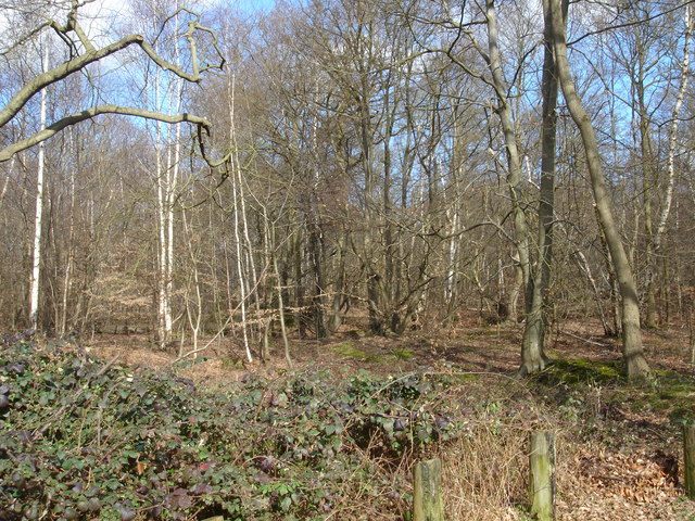
Derry's Wood is a picturesque woodland located in Hertfordshire, England. It covers an area of approximately 40 hectares and is a designated Site of Special Scientific Interest (SSSI). The wood is situated near the village of Derry's Green, hence its name, and is easily accessible from the nearby towns of Watford and Rickmansworth.

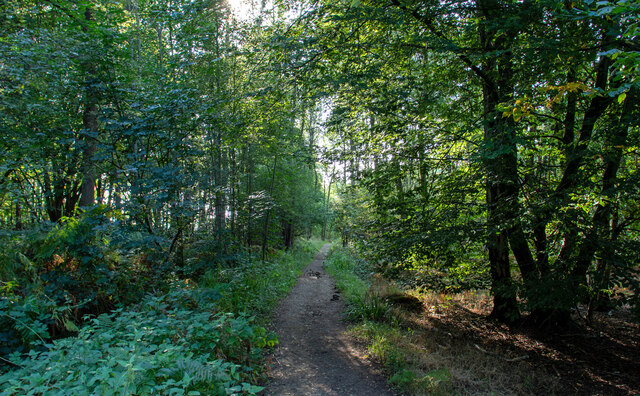
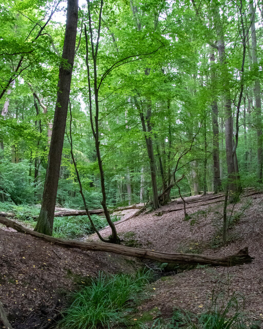
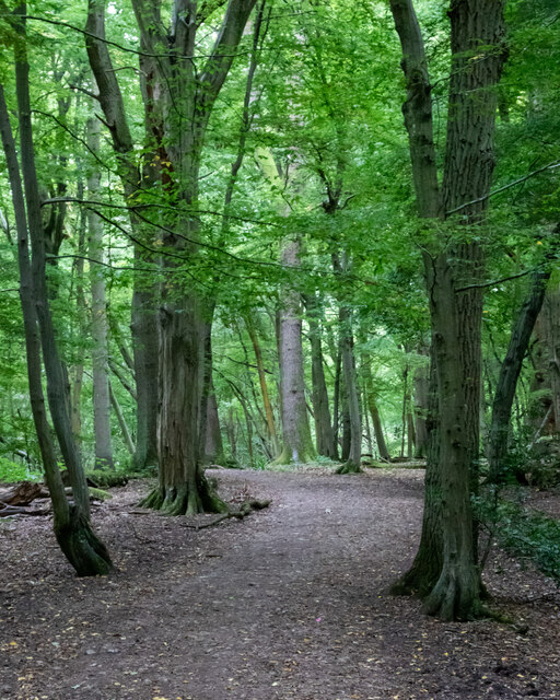
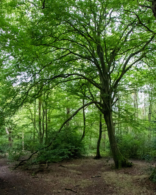
The woodland is predominantly composed of ancient oak trees, with some areas also featuring beech and ash trees. These majestic trees create a dense canopy that provides a habitat for a diverse range of wildlife. Derry's Wood is known for its rich biodiversity, with a variety of flora and fauna thriving within its boundaries. It is home to numerous bird species, including woodpeckers, owls, and various songbirds, making it a popular spot for birdwatching enthusiasts.

Nature lovers and walkers can enjoy a network of well-maintained footpaths that meander through the wood, allowing visitors to explore its beauty at their own pace. The wood is also intersected by several streams and ponds, adding to its natural charm. During spring, Derry's Wood bursts into life with a vibrant carpet of bluebells, creating a stunning display that attracts many visitors.

The wood is managed by the local conservation trust, which ensures the preservation of its natural habitat and biodiversity. It offers educational programs and guided tours to raise awareness about the importance of woodland conservation. Derry's Wood is a tranquil retreat for those seeking solace in nature and a prime location for nature enthusiasts to immerse themselves in the beauty of Hertfordshire's woodlands.

If you have any feedback on the listing, please let us know in the comments section below.
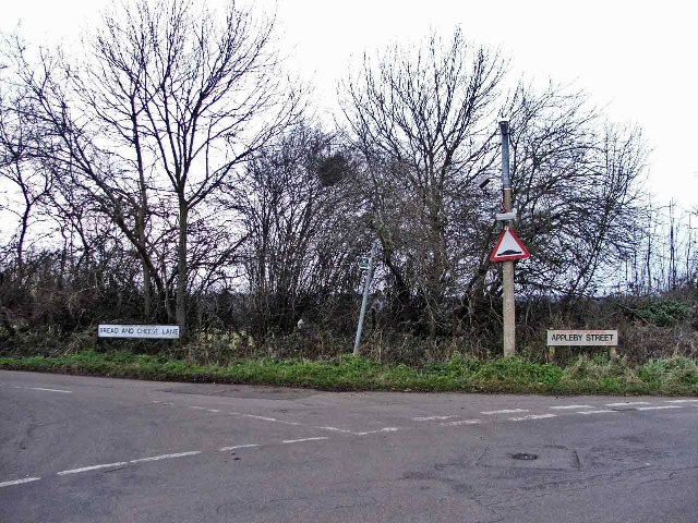
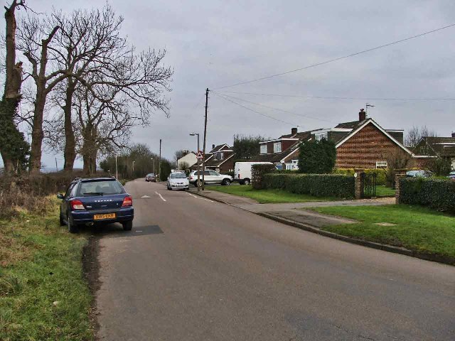
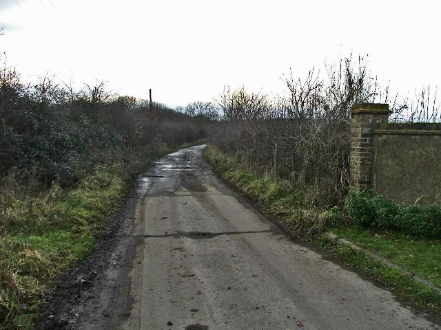
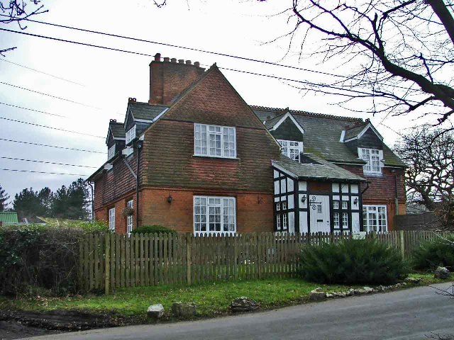
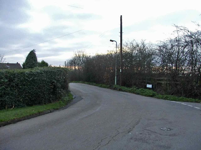
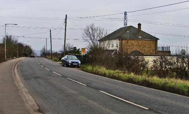
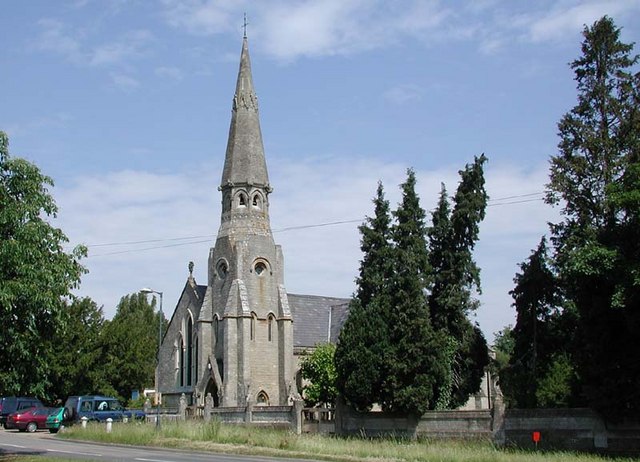
Derry's Wood Images

Images are sourced within 2km of 51.731114/-0.092745981 or Grid Reference TL3105. Thanks to Geograph Open Source API. All images are credited.

Path in Broxbourne Wood
Stream in Wormley Wood, Broxbourne Woods National Nature Reserve Wormley Wood is part of the Broxbourne Woods National Nature Reserve.

See Woodland Trust website: <span class="nowrap"><a title="https://www.woodlandtrust.org.uk/visiting-woods/woods/wormley-wood-nut-wood/" rel="nofollow ugc noopener" href="https://www.woodlandtrust.org.uk/visiting-woods/woods/wormley-wood-nut-wood/">Link</a><img style="margin-left:2px;" alt="External link" title="External link - shift click to open in new window" src="https://s1.geograph.org.uk/img/external.png" width="10" height="10"/></span> -

"One of only two areas of oak-hornbeam forest in the UK, Wormley Wood & Nut Wood are of European importance and are both listed as a Special Area of Conservation (SAC).

Wormley Wood is largely ancient woodland which has been coppiced from the medieval period."
Stream in Wormley Wood, Broxbourne Woods National Nature Reserve
Wormley Wood is part of the Broxbourne Woods National Nature Reserve. See Woodland Trust website: LinkExternal link - "One of only two areas of oak-hornbeam forest in the UK, Wormley Wood & Nut Wood are of European importance and are both listed as a Special Area of Conservation (SAC). Wormley Wood is largely ancient woodland which has been coppiced from the medieval period."
Path in  Wormley Wood, Broxbourne Woods National Nature Reserve Wormley Wood is part of the Broxbourne Woods National Nature Reserve.

See Woodland Trust website: <span class="nowrap"><a title="https://www.woodlandtrust.org.uk/visiting-woods/woods/wormley-wood-nut-wood/" rel="nofollow ugc noopener" href="https://www.woodlandtrust.org.uk/visiting-woods/woods/wormley-wood-nut-wood/">Link</a><img style="margin-left:2px;" alt="External link" title="External link - shift click to open in new window" src="https://s1.geograph.org.uk/img/external.png" width="10" height="10"/></span> -

"One of only two areas of oak-hornbeam forest in the UK, Wormley Wood & Nut Wood are of European importance and are both listed as a Special Area of Conservation (SAC).

Wormley Wood is largely ancient woodland which has been coppiced from the medieval period."
Path in Wormley Wood, Broxbourne Woods National Nature Reserve
Wormley Wood is part of the Broxbourne Woods National Nature Reserve. See Woodland Trust website: LinkExternal link - "One of only two areas of oak-hornbeam forest in the UK, Wormley Wood & Nut Wood are of European importance and are both listed as a Special Area of Conservation (SAC). Wormley Wood is largely ancient woodland which has been coppiced from the medieval period."
Westfield Grove, Broxbourne Woods National Nature Reserve Managed by the Woodland Trust, as part of Wormley Wood.

See Woodland Trust website: <span class="nowrap"><a title="https://www.woodlandtrust.org.uk/visiting-woods/woods/wormley-wood-nut-wood/" rel="nofollow ugc noopener" href="https://www.woodlandtrust.org.uk/visiting-woods/woods/wormley-wood-nut-wood/">Link</a><img style="margin-left:2px;" alt="External link" title="External link - shift click to open in new window" src="https://s1.geograph.org.uk/img/external.png" width="10" height="10"/></span> -

"One of only two areas of oak-hornbeam forest in the UK, Wormley Wood & Nut Wood are of European importance and are both listed as a Special Area of Conservation (SAC).

Wormley Wood is largely ancient woodland which has been coppiced from the medieval period."
Westfield Grove, Broxbourne Woods National Nature Reserve
Managed by the Woodland Trust, as part of Wormley Wood. See Woodland Trust website: LinkExternal link - "One of only two areas of oak-hornbeam forest in the UK, Wormley Wood & Nut Wood are of European importance and are both listed as a Special Area of Conservation (SAC). Wormley Wood is largely ancient woodland which has been coppiced from the medieval period."
St Mary's Church Newgate Street Quite a handsome church
St Mary's Church Newgate Street
Quite a handsome church
Shopping Parade in Goff's Oak These buildings are fairly new but already one can see the discolouration of brickwork at parapet level. Interesting to compare with shops in Chingford
Shopping Parade in Goff's Oak
These buildings are fairly new but already one can see the discolouration of brickwork at parapet level. Interesting to compare with shops in Chingford
Cuffley world War 2 Anti-tank Blocks This railway bridge at Cuffley was also an intersection with a road and a river and is protected by no less than 85 anti-tank blocks. This is the most extensive surviving group of anti-tank obstacles in Hertfordshire. 

For more info visit <span class="nowrap"><a title="http://www.pillboxesuk.co.uk" rel="nofollow ugc noopener" href="http://www.pillboxesuk.co.uk">Link</a><img style="margin-left:2px;" alt="External link" title="External link - shift click to open in new window" src="https://s1.geograph.org.uk/img/external.png" width="10" height="10"/></span>
Cuffley world War 2 Anti-tank Blocks
This railway bridge at Cuffley was also an intersection with a road and a river and is protected by no less than 85 anti-tank blocks. This is the most extensive surviving group of anti-tank obstacles in Hertfordshire. For more info visit LinkExternal link
Beaumont Manor, Beaumont Road, Cheshunt Beaumont Manor, is on the corner of Beaumont Road and Bread and Cheese Lane, Cheshunt, Hertfordshire
Beaumont Manor, Beaumont Road, Cheshunt
Beaumont Manor, is on the corner of Beaumont Road and Bread and Cheese Lane, Cheshunt, Hertfordshire
Cottages, Beaumont Road, Cheshunt These cottages are at the end of Beaumont Road before it becomes a path leading to Baisley's Wood
Cottages, Beaumont Road, Cheshunt
These cottages are at the end of Beaumont Road before it becomes a path leading to Baisley's Wood
Farmland, Beaumont Road, looking South Farmland in Beaumont Road, Cheshunt, looking southwards.  This farmland is adjacent to Beaumont Manor.
Farmland, Beaumont Road, looking South
Farmland in Beaumont Road, Cheshunt, looking southwards. This farmland is adjacent to Beaumont Manor.
Corner of Bread and Cheese Lane where it meets Beaumont Road, Cheshunt Bread and Cheese Lane Cheshunt on the corner of Beaumont Road.  The brick wall belongs to Beaumont Manor
Corner of Bread and Cheese Lane where it meets Beaumont Road, Cheshunt
Bread and Cheese Lane Cheshunt on the corner of Beaumont Road. The brick wall belongs to Beaumont Manor
Bread and Cheese Bridge, Bread and Cheese Lane, Cheshunt Bread and Cheese Bridge is in the valley in Bread and Cheese Lane, where the road passes over the Turnford Brook.
Bread and Cheese Bridge, Bread and Cheese Lane, Cheshunt
Bread and Cheese Bridge is in the valley in Bread and Cheese Lane, where the road passes over the Turnford Brook.
Junction of Bread and Cheese Lane and Appleby Street, Cheshunt Junction of Bread and Cheese Lane and Appleby Street, Cheshunt, Hertfordshire
Junction of Bread and Cheese Lane and Appleby Street, Cheshunt
Junction of Bread and Cheese Lane and Appleby Street, Cheshunt, Hertfordshire
Appleby Street, Cheshunt, Hertfordshire Appleby Street, Cheshunt, looking east
Appleby Street, Cheshunt, Hertfordshire
Appleby Street, Cheshunt, looking east
Beaumont Road looking West Beaumont Road, Cheshunt, looking west towards Bailey's Wood
Beaumont Road looking West
Beaumont Road, Cheshunt, looking west towards Bailey's Wood
Keeper's Cottage, Beaumont Road, Cheshunt, Hertfordshire
Smith Lane, Cheshunt, Hertfordshire Smith Lane, Cheshunt, Hertfordshire, at junction with Bread and Cheese Lane and Appleby Street
Smith Lane, Cheshunt, Hertfordshire
Smith Lane, Cheshunt, Hertfordshire, at junction with Bread and Cheese Lane and Appleby Street
Darnicle Hill, Cheshunt, Hertfordshire Darnicle Hill, Cheshunt, looking east.
Darnicle Hill, Cheshunt, Hertfordshire
Darnicle Hill, Cheshunt, looking east.
Show me another place!

Derry's Wood is located at Grid Ref: TL3105 (Lat: 51.731114, Lng: -0.092745981)

Administrative County: Hertfordshire

District: Broxbourne

Police Authority: Hertfordshire

What 3 Words

///drum.shall.dragon. Near Cuffley, Hertfordshire

Related Wikis

Newgate Street, Hertfordshire

Newgate Street is a village near Cuffley, in Hatfield civil parish, in the Welwyn Hatfield district of Hertfordshire, England. It is approximately six...

Tolmers Park

Tolmers Park is a manor house in Newgate Street Village near Hatfield in Hertfordshire, England. == Early history == The early history of the manor is...

Broxbourne (UK Parliament constituency)

Broxbourne is a constituency in Hertfordshire represented in the House of Commons of the UK Parliament since 2005 by Charles Walker of the Conservative...

Wormley-Hoddesdonpark Wood South

Wormley-Hoddesdonpark Wood South is a 192.5 hectares (476 acres) is a biological site of Special Scientific Interest near Cheshunt in Hertfordshire. It...

Broxbourne Woods

Broxbourne Woods are a 239.1 hectare National Nature Reserve west of Broxbourne in Hertfordshire. The site is Hertfordshire's only National Nature Reserve...

Wormley-Hoddesdonpark Wood North

Wormley-Hoddesdonpark Wood North is a 143.9-hectare (356-acre) woodland area in Hertfordshire which has been designated as a biological site of Special...

Goffs Oak

Goffs Oak (Goff's Oak on Ordnance Survey maps) is a large village in the borough of Broxbourne in Hertfordshire in the United Kingdom. It lies between...

Cuffley

Cuffley is a village in the civil parish of Northaw and Cuffley, in the Welwyn Hatfield district of south-east Hertfordshire located between Cheshunt and...

Nearby Amenities

Located within 500m of 51.731114,-0.092745981
Power: tower
Lat/Long: 51.7288437/-0.0933946
Power: tower
Lat/Long: 51.7288543/-0.0898973
Power: tower
Lat/Long: 51.7287864/-0.0986712
The data included in this document is from www.openstreetmap.org. The data is made available under ODbL.

Have you been to Derry's Wood?

Leave your review of Derry's Wood below (or comments, questions and feedback).