Middle Hanger

Wood, Forest in Sussex Mid Sussex

England

Middle Hanger

The village sign at Ansty Some relatively recent maps spell Ansty with an 'e' on the end.
The village sign at Ansty Credit: Marathon

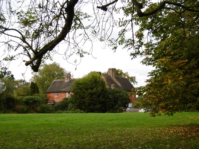
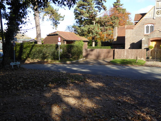
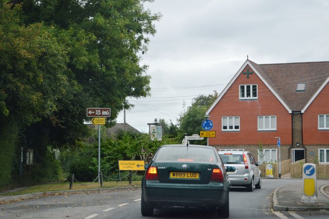
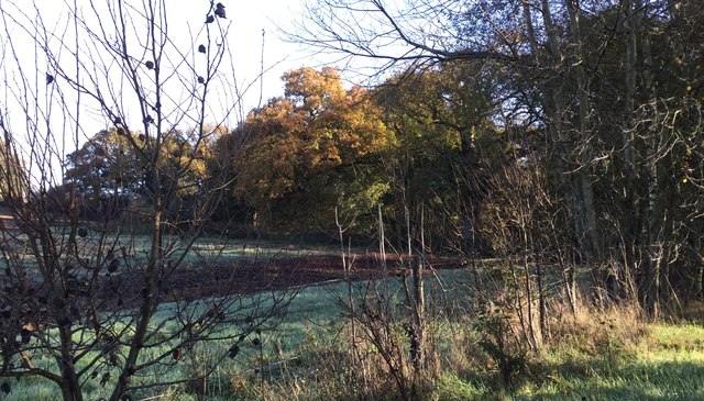
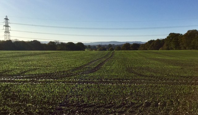
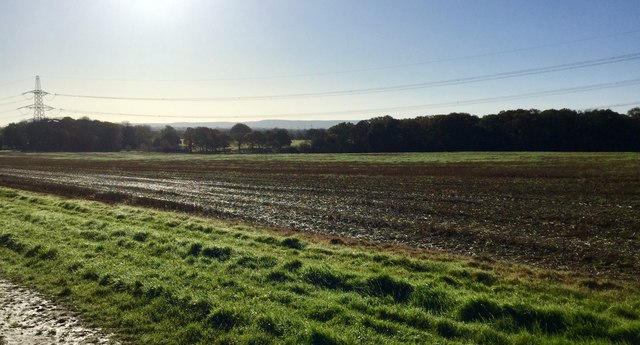
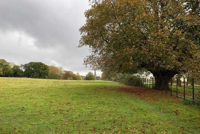
Middle Hanger is a picturesque woodland located in Sussex, England. Situated in the heart of the South Downs National Park, this enchanting forest is known for its natural beauty and serene surroundings. The woodland covers a vast area and is characterized by an abundance of tall, majestic trees that create a dense canopy overhead, providing a sense of seclusion and tranquility.

The name "Middle Hanger" refers to the location of the woodland, which is positioned between two other hangers (wooded hills) in the area. The forest is home to a diverse range of flora and fauna, with a rich variety of plant species, including ancient oaks, beech trees, and vibrant wildflowers. This biodiversity makes Middle Hanger a haven for nature enthusiasts and a popular destination for hikers, birdwatchers, and photographers.

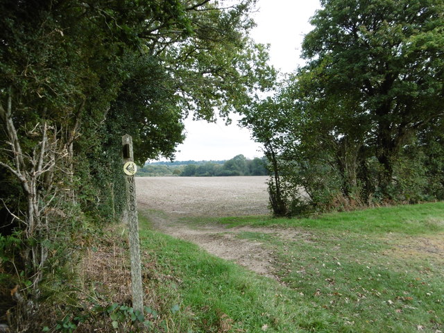
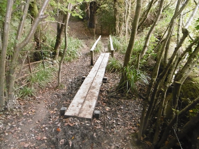
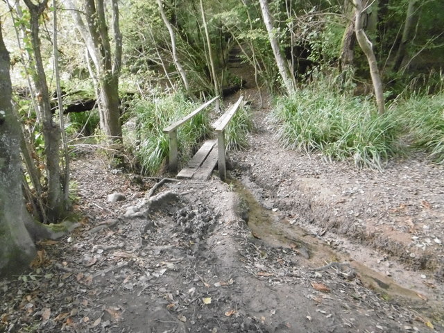
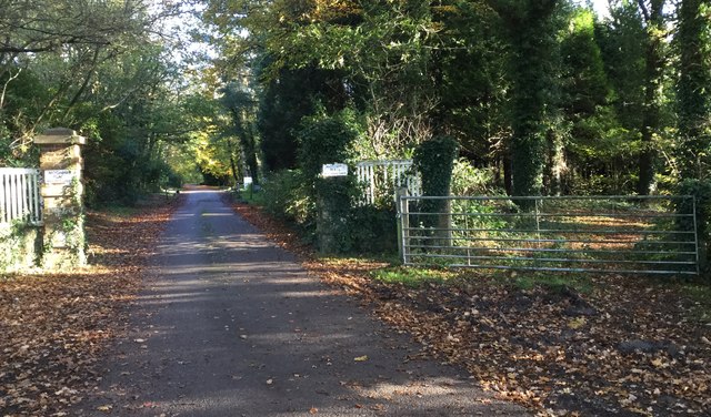
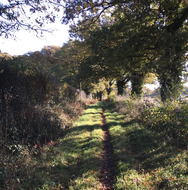
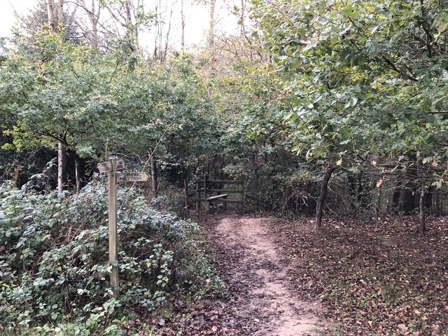
The forest offers a network of well-maintained trails that wind through the woodland, allowing visitors to explore its hidden gems. These paths lead to scenic viewpoints, babbling brooks, and secluded picnic spots, providing ample opportunities for outdoor recreation and relaxation. Additionally, Middle Hanger is intersected by a small stream, which adds to its natural charm and serves as a water source for the local wildlife.

Middle Hanger is not only a haven for nature but also has historical significance. Evidence of human activity from ancient times can be found within the woodland, including archaeological remains and remnants of old settlements. This adds an intriguing dimension to the forest, making it a fascinating location for history enthusiasts and researchers.

Overall, Middle Hanger in Sussex offers a serene and captivating experience for those seeking to immerse themselves in the beauty of nature and explore the rich history of the region.

If you have any feedback on the listing, please let us know in the comments section below.

Middle Hanger Images

Images are sourced within 2km of 50.993194/-0.13619596 or Grid Reference TQ3023. Thanks to Geograph Open Source API. All images are credited.

The village sign at Ansty Some relatively recent maps spell Ansty with an 'e' on the end.
The village sign at Ansty
Some relatively recent maps spell Ansty with an 'e' on the end.
House to the east of Ansty This fine house is seen from a footpath leading east from Ansty to Furnace Wood.
House to the east of Ansty
This fine house is seen from a footpath leading east from Ansty to Furnace Wood.
The footpath turns left here It then turns right again just beyond the hedge on the left before heading to Furnace Wood in the distance.
The footpath turns left here
It then turns right again just beyond the hedge on the left before heading to Furnace Wood in the distance.
Footbridge in Cuckfield Park Cuckfield Park was built in 1574. This is where the High Weald Landscape Trail crosses a stream in New England Wood. The stream opens out to form the lake in Cuckfield Park just to the right of the footbridge.
Footbridge in Cuckfield Park
Cuckfield Park was built in 1574. This is where the High Weald Landscape Trail crosses a stream in New England Wood. The stream opens out to form the lake in Cuckfield Park just to the right of the footbridge.
Footbridge in Cuckfield Park Cuckfield Park was built in 1574. This is where the High Weald Landscape Trail crosses a stream in New England Wood. The stream opens out to form the lake in Cuckfield Park just to the left of the footbridge.
Footbridge in Cuckfield Park
Cuckfield Park was built in 1574. This is where the High Weald Landscape Trail crosses a stream in New England Wood. The stream opens out to form the lake in Cuckfield Park just to the left of the footbridge.
"St John's" on Deak's Lane See <a title="https://www.geograph.org.uk/photo/4195839" href="https://www.geograph.org.uk/photo/4195839">Link</a> from 2014 for more information.
"St John's" on Deak's Lane
See Link from 2014 for more information.
Looking westwards on Bolney Road There is a commemorative bench in the foreground.
Looking westwards on Bolney Road
There is a commemorative bench in the foreground.
Houses at the mini roundabout in Ansty The road is the A272.  See <a title="https://www.geograph.org.uk/photo/4297403" href="https://www.geograph.org.uk/photo/4297403">Link</a> for information on the history of this site.  Both houses sport a green cross.
Houses at the mini roundabout in Ansty
The road is the A272. See Link for information on the history of this site. Both houses sport a green cross.
The southern end of Deak's Lane
A272, Ansty The A272 is a very rural A road, which follows an east to west route from near Heathfield to Winchester, passing through the Sussex countryside. It runs 86 miles from Sutton Scotney to Five Ashes <a href="https://www.geograph.org.uk/photo/6669405">TQ5523 : A267, A272 junction</a>.
<span class="nowrap"><a title="http://www.sabre-roads.org.uk/wiki/index.php?title=A272" rel="nofollow ugc noopener" href="http://www.sabre-roads.org.uk/wiki/index.php?title=A272">Link</a><img style="margin-left:2px;" alt="External link" title="External link - shift click to open in new window" src="https://s1.geograph.org.uk/img/external.png" width="10" height="10"/></span> 
Wikipedia: <span class="nowrap"><a title="http://en.wikipedia.org/wiki/A272_road" rel="nofollow ugc noopener" href="http://en.wikipedia.org/wiki/A272_road">Link</a><img style="margin-left:2px;" alt="External link" title="External link - shift click to open in new window" src="https://s1.geograph.org.uk/img/external.png" width="10" height="10"/></span>
A272, Ansty
The A272 is a very rural A road, which follows an east to west route from near Heathfield to Winchester, passing through the Sussex countryside. It runs 86 miles from Sutton Scotney to Five Ashes TQ5523 : A267, A272 junction. LinkExternal link Wikipedia: LinkExternal link
Kiln Wood Kiln Wood viewed from the passing Bridleway.
Kiln Wood
Kiln Wood viewed from the passing Bridleway.
Looking South from Kiln Wood The view of the fields South of Kiln Wood with the South Downs in the far distance.
Looking South from Kiln Wood
The view of the fields South of Kiln Wood with the South Downs in the far distance.
Looking to the South East of Kiln Wood Fields to the South East of Kiln Wood. The Town of Burgess Hill is a short distance away but is out of sight at present, although future housing development is expected to head towards this view.
Looking to the South East of Kiln Wood
Fields to the South East of Kiln Wood. The Town of Burgess Hill is a short distance away but is out of sight at present, although future housing development is expected to head towards this view.
Entrance to Moonhill Place A public footpath follows the driveway to Moonhill Place whilst the bridleway leaves to the right through the gateway.
Entrance to Moonhill Place
A public footpath follows the driveway to Moonhill Place whilst the bridleway leaves to the right through the gateway.
Bridleway heading East Looking eastwards along the Bridleway near to Moonhill Farm.
Bridleway heading East
Looking eastwards along the Bridleway near to Moonhill Farm.
West Riddens The gated entrance to West Riddens from the Cuckfield Road.
West Riddens
The gated entrance to West Riddens from the Cuckfield Road.
High Weald Landscape Trail Looking eastwards towards Cuckfield.
High Weald Landscape Trail
Looking eastwards towards Cuckfield.
Path Junction The path leaves off to the right heading towards Whitemans Green.
Path Junction
The path leaves off to the right heading towards Whitemans Green.
Show me another place!

Middle Hanger is located at Grid Ref: TQ3023 (Lat: 50.993194, Lng: -0.13619596)

Administrative County: West Sussex

District: Mid Sussex

Police Authority: Sussex

What 3 Words

///bids.ashes.note. Near Cuckfield, West Sussex

Related Wikis

Warden Park Secondary Academy

Warden Park Secondary Academy is a coeducational secondary school based in Cuckfield (near Haywards Heath), West Sussex, England. == Description == There...

Holy Trinity Church, Cuckfield

Holy Trinity Church is an Anglican church in the village of Cuckfield in the district of Mid Sussex; one of seven local government districts in the English...

Whitemans Green

Whiteman's Green is a place in the north of the large village and civil parish of Cuckfield in the Mid Sussex District of West Sussex, England. It is located...

Ashenground and Bolnore Woods

Ashenground and Bolnore Woods is a 14.4-hectare (36-acre) Local Nature Reserve in Haywards Heath in West Sussex. It is owned and managed by Mid Sussex...

Ockenden Manor

Ockenden Manor is located in Cuckfield, West Sussex, England. The building itself dates from 1520 and is operated as a hotel and restaurant by the Historic...
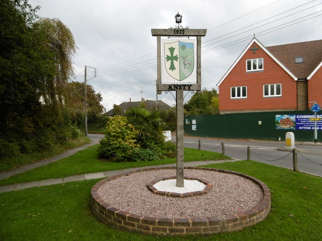
Ansty, West Sussex

Ansty is a village in the Mid Sussex district of West Sussex, England. It lies on the A272 road 1.4 miles (2.2 km) southwest of Cuckfield. It is in the...

Cuckfield

Cuckfield ( KUUK-feeld) is a village and civil parish in the Mid Sussex District of West Sussex, England, on the southern slopes of the Weald. It lies...

Battle of Muster Green

The Battle of Muster Green (also known as the Battle of Haywards Heath) was a minor battle of major significance that took place during the first week...

Nearby Amenities

Located within 500m of 50.993194,-0.13619596
Barrier: kissing_gate
Lat/Long: 50.9902791/-0.1351683
Barrier: stile
Foot: yes
Lat/Long: 50.9956402/-0.1417323
The data included in this document is from www.openstreetmap.org. The data is made available under ODbL.

Have you been to Middle Hanger?

Leave your review of Middle Hanger below (or comments, questions and feedback).