Oak Spinney

Wood, Forest in Bedfordshire

England

Oak Spinney

Entrance to quarry
Entrance to quarry Credit: d brewerton

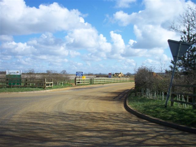
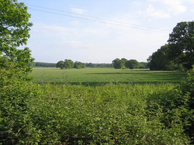
Oak Spinney is a picturesque woodland located in Bedfordshire, England. Spanning over an area of approximately 50 acres, it is a beloved natural gem for both locals and tourists alike. The woodland is characterized by its dense population of majestic oak trees, which give it its name and create a stunning canopy of foliage.

The enchanting atmosphere of Oak Spinney is enhanced by the diverse range of flora and fauna that call it home. The forest floor is carpeted with a rich variety of wildflowers, creating a vibrant burst of colors during the spring and summer months. The undergrowth is teeming with ferns, mosses, and lichens, adding to the woodland's magical ambiance.

The woodland is also a haven for wildlife enthusiasts, as it is home to a plethora of animal species. Birdwatchers will delight in the sight of various avian species, including woodpeckers, owls, and jays. Squirrels can be spotted scurrying amongst the branches, while deer occasionally make appearances, adding a touch of wilderness to the landscape.

For outdoor enthusiasts, Oak Spinney offers a range of recreational activities. There are several well-maintained walking trails that wind through the woodland, allowing visitors to explore its beauty at their own pace. These trails are suitable for all levels of fitness and provide ample opportunities for photography, birdwatching, or simply enjoying the tranquility of nature.

Oak Spinney is not only a natural treasure but also an important ecological site, contributing to the preservation of biodiversity in the region. Its beauty and serenity make it a popular destination for those seeking solace in nature or a peaceful retreat from the hustle and bustle of everyday life.

If you have any feedback on the listing, please let us know in the comments section below.

Oak Spinney Images

Images are sourced within 2km of 52.119984/-0.22176256 or Grid Reference TL2148. Thanks to Geograph Open Source API. All images are credited.

Entrance to quarry
Entrance to quarry
Unsightly set-aside, Sutton, Beds View N across an entirely agricultural square from the Sutton-Eyeworth road.
Unsightly set-aside, Sutton, Beds
View N across an entirely agricultural square from the Sutton-Eyeworth road.
High Street, Sutton, Beds
John o' Gaunt pub, Sutton, Beds on the High Street.
John o' Gaunt pub, Sutton, Beds
on the High Street.
All Saints' church, Sutton, Beds situated north of Church Road, built in the Early English and Decorated styles.
All Saints' church, Sutton, Beds
situated north of Church Road, built in the Early English and Decorated styles.
Ford and bridge, Sutton, Beds A medieval twin-arched packhorse bridge over Potton Brook, a tributary of the River Ivel, where High Street meets Church Road.
Ford and bridge, Sutton, Beds
A medieval twin-arched packhorse bridge over Potton Brook, a tributary of the River Ivel, where High Street meets Church Road.
Medieval packhorse bridge, Sutton, Beds now serving as a footbridge over the Potton Brook.
Medieval packhorse bridge, Sutton, Beds
now serving as a footbridge over the Potton Brook.
High Street, Sutton, Beds
Biggleswade Road, Sutton, Beds approaching the bend on the B1040 at Watermill Bridge.
Biggleswade Road, Sutton, Beds
approaching the bend on the B1040 at Watermill Bridge.
Pegnut Wood, Sutton, Beds A new poplar plantation to produce high quality timber, open to the public; view from the car park beside Sutton Road.
Pegnut Wood, Sutton, Beds
A new poplar plantation to produce high quality timber, open to the public; view from the car park beside Sutton Road.
Leaving Potton, Beds – view out of town along the Sutton Road.
Leaving Potton, Beds
– view out of town along the Sutton Road.
Standalone Farm drive, Sutton, Beds – view from Sutton Road.
Standalone Farm drive, Sutton, Beds
– view from Sutton Road.
Wrestlingworth Road, Potton, Beds
Winter wheat, Sutton, Beds on Fen Farm SW of Carthagena Road.
Winter wheat, Sutton, Beds
on Fen Farm SW of Carthagena Road.
Lupin crop, Sutton, Beds on sandy soils (Frilford series – argillic brown sands); view from Carthgena Road towards the wooded Greensand ridge.
Lupin crop, Sutton, Beds
on sandy soils (Frilford series – argillic brown sands); view from Carthgena Road towards the wooded Greensand ridge.
Entrance to bridleway, Sutton/Potton, Beds from Carthagena Road towards Galley Hill, forming the parish boundary.
Entrance to bridleway, Sutton/Potton, Beds
from Carthagena Road towards Galley Hill, forming the parish boundary.
St Mary's, Potton St Mary's is situated on a small hill on the edge of Potton. An ancient right of way (locally called the Church Causeway) leads from opposite the Church to the centre of Potton. The Church recently celebrated its 900th anniversary although the present building mostly originates from the 13th Century.
St Mary's, Potton
St Mary's is situated on a small hill on the edge of Potton. An ancient right of way (locally called the Church Causeway) leads from opposite the Church to the centre of Potton. The Church recently celebrated its 900th anniversary although the present building mostly originates from the 13th Century.
Sandy Heath TV Transmitter Sandy Heath TV transmitter (lots of information here: <span class="nowrap"><a title="http://tx.mb21.co.uk/gallery/gallerypage.php?txid=840" rel="nofollow ugc noopener" href="http://tx.mb21.co.uk/gallery/gallerypage.php?txid=840">Link</a><img style="margin-left:2px;" alt="External link" title="External link - shift click to open in new window" src="https://s1.geograph.org.uk/img/external.png" width="10" height="10"/></span> and here <span class="nowrap"><a title="https://www.thebigtower.com/live/SandyHeath/Index.htm" rel="nofollow ugc noopener" href="https://www.thebigtower.com/live/SandyHeath/Index.htm">Link</a><img style="margin-left:2px;" alt="External link" title="External link - shift click to open in new window" src="https://s1.geograph.org.uk/img/external.png" width="10" height="10"/></span> ) with Sandy Quarry in the foreground.
Sandy Heath TV Transmitter
Sandy Heath TV transmitter (lots of information here: LinkExternal link and here LinkExternal link ) with Sandy Quarry in the foreground.
Show me another place!

Oak Spinney is located at Grid Ref: TL2148 (Lat: 52.119984, Lng: -0.22176256)

Unitary Authority: Central Bedfordshire

Police Authority: Bedfordshire

What 3 Words

///commands.slim.songbirds. Near Potton, Bedfordshire

Related Wikis

John O'Gaunt Golf Club

John O'Gaunt Golf Club is a golf club, located two-and-a-half miles to the north-east of Biggleswade, Bedfordshire, England, just north of the village...

Potton United F.C.

Potton United F.C. is an English football club based in Potton, Bedfordshire. The club are currently members of the Spartan South Midlands League Premier...

BigglesFM

BigglesFM is a local radio station based in Potton. It started broadcasting a full-time service on 22 April 2011.The station plays both modern and older...

Church of All Saints, Sutton, Bedfordshire

Church of All Saints is a Grade I listed church in Sutton, Bedfordshire, England. It became a listed building on 31 October 1966. == See also == Grade...

Potton railway station

Potton was a railway station on the Varsity Line which served the small town of the same name in Bedfordshire. Opened in 1857 as part of Sir William Peel...

Sutton, Bedfordshire

Sutton is a rural village and civil parish in the Central Bedfordshire district of Bedfordshire, England. It lies 11 miles (18 km) east of Bedford. At...

Potton

Potton is a town and civil parish in the Central Bedfordshire district of Bedfordshire, England, about 10 miles (16 km) east of the county town Bedford...

St Mary's Church, Potton

The Parish Church of St Mary is the Anglican parish church for Potton in Bedfordshire. It has been a Grade I listed building since 1966 and comes under...

Nearby Amenities

Located within 500m of 52.119984,-0.22176256
Barrier: stile
Foot: yes
Source: GPS
Lat/Long: 52.1224675/-0.2187275
Barrier: stile
Foot: yes
Source: GPS
Lat/Long: 52.1232538/-0.2245657
Historic: milestone
Lat/Long: 52.1168711/-0.2246457
Direction: 110
Generator Method: photovoltaic
Generator Output Electricity: yes
Generator Solar Modules: 8
Generator Source: solar
Generator Type: solar_photovoltaic_panel
Location: roof
Power: generator
Lat/Long: 52.1237886/-0.2183406
Fixme: solar panels?
Lat/Long: 52.123798/-0.2182316
The data included in this document is from www.openstreetmap.org. The data is made available under ODbL.

Have you been to Oak Spinney?

Leave your review of Oak Spinney below (or comments, questions and feedback).