Waterloo Wood
Wood, Forest in Bedfordshire
England
Waterloo Wood

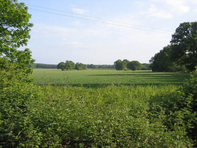
Waterloo Wood is a picturesque forest located in the county of Bedfordshire, England. Spanning over 100 acres, this woodland is a popular destination for nature enthusiasts and outdoor adventurers alike.
The wood is characterized by its diverse range of tree species, including oak, beech, and ash, which create a lush and vibrant landscape throughout the year. The forest floor is carpeted with a variety of wildflowers and ferns, adding to the beauty and tranquility of the surroundings.
The wood offers a network of well-maintained trails that wind through its enchanting terrain, making it a perfect spot for hiking, walking, and cycling. These paths are suitable for all levels of fitness, allowing visitors to explore the wood at their own pace and enjoy the peaceful ambiance.
Wildlife thrives in Waterloo Wood, with numerous species calling it home. Birdwatchers can spot a variety of birds, including woodpeckers, owls, and thrushes. Squirrels, rabbits, and deer can also be spotted among the trees, adding to the woodland's charm.
Waterloo Wood is not only a haven for nature enthusiasts but also serves as an important ecological site. The forest plays a crucial role in maintaining the local ecosystem, providing a habitat for diverse flora and fauna, and promoting biodiversity in the area.
For those seeking a tranquil escape from the hustle and bustle of everyday life, Waterloo Wood offers a serene retreat surrounded by the beauty of nature. Whether it is for a leisurely stroll, a family picnic, or wildlife observation, this woodland is a must-visit destination for anyone looking to reconnect with the natural world.
If you have any feedback on the listing, please let us know in the comments section below.
Waterloo Wood Images
Images are sourced within 2km of 52.117903/-0.23166076 or Grid Reference TL2148. Thanks to Geograph Open Source API. All images are credited.


Waterloo Wood is located at Grid Ref: TL2148 (Lat: 52.117903, Lng: -0.23166076)
Unitary Authority: Central Bedfordshire
Police Authority: Bedfordshire
What 3 Words
///emphasis.engrossed.february. Near Potton, Bedfordshire
Nearby Locations
Related Wikis

John O'Gaunt Golf Club
John O'Gaunt Golf Club is a golf club, located two-and-a-half miles to the north-east of Biggleswade, Bedfordshire, England, just north of the village...

Church of All Saints, Sutton, Bedfordshire
Church of All Saints is a Grade I listed church in Sutton, Bedfordshire, England. It became a listed building on 31 October 1966. == See also == Grade...
BigglesFM
BigglesFM is a local radio station based in Potton. It started broadcasting a full-time service on 22 April 2011.The station plays both modern and older...
Sutton, Bedfordshire
Sutton is a rural village and civil parish in the Central Bedfordshire district of Bedfordshire, England. It lies 11 miles (18 km) east of Bedford. At...
Potton United F.C.
Potton United F.C. is an English football club based in Potton, Bedfordshire. The club are currently members of the Spartan South Midlands League Premier...
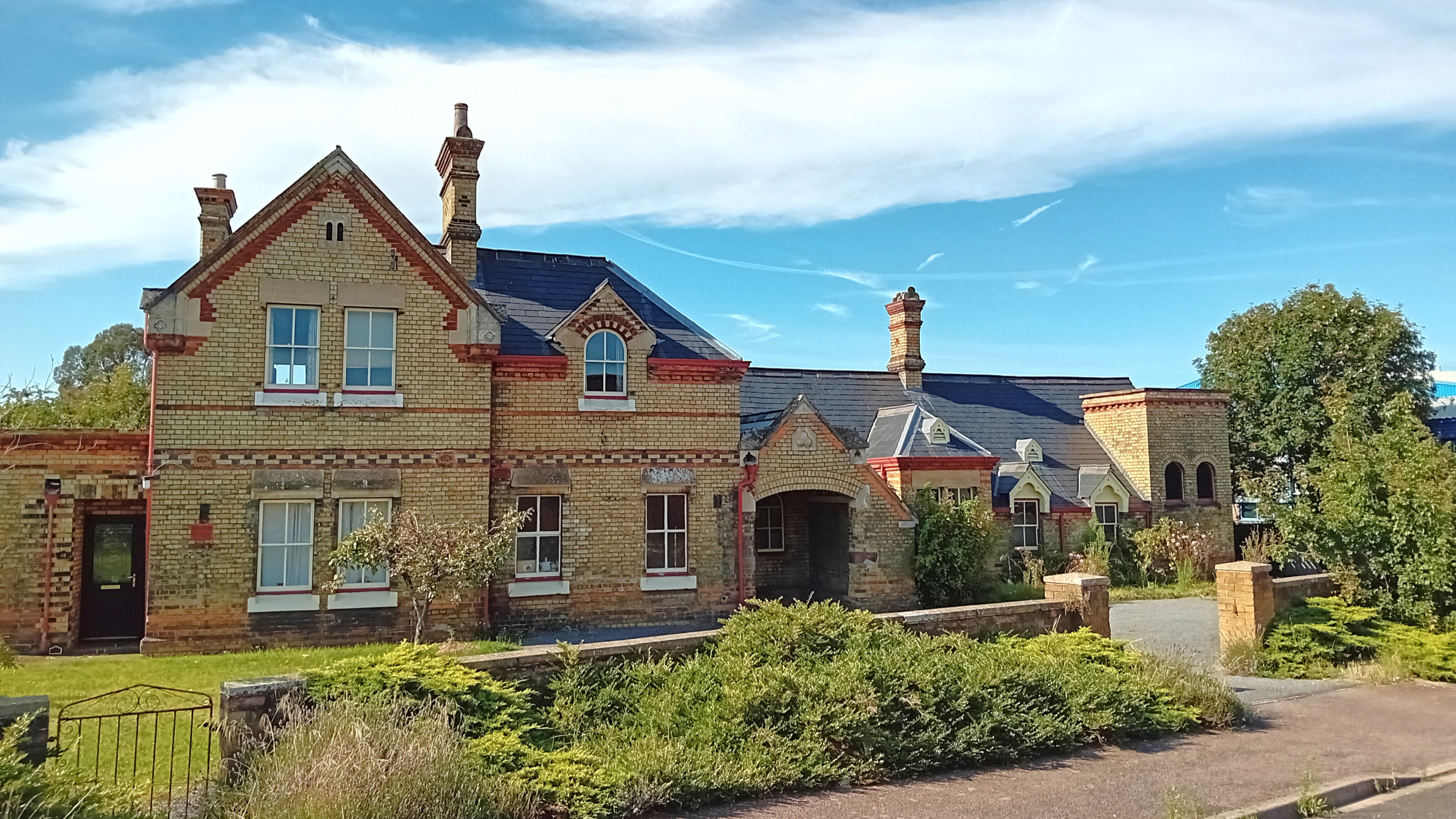
Potton railway station
Potton was a railway station on the Varsity Line which served the small town of the same name in Bedfordshire. Opened in 1857 as part of Sir William Peel...

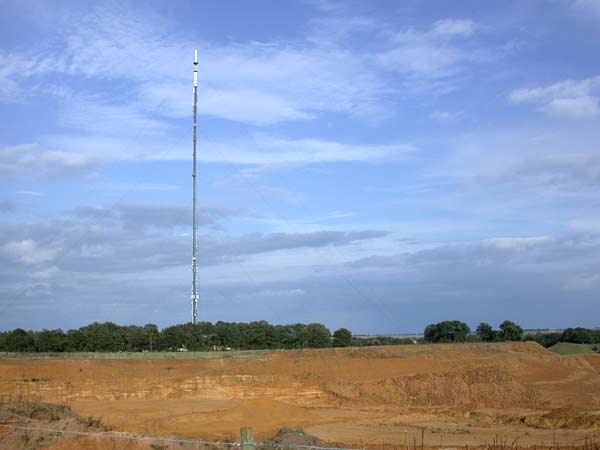
Sandy Heath transmitting station
Sandy Heath transmitting station is a television and radio broadcasting station in England, located between Sandy, Bedfordshire and Potton near the B1042...
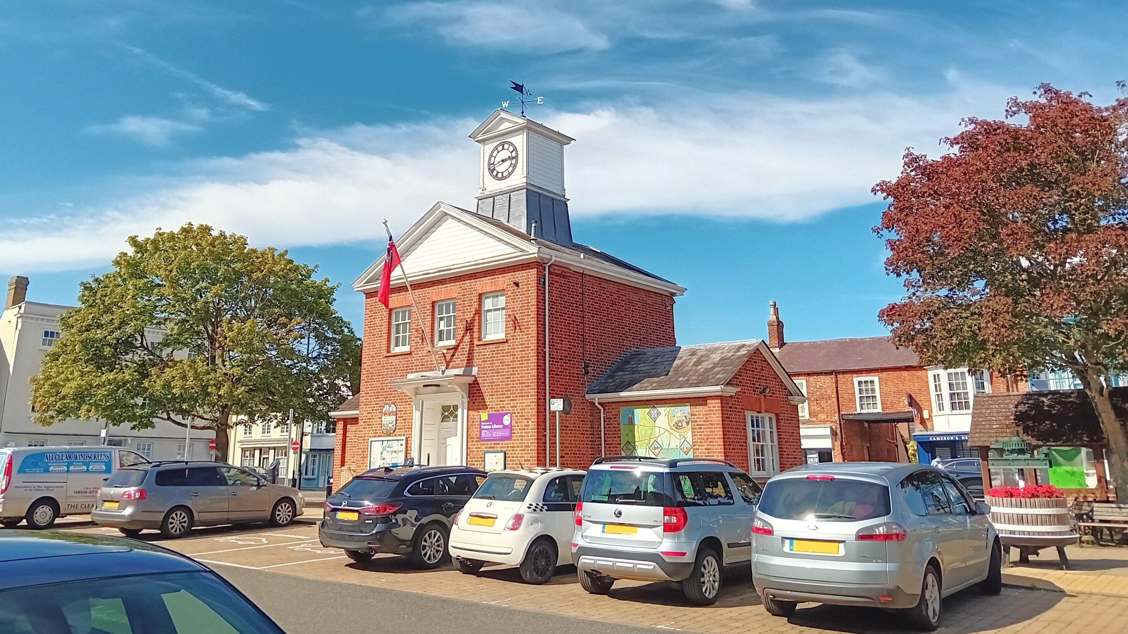
Potton
Potton is a town and civil parish in the Central Bedfordshire district of Bedfordshire, England, about 10 miles (16 km) east of the county town Bedford...
Nearby Amenities
Located within 500m of 52.117903,-0.23166076Have you been to Waterloo Wood?
Leave your review of Waterloo Wood below (or comments, questions and feedback).