Six Acre Plantation

Wood, Forest in Lincolnshire East Lindsey

England

Six Acre Plantation

Brickyard Farm and A 157 west of Baumber: aerial 2022
Brickyard Farm and A 157 west of Baumber: aerial 2022 Credit: Chris

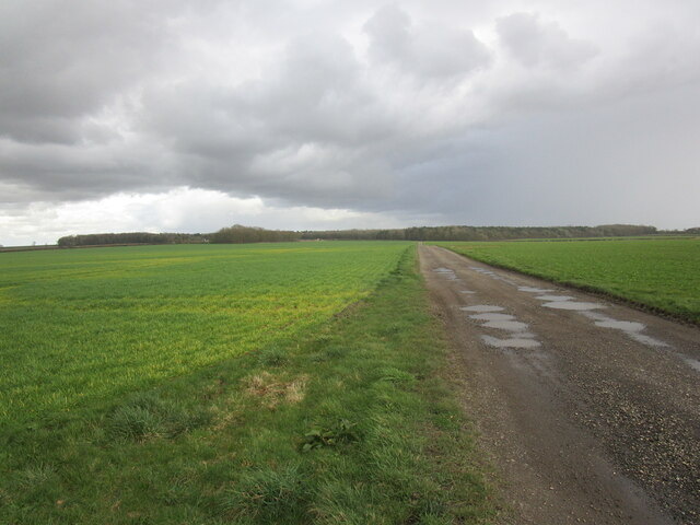
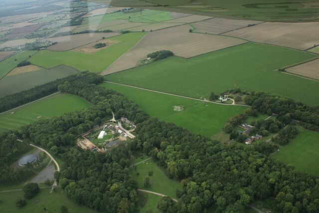
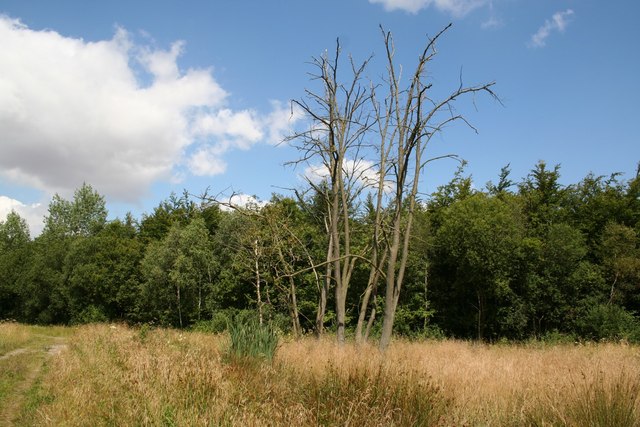
Six Acre Plantation is a picturesque woodland located in Lincolnshire, England. Situated in the heart of the countryside, this stunning forest covers an area of approximately six acres, hence its name. The plantation is known for its dense foliage, diverse wildlife, and tranquil atmosphere.

The woodland is predominantly made up of native trees such as oak, beech, and birch, which create a beautiful canopy that provides shade and shelter to the flora and fauna that call this area home. The forest floor is covered in a lush carpet of ferns, mosses, and wildflowers, adding to its natural charm.

Six Acre Plantation is a haven for wildlife enthusiasts, offering a sanctuary for a wide variety of animals and birds. Visitors may spot deer, squirrels, rabbits, and numerous species of birds, including woodpeckers and owls, among the trees. The plantation is also home to a rich insect population, with butterflies, dragonflies, and bees commonly seen throughout the seasons.

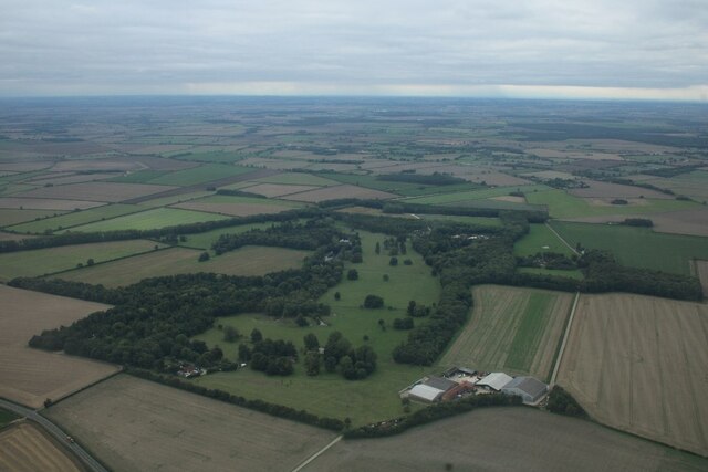
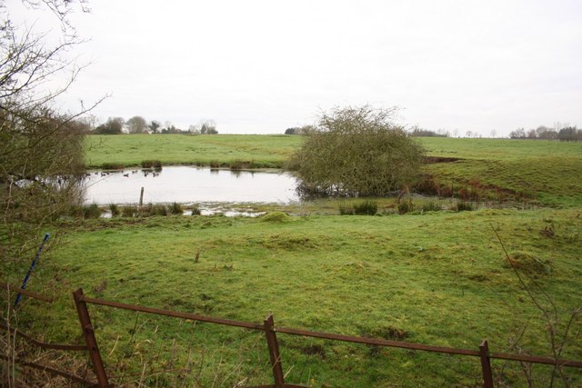
For those seeking a peaceful retreat, Six Acre Plantation provides an ideal escape from the hustle and bustle of daily life. The woodland offers tranquil walking paths, allowing visitors to immerse themselves in the beauty of nature. The sounds of rustling leaves and birdsong create a calming ambience, making it the perfect place for a leisurely stroll or a moment of reflection.

Overall, Six Acre Plantation in Lincolnshire is a stunning woodland that showcases the natural beauty of the region. Its diverse flora and fauna, along with its serene atmosphere, make it a must-visit destination for nature lovers and those seeking a peaceful respite in the heart of the countryside.

If you have any feedback on the listing, please let us know in the comments section below.

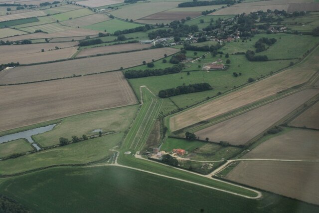
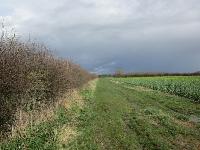
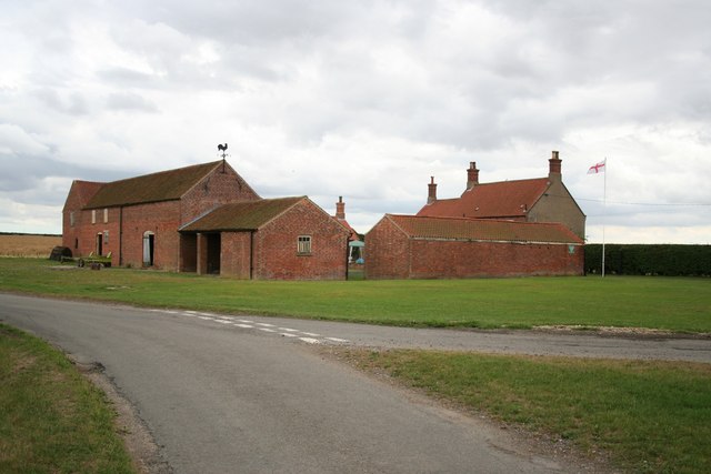
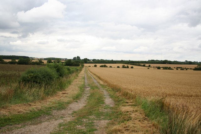
Six Acre Plantation Images

Images are sourced within 2km of 53.26574/-0.18701405 or Grid Reference TF2175. Thanks to Geograph Open Source API. All images are credited.

Brickyard Farm and A 157 west of Baumber: aerial 2022
Track to Stourton
Track to Stourton
Little Stourton Old Hall: aerial 2022 (1) Stourton Old Hall represents the extinct village of Little Stourton. It is the fragmentary ruin of a country house, dating to the 16th century with 18th century alterations. The house was deserted by 1810 when the Livesey family bought the Estate and built the new Hall in Stourton Park.

See <span class="nowrap"><a title="https://www.heritagegateway.org.uk/Gateway/Results_Single.aspx?uid=MLI40286&resourceID=1006" rel="nofollow ugc noopener" href="https://www.heritagegateway.org.uk/Gateway/Results_Single.aspx?uid=MLI40286&resourceID=1006">Link</a><img style="margin-left:2px;" alt="External link" title="External link - shift click to open in new window" src="https://s1.geograph.org.uk/img/external.png" width="10" height="10"/></span> and
<span class="nowrap"><a title="https://www.heritagegateway.org.uk/Gateway/Results_Single.aspx?uid=1359926&resourceID=5" rel="nofollow ugc noopener" href="https://www.heritagegateway.org.uk/Gateway/Results_Single.aspx?uid=1359926&resourceID=5">Link</a><img style="margin-left:2px;" alt="External link" title="External link - shift click to open in new window" src="https://s1.geograph.org.uk/img/external.png" width="10" height="10"/></span>
Little Stourton Old Hall: aerial 2022 (1)
Stourton Old Hall represents the extinct village of Little Stourton. It is the fragmentary ruin of a country house, dating to the 16th century with 18th century alterations. The house was deserted by 1810 when the Livesey family bought the Estate and built the new Hall in Stourton Park. See LinkExternal link and LinkExternal link
Little Stourton Old Hall: aerial 2022 (2) Stourton Old Hall represents the extinct village of Little Stourton. It is the fragmentary ruin of a country house, dating to the 16th century with 18th century alterations. The house was deserted by 1810 when the Livesey family bought the Estate and built the new Hall in Stourton Park.

See <span class="nowrap"><a title="https://www.heritagegateway.org.uk/Gateway/Results_Single.aspx?uid=MLI40286&resourceID=1006" rel="nofollow ugc noopener" href="https://www.heritagegateway.org.uk/Gateway/Results_Single.aspx?uid=MLI40286&resourceID=1006">Link</a><img style="margin-left:2px;" alt="External link" title="External link - shift click to open in new window" src="https://s1.geograph.org.uk/img/external.png" width="10" height="10"/></span> and
<span class="nowrap"><a title="https://www.heritagegateway.org.uk/Gateway/Results_Single.aspx?uid=1359926&resourceID=5" rel="nofollow ugc noopener" href="https://www.heritagegateway.org.uk/Gateway/Results_Single.aspx?uid=1359926&resourceID=5">Link</a><img style="margin-left:2px;" alt="External link" title="External link - shift click to open in new window" src="https://s1.geograph.org.uk/img/external.png" width="10" height="10"/></span>
Little Stourton Old Hall: aerial 2022 (2)
Stourton Old Hall represents the extinct village of Little Stourton. It is the fragmentary ruin of a country house, dating to the 16th century with 18th century alterations. The house was deserted by 1810 when the Livesey family bought the Estate and built the new Hall in Stourton Park. See LinkExternal link and LinkExternal link
Garden House on the Stourton Estate: aerial 2022 (1)
Garden House on the Stourton Estate: aerial 2022 (2)
Fields east of Stourton Wood: aerial 2022
Part of the Stourton Estate: aerial 2022
Watermill Farm, Hemingby: aerial 2022 (1)
Watermill Farm, Hemingby: aerial 2022 (2)
Field edge and oilseed rape near Hungram Farm
Deserted Hamlet of Lowthorpe near Great Sturton: aerial 2023 (1) See: <span class="nowrap"><a title="https://www.heritagegateway.org.uk/Gateway/Results_Single.aspx?uid=MLI40309&resourceID=1006" rel="nofollow ugc noopener" href="https://www.heritagegateway.org.uk/Gateway/Results_Single.aspx?uid=MLI40309&resourceID=1006">Link</a><img style="margin-left:2px;" alt="External link" title="External link - shift click to open in new window" src="https://s1.geograph.org.uk/img/external.png" width="10" height="10"/></span>
Deserted Hamlet of Lowthorpe near Great Sturton: aerial 2023 (1)
See: LinkExternal link
Deserted hamlet of Lowthorpe near Great Sturton: aerial 2023 (2)
Corner Farm Marked Sturton Harden on some old maps
Corner Farm
Marked Sturton Harden on some old maps
Bridleway to Wass Lane To Wass Lane via Moor Farm
Bridleway to Wass Lane
To Wass Lane via Moor Farm
Hungram Gorse Looking south on the green lane at Hungram Gorse, the parish boundary between Baumber and Minting
Hungram Gorse
Looking south on the green lane at Hungram Gorse, the parish boundary between Baumber and Minting
Hungram Lane Looking north at Hungram Gorse
Hungram Lane
Looking north at Hungram Gorse
Cock of Corner Farm Curious cockerel and his brood.
Cock of Corner Farm
Curious cockerel and his brood.
Show me another place!

Six Acre Plantation is located at Grid Ref: TF2175 (Lat: 53.26574, Lng: -0.18701405)

Administrative County: Lincolnshire

District: East Lindsey

Police Authority: Lincolnshire

What 3 Words

///tilts.magpie.legwork. Near Wragby, Lincolnshire

Related Wikis

Hanby Hall

Hanby Hall is a Grade II* listed early 18th-century building in Alford, Lincolnshire. Hanby Hall was built by John Andrews. It is situated opposite St...

Great Sturton

Great Sturton is a hamlet and civil parish in the East Lindsey district of Lincolnshire, England. It is situated approximately 7 miles (11 km) from the...

Baumber

Baumber ( BAWM-bər) is a village and civil parish in the East Lindsey district of Lincolnshire, England. It is situated approximately 4 miles (6 km) north...

Sotby

Sotby is a village and civil parish in the East Lindsey district of Lincolnshire, England. It is situated 15 miles (24 km) north-east from the city and...

Hemingby

Hemingby is a dispersed village and civil parish in the East Lindsey district of Lincolnshire, England. It is situated approximately 3 miles (5 km) north...

Minting

Minting is a village and civil parish in the East Lindsey district of Lincolnshire, England. The village is situated 1 mile (1.6 km) south from the A158...

Hatton, Lincolnshire

Hatton is a small village and civil parish in the East Lindsey district of Lincolnshire, England. It is situated 3 miles (5 km) east of the town of Wragby...

Minting Priory

Minting Priory was a priory in Minting, Lincolnshire, England. The priory for Benedictine monks was founded by Ranulf de Meschines, earl of Chester, to...

Nearby Amenities

Located within 500m of 53.26574,-0.18701405
Power: pole
Lat/Long: 53.2701866/-0.1869883
Power: pole
Source: Bing
Lat/Long: 53.265558/-0.1804785
Power: pole
Lat/Long: 53.2664268/-0.1803007
Power: pole
Lat/Long: 53.2673375/-0.1800941
Home Farm
Historic Place: farm
Source: Bing
Lat/Long: 53.2637348/-0.1878287
Garden House
Place: isolated_dwelling
Source: Bing
Lat/Long: 53.2620748/-0.1904549
Garth House
Place: isolated_dwelling
Source: Bing
Lat/Long: 53.2643208/-0.1902789
Stourton Home Farm
Place: farm
Source: Bing
Lat/Long: 53.2637914/-0.1875951
The data included in this document is from www.openstreetmap.org. The data is made available under ODbL.

Have you been to Six Acre Plantation?

Leave your review of Six Acre Plantation below (or comments, questions and feedback).