Old Rough Wood

Wood, Forest in Sussex Horsham

England

Old Rough Wood

Pot Common Potcommon Furzefield to the left, Soil Wood to the right. Taken from the bridleway.
Pot Common Credit: Simon Carey

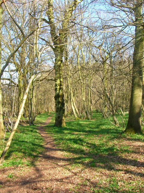
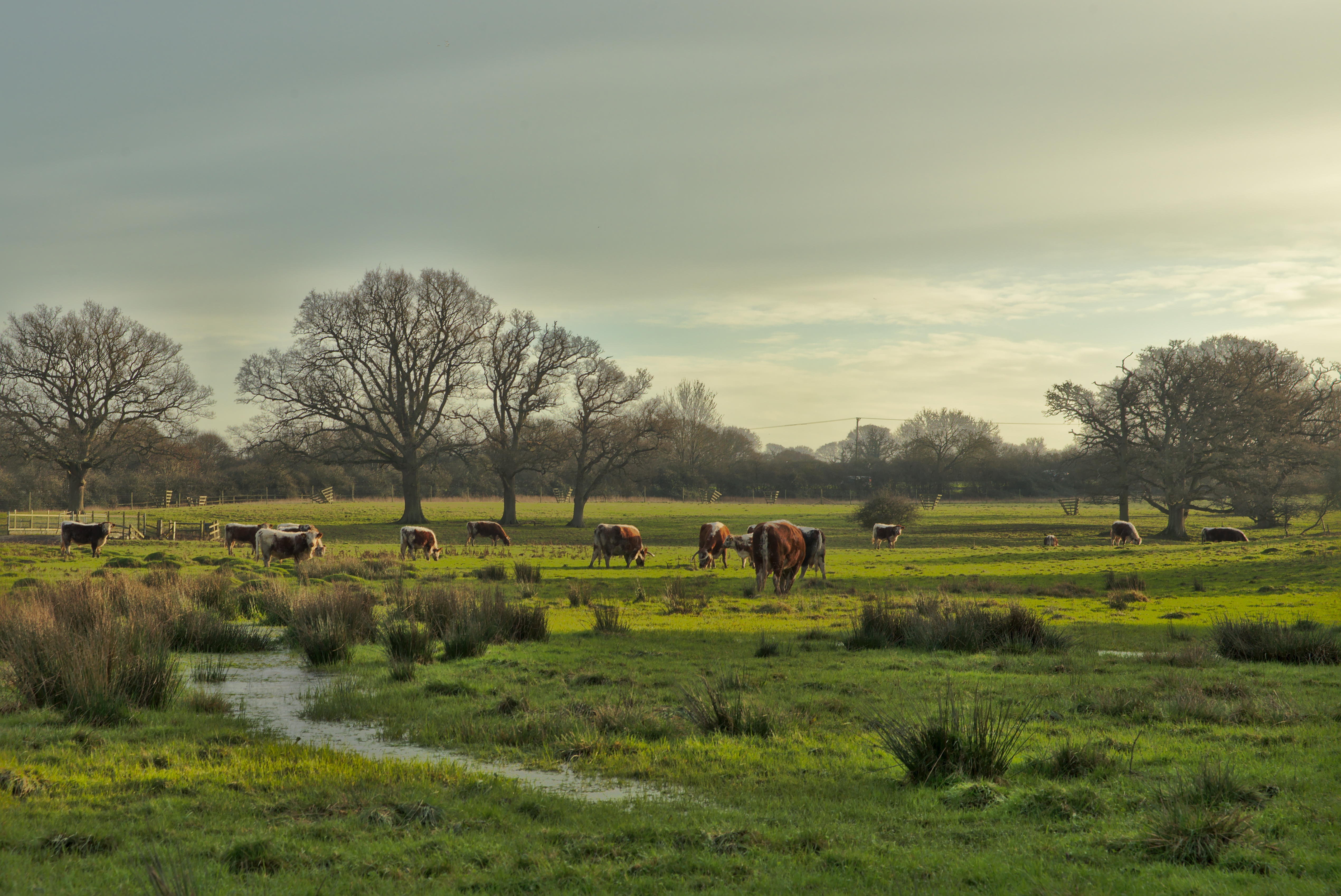
Old Rough Wood is a charming forest located in the county of Sussex, England. Known for its picturesque beauty and rich biodiversity, this woodland is a haven for nature enthusiasts and hikers alike. Covering an area of approximately 500 acres, Old Rough Wood offers a peaceful and serene escape from the bustle of everyday life.

The forest is characterized by its dense canopy of ancient oak and beech trees, which provide a sheltered habitat for a wide variety of flora and fauna. The woodland floor is carpeted with a diverse range of wildflowers, including bluebells, primroses, and wood anemones, creating a vibrant and colorful landscape during the spring months.

Wandering through Old Rough Wood, visitors can expect to encounter an array of wildlife. The forest is home to numerous species of birds, such as woodpeckers, owls, and warblers, whose melodious songs can be heard throughout the day. In addition, the wood is inhabited by mammals like deer, foxes, and badgers, which can sometimes be spotted during early morning or late evening walks.

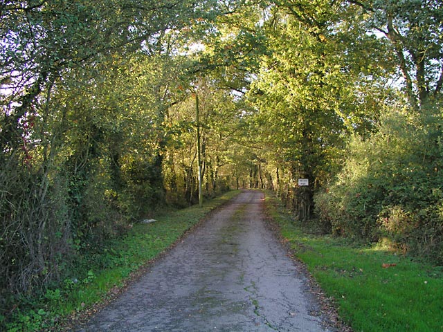
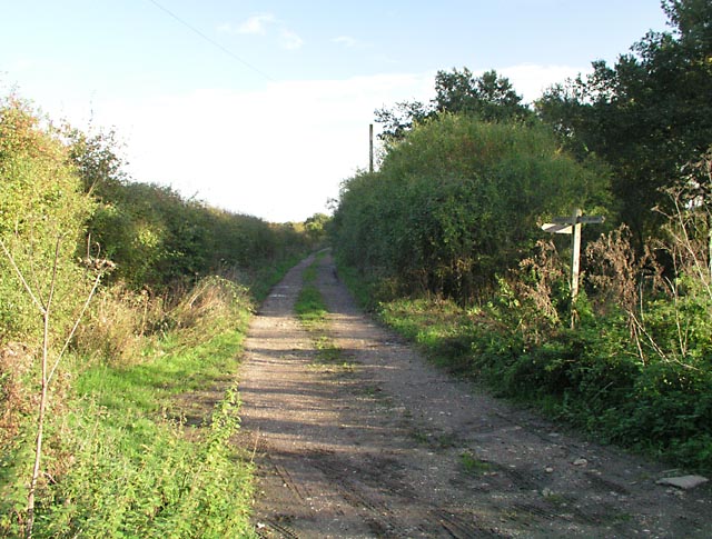
The forest offers a network of well-maintained trails and footpaths, making it an ideal destination for walking, jogging, and cycling. The paths meander through the wood, leading visitors to hidden glades, babbling streams, and tranquil ponds. There are also designated picnic areas where visitors can pause and enjoy a packed lunch amidst the serenity of nature.

Old Rough Wood, Sussex, with its ancient trees, vibrant wildflowers, and diverse wildlife, is a true gem of natural beauty. Whether seeking solace or adventure, this enchanting forest provides an idyllic setting for anyone eager to explore the wonders of the natural world.

If you have any feedback on the listing, please let us know in the comments section below.

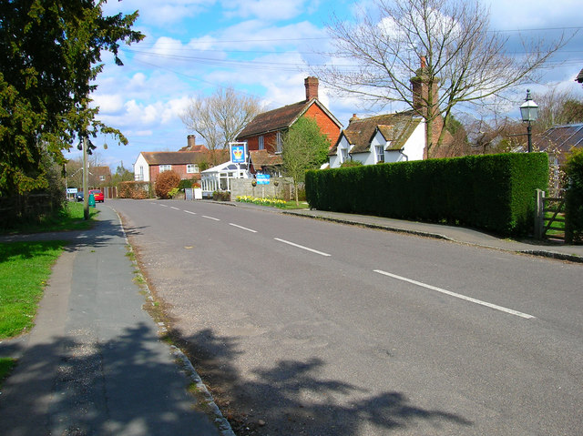
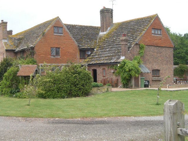
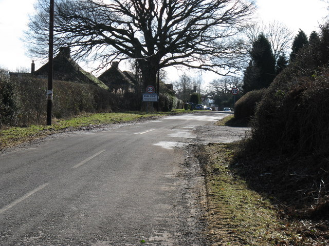
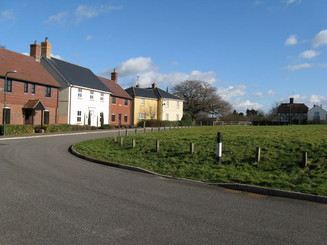
Old Rough Wood Images

Images are sourced within 2km of 50.967607/-0.35205012 or Grid Reference TQ1519. Thanks to Geograph Open Source API. All images are credited.

Pot Common Potcommon Furzefield to the left, Soil Wood to the right. Taken from the bridleway.
Pot Common
Potcommon Furzefield to the left, Soil Wood to the right. Taken from the bridleway.
Entrance to Whitefoots Wheelie bin standing guard. This is the point where the bridleway turns shapely west.
Entrance to Whitefoots
Wheelie bin standing guard. This is the point where the bridleway turns shapely west.
Jasmine Cottage, Rookcross Lane Situated at the junction of the lane with the entrance to Rooklands Farm.
Jasmine Cottage, Rookcross Lane
Situated at the junction of the lane with the entrance to Rooklands Farm.
Worthing Road, Dial Post Hard to believe that the A24 used to thunder through this village until the 1980s. Now all is quiet and serene. Dial Post is a hamlet within the parish of West Grinstead and grew in size from the eighteenth century onwards. The in is The Crown.
Worthing Road, Dial Post
Hard to believe that the A24 used to thunder through this village until the 1980s. Now all is quiet and serene. Dial Post is a hamlet within the parish of West Grinstead and grew in size from the eighteenth century onwards. The in is The Crown.
Grinders Wood Taken from the footpath that links Thistleworth Farm with Buckells Farm.
Grinders Wood
Taken from the footpath that links Thistleworth Farm with Buckells Farm.
Entrance to Perrylands Seen from the A24.
Entrance to Perrylands
Seen from the A24.
Junction of Bridleway 1886/1 and Footpath 1886/2 On Benton's Lane near Wickwood Cottage.
Junction of Bridleway 1886/1 and Footpath 1886/2
On Benton's Lane near Wickwood Cottage.
Pond at Hatterell's farm Hatterell farm has now gone and has been ploughed under (see Old Maps <span class="nowrap"><a title="http://www.old-maps.co.uk/" rel="nofollow ugc noopener" href="http://www.old-maps.co.uk/">Link</a><img style="margin-left:2px;" alt="External link" title="External link - shift click to open in new window" src="https://s1.geograph.org.uk/img/external.png" width="10" height="10"/></span> for an 1879 OS map) but its pond survives (but for how long?).
Pond at Hatterell's farm
Hatterell farm has now gone and has been ploughed under (see Old Maps LinkExternal link for an 1879 OS map) but its pond survives (but for how long?).
Clothall's Farmhouse Clothalls is on a moated site with the southern (right) representing the earliest portion.  A three-bay hall and northern cross-wing being added in the  C15.
Clothall is a small parish in Hertfordshire and a family from there seems to have made its way to Sussex.  Adam de Clothale married into the 'de Grensted' family about 1270.  The last, Richard de Clothale, died in 1454.
'Wealden Buildings' Editor John Warren.  Coach Publishing, Horsham 1990.  ISBN 0 902608 06 1
'The Victoria County History' A History of the County of Sussex: Volume 6 Part 2
Bramber Rape (North-Western Part) including Horsham
Clothall's Farmhouse
Clothalls is on a moated site with the southern (right) representing the earliest portion. A three-bay hall and northern cross-wing being added in the C15. Clothall is a small parish in Hertfordshire and a family from there seems to have made its way to Sussex. Adam de Clothale married into the 'de Grensted' family about 1270. The last, Richard de Clothale, died in 1454. 'Wealden Buildings' Editor John Warren. Coach Publishing, Horsham 1990. ISBN 0 902608 06 1 'The Victoria County History' A History of the County of Sussex: Volume 6 Part 2 Bramber Rape (North-Western Part) including Horsham
River Adur looking north from Hatterell bridge This section of the river Adur was part of the Baybridge canal which ran for 3.5 miles from Pike's brook, near Knepp castle, to Locks farm.  From Locks farm, as the Adur Navigation, the river ran to the sea at Shoreham.
See <span class="nowrap"><a title="http://www.sussex.co.uk/waterways/baybridge.htm" rel="nofollow ugc noopener" href="http://www.sussex.co.uk/waterways/baybridge.htm">Link</a><img style="margin-left:2px;" alt="External link" title="External link - shift click to open in new window" src="https://s1.geograph.org.uk/img/external.png" width="10" height="10"/></span>
for just a little more.
The canal had closed by 1875 due to competition from the Horsham to Shoreham railway.
River Adur looking north from Hatterell bridge
This section of the river Adur was part of the Baybridge canal which ran for 3.5 miles from Pike's brook, near Knepp castle, to Locks farm. From Locks farm, as the Adur Navigation, the river ran to the sea at Shoreham. See LinkExternal link for just a little more. The canal had closed by 1875 due to competition from the Horsham to Shoreham railway.
Bentons Place Farm, Shipley Note the fine Horsham stone roof.
There was once a manor of Bentons which also included nearby 'Blonks' - farm and cottage.
Bentons Place Farm, Shipley
Note the fine Horsham stone roof. There was once a manor of Bentons which also included nearby 'Blonks' - farm and cottage.
Farmland near the River Adur The line of reeds in the foreground mark the course of the river.
Farmland near the River Adur
The line of reeds in the foreground mark the course of the river.
River Adur Taken from Hatterell's Bridge. The river was straightened and made navigable in 1825 as far as the wharf at Bay Bridge and saw regular barges travelling the waterway until the opening of the Horsham-Shoreham railway in 1861 ruined it. The company operating it ceased to function in 1875 though some traffic remained until the 1890s.
River Adur
Taken from Hatterell's Bridge. The river was straightened and made navigable in 1825 as far as the wharf at Bay Bridge and saw regular barges travelling the waterway until the opening of the Horsham-Shoreham railway in 1861 ruined it. The company operating it ceased to function in 1875 though some traffic remained until the 1890s.
Bridleway to Clothalls Farm Linking the farm with Jolesfield Common via Haterells Bridge.
Bridleway to Clothalls Farm
Linking the farm with Jolesfield Common via Haterells Bridge.
Clothalls Farm Former manor house largely dating from the 17th century but incorporating parts as early as the 14th century. The former moat lies beyond the farm house obscured by bushes.
Clothalls Farm
Former manor house largely dating from the 17th century but incorporating parts as early as the 14th century. The former moat lies beyond the farm house obscured by bushes.
River Adur North of Hatterell Bridge with low flying helicopter to the right which had flown southwards to probably Locks Farm landed then left heading north again.
River Adur
North of Hatterell Bridge with low flying helicopter to the right which had flown southwards to probably Locks Farm landed then left heading north again.
Approaching Dial Post from the north Many years ago this was the main A24 which now runs to the east of the village
Approaching Dial Post from the north
Many years ago this was the main A24 which now runs to the east of the village
The Green at Dial Post Incidentally the road is called The Green
The Green at Dial Post
Incidentally the road is called The Green
Show me another place!

Old Rough Wood is located at Grid Ref: TQ1519 (Lat: 50.967607, Lng: -0.35205012)

Administrative County: West Sussex

District: Horsham

Police Authority: Sussex

What 3 Words

///soothing.gets.prevented. Near Partridge Green, West Sussex

Nearby Locations

Old Rough Wood Dial Post

Related Wikis

Dial Post

Dial Post is a village in the Horsham District of West Sussex, England. The civil parish, where the lowest level political meetings are held, is West Grinstead...

Knepp Castle

The medieval Knepp Castle (sometimes referred to as 'Old Knepp Castle', to distinguish it from the nearby 19th-century mansion) is to the west of the village...

Knepp Wildland

Knepp Wildland is the first major lowland rewilding project in England. It comprises 1,400 hectares (3,500 acres; 5.4 square miles) of former arable and...

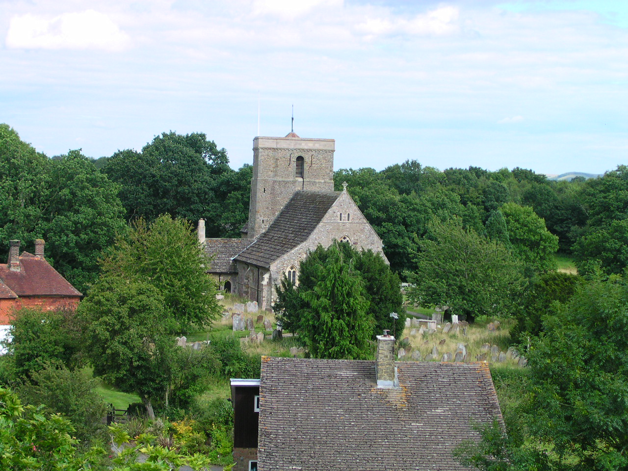
St George's Church, West Grinstead

St George's Church is an Anglican church in West Grinstead, West Sussex, England. It is in the Diocese of Chichester, occupying a rural position in the...

West Grinstead

West Grinstead is a village and civil parish in the Horsham District of West Sussex, England. It lies just off the B2135 road four miles (6.3 km) northwest...

Shrine of Our Lady of Consolation

The Shrine of Our Lady of Consolation or Church of Our Lady of Consolation and Saint Francis is a Roman Catholic parish church in West Grinstead, in West...

St Mary's Church, Shipley

The Church of St Mary the Virgin is an Anglican church in the village of Shipley, in West Sussex, England. It is in the Diocese of Chichester. Built in...

Shipley, West Sussex

Shipley is a village and civil parish in the Horsham District of West Sussex, England. It lies just off the A272 road 6 miles (10 kilometres) north-east...

Nearby Amenities

Located within 500m of 50.967607,-0.35205012
Swallows Farm
Naptan AtcoCode: 4400HR0845
Naptan Bearing: NE
Naptan BusStopType: CUS
Naptan CommonName: Swallows Farm
Naptan Indicator: opp
Naptan Landmark: Hail & Ride
Naptan NaptanCode: wsxdwmtm
Naptan Street: Swallows Lane
Naptan Verified: no
Source: naptan_import
Lat/Long: 50.9688983/-0.3557805
Swallows Farm
Naptan AtcoCode: 4400HR0846
Naptan Bearing: SW
Naptan BusStopType: CUS
Naptan CommonName: Swallows Farm
Naptan Indicator: adj
Naptan Landmark: Hail & Ride
Naptan NaptanCode: wsxdwmtp
Naptan Street: Swallows Lane
Naptan Verified: no
Source: naptan_import
Lat/Long: 50.968911/-0.3555904
A24
Naptan AtcoCode: 4400HR1108
Naptan Bearing: N
Naptan BusStopType: CUS
Naptan CommonName: A24
Naptan Indicator: HAR
Naptan Landmark: Hail & Ride
Naptan NaptanCode: wsxdtgjg
Naptan Street: A24
Naptan Verified: no
Source: naptan_import
Lat/Long: 50.9699405/-0.3478561
Power: pole
Lat/Long: 50.9639123/-0.355797
Power: pole
Lat/Long: 50.9714476/-0.3494254
Power: pole
Lat/Long: 50.9714706/-0.3510664
Power: pole
Lat/Long: 50.9714783/-0.3522542
Power: pole
Lat/Long: 50.9715196/-0.3547274
Power: pole
Lat/Long: 50.9715376/-0.3554062
Barrier: height_restrictor
Maxheight: 2.1
Lat/Long: 50.9657808/-0.3563315
Barrier: cattle_grid
Lat/Long: 50.9658636/-0.3566483
The data included in this document is from www.openstreetmap.org. The data is made available under ODbL.

Have you been to Old Rough Wood?

Leave your review of Old Rough Wood below (or comments, questions and feedback).