Well Wood

Wood, Forest in Hertfordshire St. Albans

England

Well Wood

The Green Man, Sandridge
The Green Man, Sandridge Credit: David Howard

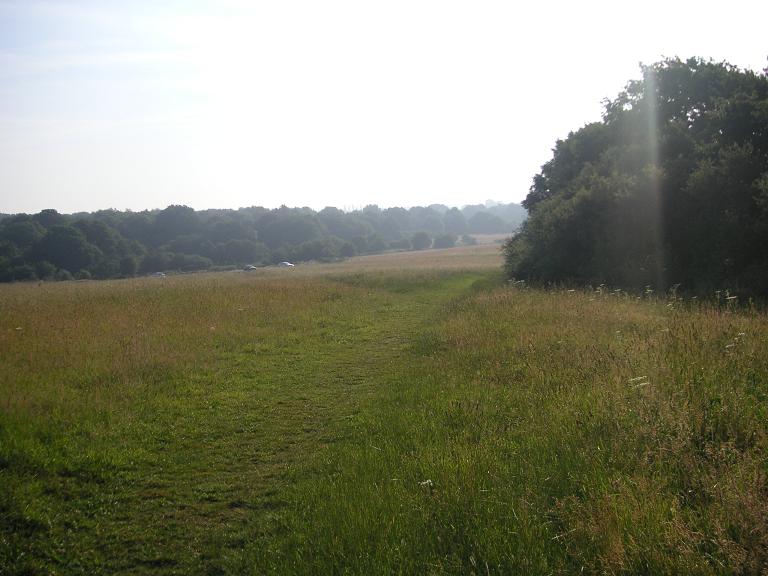
Well Wood is a picturesque woodland located in the county of Hertfordshire, England. It is situated in the eastern part of the county, near the town of Welwyn Garden City. Covering an area of approximately 200 acres, this ancient forest is a haven for nature enthusiasts and hikers alike.

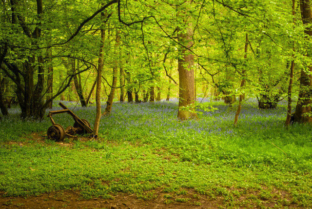
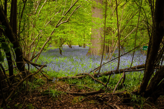
The woodland is predominantly composed of broadleaf trees, including oak, beech, and ash, which create a dense and verdant canopy. These trees provide ample shade during the summer months and a stunning display of colors during autumn. The forest floor is blanketed with a rich carpet of ferns, bluebells, and wildflowers, adding to its natural beauty.

Well Wood is crisscrossed by a network of well-maintained footpaths and trails, allowing visitors to explore its diverse terrain. The paths wind through the forest, leading to hidden clearings, babbling brooks, and serene ponds. This natural environment provides a sanctuary for a variety of wildlife, including deer, foxes, badgers, and numerous bird species.

The woodland is also home to a diverse range of plant and tree species, attracting botany enthusiasts and researchers. It has been designated as a Site of Special Scientific Interest (SSSI) due to its ecological significance and the presence of rare plant species. To protect its delicate ecosystem, the wood is managed by local authorities in collaboration with environmental organizations.

Well Wood offers a tranquil escape from the hustle and bustle of urban life, providing visitors with an opportunity to connect with nature and enjoy the peaceful surroundings. With its enchanting beauty and ecological importance, this ancient forest is truly a gem in the heart of Hertfordshire.

If you have any feedback on the listing, please let us know in the comments section below.
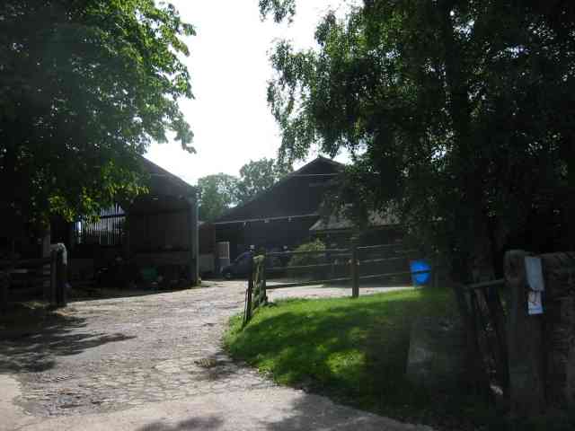
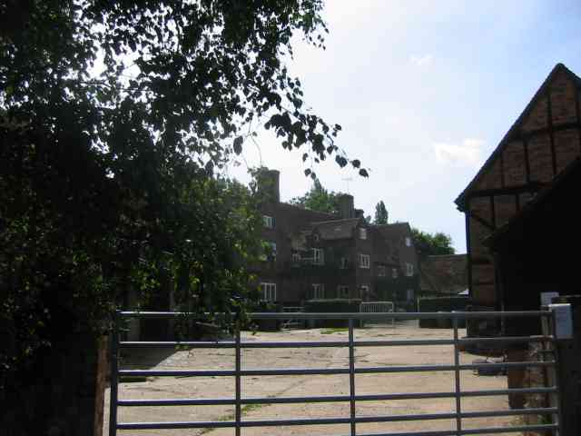
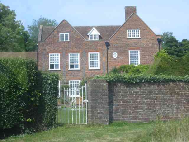
Well Wood Images

Images are sourced within 2km of 51.789738/-0.32240332 or Grid Reference TL1511. Thanks to Geograph Open Source API. All images are credited.

The Green Man, Sandridge
High Street, Sandridge
Sandridge : Heartwood Forest
Sandridge : Heartwood Forest bluebells
Sandridge : "Green Man" public house
Sandridge : village shop Grade II listed - <span class="nowrap"><a title="https://historicengland.org.uk/listing/the-list/list-entry/1308275?section=official-list-entry" rel="nofollow ugc noopener" href="https://historicengland.org.uk/listing/the-list/list-entry/1308275?section=official-list-entry">Link</a><img style="margin-left:2px;" alt="External link" title="External link - shift click to open in new window" src="https://s1.geograph.org.uk/img/external.png" width="10" height="10"/></span>.
Sandridge : village shop
Grade II listed - LinkExternal link.
Sandridge : "Queens Head" public house Grade II listed - <span class="nowrap"><a title="https://historicengland.org.uk/listing/the-list/list-entry/1102874?section=official-list-entry" rel="nofollow ugc noopener" href="https://historicengland.org.uk/listing/the-list/list-entry/1102874?section=official-list-entry">Link</a><img style="margin-left:2px;" alt="External link" title="External link - shift click to open in new window" src="https://s1.geograph.org.uk/img/external.png" width="10" height="10"/></span>.
Sandridge : "Queens Head" public house
Grade II listed - LinkExternal link.
Sandridge : Queens Head and flag
Sandridge : Church of St Leonard Grade II* listed church : description at this <span class="nowrap"><a title="https://historicengland.org.uk/listing/the-list/list-entry/1308298?section=official-list-entry" rel="nofollow ugc noopener" href="https://historicengland.org.uk/listing/the-list/list-entry/1308298?section=official-list-entry">Link</a><img style="margin-left:2px;" alt="External link" title="External link - shift click to open in new window" src="https://s1.geograph.org.uk/img/external.png" width="10" height="10"/></span>.
Sandridge : Church of St Leonard
Grade II* listed church : description at this LinkExternal link.
Sandridge : lych-gate to Church of St Leonard "Built 1920, dedicated as a war memorial 1921" - <span class="nowrap"><a title="https://historicengland.org.uk/listing/the-list/list-entry/1102872?section=official-list-entry" rel="nofollow ugc noopener" href="https://historicengland.org.uk/listing/the-list/list-entry/1102872?section=official-list-entry">Link</a><img style="margin-left:2px;" alt="External link" title="External link - shift click to open in new window" src="https://s1.geograph.org.uk/img/external.png" width="10" height="10"/></span>.
Sandridge : lych-gate to Church of St Leonard
"Built 1920, dedicated as a war memorial 1921" - LinkExternal link.
St Leonard's church, Sandridge Looking East from TL171106 to St Leonard's church (with a steeple).
St Leonard's church, Sandridge
Looking East from TL171106 to St Leonard's church (with a steeple).
Entrance gates, Sandridgebury Entrance gate on the lane leading to Sandridgebury Farm, though not the entrance to the farm.
Entrance gates, Sandridgebury
Entrance gate on the lane leading to Sandridgebury Farm, though not the entrance to the farm.
Cross Farm  Harpenden There seemed to be a fair amount of pony riding activity in the yard. The sun always seems to be wrong hey ho.
Cross Farm Harpenden
There seemed to be a fair amount of pony riding activity in the yard. The sun always seems to be wrong hey ho.
The house at Cross Farm Harpenden This design seems to be Elizabethan
The house at Cross Farm Harpenden
This design seems to be Elizabethan
The Grove Harpenden It looks like some form of rest home but I'm not too sure.
The Grove Harpenden
It looks like some form of rest home but I'm not too sure.
West End Farm near Ayres End The farm buildings are a motley mix in all states of disrepair. There are builders in the yard
West End Farm near Ayres End
The farm buildings are a motley mix in all states of disrepair. There are builders in the yard
Cottages at Ayres End My mind is struggling with the concept of those huge structures as cottages
Cottages at Ayres End
My mind is struggling with the concept of those huge structures as cottages
Nomansland: Stubble field Viewed looking westwards, with Ferrers Lane to the right and Hillend Farm on the horizon.
Nomansland: Stubble field
Viewed looking westwards, with Ferrers Lane to the right and Hillend Farm on the horizon.
Show me another place!

Well Wood is located at Grid Ref: TL1511 (Lat: 51.789738, Lng: -0.32240332)

Administrative County: Hertfordshire

District: St. Albans

Police Authority: Hertfordshire

What 3 Words

///filer.makes.rising. Near Wheathampstead, Hertfordshire

Related Wikis

Heartwood Forest

Heartwood Forest is a planned forest (woodland creation site) in Hertfordshire, England. The site covers 347 hectares (860 acres), the largest continuous...

St Albans City and District

St Albans (), commonly known as the City and District of St Albans, is a local government district with city status in Hertfordshire, England. Its council...

Sandridge Rovers F.C.

Sandridge Rovers Football Club is an English football club based in Sandridge, Hertfordshire. They currently compete in the Herts County League Premier...

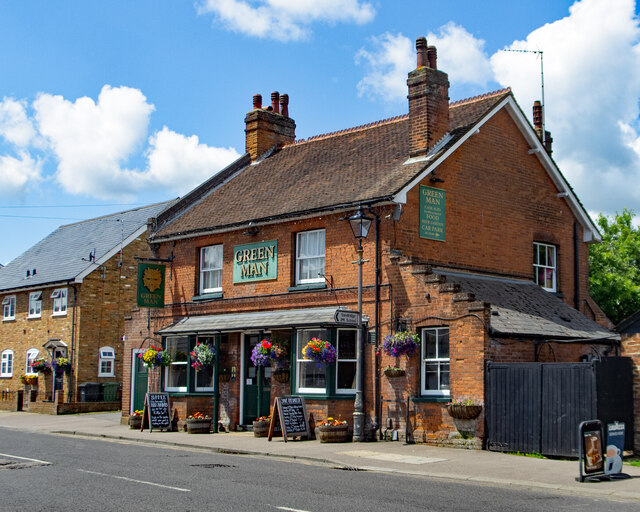
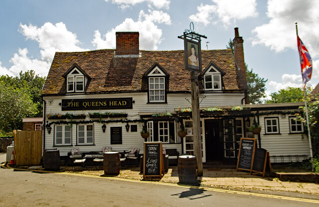
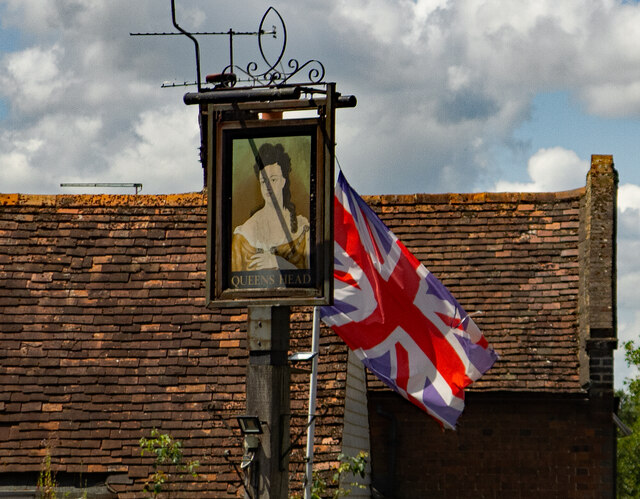
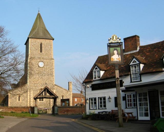
The Queen's Head, Sandridge

The Queens Head is a public house in the village of Sandridge to the north of St Albans, Hertfordshire, England. The timber framed building is weather...

Nomansland Common

Nomansland Common (sometimes simply called No Man's Land) is an area of common land in Hertfordshire, England to the south of Harpenden and the south-west...
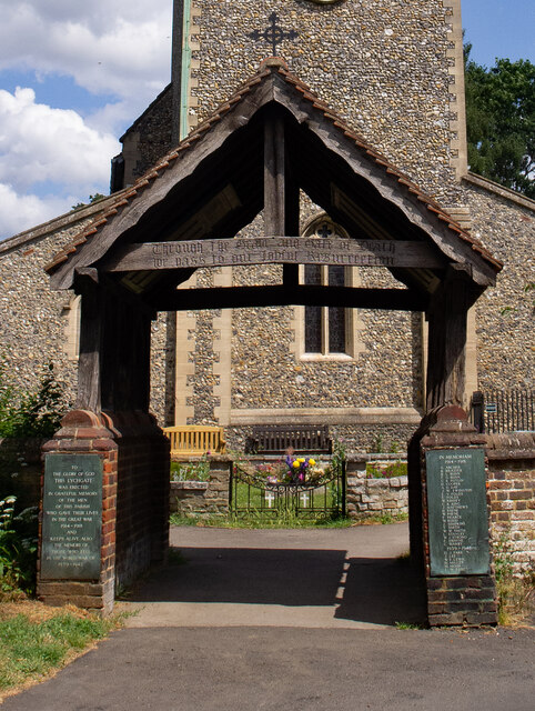
Sandridge Lychgate

Sandridge Lychgate is a war memorial in the village of Sandridge, Hertfordshire, England. The timber lychgate with its flanking walls is listed Grade II...

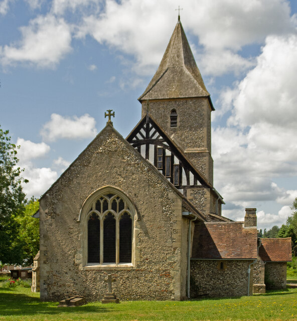
St Leonard's Church, Sandridge

St Leonard's Church is in Sandridge, a village in Hertfordshire, England. It is an active Anglican parish church. The building is Grade II* listed: notable...

Sandridge

Sandridge is a village and civil parish between the city centre of St Albans (2.5 miles (4.0 km) to the south-west) and Wheathampstead in Hertfordshire...

Nearby Amenities

Located within 500m of 51.789738,-0.32240332
The Magical Wood
Information: board
Tourism: information
Lat/Long: 51.7865681/-0.3175986
Source: GPS, Bing, observation
Tourism: picnic_site
Lat/Long: 51.7886339/-0.3180805
The data included in this document is from www.openstreetmap.org. The data is made available under ODbL.

Have you been to Well Wood?

Leave your review of Well Wood below (or comments, questions and feedback).