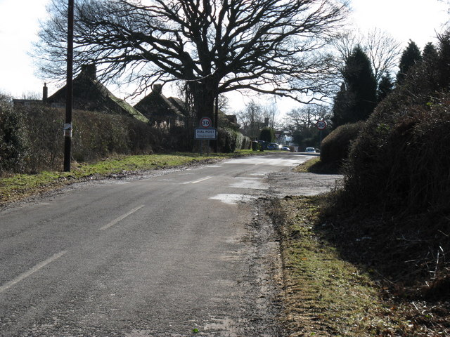
Dial Post

Settlement in Sussex Horsham

England

Dial Post

Pot Common Potcommon Furzefield to the left, Soil Wood to the right. Taken from the bridleway.
Pot Common Credit: Simon Carey

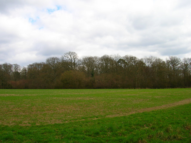
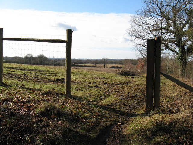
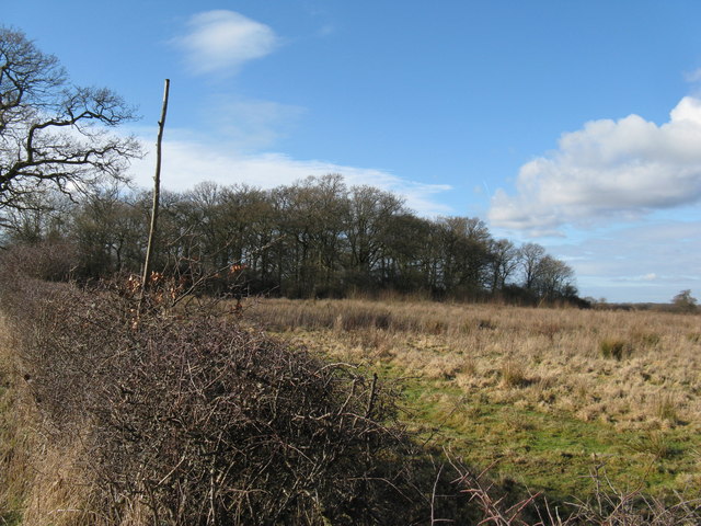
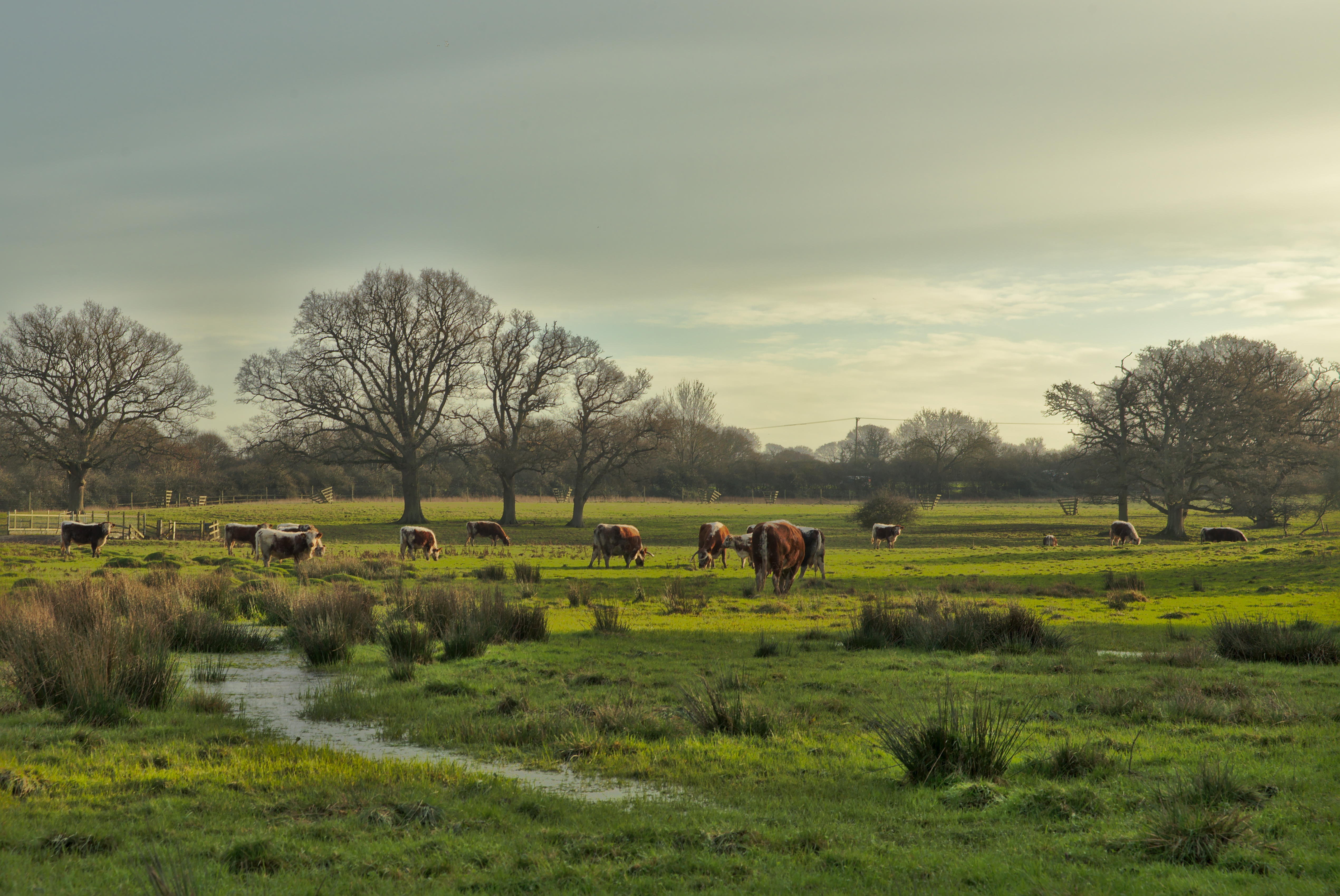
Dial Post is a small village located in the Horsham District of West Sussex, England. Situated approximately 50 miles south of London, it is nestled in the picturesque countryside of the South Downs National Park. With a population of just over 200 residents, Dial Post offers a peaceful and rural setting, making it an ideal place for those seeking tranquility away from the bustling city life.

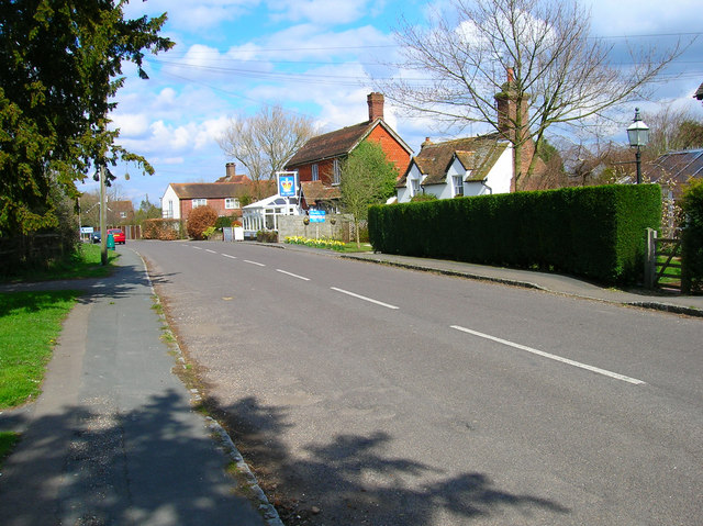
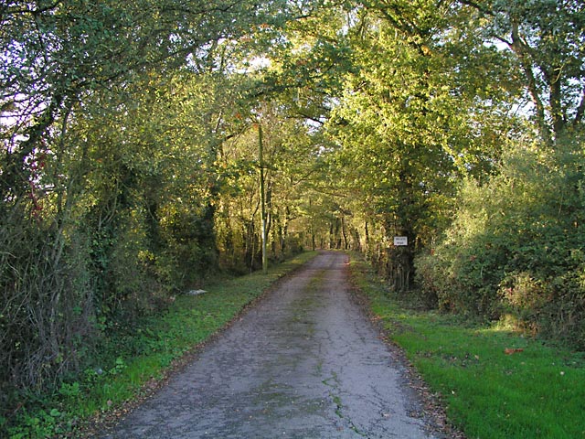
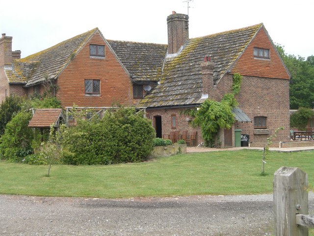
The village is known for its charming and traditional architecture, consisting mostly of quaint cottages and farmhouses. The surrounding area is predominantly agricultural, with vast fields and rolling hills that contribute to the village's idyllic atmosphere. The nearby Dial Post Cricket Club provides a popular recreational activity for both locals and visitors.

Despite its small size, Dial Post boasts a strong sense of community, with various events and activities organized throughout the year. The village pub, The Crown Inn, serves as a hub for social gatherings and provides a warm and welcoming atmosphere for residents and visitors alike.

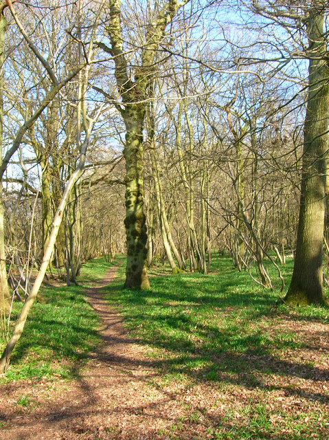
For those looking to explore the natural beauty of the area, Dial Post offers easy access to the South Downs Way, a long-distance footpath that provides stunning views of the surrounding countryside. Additionally, the nearby South Downs National Park offers countless opportunities for outdoor activities such as hiking, cycling, and horseback riding.

In conclusion, Dial Post is a charming and peaceful village in Sussex, offering a serene countryside setting and a strong sense of community. Its proximity to the South Downs National Park makes it an attractive destination for nature enthusiasts and those seeking a break from the city.

If you have any feedback on the listing, please let us know in the comments section below.
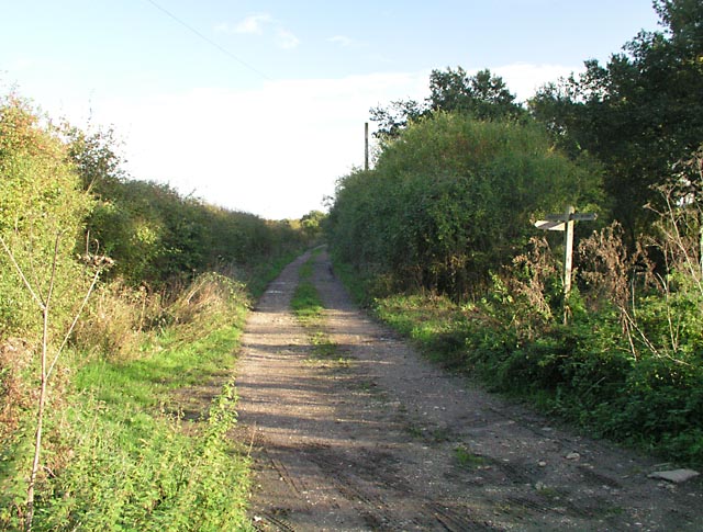
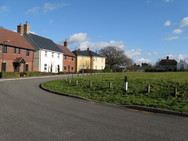
Dial Post Images

Images are sourced within 2km of 50.963796/-0.354207 or Grid Reference TQ1519. Thanks to Geograph Open Source API. All images are credited.

Pot Common Potcommon Furzefield to the left, Soil Wood to the right. Taken from the bridleway.
Pot Common
Potcommon Furzefield to the left, Soil Wood to the right. Taken from the bridleway.
Flat Dossers Known a few of them in my time! Taken from the bridleway.
Flat Dossers
Known a few of them in my time! Taken from the bridleway.
Entrance to Whitefoots Wheelie bin standing guard. This is the point where the bridleway turns shapely west.
Entrance to Whitefoots
Wheelie bin standing guard. This is the point where the bridleway turns shapely west.
Jasmine Cottage, Rookcross Lane Situated at the junction of the lane with the entrance to Rooklands Farm.
Jasmine Cottage, Rookcross Lane
Situated at the junction of the lane with the entrance to Rooklands Farm.
Worthing Road, Dial Post Hard to believe that the A24 used to thunder through this village until the 1980s. Now all is quiet and serene. Dial Post is a hamlet within the parish of West Grinstead and grew in size from the eighteenth century onwards. The in is The Crown.
Worthing Road, Dial Post
Hard to believe that the A24 used to thunder through this village until the 1980s. Now all is quiet and serene. Dial Post is a hamlet within the parish of West Grinstead and grew in size from the eighteenth century onwards. The in is The Crown.
Grinders Wood Taken from the footpath that links Thistleworth Farm with Buckells Farm.
Grinders Wood
Taken from the footpath that links Thistleworth Farm with Buckells Farm.
Entrance to Perrylands Seen from the A24.
Entrance to Perrylands
Seen from the A24.
Junction of Bridleway 1886/1 and Footpath 1886/2 On Benton's Lane near Wickwood Cottage.
Junction of Bridleway 1886/1 and Footpath 1886/2
On Benton's Lane near Wickwood Cottage.
Farmland, Lock Farm To the north west of the farm buildings with Stony Copse just over the brow.
Farmland, Lock Farm
To the north west of the farm buildings with Stony Copse just over the brow.
Clothall's Farmhouse Clothalls is on a moated site with the southern (right) representing the earliest portion.  A three-bay hall and northern cross-wing being added in the  C15.
Clothall is a small parish in Hertfordshire and a family from there seems to have made its way to Sussex.  Adam de Clothale married into the 'de Grensted' family about 1270.  The last, Richard de Clothale, died in 1454.
'Wealden Buildings' Editor John Warren.  Coach Publishing, Horsham 1990.  ISBN 0 902608 06 1
'The Victoria County History' A History of the County of Sussex: Volume 6 Part 2
Bramber Rape (North-Western Part) including Horsham
Clothall's Farmhouse
Clothalls is on a moated site with the southern (right) representing the earliest portion. A three-bay hall and northern cross-wing being added in the C15. Clothall is a small parish in Hertfordshire and a family from there seems to have made its way to Sussex. Adam de Clothale married into the 'de Grensted' family about 1270. The last, Richard de Clothale, died in 1454. 'Wealden Buildings' Editor John Warren. Coach Publishing, Horsham 1990. ISBN 0 902608 06 1 'The Victoria County History' A History of the County of Sussex: Volume 6 Part 2 Bramber Rape (North-Western Part) including Horsham
Bentons Place Farm, Shipley Note the fine Horsham stone roof.
There was once a manor of Bentons which also included nearby 'Blonks' - farm and cottage.
Bentons Place Farm, Shipley
Note the fine Horsham stone roof. There was once a manor of Bentons which also included nearby 'Blonks' - farm and cottage.
Farmland near the River Adur The line of reeds in the foreground mark the course of the river.
Farmland near the River Adur
The line of reeds in the foreground mark the course of the river.
Bridleway to Clothalls Farm Linking the farm with Jolesfield Common via Haterells Bridge.
Bridleway to Clothalls Farm
Linking the farm with Jolesfield Common via Haterells Bridge.
Clothalls Farm Former manor house largely dating from the 17th century but incorporating parts as early as the 14th century. The former moat lies beyond the farm house obscured by bushes.
Clothalls Farm
Former manor house largely dating from the 17th century but incorporating parts as early as the 14th century. The former moat lies beyond the farm house obscured by bushes.
Approaching Dial Post from the north Many years ago this was the main A24 which now runs to the east of the village
Approaching Dial Post from the north
Many years ago this was the main A24 which now runs to the east of the village
The Green at Dial Post Incidentally the road is called The Green
The Green at Dial Post
Incidentally the road is called The Green
Footpath west out of Dial Post New deer fencing being erected
Footpath west out of Dial Post
New deer fencing being erected
Tory Copse On footpath west to Bentons Place Farm
Tory Copse
On footpath west to Bentons Place Farm
Show me another place!

Dial Post is located at Grid Ref: TQ1519 (Lat: 50.963796, Lng: -0.354207)

Administrative County: West Sussex

District: Horsham

Police Authority: Sussex

What 3 Words

///shining.ranking.merely. Near Partridge Green, West Sussex

Nearby Locations

Old Rough Wood Dial Post

Related Wikis

Dial Post

Dial Post is a village in the Horsham District of West Sussex, England. The civil parish, where the lowest level political meetings are held, is West Grinstead...

Knepp Castle

The medieval Knepp Castle (sometimes referred to as 'Old Knepp Castle', to distinguish it from the nearby 19th-century mansion) is to the west of the village...

Knepp Wildland

Knepp Wildland is the first major lowland rewilding project in England. It comprises 1,400 hectares (3,500 acres; 5.4 square miles) of former arable and...

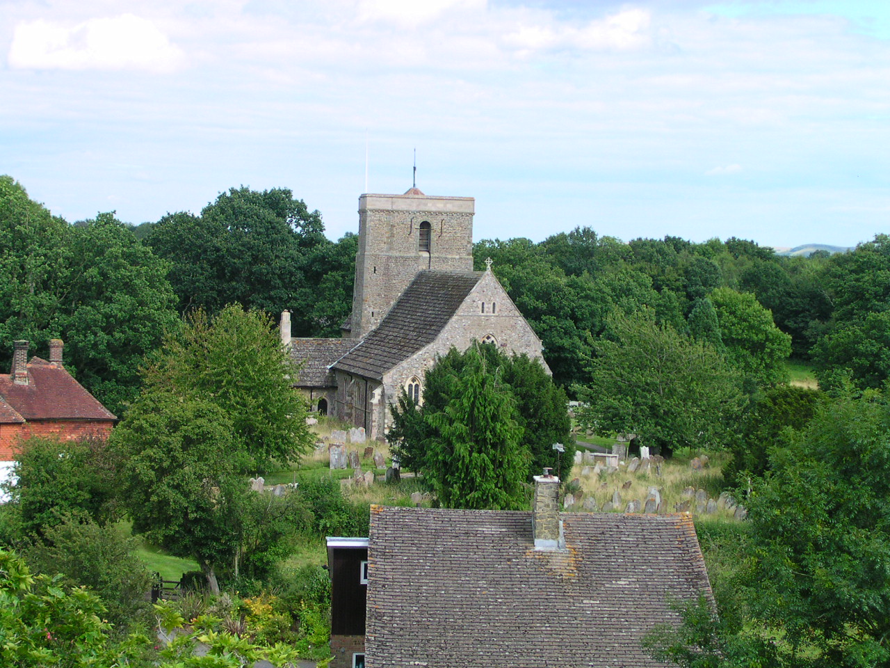
St George's Church, West Grinstead

St George's Church is an Anglican church in West Grinstead, West Sussex, England. It is in the Diocese of Chichester, occupying a rural position in the...

West Grinstead

West Grinstead is a village and civil parish in the Horsham District of West Sussex, England. It lies just off the B2135 road four miles (6.3 km) northwest...

St Mary's Church, Shipley

The Church of St Mary the Virgin is an Anglican church in the village of Shipley, in West Sussex, England. It is in the Diocese of Chichester. Built in...

Shrine of Our Lady of Consolation

The Shrine of Our Lady of Consolation or Church of Our Lady of Consolation and Saint Francis is a Roman Catholic parish church in West Grinstead, in West...

Shipley, West Sussex

Shipley is a village and civil parish in the Horsham District of West Sussex, England. It lies just off the A272 road 6 miles (10 kilometres) north-east...

Nearby Amenities

Located within 500m of 50.963796,-0.354207
Dial Post
Is In: West Sussex, England, UK
Place: village
Source: npe
Wikidata: Q5270472
Lat/Long: 50.9633475/-0.3578485
Barrier: kissing_gate
Foot: yes
Lat/Long: 50.9640822/-0.3587326
Bus Stop
Crown Inn
Bus: yes
Naptan AtcoCode: 4400HR0314
Naptan Bearing: NE
Naptan CommonName: Crown Inn
Naptan Indicator: opp The Crown Inn
Naptan Landmark: The Green
Naptan NaptanCode: wsxawawj
Naptan Street: Worthing Road
Naptan Verified: no
Public Transport: platform
Source: naptan_import
Lat/Long: 50.9636524/-0.3566525
Bus Stop
Crown Inn
Bus: yes
Naptan AtcoCode: 4400HR0315
Naptan Bearing: SW
Naptan CommonName: Crown Inn
Naptan Indicator: o/s The Crown Inn
Naptan Landmark: The Green
Naptan NaptanCode: wsxawawm
Naptan Street: Worthing Road
Naptan Verified: no
Public Transport: platform
Source: naptan_import
Lat/Long: 50.9630853/-0.3571227
Post Box
Operator: Royal Mail
Operator Wikidata: Q638098
Post Box Type: lamp
Ref: RH13 137
Royal Cypher: EIIR
Royal Cypher Wikidata: Q33102113
Lat/Long: 50.9635557/-0.3567043
Defibrillator
Defibrillator Location: Outside wall of village hall
Emergency: defibrillator
Lat/Long: 50.9619931/-0.3577599
Bench
Lat/Long: 50.9631195/-0.3571041
Power: pole
Lat/Long: 50.9639123/-0.355797
Power: pole
Lat/Long: 50.9631872/-0.3557555
Power: pole
Lat/Long: 50.962417/-0.3560075
Power: pole
Lat/Long: 50.961585/-0.3493584
Power: pole
Lat/Long: 50.961937/-0.3505023
Power: pole
Lat/Long: 50.9622527/-0.3514554
Power: pole
Lat/Long: 50.9626093/-0.3533132
Power: pole
Lat/Long: 50.9625396/-0.3546435
Power: pole
Lat/Long: 50.9626745/-0.3519865
Barrier: height_restrictor
Maxheight: 2.1
Lat/Long: 50.9657808/-0.3563315
Barrier: cattle_grid
Lat/Long: 50.9658636/-0.3566483
The data included in this document is from www.openstreetmap.org. The data is made available under ODbL.

Have you been to Dial Post?

Leave your review of Dial Post below (or comments, questions and feedback).