Horsham Common

Wood, Forest in Sussex Horsham

England

Horsham Common

McDonald's restaurant, A24 near West Grinstead
McDonald's restaurant, A24 near West Grinstead Credit: Stacey Harris

Horsham Common, located in Sussex, England, is a picturesque woodland area that spans approximately 175 acres. It is a designated Local Nature Reserve and is managed by the Horsham District Council. The common is situated on the outskirts of the historic market town of Horsham and is a popular destination for both locals and visitors.

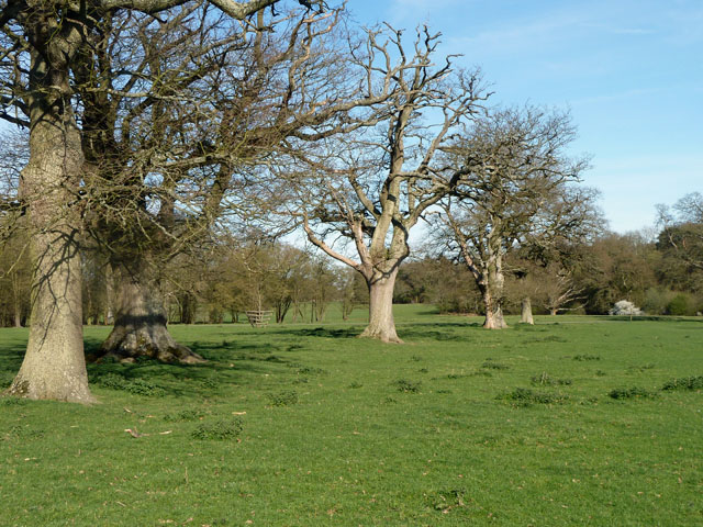
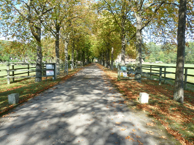
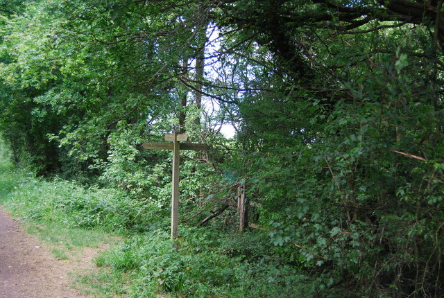
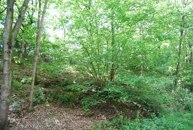
Horsham Common is characterized by its diverse range of habitats, including woodland, heathland, and wetland areas. The woodland section of the common is predominantly made up of mature oak trees, interspersed with other native species such as birch and holly. This creates a rich and vibrant canopy, providing a haven for a wide variety of bird species, including woodpeckers and warblers.

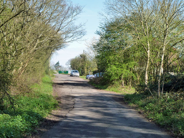
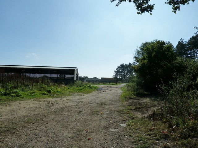
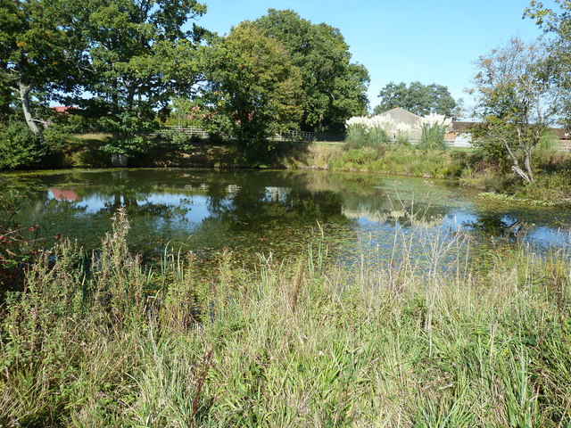
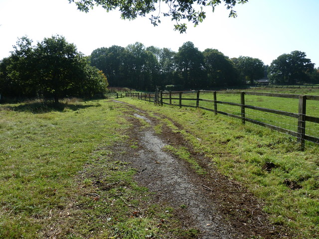
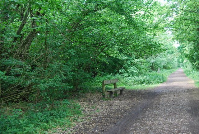
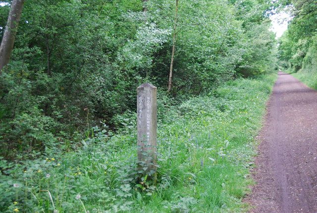
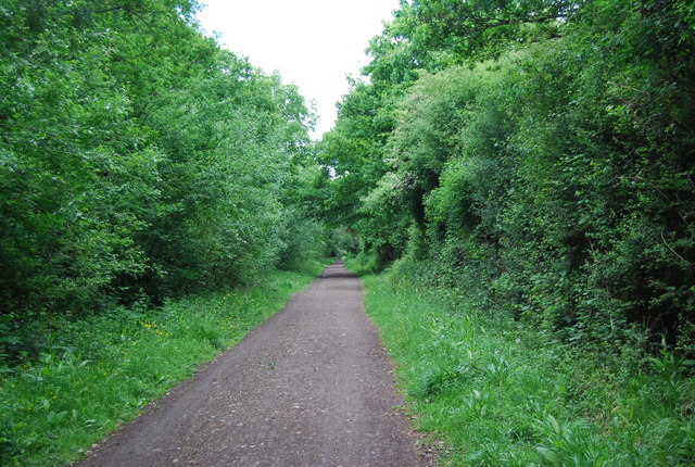
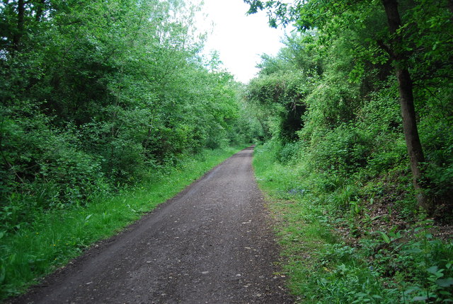
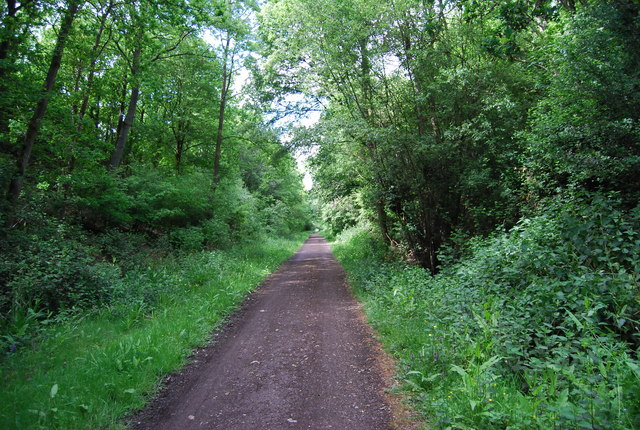
The forest also features several well-maintained footpaths that allow visitors to explore the area and enjoy its natural beauty. These paths wind through the woodland, offering breathtaking views and opportunities for wildlife spotting. The common is also home to a number of ponds and streams, which add to its charm and provide habitat for various aquatic creatures.

Horsham Common is not only a haven for nature enthusiasts but also a recreational space for the local community. It boasts a children's playground, picnic areas, and a dedicated space for sports activities such as football and cricket. Additionally, the common hosts a range of events throughout the year, including guided walks, nature workshops, and seasonal fairs.

Overall, Horsham Common is a stunning woodland area, offering a peaceful retreat from the hustle and bustle of daily life. Its natural beauty, diverse habitats, and recreational facilities make it a true gem in the heart of Sussex.

If you have any feedback on the listing, please let us know in the comments section below.

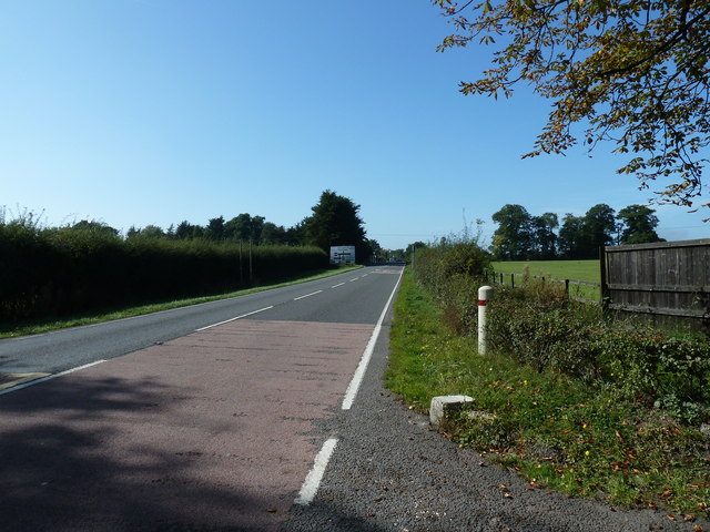
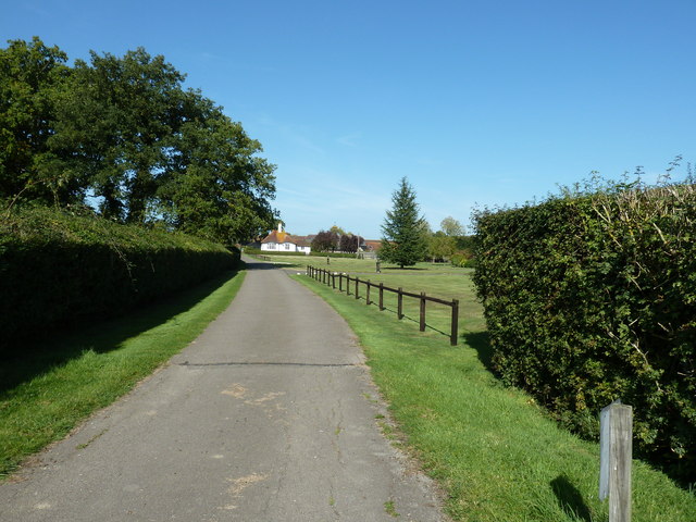
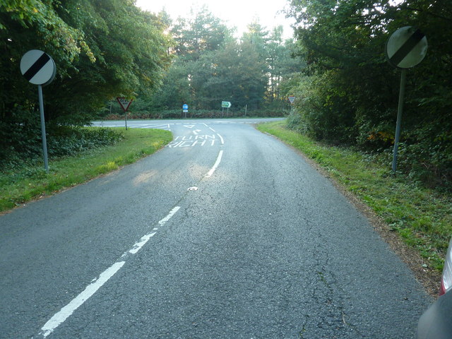
Horsham Common Images

Images are sourced within 2km of 51.00266/-0.35125033 or Grid Reference TQ1523. Thanks to Geograph Open Source API. All images are credited.

McDonald's restaurant, A24 near West Grinstead
A24 near West Grinstead
Worthing Road - old course A small loop off the A24 dual carriageway serving a few houses. This was the original course of the road, but the width may have been reduced, as the road is mapped coming this way when it was already classified as an A road.
Worthing Road - old course
A small loop off the A24 dual carriageway serving a few houses. This was the original course of the road, but the width may have been reduced, as the road is mapped coming this way when it was already classified as an A road.
Row of oaks, Knepp Castle parkland A public footpath runs along the row. In front of the blooming blackthorn on the right is a fingerpost directing walkers along the castle approach drive.
Row of oaks, Knepp Castle parkland
A public footpath runs along the row. In front of the blooming blackthorn on the right is a fingerpost directing walkers along the castle approach drive.
Out buildings at Newhouse Farm
Pond at Newhouse Farm
Footpath 1793 to Model Farm
Driveway to Model Farm Although I couldn't see a name, the name on the WSCC map is Model Farm.
Driveway to Model Farm
Although I couldn't see a name, the name on the WSCC map is Model Farm.
View west on the A272 towards Buckbarn Crossroads
Footpath 1793 through the grounds of The Old Sussex Stud
Link road between the two carriageways of the A24 This short section of road enables traffic, from Copsale, to join the A24 in either directions.
Many years ago while returning south from Horsham we encountered an elderly lady heading north on the southbound carriageway. Fortunately it is a two lane carriageway and we were in the left lane and she was in the other as we rounded the bend a little further north from here. We only said one word which now translate into 'excrement'.
Link road between the two carriageways of the A24
This short section of road enables traffic, from Copsale, to join the A24 in either directions. Many years ago while returning south from Horsham we encountered an elderly lady heading north on the southbound carriageway. Fortunately it is a two lane carriageway and we were in the left lane and she was in the other as we rounded the bend a little further north from here. We only said one word which now translate into 'excrement'.
Bench by the Downs Link The Downs Link is a 37-mile (59 km) footpath and bridleway linking the North Downs Way <a title="https://www.geograph.org.uk/snippet/174" href="https://www.geograph.org.uk/snippet/174">Link</a>  at St. Martha's Hill in Surrey with the South Downs Way <a title="https://www.geograph.org.uk/snippet/1186" href="https://www.geograph.org.uk/snippet/1186">Link</a>  near Steyning in West Sussex and on via the Coastal Link to Shoreham-by-Sea. Most of the route follows two dismantled railway lines, both closed by the Beeching cuts in the 1960s. The Shoreham-On-Sea to Christ’s Hospital line and the Christ’s Hospital to Shalford Junction line. The link opened in 1984. 
Cycle Route 223 follows the Downs link from Guildford to Shoreham.
The logo for the walk is the viaduct across the River Arun <a href="https://www.geograph.org.uk/photo/1870646">TQ0932 : Double Viaduct over the River Arun</a>.
A full history of the Cranleigh line (Christ’s Hospital to Shalford Junction) can be read at <span class="nowrap"><a title="http://en.wikipedia.org/wiki/Cranleigh_Line" rel="nofollow ugc noopener" href="http://en.wikipedia.org/wiki/Cranleigh_Line">Link</a><img style="margin-left:2px;" alt="External link" title="External link - shift click to open in new window" src="https://s1.geograph.org.uk/img/external.png" width="10" height="10"/></span>
Bench by the Downs Link
The Downs Link is a 37-mile (59 km) footpath and bridleway linking the North Downs Way Link at St. Martha's Hill in Surrey with the South Downs Way Link near Steyning in West Sussex and on via the Coastal Link to Shoreham-by-Sea. Most of the route follows two dismantled railway lines, both closed by the Beeching cuts in the 1960s. The Shoreham-On-Sea to Christ’s Hospital line and the Christ’s Hospital to Shalford Junction line. The link opened in 1984. Cycle Route 223 follows the Downs link from Guildford to Shoreham. The logo for the walk is the viaduct across the River Arun TQ0932 : Double Viaduct over the River Arun. A full history of the Cranleigh line (Christ’s Hospital to Shalford Junction) can be read at LinkExternal link
Footpath crosses the Downs Link The Downs Link is a 37-mile (59 km) footpath and bridleway linking the North Downs Way <a title="https://www.geograph.org.uk/snippet/174" href="https://www.geograph.org.uk/snippet/174">Link</a>  at St. Martha's Hill in Surrey with the South Downs Way <a title="https://www.geograph.org.uk/snippet/1186" href="https://www.geograph.org.uk/snippet/1186">Link</a>  near Steyning in West Sussex and on via the Coastal Link to Shoreham-by-Sea. Most of the route follows two dismantled railway lines, both closed by the Beeching cuts in the 1960s. The Shoreham-On-Sea to Christ’s Hospital line and the Christ’s Hospital to Shalford Junction line. The link opened in 1984. 
Cycle Route 223 follows the Downs link from Guildford to Shoreham.
The logo for the walk is the viaduct across the River Arun <a href="https://www.geograph.org.uk/photo/1870646">TQ0932 : Double Viaduct over the River Arun</a>.
A full history of the Cranleigh line (Christ’s Hospital to Shalford Junction) can be read at <span class="nowrap"><a title="http://en.wikipedia.org/wiki/Cranleigh_Line" rel="nofollow ugc noopener" href="http://en.wikipedia.org/wiki/Cranleigh_Line">Link</a><img style="margin-left:2px;" alt="External link" title="External link - shift click to open in new window" src="https://s1.geograph.org.uk/img/external.png" width="10" height="10"/></span>
Footpath crosses the Downs Link
The Downs Link is a 37-mile (59 km) footpath and bridleway linking the North Downs Way Link at St. Martha's Hill in Surrey with the South Downs Way Link near Steyning in West Sussex and on via the Coastal Link to Shoreham-by-Sea. Most of the route follows two dismantled railway lines, both closed by the Beeching cuts in the 1960s. The Shoreham-On-Sea to Christ’s Hospital line and the Christ’s Hospital to Shalford Junction line. The link opened in 1984. Cycle Route 223 follows the Downs link from Guildford to Shoreham. The logo for the walk is the viaduct across the River Arun TQ0932 : Double Viaduct over the River Arun. A full history of the Cranleigh line (Christ’s Hospital to Shalford Junction) can be read at LinkExternal link
Milepost, Downs Link The Downs Link is a 37-mile (59 km) footpath and bridleway linking the North Downs Way <a title="https://www.geograph.org.uk/snippet/174" href="https://www.geograph.org.uk/snippet/174">Link</a>  at St. Martha's Hill in Surrey with the South Downs Way <a title="https://www.geograph.org.uk/snippet/1186" href="https://www.geograph.org.uk/snippet/1186">Link</a>  near Steyning in West Sussex and on via the Coastal Link to Shoreham-by-Sea. Most of the route follows two dismantled railway lines, both closed by the Beeching cuts in the 1960s. The Shoreham-On-Sea to Christ’s Hospital line and the Christ’s Hospital to Shalford Junction line. The link opened in 1984. 
Cycle Route 223 follows the Downs link from Guildford to Shoreham.
The logo for the walk is the viaduct across the River Arun <a href="https://www.geograph.org.uk/photo/1870646">TQ0932 : Double Viaduct over the River Arun</a>.
A full history of the Cranleigh line (Christ’s Hospital to Shalford Junction) can be read at <span class="nowrap"><a title="http://en.wikipedia.org/wiki/Cranleigh_Line" rel="nofollow ugc noopener" href="http://en.wikipedia.org/wiki/Cranleigh_Line">Link</a><img style="margin-left:2px;" alt="External link" title="External link - shift click to open in new window" src="https://s1.geograph.org.uk/img/external.png" width="10" height="10"/></span>
Milepost, Downs Link
The Downs Link is a 37-mile (59 km) footpath and bridleway linking the North Downs Way Link at St. Martha's Hill in Surrey with the South Downs Way Link near Steyning in West Sussex and on via the Coastal Link to Shoreham-by-Sea. Most of the route follows two dismantled railway lines, both closed by the Beeching cuts in the 1960s. The Shoreham-On-Sea to Christ’s Hospital line and the Christ’s Hospital to Shalford Junction line. The link opened in 1984. Cycle Route 223 follows the Downs link from Guildford to Shoreham. The logo for the walk is the viaduct across the River Arun TQ0932 : Double Viaduct over the River Arun. A full history of the Cranleigh line (Christ’s Hospital to Shalford Junction) can be read at LinkExternal link
Downs Link The Downs Link is a 37-mile (59 km) footpath and bridleway linking the North Downs Way <a title="https://www.geograph.org.uk/snippet/174" href="https://www.geograph.org.uk/snippet/174">Link</a>  at St. Martha's Hill in Surrey with the South Downs Way <a title="https://www.geograph.org.uk/snippet/1186" href="https://www.geograph.org.uk/snippet/1186">Link</a>  near Steyning in West Sussex and on via the Coastal Link to Shoreham-by-Sea. Most of the route follows two dismantled railway lines, both closed by the Beeching cuts in the 1960s. The Shoreham-On-Sea to Christ’s Hospital line and the Christ’s Hospital to Shalford Junction line. The link opened in 1984. 
Cycle Route 223 follows the Downs link from Guildford to Shoreham.
The logo for the walk is the viaduct across the River Arun <a href="https://www.geograph.org.uk/photo/1870646">TQ0932 : Double Viaduct over the River Arun</a>.
A full history of the Cranleigh line (Christ’s Hospital to Shalford Junction) can be read at <span class="nowrap"><a title="http://en.wikipedia.org/wiki/Cranleigh_Line" rel="nofollow ugc noopener" href="http://en.wikipedia.org/wiki/Cranleigh_Line">Link</a><img style="margin-left:2px;" alt="External link" title="External link - shift click to open in new window" src="https://s1.geograph.org.uk/img/external.png" width="10" height="10"/></span>
Downs Link
The Downs Link is a 37-mile (59 km) footpath and bridleway linking the North Downs Way Link at St. Martha's Hill in Surrey with the South Downs Way Link near Steyning in West Sussex and on via the Coastal Link to Shoreham-by-Sea. Most of the route follows two dismantled railway lines, both closed by the Beeching cuts in the 1960s. The Shoreham-On-Sea to Christ’s Hospital line and the Christ’s Hospital to Shalford Junction line. The link opened in 1984. Cycle Route 223 follows the Downs link from Guildford to Shoreham. The logo for the walk is the viaduct across the River Arun TQ0932 : Double Viaduct over the River Arun. A full history of the Cranleigh line (Christ’s Hospital to Shalford Junction) can be read at LinkExternal link
Downs Link in a cutting The Downs Link is a 37-mile (59 km) footpath and bridleway linking the North Downs Way <a title="https://www.geograph.org.uk/snippet/174" href="https://www.geograph.org.uk/snippet/174">Link</a>  at St. Martha's Hill in Surrey with the South Downs Way <a title="https://www.geograph.org.uk/snippet/1186" href="https://www.geograph.org.uk/snippet/1186">Link</a>  near Steyning in West Sussex and on via the Coastal Link to Shoreham-by-Sea. Most of the route follows two dismantled railway lines, both closed by the Beeching cuts in the 1960s. The Shoreham-On-Sea to Christ’s Hospital line and the Christ’s Hospital to Shalford Junction line. The link opened in 1984. 
Cycle Route 223 follows the Downs link from Guildford to Shoreham.
The logo for the walk is the viaduct across the River Arun <a href="https://www.geograph.org.uk/photo/1870646">TQ0932 : Double Viaduct over the River Arun</a>.
A full history of the Cranleigh line (Christ’s Hospital to Shalford Junction) can be read at <span class="nowrap"><a title="http://en.wikipedia.org/wiki/Cranleigh_Line" rel="nofollow ugc noopener" href="http://en.wikipedia.org/wiki/Cranleigh_Line">Link</a><img style="margin-left:2px;" alt="External link" title="External link - shift click to open in new window" src="https://s1.geograph.org.uk/img/external.png" width="10" height="10"/></span>
Downs Link in a cutting
The Downs Link is a 37-mile (59 km) footpath and bridleway linking the North Downs Way Link at St. Martha's Hill in Surrey with the South Downs Way Link near Steyning in West Sussex and on via the Coastal Link to Shoreham-by-Sea. Most of the route follows two dismantled railway lines, both closed by the Beeching cuts in the 1960s. The Shoreham-On-Sea to Christ’s Hospital line and the Christ’s Hospital to Shalford Junction line. The link opened in 1984. Cycle Route 223 follows the Downs link from Guildford to Shoreham. The logo for the walk is the viaduct across the River Arun TQ0932 : Double Viaduct over the River Arun. A full history of the Cranleigh line (Christ’s Hospital to Shalford Junction) can be read at LinkExternal link
Wooded cutting, Downs Link
Downs Link The Downs Link is a 37-mile (59 km) footpath and bridleway linking the North Downs Way <a title="https://www.geograph.org.uk/snippet/174" href="https://www.geograph.org.uk/snippet/174">Link</a>  at St. Martha's Hill in Surrey with the South Downs Way <a title="https://www.geograph.org.uk/snippet/1186" href="https://www.geograph.org.uk/snippet/1186">Link</a>  near Steyning in West Sussex and on via the Coastal Link to Shoreham-by-Sea. Most of the route follows two dismantled railway lines, both closed by the Beeching cuts in the 1960s. The Shoreham-On-Sea to Christ’s Hospital line and the Christ’s Hospital to Shalford Junction line. The link opened in 1984. 
Cycle Route 223 follows the Downs link from Guildford to Shoreham.
The logo for the walk is the viaduct across the River Arun <a href="https://www.geograph.org.uk/photo/1870646">TQ0932 : Double Viaduct over the River Arun</a>.
A full history of the Cranleigh line (Christ’s Hospital to Shalford Junction) can be read at <span class="nowrap"><a title="http://en.wikipedia.org/wiki/Cranleigh_Line" rel="nofollow ugc noopener" href="http://en.wikipedia.org/wiki/Cranleigh_Line">Link</a><img style="margin-left:2px;" alt="External link" title="External link - shift click to open in new window" src="https://s1.geograph.org.uk/img/external.png" width="10" height="10"/></span>
Downs Link
The Downs Link is a 37-mile (59 km) footpath and bridleway linking the North Downs Way Link at St. Martha's Hill in Surrey with the South Downs Way Link near Steyning in West Sussex and on via the Coastal Link to Shoreham-by-Sea. Most of the route follows two dismantled railway lines, both closed by the Beeching cuts in the 1960s. The Shoreham-On-Sea to Christ’s Hospital line and the Christ’s Hospital to Shalford Junction line. The link opened in 1984. Cycle Route 223 follows the Downs link from Guildford to Shoreham. The logo for the walk is the viaduct across the River Arun TQ0932 : Double Viaduct over the River Arun. A full history of the Cranleigh line (Christ’s Hospital to Shalford Junction) can be read at LinkExternal link
Show me another place!

Horsham Common is located at Grid Ref: TQ1523 (Lat: 51.00266, Lng: -0.35125033)

Administrative County: West Sussex

District: Horsham

Police Authority: Sussex

What 3 Words

///inspected.heeding.insisting. Near Southwater, West Sussex

Related Wikis

Dragon's Green

Dragon's Green is a hamlet in the civil parish of Shipley, and the Horsham district of West Sussex, England. The hamlet is 5 miles (8 km) south from the...

Copsale

Copsale is a hamlet in the civil parish of Nuthurst, and the Horsham District of West Sussex, England. It lies on the Southwater to Maplehurst road 3.5...

Newbuildings Place

Newbuildings Place is a 17th-century Artisan Mannerist house near Shipley, West Sussex. The house is a former home of Wilfrid Scawen Blunt, who is buried...

Southwater

Southwater is a large village and civil parish in the Horsham District of West Sussex, England, with a population of roughly 10,000. It is administered...

Shipley, West Sussex

Shipley is a village and civil parish in the Horsham District of West Sussex, England. It lies just off the A272 road 6 miles (10 kilometres) north-east...

Southwater railway station

Southwater was a railway station on the Steyning Line which served the village of Southwater. A goods siding allowed for the transportation of coal and...

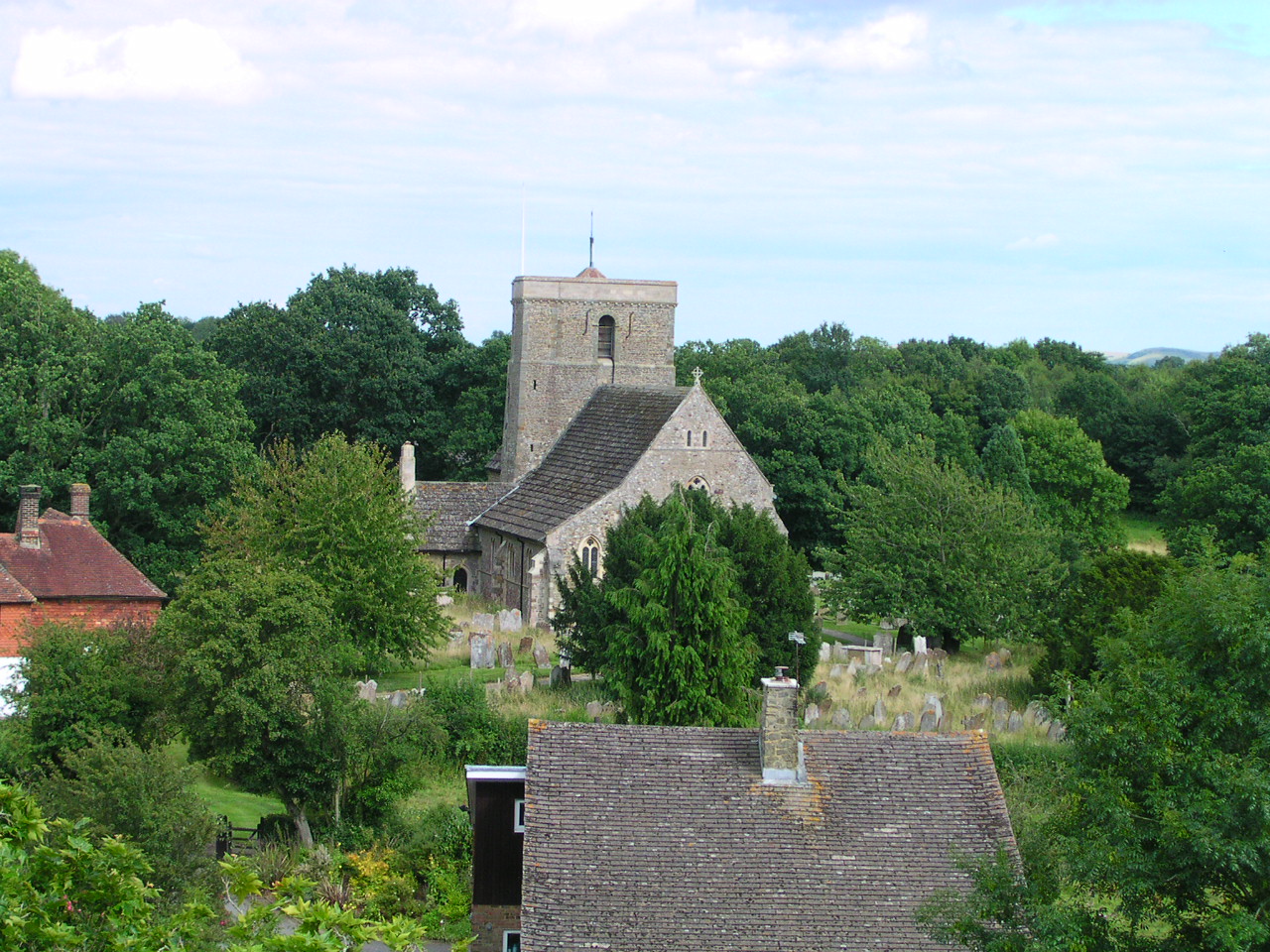
St Mary's Church, Shipley

The Church of St Mary the Virgin is an Anglican church in the village of Shipley, in West Sussex, England. It is in the Diocese of Chichester. Built in...

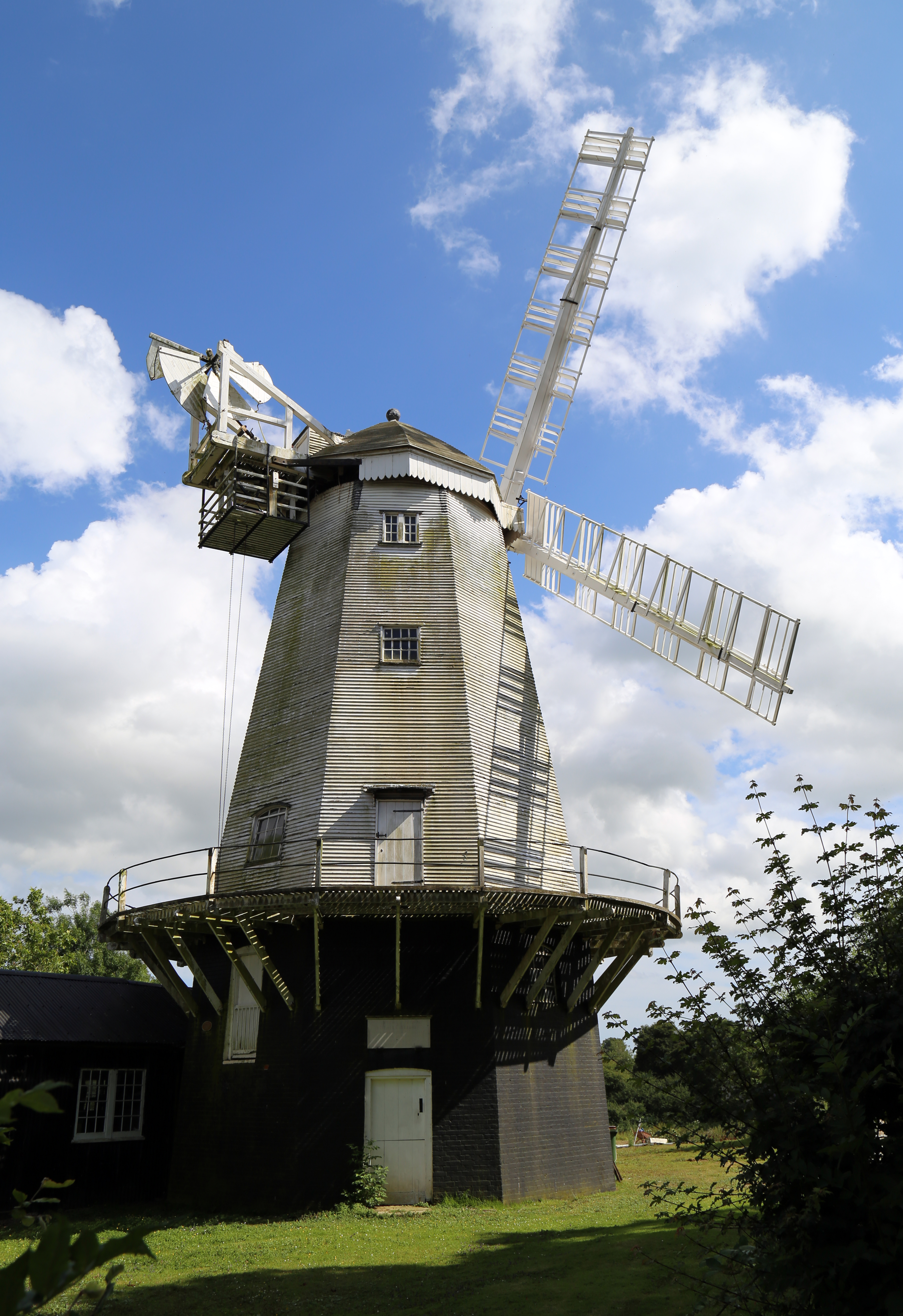
King's Mill, Shipley

King's Mill or Vincent's Mill, Shipley, West Sussex, England, is a smock mill built in 1879. == History == King's Mill was built in 1879 for Friend Martin...

Nearby Amenities

Located within 500m of 51.00266,-0.35125033
Power: tower
Lat/Long: 50.9995199/-0.35633
Power: tower
Lat/Long: 50.9986187/-0.3522513
Power: pole
Source: Bing
Lat/Long: 51.0069638/-0.3528607
Power: pole
Source: Bing
Lat/Long: 51.0063056/-0.3521258
Brown's Barn
Place: isolated_dwelling
Lat/Long: 51.0058062/-0.3475457
Brick Kiln Farm
Place: farm
Lat/Long: 51.0060505/-0.3514706
The data included in this document is from www.openstreetmap.org. The data is made available under ODbL.

Have you been to Horsham Common?

Leave your review of Horsham Common below (or comments, questions and feedback).