Alder Copse

Wood, Forest in Sussex Horsham

England

Alder Copse

Old Milestone by the former A24, Mill Straight, Southwater parish Carved stone post by the UC road (was A24), in parish of Southwater (Horsham District), Mill Straight, West of Fieldings, against fence, on South side of road at end of bus lay-by. Steyning stone, erected by the Horsham & Steyning turnpike trust in the 19th century. Painted and re-engraved by Lionel Joseph in about 2011.

Inscription reads:-
40
MILES
FROM
LONDON
Carved benchmark upper centre, rivet on top.

West Sussex HER.
HER Ref: MWS8538 <span class="nowrap"><a title="https://www.heritagegateway.org.uk/Gateway/Results_Single.aspx?uid=MWS8538&resourceID=1032" rel="nofollow ugc noopener" href="https://www.heritagegateway.org.uk/Gateway/Results_Single.aspx?uid=MWS8538&resourceID=1032">Link</a><img style="margin-left:2px;" alt="External link" title="External link - shift click to open in new window" src="https://s1.geograph.org.uk/img/external.png" width="10" height="10"/></span>

Milestone Society National ID: SX_LA40
Old Milestone by the former A24, Mill Straight, Southwater parish Credit: Lionel Joseph

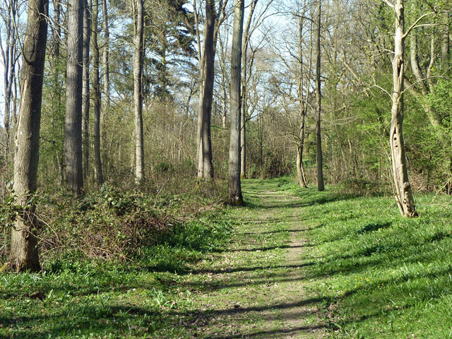
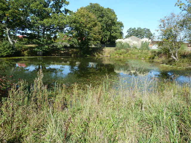
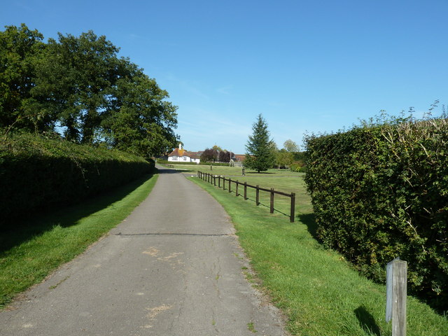
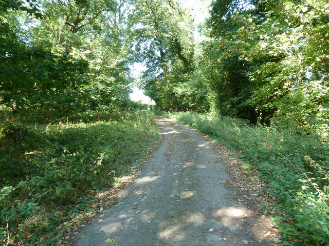
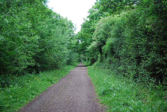
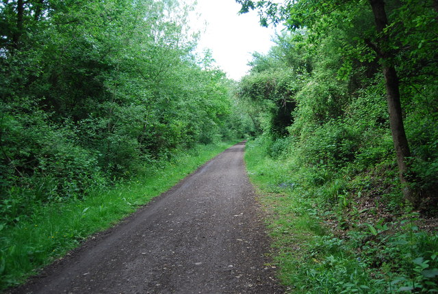
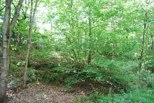
Alder Copse, located in Sussex, England, is a picturesque woodland area renowned for its natural beauty and diverse ecosystem. Spanning over a vast expanse, the copse is characterized by its dense concentration of alder trees, which are known for their distinctive dark bark and broad leaves. This thriving forest is a haven for wildlife, providing a habitat for a wide range of flora and fauna.

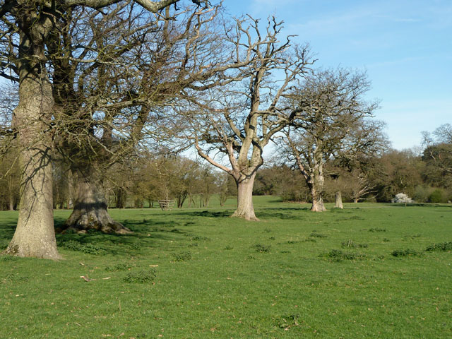
As one ventures into Alder Copse, they are greeted by an enchanting landscape filled with towering trees that create a dense canopy overhead, filtering sunlight and casting intricate patterns of shadows on the forest floor. The copse is home to a rich assortment of plant species, including bluebells, wood sorrel, and wild garlic, which carpet the ground with vibrant colors during the spring months.

The diversity of wildlife in Alder Copse is truly remarkable. Birdwatchers are treated to the sights and sounds of various avian species such as woodpeckers, thrushes, and owls, while small mammals like squirrels and hedgehogs scurry through the undergrowth. The copse is also a haven for insect life, with butterflies, dragonflies, and bees flitting about in the warm summer air.

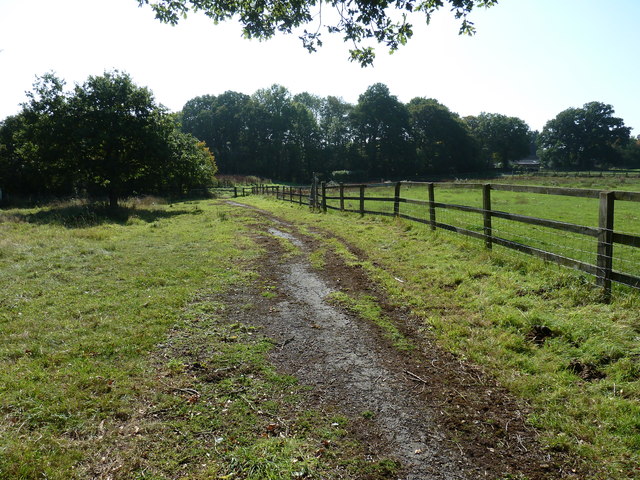
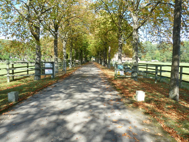
Alder Copse offers visitors a tranquil escape from the hustle and bustle of everyday life. With its well-maintained footpaths and picnic areas, it is an ideal spot for leisurely walks, family outings, and nature enthusiasts. The copse's serene ambiance and natural beauty make it a popular destination for photographers, painters, and those seeking solace in the great outdoors.

In conclusion, Alder Copse is a captivating woodland retreat in Sussex, offering a glimpse into the wonders of nature. With its abundant flora and fauna, it provides a haven for both wildlife and visitors alike, making it a must-visit destination for those seeking solace and serenity in a truly enchanting setting.

If you have any feedback on the listing, please let us know in the comments section below.
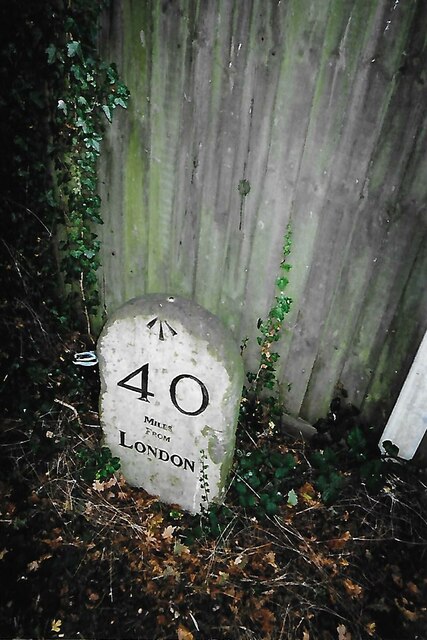
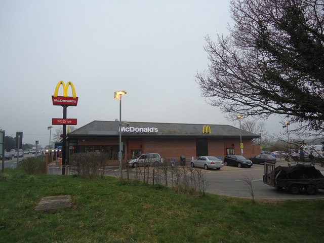
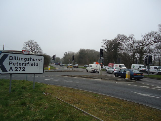
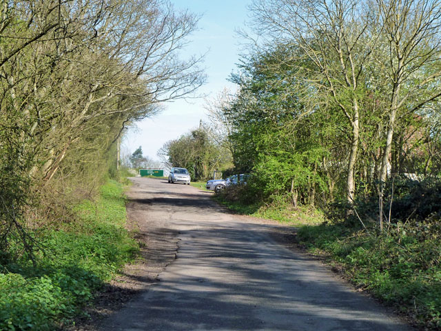
Alder Copse Images

Images are sourced within 2km of 51.000183/-0.35225026 or Grid Reference TQ1523. Thanks to Geograph Open Source API. All images are credited.

Old Milestone by the former A24, Mill Straight, Southwater parish Carved stone post by the UC road (was A24), in parish of Southwater (Horsham District), Mill Straight, West of Fieldings, against fence, on South side of road at end of bus lay-by. Steyning stone, erected by the Horsham & Steyning turnpike trust in the 19th century. Painted and re-engraved by Lionel Joseph in about 2011.

Inscription reads:-
40
MILES
FROM
LONDON
Carved benchmark upper centre, rivet on top.

West Sussex HER.
HER Ref: MWS8538 <span class="nowrap"><a title="https://www.heritagegateway.org.uk/Gateway/Results_Single.aspx?uid=MWS8538&resourceID=1032" rel="nofollow ugc noopener" href="https://www.heritagegateway.org.uk/Gateway/Results_Single.aspx?uid=MWS8538&resourceID=1032">Link</a><img style="margin-left:2px;" alt="External link" title="External link - shift click to open in new window" src="https://s1.geograph.org.uk/img/external.png" width="10" height="10"/></span>

Milestone Society National ID: SX_LA40
Old Milestone by the former A24, Mill Straight, Southwater parish
Carved stone post by the UC road (was A24), in parish of Southwater (Horsham District), Mill Straight, West of Fieldings, against fence, on South side of road at end of bus lay-by. Steyning stone, erected by the Horsham & Steyning turnpike trust in the 19th century. Painted and re-engraved by Lionel Joseph in about 2011. Inscription reads:- 40 MILES FROM LONDON Carved benchmark upper centre, rivet on top. West Sussex HER. HER Ref: MWS8538 LinkExternal link Milestone Society National ID: SX_LA40
McDonald's restaurant, A24 near West Grinstead
A24 near West Grinstead
Worthing Road - old course A small loop off the A24 dual carriageway serving a few houses. This was the original course of the road, but the width may have been reduced, as the road is mapped coming this way when it was already classified as an A road.
Worthing Road - old course
A small loop off the A24 dual carriageway serving a few houses. This was the original course of the road, but the width may have been reduced, as the road is mapped coming this way when it was already classified as an A road.
Knepp Castle The hub of a well kept estate.
Knepp Castle
The hub of a well kept estate.
Permissive footpath, Church Wood One of the several public-spirited actions of the Knepp Castle Estate. This leads from the public footpath to Red Lane. There are other permissive paths in the small wood.
Permissive footpath, Church Wood
One of the several public-spirited actions of the Knepp Castle Estate. This leads from the public footpath to Red Lane. There are other permissive paths in the small wood.
Row of oaks, Knepp Castle parkland A public footpath runs along the row. In front of the blooming blackthorn on the right is a fingerpost directing walkers along the castle approach drive.
Row of oaks, Knepp Castle parkland
A public footpath runs along the row. In front of the blooming blackthorn on the right is a fingerpost directing walkers along the castle approach drive.
Out buildings at Newhouse Farm
Pond at Newhouse Farm
Footpath 1793 to Model Farm
Driveway to Model Farm Although I couldn't see a name, the name on the WSCC map is Model Farm.
Driveway to Model Farm
Although I couldn't see a name, the name on the WSCC map is Model Farm.
View west on the A272 towards Buckbarn Crossroads
Footpath 1793 through the grounds of The Old Sussex Stud
Footpath track through woodland Greenlane plantation on the left and Greenbridge plantation to the right.
Footpath track through woodland
Greenlane plantation on the left and Greenbridge plantation to the right.
Link road between the two carriageways of the A24 This short section of road enables traffic, from Copsale, to join the A24 in either directions.
Many years ago while returning south from Horsham we encountered an elderly lady heading north on the southbound carriageway. Fortunately it is a two lane carriageway and we were in the left lane and she was in the other as we rounded the bend a little further north from here. We only said one word which now translate into 'excrement'.
Link road between the two carriageways of the A24
This short section of road enables traffic, from Copsale, to join the A24 in either directions. Many years ago while returning south from Horsham we encountered an elderly lady heading north on the southbound carriageway. Fortunately it is a two lane carriageway and we were in the left lane and she was in the other as we rounded the bend a little further north from here. We only said one word which now translate into 'excrement'.
Downs Link The Downs Link is a 37-mile (59 km) footpath and bridleway linking the North Downs Way <a title="https://www.geograph.org.uk/snippet/174" href="https://www.geograph.org.uk/snippet/174">Link</a>  at St. Martha's Hill in Surrey with the South Downs Way <a title="https://www.geograph.org.uk/snippet/1186" href="https://www.geograph.org.uk/snippet/1186">Link</a>  near Steyning in West Sussex and on via the Coastal Link to Shoreham-by-Sea. Most of the route follows two dismantled railway lines, both closed by the Beeching cuts in the 1960s. The Shoreham-On-Sea to Christ’s Hospital line and the Christ’s Hospital to Shalford Junction line. The link opened in 1984. 
Cycle Route 223 follows the Downs link from Guildford to Shoreham.
The logo for the walk is the viaduct across the River Arun <a href="https://www.geograph.org.uk/photo/1870646">TQ0932 : Double Viaduct over the River Arun</a>.
A full history of the Cranleigh line (Christ’s Hospital to Shalford Junction) can be read at <span class="nowrap"><a title="http://en.wikipedia.org/wiki/Cranleigh_Line" rel="nofollow ugc noopener" href="http://en.wikipedia.org/wiki/Cranleigh_Line">Link</a><img style="margin-left:2px;" alt="External link" title="External link - shift click to open in new window" src="https://s1.geograph.org.uk/img/external.png" width="10" height="10"/></span>
Downs Link
The Downs Link is a 37-mile (59 km) footpath and bridleway linking the North Downs Way Link at St. Martha's Hill in Surrey with the South Downs Way Link near Steyning in West Sussex and on via the Coastal Link to Shoreham-by-Sea. Most of the route follows two dismantled railway lines, both closed by the Beeching cuts in the 1960s. The Shoreham-On-Sea to Christ’s Hospital line and the Christ’s Hospital to Shalford Junction line. The link opened in 1984. Cycle Route 223 follows the Downs link from Guildford to Shoreham. The logo for the walk is the viaduct across the River Arun TQ0932 : Double Viaduct over the River Arun. A full history of the Cranleigh line (Christ’s Hospital to Shalford Junction) can be read at LinkExternal link
Downs Link in a cutting The Downs Link is a 37-mile (59 km) footpath and bridleway linking the North Downs Way <a title="https://www.geograph.org.uk/snippet/174" href="https://www.geograph.org.uk/snippet/174">Link</a>  at St. Martha's Hill in Surrey with the South Downs Way <a title="https://www.geograph.org.uk/snippet/1186" href="https://www.geograph.org.uk/snippet/1186">Link</a>  near Steyning in West Sussex and on via the Coastal Link to Shoreham-by-Sea. Most of the route follows two dismantled railway lines, both closed by the Beeching cuts in the 1960s. The Shoreham-On-Sea to Christ’s Hospital line and the Christ’s Hospital to Shalford Junction line. The link opened in 1984. 
Cycle Route 223 follows the Downs link from Guildford to Shoreham.
The logo for the walk is the viaduct across the River Arun <a href="https://www.geograph.org.uk/photo/1870646">TQ0932 : Double Viaduct over the River Arun</a>.
A full history of the Cranleigh line (Christ’s Hospital to Shalford Junction) can be read at <span class="nowrap"><a title="http://en.wikipedia.org/wiki/Cranleigh_Line" rel="nofollow ugc noopener" href="http://en.wikipedia.org/wiki/Cranleigh_Line">Link</a><img style="margin-left:2px;" alt="External link" title="External link - shift click to open in new window" src="https://s1.geograph.org.uk/img/external.png" width="10" height="10"/></span>
Downs Link in a cutting
The Downs Link is a 37-mile (59 km) footpath and bridleway linking the North Downs Way Link at St. Martha's Hill in Surrey with the South Downs Way Link near Steyning in West Sussex and on via the Coastal Link to Shoreham-by-Sea. Most of the route follows two dismantled railway lines, both closed by the Beeching cuts in the 1960s. The Shoreham-On-Sea to Christ’s Hospital line and the Christ’s Hospital to Shalford Junction line. The link opened in 1984. Cycle Route 223 follows the Downs link from Guildford to Shoreham. The logo for the walk is the viaduct across the River Arun TQ0932 : Double Viaduct over the River Arun. A full history of the Cranleigh line (Christ’s Hospital to Shalford Junction) can be read at LinkExternal link
Wooded cutting, Downs Link
Show me another place!

Alder Copse is located at Grid Ref: TQ1523 (Lat: 51.000183, Lng: -0.35225026)

Administrative County: West Sussex

District: Horsham

Police Authority: Sussex

What 3 Words

///smooth.trails.blissful. Near Southwater, West Sussex

Related Wikis

Dragon's Green

Dragon's Green is a hamlet in the civil parish of Shipley, and the Horsham district of West Sussex, England. The hamlet is 5 miles (8 km) south from the...

Newbuildings Place

Newbuildings Place is a 17th-century Artisan Mannerist house near Shipley, West Sussex. The house is a former home of Wilfrid Scawen Blunt, who is buried...

Copsale

Copsale is a hamlet in the civil parish of Nuthurst, and the Horsham District of West Sussex, England. It lies on the Southwater to Maplehurst road 3.5...

Shipley, West Sussex

Shipley is a village and civil parish in the Horsham District of West Sussex, England. It lies just off the A272 road 6 miles (10 kilometres) north-east...

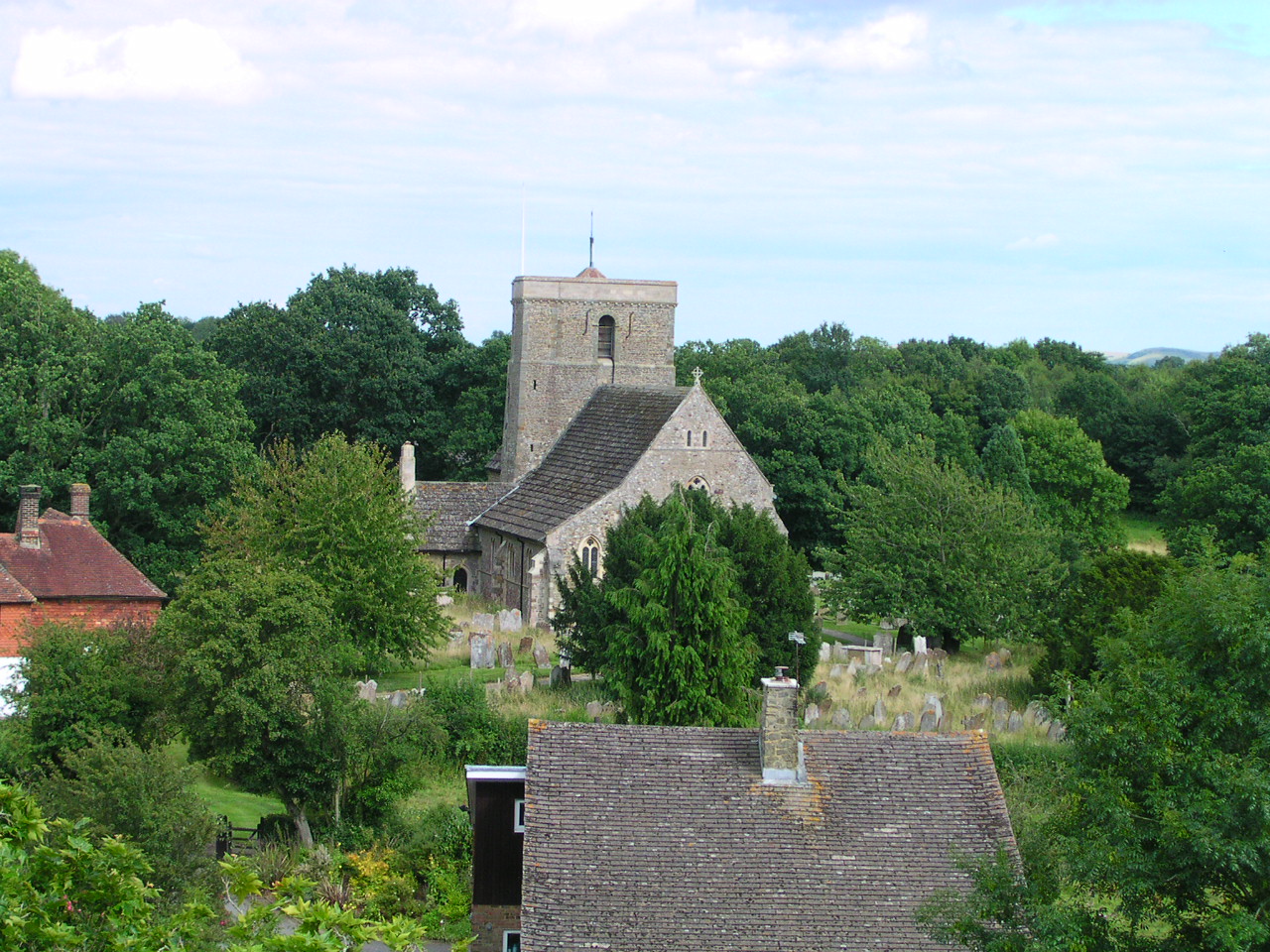
St Mary's Church, Shipley

The Church of St Mary the Virgin is an Anglican church in the village of Shipley, in West Sussex, England. It is in the Diocese of Chichester. Built in...

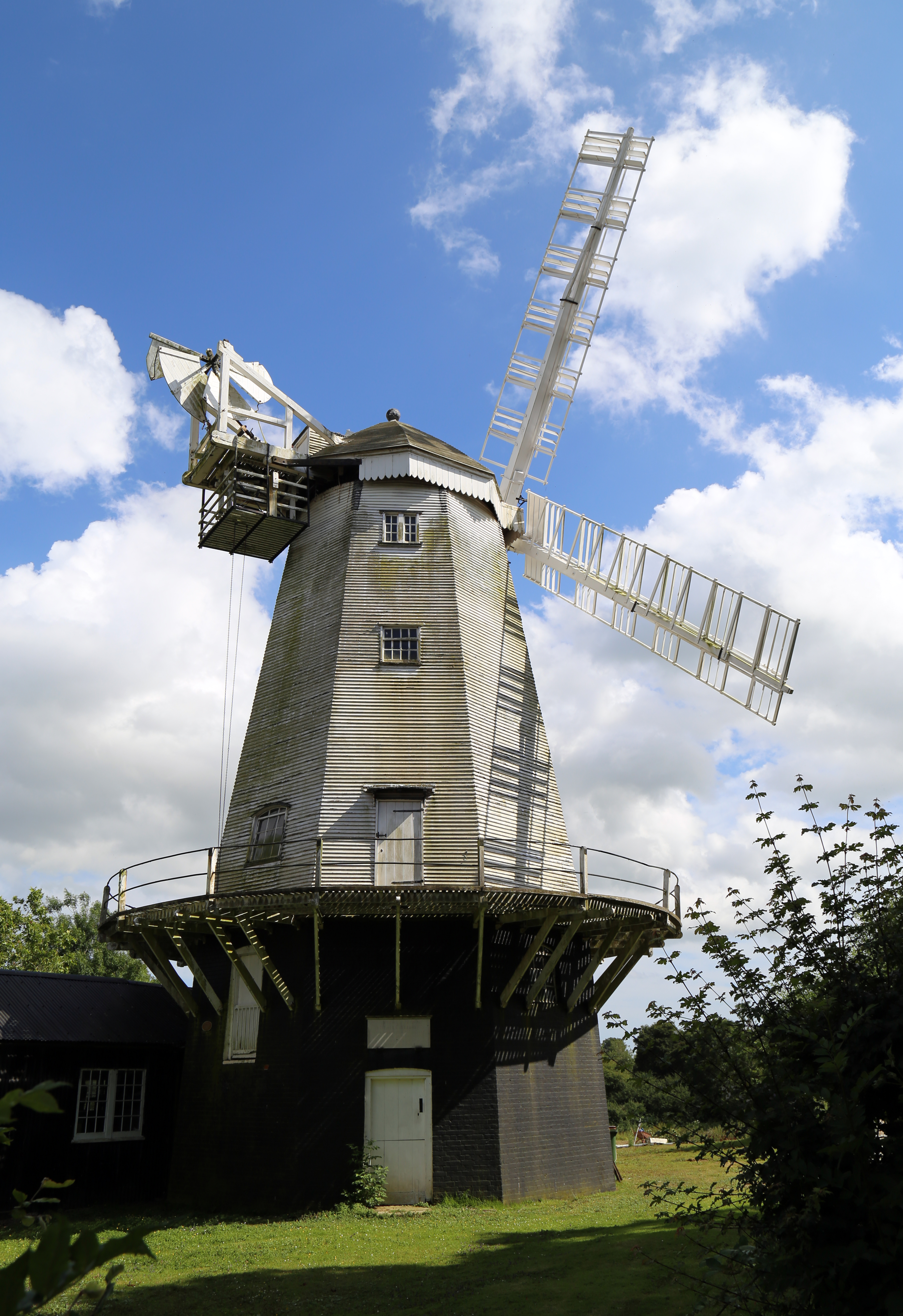
King's Mill, Shipley

King's Mill or Vincent's Mill, Shipley, West Sussex, England, is a smock mill built in 1879. == History == King's Mill was built in 1879 for Friend Martin...

Southwater

Southwater is a large village and civil parish in the Horsham District of West Sussex, England, with a population of roughly 10,000. It is administered...

Southwater railway station

Southwater was a railway station on the Steyning Line which served the village of Southwater. A goods siding allowed for the transportation of coal and...

Nearby Amenities

Located within 500m of 51.000183,-0.35225026
Power: tower
Lat/Long: 50.9991449/-0.3466309
Power: tower
Lat/Long: 50.9995199/-0.35633
Power: tower
Lat/Long: 50.9986187/-0.3522513
The data included in this document is from www.openstreetmap.org. The data is made available under ODbL.

Have you been to Alder Copse?

Leave your review of Alder Copse below (or comments, questions and feedback).