Square Copse

Wood, Forest in Surrey Mole Valley

England

Square Copse

Hampstead Lane, Dorking
Hampstead Lane, Dorking Credit: Robin Webster

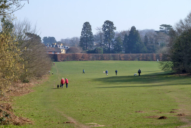
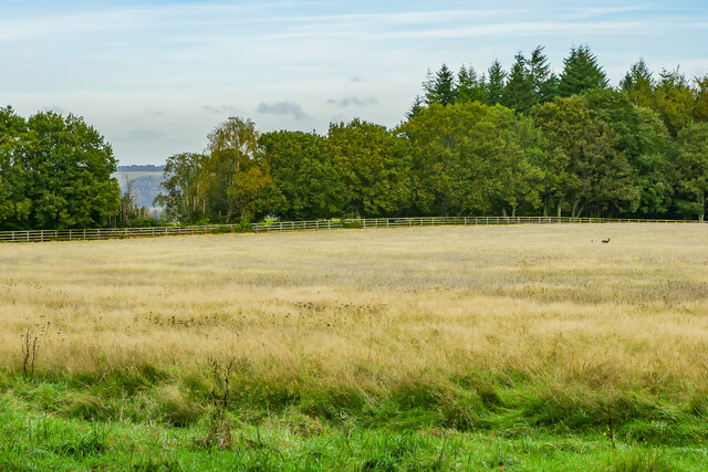
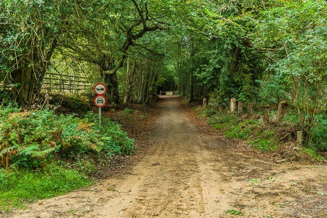
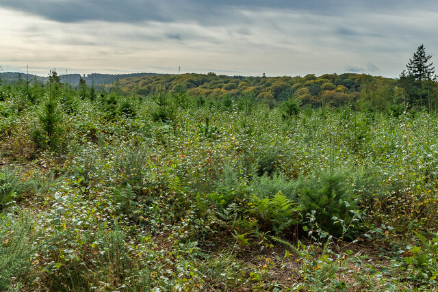
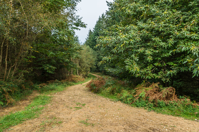
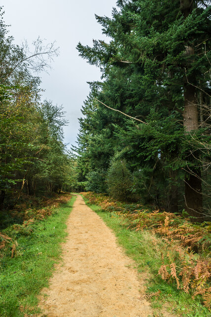
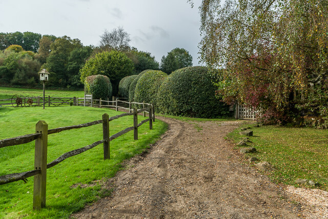
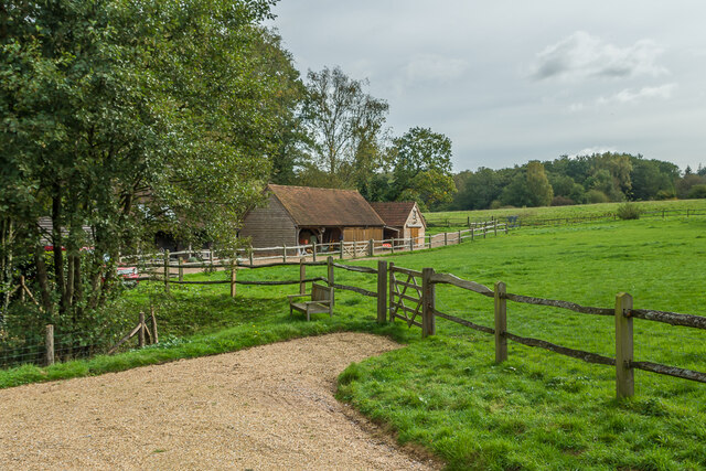
Square Copse is a picturesque woodland located in Surrey, England. Situated in the southeastern part of the county, this tranquil forest covers an area of approximately 50 acres. The copse is known for its dense concentration of trees, making it a popular destination for nature lovers, hikers, and birdwatchers.

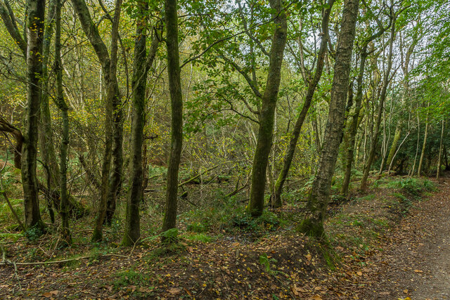
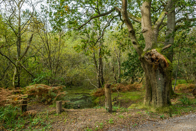
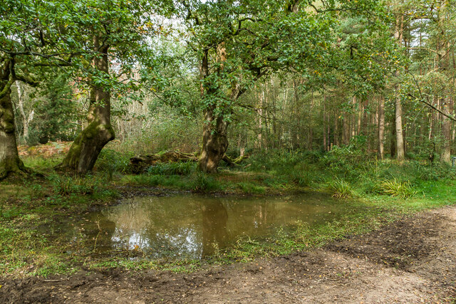
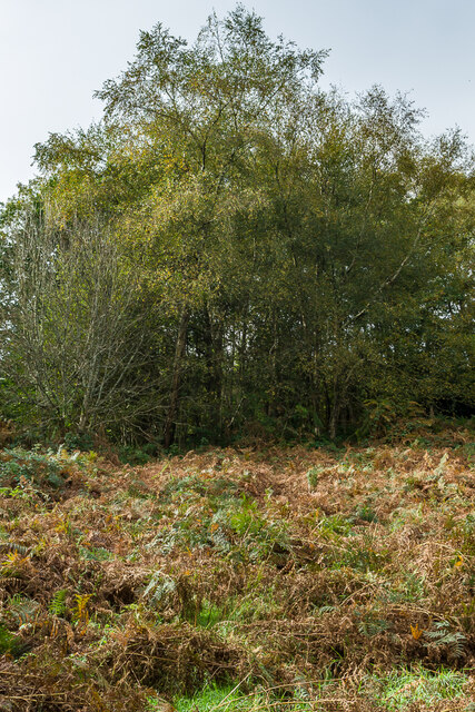
The woodland is primarily composed of deciduous trees, such as oak, beech, and birch, which provide a vibrant display of colors during the autumn season. These trees also create a dense canopy, offering shade and shelter to a diverse range of wildlife that calls Square Copse home.

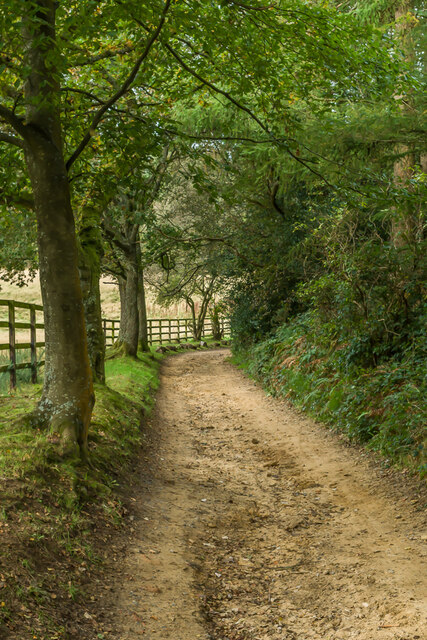
The forest floor is covered in a thick layer of moss, ferns, and wildflowers, creating a vibrant and enchanting atmosphere. Along the winding pathways that traverse the copse, visitors can spot a variety of plant species, including bluebells, primroses, and foxgloves, depending on the time of year.

The copse is also home to an array of bird species, including woodpeckers, owls, and thrushes, making it a haven for birdwatching enthusiasts. Squirrels, rabbits, and deer are also commonly spotted within the woodland, adding to the natural charm of Square Copse.

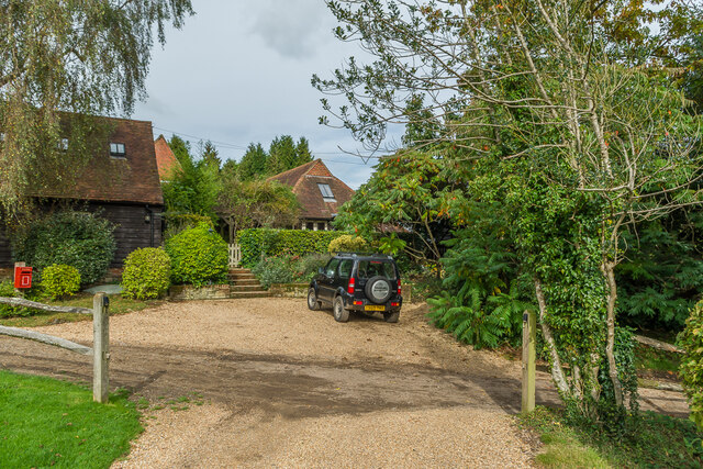
Due to its natural beauty and peaceful ambiance, Square Copse is a popular location for outdoor activities such as picnics, photography, and nature walks. The copse is easily accessible, with well-maintained footpaths and ample parking facilities nearby.

Overall, Square Copse in Surrey offers visitors a serene and immersive experience in the heart of nature, providing a welcome escape from the hustle and bustle of daily life.

If you have any feedback on the listing, please let us know in the comments section below.

Square Copse Images

Images are sourced within 2km of 51.20998/-0.35631288 or Grid Reference TQ1446. Thanks to Geograph Open Source API. All images are credited.

Hampstead Lane, Dorking
Open area, The Nower, Dorking
Field Field off Wolvens Lane, a byway between Coldharbour and Wotton.  A couple of Roe Deer can be seen towards the right of the photo.  In the far distance are the North Downs.
Field
Field off Wolvens Lane, a byway between Coldharbour and Wotton. A couple of Roe Deer can be seen towards the right of the photo. In the far distance are the North Downs.
Wolvens Lane Byway between Coldharbour and Wotton.
Wolvens Lane
Byway between Coldharbour and Wotton.
Upper Merriden Cottage Remote house on Wolvens Lane, a byway between Coldharbour and Wotton.  The current building dates from the early 2000s, replacing an earlier slightly smaller forester's cottage on the same site but nearer the lane, which had been damaged by fire.
Upper Merriden Cottage
Remote house on Wolvens Lane, a byway between Coldharbour and Wotton. The current building dates from the early 2000s, replacing an earlier slightly smaller forester's cottage on the same site but nearer the lane, which had been damaged by fire.
Wolvens Lane Byway between Coldharbour and Wotton.  Although it is a "BOAT" (Byway open to all traffic), there is currently a temporary closure to four wheel drive vehicles (and horses and carts!), to avoid damage to recent repairs, as indicated by the signs here).  A consultation is currently under way to make the closure permanent.
Wolvens Lane
Byway between Coldharbour and Wotton. Although it is a "BOAT" (Byway open to all traffic), there is currently a temporary closure to four wheel drive vehicles (and horses and carts!), to avoid damage to recent repairs, as indicated by the signs here). A consultation is currently under way to make the closure permanent.
Tankards Pond Partly overgrown pond alongside Wolvens Lane, a byway between Coldharbour and Wotton.
Tankards Pond
Partly overgrown pond alongside Wolvens Lane, a byway between Coldharbour and Wotton.
Tankards Pond Partly overgrown pond alongside Wolvens Lane, a byway between Coldharbour and Wotton.
Tankards Pond
Partly overgrown pond alongside Wolvens Lane, a byway between Coldharbour and Wotton.
Pond A small pond just north of the larger Tankards Pond, alongside Wolvens Lane, a byway between Coldharbour and Wotton.
Pond
A small pond just north of the larger Tankards Pond, alongside Wolvens Lane, a byway between Coldharbour and Wotton.
Replanted woodland Replanted woodland off Wolvens Lane, a byway between Coldharbour and Wotton.  In the left distance can be seen the tower on the summit of Leith Hill.
Replanted woodland
Replanted woodland off Wolvens Lane, a byway between Coldharbour and Wotton. In the left distance can be seen the tower on the summit of Leith Hill.
Squire's Great Wood Path through Squire's Great Wood.
Squire's Great Wood
Path through Squire's Great Wood.
Squire's Great Wood Path through Squire's Great Wood.
Squire's Great Wood
Path through Squire's Great Wood.
Bracken slope A bracken covered slope near Logmore Farm.
Bracken slope
A bracken covered slope near Logmore Farm.
Logmore Farm Track outside Logmore Farm.
Logmore Farm
Track outside Logmore Farm.
Logmore Farm Farm near Logmore Green.
Logmore Farm
Farm near Logmore Green.
Logmore Farm Paddocks at Logmore Farm near Logmore Green.
Logmore Farm
Paddocks at Logmore Farm near Logmore Green.
Meadow House and April Cottage Pair of semi-detached cottages on Logmore Lane.
Meadow House and April Cottage
Pair of semi-detached cottages on Logmore Lane.
Meadow House and April Cottage Pair of semi-detached cottages on Logmore Lane.
Meadow House and April Cottage
Pair of semi-detached cottages on Logmore Lane.
Show me another place!

Square Copse is located at Grid Ref: TQ1446 (Lat: 51.20998, Lng: -0.35631288)

Administrative County: Surrey

District: Mole Valley

Police Authority: Surrey

What 3 Words

///donor.mimic.funded. Near Westcott, Surrey

Related Wikis

Westcott, Surrey

Westcott is a village in central Surrey, England, about 1.5 miles (2.5 km) west of the centre of Dorking. It is in the Mole Valley district and the Surrey...

A24 road (England)

The A24 is a major road in England that runs for 53.2 miles (85.6 km) from Clapham in south-west London to Worthing on the English Channel in West Sussex...

The Priory School, Dorking

The Priory (C of E Aided) School, Dorking is a voluntary-aided Church of England school for pupils aged 11–16, in Dorking, Surrey. The school opened 1996...

St Joseph's Church, Dorking

St Joseph's Church is a Roman Catholic Church in Dorking, Surrey. It was founded in 1872 with help from the Duke of Norfolk. It is situated in Falkland...

Wotton and Abinger Commons

Wotton and Abinger Commons is a 324-hectare (800-acre) nature reserve south-west of Dorking in Surrey. It is managed by the Surrey Wildlife Trust. Part...

Goodwyns

Goodwyns is a housing estate in Dorking, a market town in Surrey, England. It is on the return slope of one of two hillsides of the town and adjoins North...

North Holmwood

North Holmwood is a residential area on the outskirts of Dorking, in Surrey, England. The village is accessible from the A24, the village's historic heart...

Wotton, Surrey

Wotton is a well-wooded parish with one main settlement, a small village mostly south of the A25 between Guildford in the west and Dorking in the east...

Nearby Amenities

Located within 500m of 51.20998,-0.35631288
Westlees Farm
Landuse: farm
Note Retag: CS #48756035
Source: npe
Lat/Long: 51.2118963/-0.3616487
Barrier: kissing_gate
Lat/Long: 51.2127895/-0.3554673
Barrier: kissing_gate
Lat/Long: 51.2102567/-0.356826
Barrier: kissing_gate
Lat/Long: 51.2090433/-0.356811
Barrier: stile
Lat/Long: 51.2103851/-0.3626243
Barrier: stile
Lat/Long: 51.2113429/-0.3625406
Barrier: kissing_gate
Lat/Long: 51.2086511/-0.3574246
Power: pole
Source: gps
Lat/Long: 51.2090881/-0.35815
Power: pole
Source: gps;Bing
Lat/Long: 51.2130955/-0.3613633
The data included in this document is from www.openstreetmap.org. The data is made available under ODbL.

Have you been to Square Copse?

Leave your review of Square Copse below (or comments, questions and feedback).