Leith Hill Place Wood

Wood, Forest in Surrey Mole Valley

England

Leith Hill Place Wood

Leith Hill - Rhododendron A common shrub on Leith Hill, part of the Greensand Ridge.
Leith Hill - Rhododendron Credit: Colin Smith

Leith Hill Place Wood is a charming woodland located in Surrey, England, known for its scenic beauty and rich biodiversity. Situated near the village of Coldharbour, this wood is part of the larger Leith Hill Place estate.

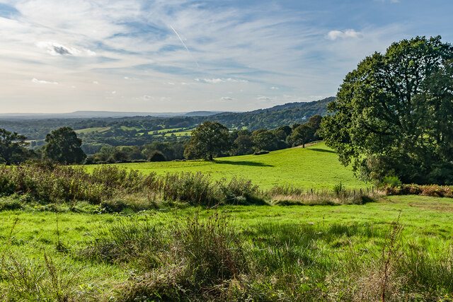
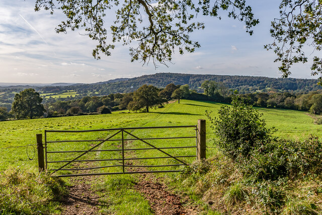
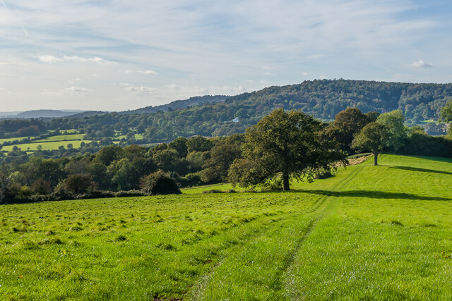
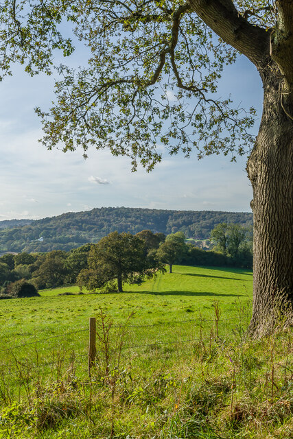
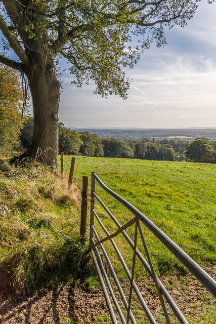
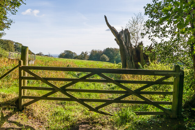
Covering an area of approximately 100 acres, Leith Hill Place Wood is characterized by its diverse array of tree species, including oak, beech, birch, and hazel. The wood is well-preserved and managed by the National Trust, ensuring its natural heritage is protected for future generations.

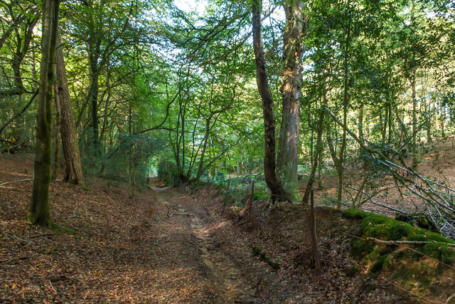
Visitors to Leith Hill Place Wood can explore its numerous walking trails, which wind through the ancient trees and offer stunning views of the surrounding landscape. The peaceful ambiance of the wood makes it an ideal destination for nature enthusiasts, birdwatchers, and those simply seeking a tranquil retreat from the bustling city.

Wildlife thrives in Leith Hill Place Wood, with an abundance of bird species, such as woodpeckers, nightingales, and tawny owls, calling the wood their home. Additionally, the wood provides a habitat for various mammals, including deer, foxes, and badgers.

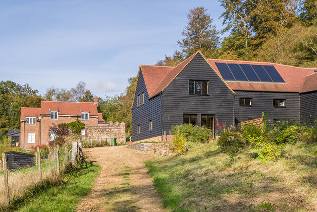
Leith Hill Place Wood is also historically significant, as it is adjacent to Leith Hill Place, the childhood home of the famous composer Ralph Vaughan Williams. The wood provides a picturesque backdrop to the house, and visitors can explore the grounds to gain insight into the composer's life and inspiration.

Overall, Leith Hill Place Wood is a captivating destination for nature lovers, offering a combination of natural beauty, diverse wildlife, and a touch of history. Its serene atmosphere and scenic trails make it a must-visit location for anyone seeking a peaceful escape in the heart of Surrey.

If you have any feedback on the listing, please let us know in the comments section below.

Leith Hill Place Wood Images

Images are sourced within 2km of 51.171782/-0.37259135 or Grid Reference TQ1342. Thanks to Geograph Open Source API. All images are credited.

Leith Hill - Rhododendron A common shrub on Leith Hill, part of the Greensand Ridge.
Leith Hill - Rhododendron
A common shrub on Leith Hill, part of the Greensand Ridge.
West from near Tanhurst Looking west from near Tanhurst, on the western slopes of Leith Hill.  In the far distance is Black Down.
West from near Tanhurst
Looking west from near Tanhurst, on the western slopes of Leith Hill. In the far distance is Black Down.
West from near Tanhurst Looking west from near Tanhurst, on the western slopes of Leith Hill.  In the distance is Holmbury Hill.
West from near Tanhurst
Looking west from near Tanhurst, on the western slopes of Leith Hill. In the distance is Holmbury Hill.
West from near Tanhurst Looking west from near Tanhurst, on the western slopes of Leith Hill.  In the distance is Holmbury Hill.
West from near Tanhurst
Looking west from near Tanhurst, on the western slopes of Leith Hill. In the distance is Holmbury Hill.
West from near Tanhurst Looking west from near Tanhurst, on the western slopes of Leith Hill.  In the distance is Holmbury Hill.
West from near Tanhurst
Looking west from near Tanhurst, on the western slopes of Leith Hill. In the distance is Holmbury Hill.
South from near Tanhurst Looking south from near Tanhurst, on the western slopes of Leith Hill.  In the far distance are the South Downs.
South from near Tanhurst
Looking south from near Tanhurst, on the western slopes of Leith Hill. In the far distance are the South Downs.
South from above Tanhurst Looking south from above Tanhurst, on the western slopes of Leith Hill.
South from above Tanhurst
Looking south from above Tanhurst, on the western slopes of Leith Hill.
Drinking trough Drinking trough and fountain near the summit of Leith Hill.  Originally installed in Roehampton Vale, Wandsworth, by the Metropolitan Drinking Fountain and Cattle Trough Association, it was moved here in July 2018 with the support of the charity (now known as The Drinking Fountain Association).
Drinking trough
Drinking trough and fountain near the summit of Leith Hill. Originally installed in Roehampton Vale, Wandsworth, by the Metropolitan Drinking Fountain and Cattle Trough Association, it was moved here in July 2018 with the support of the charity (now known as The Drinking Fountain Association).
Leith Hill Tower Tower on the summit of Leith Hill, built in 1774-5 with the stair turret added in 1864.  Grade II listed - see <span class="nowrap"><a title="www.historicengland.org.uk/listing/the-list/list-entry/1028808" rel="nofollow ugc noopener" href="http://www.historicengland.org.uk/listing/the-list/list-entry/1028808">Link</a><img style="margin-left:2px;" alt="External link" title="External link - shift click to open in new window" src="https://s1.geograph.org.uk/img/external.png" width="10" height="10"/></span>.
Leith Hill Tower
Tower on the summit of Leith Hill, built in 1774-5 with the stair turret added in 1864. Grade II listed - see LinkExternal link.
Leith Hill summit The summit of Leith Hill, with the drinking trough installed in 2018 on the left (see <a href="https://www.geograph.org.uk/photo/6994981">TQ1343 : Drinking trough</a> and Leith Hill Tower in the background (see <a href="https://www.geograph.org.uk/photo/6994999">TQ1343 : Leith Hill Tower</a>).
Leith Hill summit
The summit of Leith Hill, with the drinking trough installed in 2018 on the left (see TQ1343 : Drinking trough and Leith Hill Tower in the background (see TQ1343 : Leith Hill Tower).
Sheephouse Lane Looking along Sheephouse Lane with the entrance to Leyland's Farm on the left.
Sheephouse Lane
Looking along Sheephouse Lane with the entrance to Leyland's Farm on the left.
Bridleway Bridleway in Abinger Bottom.
Bridleway
Bridleway in Abinger Bottom.
Bridleway Bridleway in Abinger Bottom.
Bridleway
Bridleway in Abinger Bottom.
Track Track off Leith Hill Road.
Track
Track off Leith Hill Road.
High Ashes Farm Farm off Leith Hill Road.
High Ashes Farm
Farm off Leith Hill Road.
Driveway Driveway for The Coach House, Tanhurst.
Driveway
Driveway for The Coach House, Tanhurst.
The Coach House The Coach House is on the left of the photo and was formerly the coach house to Tanhurst, a late 18th Century mansion.  For some years, Tanhurst was the home of Sir Edward and Lady Jane Vaughan Williams, grandparents to Ralph Vaughan Williams.  The Coach House was converted into its present form in 1960.  The building on the right, a former barn, was converted to holiday accommodation in the late 2010s.
The Coach House
The Coach House is on the left of the photo and was formerly the coach house to Tanhurst, a late 18th Century mansion. For some years, Tanhurst was the home of Sir Edward and Lady Jane Vaughan Williams, grandparents to Ralph Vaughan Williams. The Coach House was converted into its present form in 1960. The building on the right, a former barn, was converted to holiday accommodation in the late 2010s.
The Coach House The Coach House is in the centre of the photo and was formerly the coach house to Tanhurst, a late 18th Century mansion.  For some years, Tanhurst was the home of Sir Edward and Lady Jane Vaughan Williams, grandparents to Ralph Vaughan Williams.  The Coach House was converted into its present form in 1960.  The building on the right, a former barn, was converted to holiday accommodation in the late 2010s.
The Coach House
The Coach House is in the centre of the photo and was formerly the coach house to Tanhurst, a late 18th Century mansion. For some years, Tanhurst was the home of Sir Edward and Lady Jane Vaughan Williams, grandparents to Ralph Vaughan Williams. The Coach House was converted into its present form in 1960. The building on the right, a former barn, was converted to holiday accommodation in the late 2010s.
Show me another place!

Leith Hill Place Wood is located at Grid Ref: TQ1342 (Lat: 51.171782, Lng: -0.37259135)

Administrative County: Surrey

District: Mole Valley

Police Authority: Surrey

What 3 Words

///third.tend.slows. Near Holmwood, Surrey

Related Wikis

Leith Hill

Leith Hill in southern England is the highest summit of the Greensand Ridge, approximately 6.7 km (4 mi) southwest of Dorking, Surrey and 40.5 km (30 mi...

Leith Hill multiple aircraft accident

On 26 November 1944, four C-47 transport aircraft of the 442nd Operations Group departed from Advanced Landing Ground "A-4 in Pays de la Loire, northern...

Greensand Ridge

The Greensand Ridge, also known as the Wealden Greensand, is an extensive, prominent, often wooded, mixed greensand/sandstone escarpment in south-east...

Broome Hall

Broome Hall is a Grade II-listed country house with grounds including cottages and outhouses on the wooded, upper southern slopes of the Greensand Ridge...

Leith Hill SSSI

Leith Hill SSSI is a 337.9-hectare (835-acre) biological Site of Special Scientific Interest south-east of Dorking in Surrey. The SSSI consists of four...

Coldharbour, Surrey

Coldharbour is a hamlet in the Mole Valley district, in the English county of Surrey. It is on a minor road from Dorking to Leith Hill Place. == Description... ==

Ockley

Ockley is a rural village in Surrey. It lies astride the A29, the modern road using the alignment of Stane Street (Chichester). The A29 diverges from the...

Wotton and Abinger Commons

Wotton and Abinger Commons is a 324-hectare (800-acre) nature reserve south-west of Dorking in Surrey. It is managed by the Surrey Wildlife Trust. Part...

Nearby Amenities

Located within 500m of 51.171782,-0.37259135
Tourism: viewpoint
Wheelchair: no
Wheelchair Description: Steep uneven paths or steps from car parks (1km).
Lat/Long: 51.175638/-0.3732886
Campfield Place
Building: yes
Source: npe
Lat/Long: 51.1739071/-0.3765266
Parking
Windy Gap Car Park
Access: yes
Fee: yes
Parking: surface
Toilets Wheelchair: no
Wheelchair: no
Wheelchair Description: Long flight of uneven steps to Leith Hill Tower. Nearby footpaths steep.
Lat/Long: 51.1742942/-0.37127
Parking
Windy Gap Car Park
Toilets Wheelchair: no
Wheelchair: no
Wheelchair Description: Long flight of uneven steps to Leith Hill Tower. Nearby footpaths steep.
Lat/Long: 51.1738637/-0.3715103
Bench
Lat/Long: 51.1755236/-0.3729592
Bench
Backrest: no
Lat/Long: 51.1758239/-0.3725269
Bench
Backrest: no
Covered: no
Leisure: picnic_table
Seats: 4
Tourism: picnic_site
Lat/Long: 51.1761064/-0.3723764
Bench
Backrest: yes
Check Date: 2023-10-08
Lat/Long: 51.1753193/-0.3720036
Bench
Backrest: yes
Lat/Long: 51.1755059/-0.3722089
Bench
Backrest: no
Tourism: picnic_site
Lat/Long: 51.1754378/-0.372384
Bench
Backrest: no
Check Date: 2023-10-08
Lat/Long: 51.1760769/-0.3717204
Tourism: picnic_site
Lat/Long: 51.1756855/-0.373973
Bench
Backrest: no
Check Date: 2023-10-08
Lat/Long: 51.1757525/-0.3719306
Barrier: kissing_gate
Lat/Long: 51.1674583/-0.3727599
Power: pole
Source: gps;Bing
Lat/Long: 51.1680751/-0.3707584
Power: pole
Source: gps;Bing
Lat/Long: 51.1674402/-0.3720036
Power: pole
Source: gps;Bing
Lat/Long: 51.1697099/-0.3691819
Power: pole
Source: gps;Bing
Lat/Long: 51.1683737/-0.3692409
Bench
Backrest: no
Seats: 3
Lat/Long: 51.1758039/-0.3719939
Leith Hill Place Farm
Place: farm
Lat/Long: 51.1700348/-0.3789745
Power: pole
Lat/Long: 51.1673446/-0.3722815
Colour: naturbelassen
Leisure: picnic_table
Material: wood
Lat/Long: 51.1754323/-0.3734642
Bench
Colour: naturbelassen
Material: wood
Seats: 3
Lat/Long: 51.1756114/-0.3734629
Colour: naturbelassen
Leisure: picnic_table
Material: wood
Lat/Long: 51.1754007/-0.373072
Bench
Colour: naturbelassen
Material: wood
Seats: 3
Lat/Long: 51.1702429/-0.3724498
The data included in this document is from www.openstreetmap.org. The data is made available under ODbL.

Have you been to Leith Hill Place Wood?

Leave your review of Leith Hill Place Wood below (or comments, questions and feedback).