Rhododendron Wood

Wood, Forest in Surrey Mole Valley

England

Rhododendron Wood

Leith Hill - Rhododendron A common shrub on Leith Hill, part of the Greensand Ridge.
Leith Hill - Rhododendron Credit: Colin Smith

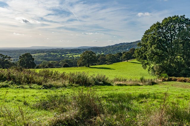
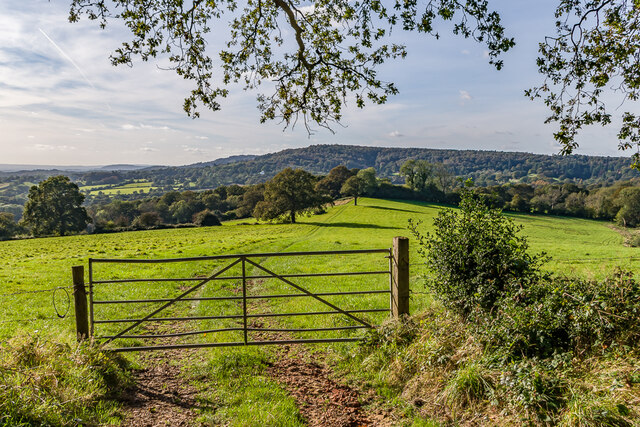
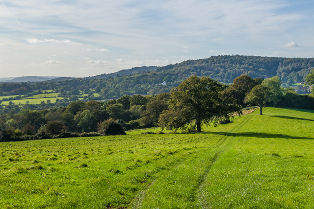
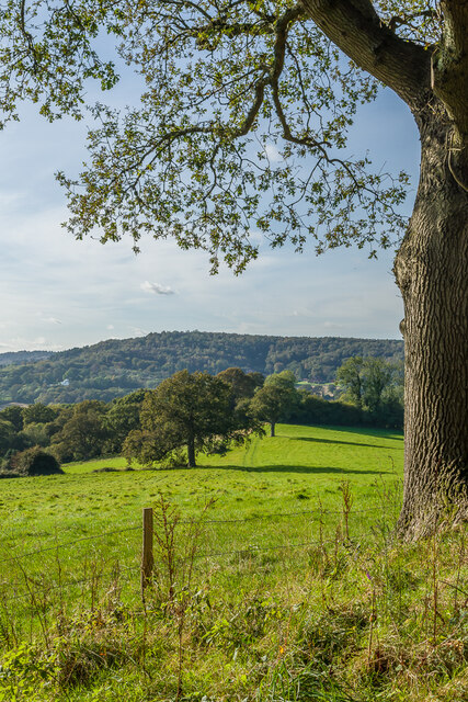
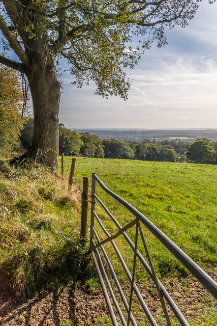
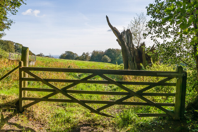
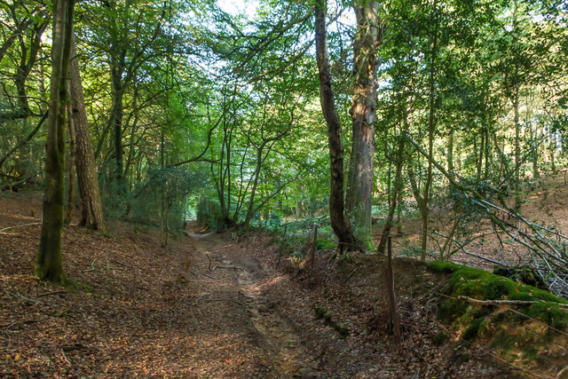
Rhododendron Wood, located in Surrey, is a captivating forest known for its vibrant display of rhododendron flowers. Spread over a vast expanse, the wood is a popular destination for nature enthusiasts and hikers alike. The dense foliage and towering trees create a serene environment, offering a tranquil escape from the bustling city life.

The wood is home to an extensive collection of rhododendron plants, which burst into a riot of colors during the spring season. These stunning flowers, ranging from pale pinks to deep purples, create a breathtaking spectacle that attracts visitors from far and wide. The rhododendron blooms are complemented by a tapestry of other wildflowers, such as bluebells and daffodils, adding to the wood's visual appeal.

A network of well-maintained trails weaves through the wood, allowing visitors to explore its beauty at their own pace. The paths meander through ancient trees and along babbling brooks, offering glimpses of local wildlife, including squirrels, rabbits, and a variety of bird species. The wood also provides ample opportunities for birdwatching enthusiasts, with sightings of woodpeckers and owls being particularly common.

Rhododendron Wood is a cherished natural habitat and efforts are made to preserve its biodiversity. Conservation initiatives have been implemented to protect the delicate ecosystem, ensuring that future generations can continue to enjoy its splendor. Visitors are encouraged to adhere to designated trails and respect the environment by avoiding littering or damaging the flora and fauna.

Overall, Rhododendron Wood in Surrey presents an enchanting retreat where visitors can immerse themselves in nature's beauty, be captivated by the vibrant rhododendron blooms, and experience the tranquility of a forest teeming with life.

If you have any feedback on the listing, please let us know in the comments section below.

Rhododendron Wood Images

Images are sourced within 2km of 51.172396/-0.38312688 or Grid Reference TQ1342. Thanks to Geograph Open Source API. All images are credited.

Leith Hill - Rhododendron A common shrub on Leith Hill, part of the Greensand Ridge.
Leith Hill - Rhododendron
A common shrub on Leith Hill, part of the Greensand Ridge.
West from near Tanhurst Looking west from near Tanhurst, on the western slopes of Leith Hill.  In the far distance is Black Down.
West from near Tanhurst
Looking west from near Tanhurst, on the western slopes of Leith Hill. In the far distance is Black Down.
West from near Tanhurst Looking west from near Tanhurst, on the western slopes of Leith Hill.  In the distance is Holmbury Hill.
West from near Tanhurst
Looking west from near Tanhurst, on the western slopes of Leith Hill. In the distance is Holmbury Hill.
West from near Tanhurst Looking west from near Tanhurst, on the western slopes of Leith Hill.  In the distance is Holmbury Hill.
West from near Tanhurst
Looking west from near Tanhurst, on the western slopes of Leith Hill. In the distance is Holmbury Hill.
West from near Tanhurst Looking west from near Tanhurst, on the western slopes of Leith Hill.  In the distance is Holmbury Hill.
West from near Tanhurst
Looking west from near Tanhurst, on the western slopes of Leith Hill. In the distance is Holmbury Hill.
South from near Tanhurst Looking south from near Tanhurst, on the western slopes of Leith Hill.  In the far distance are the South Downs.
South from near Tanhurst
Looking south from near Tanhurst, on the western slopes of Leith Hill. In the far distance are the South Downs.
South from above Tanhurst Looking south from above Tanhurst, on the western slopes of Leith Hill.
South from above Tanhurst
Looking south from above Tanhurst, on the western slopes of Leith Hill.
Drinking trough Drinking trough and fountain near the summit of Leith Hill.  Originally installed in Roehampton Vale, Wandsworth, by the Metropolitan Drinking Fountain and Cattle Trough Association, it was moved here in July 2018 with the support of the charity (now known as The Drinking Fountain Association).
Drinking trough
Drinking trough and fountain near the summit of Leith Hill. Originally installed in Roehampton Vale, Wandsworth, by the Metropolitan Drinking Fountain and Cattle Trough Association, it was moved here in July 2018 with the support of the charity (now known as The Drinking Fountain Association).
Leith Hill Tower Tower on the summit of Leith Hill, built in 1774-5 with the stair turret added in 1864.  Grade II listed - see <span class="nowrap"><a title="www.historicengland.org.uk/listing/the-list/list-entry/1028808" rel="nofollow ugc noopener" href="http://www.historicengland.org.uk/listing/the-list/list-entry/1028808">Link</a><img style="margin-left:2px;" alt="External link" title="External link - shift click to open in new window" src="https://s1.geograph.org.uk/img/external.png" width="10" height="10"/></span>.
Leith Hill Tower
Tower on the summit of Leith Hill, built in 1774-5 with the stair turret added in 1864. Grade II listed - see LinkExternal link.
Leith Hill summit The summit of Leith Hill, with the drinking trough installed in 2018 on the left (see <a href="https://www.geograph.org.uk/photo/6994981">TQ1343 : Drinking trough</a> and Leith Hill Tower in the background (see <a href="https://www.geograph.org.uk/photo/6994999">TQ1343 : Leith Hill Tower</a>).
Leith Hill summit
The summit of Leith Hill, with the drinking trough installed in 2018 on the left (see TQ1343 : Drinking trough and Leith Hill Tower in the background (see TQ1343 : Leith Hill Tower).
Sheephouse Lane Looking along Sheephouse Lane with the entrance to Leyland's Farm on the left.
Sheephouse Lane
Looking along Sheephouse Lane with the entrance to Leyland's Farm on the left.
Paddock Paddock north of Leyland's Farm.
Paddock
Paddock north of Leyland's Farm.
King George's Cottage Looking across a field to King George's Cottage, originally a terrace of 4 farmworkers' cottages, now a single house.  The name refers to the hamlet in which it is situated, known in the past as King George's Hill, itself named after a long gone pub (according to "A History of the County of Surrey" - Victoria County History, 1911).
King George's Cottage
Looking across a field to King George's Cottage, originally a terrace of 4 farmworkers' cottages, now a single house. The name refers to the hamlet in which it is situated, known in the past as King George's Hill, itself named after a long gone pub (according to "A History of the County of Surrey" - Victoria County History, 1911).
Field Field edge west of Sheephouse Lane.
Field
Field edge west of Sheephouse Lane.
Footpath sign A metal footpath sign near St George's Cottage.
Footpath sign
A metal footpath sign near St George's Cottage.
Bridleway Bridleway in Abinger Bottom.
Bridleway
Bridleway in Abinger Bottom.
Bridleway Bridleway in Abinger Bottom.
Bridleway
Bridleway in Abinger Bottom.
Track Track off Leith Hill Road.
Track
Track off Leith Hill Road.
Show me another place!

Rhododendron Wood is located at Grid Ref: TQ1342 (Lat: 51.172396, Lng: -0.38312688)

Administrative County: Surrey

District: Mole Valley

Police Authority: Surrey

What 3 Words

///expand.dimes.sector. Near Holmwood, Surrey

Related Wikis

Leith Hill

Leith Hill in southern England is the highest summit of the Greensand Ridge, approximately 6.7 km (4 mi) southwest of Dorking, Surrey and 40.5 km (30 mi...

Leith Hill multiple aircraft accident

On 26 November 1944, four C-47 transport aircraft of the 442nd Operations Group departed from Advanced Landing Ground "A-4 in Pays de la Loire, northern...

Greensand Ridge

The Greensand Ridge, also known as the Wealden Greensand, is an extensive, prominent, often wooded, mixed greensand/sandstone escarpment in south-east...

Leith Hill SSSI

Leith Hill SSSI is a 337.9-hectare (835-acre) biological Site of Special Scientific Interest south-east of Dorking in Surrey. The SSSI consists of four...

Broome Hall

Broome Hall is a Grade II-listed country house with grounds including cottages and outhouses on the wooded, upper southern slopes of the Greensand Ridge...

Joldwynds

Joldwynds is a modernist style house in Holmbury St Mary, Surrey, England, designed by architect Oliver Hill for Wilfred Greene, 1st Baron Greene. Completed...

Coldharbour, Surrey

Coldharbour is a hamlet in the Mole Valley district, in the English county of Surrey. It is on a minor road from Dorking to Leith Hill Place. == Description... ==

Holmbury St Mary

Holmbury St Mary is a village in Surrey, England centered on shallow upper slopes of the Greensand Ridge. Its developed area is a nucleated village, 4...

Nearby Amenities

Located within 500m of 51.172396,-0.38312688
Leith Hill Place
Addr City: Dorking
Addr Postcode: RH5 6LY
Addr Street: Leith Hill Lane
Place: isolated_dwelling
Source: npe
Wikidata: Q17547625
Lat/Long: 51.1693914/-0.3797717
Campfield Place
Building: yes
Source: npe
Lat/Long: 51.1739071/-0.3765266
Tanhurst
Place: isolated_dwelling
Source: npe
Wikidata: Q26581905
Lat/Long: 51.1743149/-0.3867235
Barrier: bollard
Lat/Long: 51.1730646/-0.3830658
Barrier: kissing_gate
Lat/Long: 51.1696668/-0.3828575
Crossing: informal
Lat/Long: 51.1736556/-0.3815956
Barrier: stile
Lat/Long: 51.1728657/-0.3824344
Leisure: picnic_table
Lat/Long: 51.1730261/-0.3816767
Leisure: picnic_table
Lat/Long: 51.1730436/-0.3819764
Post Box
Post Box Type: wall
Ref: RH5 107
Royal Cypher: GR
Royal Cypher Wikidata: Q33102273
Lat/Long: 51.172199/-0.3799136
Barrier: stile
Lat/Long: 51.1718629/-0.3812909
Bench
Backrest: yes
Lat/Long: 51.1722607/-0.3807442
Barrier: cycle_barrier
Lat/Long: 51.170595/-0.3867623
Bench
Backrest: yes
Lat/Long: 51.1719508/-0.3816595
Bench
Backrest: yes
Lat/Long: 51.171958/-0.381316
Bench
Backrest: yes
Lat/Long: 51.1719866/-0.3813374
Bench
Backrest: yes
Lat/Long: 51.1727673/-0.3821566
Bench
Backrest: yes
Lat/Long: 51.172962/-0.3825712
Barrier: cycle_barrier
Lat/Long: 51.175567/-0.3782065
Leisure: park
Lat/Long: 51.1725831/-0.3829121
Bench
Backrest: no
Lat/Long: 51.1715821/-0.3845156
Barrier: cycle_barrier
Lat/Long: 51.1706032/-0.3867625
Barrier: stile
Lat/Long: 51.1710023/-0.3866136
Fixme: i'm sure this footpath continues inside the Rhododendron Wood, but it had been merges with the road.
Lat/Long: 51.1727313/-0.3856394
Bench
Backrest: no
Seats: 3
Lat/Long: 51.1698133/-0.3843901
Cafe
Description: Inside house, runs on donations
Wheelchair: yes
Lat/Long: 51.169379/-0.3792847
Leith Hill Place Farm
Place: farm
Lat/Long: 51.1700348/-0.3789745
Bench
Backrest: yes
Colour: naturbelassen
Material: wood
Seats: 4
Lat/Long: 51.1724584/-0.3848975
Bench
Backrest: yes
Colour: naturbelassen
Material: wood
Seats: 4
Lat/Long: 51.1725319/-0.3830941
The data included in this document is from www.openstreetmap.org. The data is made available under ODbL.

Have you been to Rhododendron Wood?

Leave your review of Rhododendron Wood below (or comments, questions and feedback).