Baa Lamb Trees

Wood, Forest in Hertfordshire St. Albans

England

Baa Lamb Trees

Coldharbour Lane, Harpenden
Coldharbour Lane, Harpenden Credit: David Howard

Baa Lamb Trees, located in Hertfordshire, is a picturesque woodland area known for its natural beauty and tranquil atmosphere. Stretching over a vast expanse, the forest is home to a diverse range of flora and fauna, making it a haven for nature enthusiasts and wildlife lovers.

The woodland is characterized by its dense canopy of trees, which includes a mix of species such as oak, beech, and birch. The lush greenery provides a refreshing escape from the hustle and bustle of urban life, offering visitors an opportunity to immerse themselves in the peacefulness of nature.

One of the unique features of Baa Lamb Trees is its abundance of wildlife. The forest provides a habitat for numerous species, including deer, foxes, rabbits, and a variety of bird species. It is not uncommon to spot rare and elusive creatures such as the red kite soaring through the skies above.

The wood is also popular among hikers, walkers, and cyclists, who can explore the numerous trails and pathways that crisscross the area. These trails offer breathtaking views of the surrounding countryside and are suitable for all skill levels.

Baa Lamb Trees is also renowned for its annual lambing season, during which visitors can witness the birth of new lambs and experience the joys of rural life. This unique event attracts families and individuals alike, providing an educational and memorable experience.

Overall, Baa Lamb Trees in Hertfordshire is a natural gem that offers a peaceful retreat for those seeking solace in nature. With its diverse flora and fauna, scenic trails, and seasonal events, it is a must-visit destination for nature enthusiasts and outdoor enthusiasts alike.

If you have any feedback on the listing, please let us know in the comments section below.

Baa Lamb Trees Images

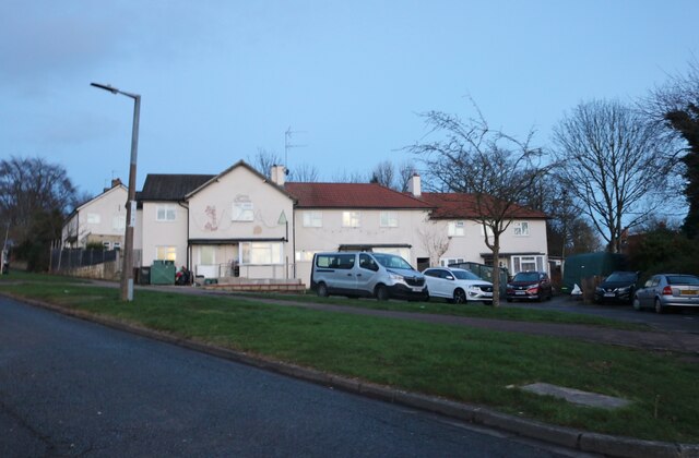
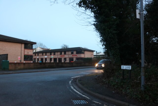
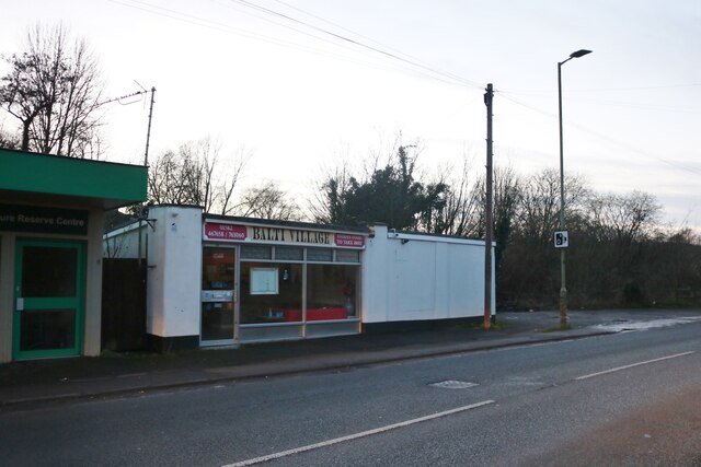
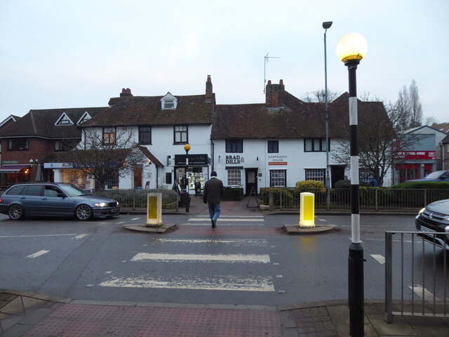
Images are sourced within 2km of 51.81229/-0.35362635 or Grid Reference TL1313. Thanks to Geograph Open Source API. All images are credited.

Coldharbour Lane, Harpenden
Batford Road at the junction of Lower Luton Road
Houses on Pickford Hill, Batford
Pickford Hill, Batford
Houses on Finley Road, Batford
Westfield Avenue, Harpenden
Westfield Road, Harpenden The railway is behind the barrier
Westfield Road, Harpenden
The railway is behind the barrier
House on Ox Lane, Harpenden
Coldharbour Lane at the end of Ox Lane
Balti Village on Lower Luton Road, Batford
Batford Springs Nature Reserve Centre Providing walks and information on the nature reserve <span class="nowrap"><a title="https://www.harpenden.gov.uk/batford-springs" rel="nofollow ugc noopener" href="https://www.harpenden.gov.uk/batford-springs">Link</a><img style="margin-left:2px;" alt="External link" title="External link - shift click to open in new window" src="https://s1.geograph.org.uk/img/external.png" width="10" height="10"/></span>
Batford Springs Nature Reserve Centre
Providing walks and information on the nature reserve LinkExternal link
Lower Luton Road, Batford
On Church Green in Harpenden Red Knitwear and The Wine Rack. High Street is the larger road adjacent.
On Church Green in Harpenden
Red Knitwear and The Wine Rack. High Street is the larger road adjacent.
The Old Cock Inn on Harpenden High Street The town is busy.
The Old Cock Inn on Harpenden High Street
The town is busy.
Kwik Fit on Harpenden High Street A female voice sings inside the workshop, either a team member or a really happy customer.
Kwik Fit on Harpenden High Street
A female voice sings inside the workshop, either a team member or a really happy customer.
Zebra crossing on Harpenden high street Opposite an estate agents, I think.
Zebra crossing on Harpenden high street
Opposite an estate agents, I think.
Show me another place!

Baa Lamb Trees is located at Grid Ref: TL1313 (Lat: 51.81229, Lng: -0.35362635)

Administrative County: Hertfordshire

District: St. Albans

Police Authority: Hertfordshire

What 3 Words

///sleeps.stole.chins. Near Harpenden, Hertfordshire

Related Wikis

Harpenden Town Hall

Harpenden Town Hall is a municipal building in Leyton Road in Harpenden, a town in Hertfordshire, in England. It accommodates the offices and meeting place...

Harpenden railway station

Harpenden railway station is on the Midland Main Line in England, serving the town of Harpenden, Hertfordshire. It is 24 miles 51 chains (39.7 km) down...

Rothamsted Research

Rothamsted Research, previously known as the Rothamsted Experimental Station and then the Institute of Arable Crops Research, is one of the oldest agricultural...

Rothamsted Park

Rothamsted Park is a 56-acre (230,000 m2) public park in Harpenden, Hertfordshire. == History == The park was formerly part of the Manor of Rothamsted...

Nearby Amenities

Located within 500m of 51.81229,-0.35362635
Mini Roundabout
Direction: clockwise
Lat/Long: 51.8144681/-0.3549475
Crossing
Crossing: marked
Crossing Island: no
Crossing Ref: zebra
Tactile Paving: yes
Lat/Long: 51.8151931/-0.3525576
Harpenden
Place: town
Population: 29448
Wikidata: Q19785
Wikipedia: en:Harpenden
Lat/Long: 51.8145103/-0.3549311
Mini Roundabout
Direction: clockwise
Lat/Long: 51.8115339/-0.3467721
Mini Roundabout
Direction: clockwise
Lat/Long: 51.8116029/-0.3469406
Mini Roundabout
Direction: clockwise
Lat/Long: 51.8094548/-0.3494579
Turning Loop
Lat/Long: 51.8137956/-0.3522897
Recycling
Location: overground
Recycling Type: container
Lat/Long: 51.8135312/-0.358438
Crossing
Crossing: unmarked
Lat/Long: 51.8095337/-0.3496531
Pub
The Wheatsheaf
Addr City: Harpenden
Addr Housenumber: 9
Addr Postcode: AL5 2RT
Addr Street: High Street
Fhrs Id: 305679
Indoor Seating: yes
Operator: Stonegate
Operator Wikidata: Q7619176
Outdoor Seating: yes
Website: https://www.greatukpubs.co.uk/wheatsheaf-harpenden
Wheelchair: yes
Lat/Long: 51.8148343/-0.3547216
Toilets
Check Date: 2022-08-07
Fee: no
Wheelchair: yes
Lat/Long: 51.8144351/-0.3555544
M&S Simply Food
Addr City: Harpenden
Addr Postcode: AL5 2TW
Addr Street: Church Green
Brand: M&S Simply Food
Brand Wikidata: Q714491
Brand Wikipedia: en:Marks & Spencer
Contact Website: https://www.marksandspencer.com/stores/harpenden-simply-food-8853
Fhrs Id: 306090
Opening Hours: Mo-Sa 08:00-20:00; Su 11:00-17:00
Shop: supermarket
Lat/Long: 51.8158271/-0.3574001
Pub
The Silver Cup
Addr City: Harpenden
Addr Housenumber: 5
Addr Postcode: AL5 2JF
Addr Street: St Albans Road
Email: hello@thesilvercup.co.uk
Fhrs Id: 306247
Phone: +44 1582 713095
Website: https://www.thesilvercup.co.uk
Wikidata: Q83558664
Lat/Long: 51.8117645/-0.3540896
Crossing
Crossing: marked
Crossing Island: no
Crossing Markings: zebra
Crossing Ref: zebra
Tactile Paving: no
Lat/Long: 51.8155041/-0.3566203
Crossing
Button Operated: yes
Crossing: marked
Crossing Island: no
Crossing Markings: dots
Crossing Signals: yes
Crossing Ref: puffin
Tactile Paving: yes
Traffic Signals Sound: yes
Traffic Signals Vibration: yes
Lat/Long: 51.8154283/-0.3557887
Post Box
Collection Times: Mo-Fr 17:00; Sa 11:45
Operator: Royal Mail
Operator Wikidata: Q638098
Post Box Type: pillar
Ref: AL5 117
Royal Cypher: EIIR
Royal Cypher Wikidata: Q33102113
Lat/Long: 51.8153372/-0.3558855
Crossing
Crossing: unmarked
Crossing Island: no
Crossing Markings: no
Tactile Paving: yes
Lat/Long: 51.8147585/-0.3548313
Building: commercial
Disused Amenity: bank
Old Name: HSBC UK
Operational Status: closed
Lat/Long: 51.8146645/-0.3545328
Cafe
Harrison + Hoole
Addr Country: GB
Diet Vegetarian: yes
Indoor Seating: yes
Opening Hours: Mo-Sa 07:30-17:30; Su 09:00-16:00
Outdoor Seating: yes
Lat/Long: 51.8154024/-0.356034
Crossing
Button Operated: yes
Crossing: marked
Crossing Island: no
Crossing Markings: dots
Crossing Signals: yes
Crossing Ref: puffin
Tactile Paving: yes
Traffic Signals Sound: yes
Traffic Signals Vibration: yes
Lat/Long: 51.8162165/-0.3565511
Bank
Nationwide
Brand: Nationwide
Brand Wikidata: Q846735
Brand Wikipedia: en:Nationwide Building Society
Contact Website: https://locations.nationwidebranches.co.uk/harpenden/20-high-street
Opening Hours: Mo,Tu,Th,Fr 09:00-14:00; We 10:00-14:00
Lat/Long: 51.8154785/-0.3560466
Bank
Halifax
Brand: Halifax
Brand Wikidata: Q3310164
Brand Wikipedia: en:Halifax (bank)
Opening Hours: Mo-Fr 09:00-14:30
Lat/Long: 51.8157884/-0.3563385
Majestic
Addr City: Harpenden
Addr Housenumber: 31A
Addr Postcode: AL5 2RU
Addr Street: High Street
Brand: Majestic
Brand Wikidata: Q6737725
Drive Through: no
Fhrs Authority: St Albans City
Fhrs Id: 1595130
Level: 0
Shop: alcohol
Website: https://www.majestic.co.uk/stores/harpenden
Lat/Long: 51.8162843/-0.3560694
Atm
Sainsbury's
Cash In: no
Check Date: 2022-12-19
Currency GBP: yes
Drive Through: no
Wheelchair: yes
Lat/Long: 51.8160829/-0.3559653
Traffic Calming: island
Lat/Long: 51.8145704/-0.3550587
Bicycle Parking
Bicycle Parking: stands
Capacity: 18
Covered: no
Lat/Long: 51.8155376/-0.3556685
Bicycle Parking
Bicycle Parking: stands
Capacity: 6
Lat/Long: 51.81599/-0.3534661
Bus Stop
The George PH
Bench: yes
Bin: yes
Bus: yes
Check Date Shelter: 2022-02-19
Naptan AtcoCode: 210021500260
Naptan NaptanCode: hrtdamgw
Public Transport: platform
Shelter: yes
Lat/Long: 51.8157249/-0.3560173
Bus Stop
Crabtree Lane
Bus: yes
Naptan AtcoCode: 210021500680
Naptan Bearing: SE
Naptan CommonName: Crabtree Lane
Naptan Crossing: opp Skew Bridge PH
Naptan Indicator: adj
Naptan Landmark: opp Skew Bridge PH
Naptan NaptanCode: hrtdajpt
Naptan PlusbusZoneRef: HRPNDN
Naptan ShortCommonName: NA
Naptan Street: Southdown Road
Naptan Verified: no
Public Transport: platform
Shelter: no
Source: naptan_import
Lat/Long: 51.8092483/-0.3489847
Bus Stop
Crabtree Lane
Bus: yes
Naptan AtcoCode: 210021511080
Naptan Bearing: NW
Naptan CommonName: Crabtree Lane
Naptan Crossing: Skew Bridge PH
Naptan Indicator: opp
Naptan Landmark: Skew Bridge PH
Naptan NaptanCode: hrtatjpg
Naptan PlusbusZoneRef: HRPNDN
Naptan ShortCommonName: NA
Naptan Street: Southdown Road
Naptan Verified: no
Public Transport: platform
Shelter: no
Source: naptan_import
Lat/Long: 51.8095908/-0.3498638
Bus Stop
Harpenden House Hotel
Bus: yes
Local Ref: NR
Naptan AtcoCode: 210021500660
Naptan Bearing: SE
Naptan CommonName: Harpenden House Hotel
Naptan Crossing: St Dominic RC School
Naptan Indicator: nr
Naptan Landmark: St Dominic RC School
Naptan NaptanCode: hrtdajpm
Naptan PlusbusZoneRef: HRPNDN
Naptan ShortCommonName: NA
Naptan Street: Southdown Road
Naptan Verified: no
Public Transport: platform
Shelter: no
Source: naptan_import
Lat/Long: 51.8117872/-0.3519459
Bus Stop
Bus: yes
Public Transport: platform
Lat/Long: 51.8141828/-0.3546557
Post Box
Brand: Royal Mail
Brand Wikidata: Q638098
Brand Wikipedia: en:Royal Mail
Collection Times: Mo-Fr 09:00, Sa 07:00
Operator: Royal Mail
Operator Wikidata: Q638098
Post Box Type: lamp
Ref: AL5 29D
Royal Cypher: EIIR
Royal Cypher Wikidata: Q33102113
Lat/Long: 51.8108179/-0.354161
Bus Stop
Harpenden Railway Station
Bench: no
Bin: yes
Bus: yes
Lit: yes
Local Ref: B
Naptan AtcoCode: 210021500280
Naptan Bearing: NE
Naptan CommonName: Harpenden Railway Station
Naptan Crossing: opp Arden Grove
Naptan Indicator: Stop B
Naptan Landmark: opp Arden Grove
Naptan NaptanCode: hrtdamja
Naptan PlusbusZoneRef: HRPNDN
Naptan ShortCommonName: NA
Naptan Street: Station Road
Naptan Verified: no
Public Transport: platform
Shelter: no
Source: naptan_import
Tactile Paving: no
Lat/Long: 51.8150249/-0.3533894
Bus Stop
The Cedars
Bus: yes
Naptan AtcoCode: 210021500300
Naptan Bearing: SE
Naptan CommonName: The Cedars
Naptan Crossing: Shakespeare Road
Naptan Indicator: opp
Naptan Landmark: Shakespeare Road
Naptan NaptanCode: hrtdamag
Naptan PlusbusZoneRef: HRPNDN
Naptan ShortCommonName: NA
Naptan Street: Milton Road
Naptan Verified: no
Public Transport: platform
Source: naptan_import
Lat/Long: 51.8143792/-0.3487835
Bus Stop
Spenser Road
Bus: yes
Local Ref: NR
Naptan AtcoCode: 210021500320
Naptan Bearing: SE
Naptan BusStopType: CUS
Naptan CommonName: Spenser Road
Naptan Crossing: Albany Court
Naptan Indicator: nr
Naptan Landmark: Albany Court
Naptan NaptanCode: hrtdamaj
Naptan PlusbusZoneRef: HRPNDN
Naptan ShortCommonName: NA
Naptan Street: Milton Road
Naptan Verified: no
Public Transport: platform
Source: naptan_import
Lat/Long: 51.8124787/-0.3473675
Bus Stop
Harpenden House Hotel
Bus: yes
Naptan AtcoCode: 210021511100
Naptan Bearing: NW
Naptan CommonName: Harpenden House Hotel
Naptan Crossing: opp St Dominic RC School
Naptan Indicator: opp
Naptan Landmark: opp St Dominic RC School
Naptan NaptanCode: hrtatjpj
Naptan PlusbusZoneRef: HRPNDN
Naptan ShortCommonName: NA
Naptan Street: Southdown Road
Naptan Verified: no
Public Transport: platform
Shelter: no
Source: naptan_import
Lat/Long: 51.8120899/-0.3523628
Day Centre
Local Ref: NR
Naptan AtcoCode: 210021511110
Naptan Bearing: NW
Naptan BusStopType: CUS
Naptan CommonName: Day Centre
Naptan Crossing: opp Harpenden Common
Naptan Indicator: nr
Naptan Landmark: opp Harpenden Common
Naptan NaptanCode: hrtatjdg
Naptan PlusbusZoneRef: HRPNDN
Naptan ShortCommonName: NA
Naptan Street: Leyton Road
Naptan Verified: no
Source: naptan_import
Lat/Long: 51.8130914/-0.3551502
Bus Stop
Spenser Road
Bus: yes
Naptan AtcoCode: 210021511340
Naptan Bearing: NW
Naptan BusStopType: CUS
Naptan CommonName: Spenser Road
Naptan Crossing: Linden Court
Naptan Indicator: opp
Naptan Landmark: Linden Court
Naptan NaptanCode: hrtatjad
Naptan PlusbusZoneRef: HRPNDN
Naptan ShortCommonName: NA
Naptan Street: Milton Road
Naptan Verified: no
Public Transport: platform
Source: naptan_import
Lat/Long: 51.8127889/-0.3476898
Bus Stop
The Cedars
Bus: yes
Local Ref: NR
Naptan AtcoCode: 210021511360
Naptan Bearing: NW
Naptan CommonName: The Cedars
Naptan Crossing: Copper Beeches
Naptan Indicator: nr
Naptan Landmark: Copper Beeches
Naptan NaptanCode: hrtatjag
Naptan PlusbusZoneRef: HRPNDN
Naptan ShortCommonName: NA
Naptan Street: Milton Road
Naptan Verified: no
Public Transport: platform
Source: naptan_import
Lat/Long: 51.8147946/-0.3491717
Bus Stop
Harpenden Railway Station
Bench: no
Bin: no
Bus: yes
Lit: yes
Local Ref: A
Naptan AtcoCode: 210021511480
Naptan Bearing: SW
Naptan CommonName: Harpenden Railway Station
Naptan Crossing: Arden Grove
Naptan Indicator: Stop A
Naptan Landmark: Arden Grove
Naptan NaptanCode: hrtatjaj
Naptan PlusbusZoneRef: HRPNDN
Naptan ShortCommonName: NA
Naptan Street: Station Road
Naptan Verified: no
Public Transport: platform
Shelter: no
Source: naptan_import
Tactile Paving: no
Lat/Long: 51.8147846/-0.3537885
Bus Stop
Amenbury Lane
Bench: no
Bin: no
Bus: yes
Lit: yes
Naptan AtcoCode: 210021511500
Naptan Bearing: NW
Naptan CommonName: Amenbury Lane
Naptan Crossing: The Oak Tree PH
Naptan Indicator: adj
Naptan Landmark: The Oak Tree PH
Naptan NaptanCode: hrtatjam
Naptan PlusbusZoneRef: HRPNDN
Naptan ShortCommonName: NA
Naptan Street: Leyton Green
Naptan Verified: no
Public Transport: platform
Shelter: no
Source: naptan_import
Tactile Paving: no
Lat/Long: 51.8146886/-0.3561946
Bus Stop
The George PH
Bench: yes
Bin: yes
Bus: yes
Lit: yes
Naptan AtcoCode: 210021511520
Naptan Bearing: NW
Naptan CommonName: The George PH
Naptan Crossing: opp Vaughan Road
Naptan Indicator: adj
Naptan Landmark: opp Vaughan Road
Naptan NaptanCode: hrtatjap
Naptan PlusbusZoneRef: HRPNDN
Naptan ShortCommonName: NA
Naptan Street: High Street
Naptan Verified: no
Public Transport: platform
Shelter: yes
Source: naptan_import
Tactile Paving: no
Lat/Long: 51.8146968/-0.3552992
Information: office
Tourism: information
Lat/Long: 51.8131833/-0.3552172
Crossing
Crossing: marked
Crossing Island: yes
Crossing Markings: zebra
Crossing Ref: zebra
Tactile Paving: yes
Lat/Long: 51.8142734/-0.3548132
Crossing
Crossing: marked
Crossing Island: no
Crossing Markings: zebra
Crossing Ref: zebra
Tactile Paving: yes
Lat/Long: 51.8135459/-0.3552955
Fountain
Lat/Long: 51.8144622/-0.3554052
Harpenden Junction
Railway: switch
Lat/Long: 51.8115928/-0.3492165
Harpenden Junction
Railway: switch
Lat/Long: 51.8111207/-0.3488528
Harpenden Junction
Railway: switch
Lat/Long: 51.8121627/-0.3497023
Harpenden Junction
Railway: switch
Lat/Long: 51.8117993/-0.3492499
Harpenden
Public Transport: stop_position
Railway: stop
Ref: 2
Train: yes
Lat/Long: 51.8153426/-0.3518817
Harpenden Junction
Railway: switch
Lat/Long: 51.8113616/-0.348972
Entrance: main
Lat/Long: 51.8145803/-0.351787
Taxi
Check Date: 2024-03-15
Lat/Long: 51.8146616/-0.3519018
Telephone
Booth: KX100
Covered: booth
Lat/Long: 51.8147886/-0.3518858
Harpenden Eye Centre
Opening Hours: Mo-Fr 09:00-17:30; Sa 09:00-16:00
Shop: optician
Lat/Long: 51.8157652/-0.3571152
Dentist
Harpenden Smiles
Addr Housenumber: 1C
Addr Postcode: AL5 2TJ
Addr Street: Leyton Road
Healthcare: dentist
Lat/Long: 51.8157407/-0.3571924
Timpson
Brand: Timpson
Brand Wikidata: Q7807658
Brand Wikipedia: en:Timpson (retailer)
Opening Hours: Mo-Sa 09:00-17:30
Shop: locksmith
Lat/Long: 51.8157348/-0.3570536
Harpenden Junction
Railway: switch
Lat/Long: 51.8103116/-0.3481309
Harpenden Junction
Railway: switch
Lat/Long: 51.8104505/-0.348241
Restaurant
Trattoria Italiana da Franco
Addr City: Harpenden
Addr Housenumber: 5
Addr Postcode: AL5 4HU
Addr Street: Vaughan Road
Capacity: 20
Cuisine: italian
Delivery: no
Opening Hours: Mo off; Tu-Sa 10:00-23:30; Su 10:00-17:00
Phone: +44 1582 765265
Takeaway: yes
Website: http://www.trattoria-italiana-da-franco.co.uk
Lat/Long: 51.8154704/-0.3545845
Harpenden
Public Transport: stop_position
Railway: stop
Ref: 1
Train: yes
Lat/Long: 51.8141517/-0.350945
Traffic Calming: island
Lat/Long: 51.8149597/-0.3553939
Atm
Cash In: no
Check Date: 2021-07-28
Operator: John Lewis Finance
Lat/Long: 51.8155397/-0.3568527
The Cutting Room
Shop: hairdresser
Lat/Long: 51.8157424/-0.356299
John Curtis
Office: estate_agent
Lat/Long: 51.8158203/-0.3563607
The Leys
Office: estate_agent
Lat/Long: 51.8158551/-0.3563835
B.J. Copestick
Opening Hours: Mo,Tu,Th-Sa 10:00-17:00
Shop: jewelry
Lat/Long: 51.8158916/-0.356417
Putterill's
Office: estate_agent
Lat/Long: 51.8159289/-0.3564519
Connells
Brand: Connells
Brand Wikidata: Q5161738
Brand Wikipedia: en:Connells Group
Office: estate_agent
Lat/Long: 51.8161072/-0.3567208
American Dry Cleaning Company
Shop: dry_cleaning
Wheelchair: yes
Lat/Long: 51.8159687/-0.3564848
Morrisons Daily
Addr City: Harpenden
Addr Housenumber: 46
Addr Postcode: AL5 2SX
Addr Street: High Street
Brand: Morrisons Daily
Brand Wikidata: Q99752411
Shop: convenience
Website: https://my.morrisons.com/storefinder/66508/morrisons-daily-harpenden-high-street
Lat/Long: 51.8160259/-0.3565679
Waterstones
Addr City: Harpenden
Addr Housename: Harpenden Books
Addr Street: High Street
Brand: Waterstones
Brand Wikidata: Q151779
Brand Wikipedia: en:Waterstones
Check Date Opening Hours: 2022-02-20
Opening Hours: Mo-Sa 09:00-17:30; Su 10:00-16:30
Operator: Waterstones
Shop: books
Website: https://www.waterstones.com/bookshops/harpenden-books
Wheelchair: yes
Lat/Long: 51.8160856/-0.3566484
Crossing
Button Operated: yes
Crossing: traffic_signals
Crossing Island: no
Crossing Ref: pelican
Tactile Paving: yes
Traffic Signals Sound: yes
Lat/Long: 51.8160252/-0.351796
Perry Florist
Addr City: Harpenden
Addr Housenumber: 5
Addr Postcode: AL5 2RT
Addr Street: High Street
Opening Hours: Mo-Fr 09:00-17:30; Sa 09:00-16:00
Phone: +44 1582 764554
Shop: florist
Website: https://perryflorist.co.uk/
Lat/Long: 51.814759/-0.354689
Post Box
Collection Times: Mo-Fr 18:00, Sa 12:30
Post Box Apertures: 2
Post Box Type: pillar
Ref: AL5 132;AL5 131
Royal Cypher: EIIR
Royal Cypher Wikidata: Q33102113
Lat/Long: 51.8149071/-0.3533819
Restaurant
Côte Brasserie
Addr City: Harpenden
Addr Housenumber: 9
Addr Postcode: AL5 4AA
Addr Street: Station Road
Brand: Côte Brasserie
Brand Wikidata: Q48699908
Brand Wikipedia: en:Côte
Cuisine: french
Phone: +44 1582 957391
Website: https://www.cote.co.uk/restaurant/harpenden/
Lat/Long: 51.8147072/-0.3539068
Restaurant
Meating Room
Cuisine: burger
Lat/Long: 51.8146194/-0.3541535
Bench
Backrest: yes
Lat/Long: 51.8141072/-0.3545418
Waste Basket
Check Date: 2022-02-19
Lat/Long: 51.8141252/-0.3542206
Bench
Backrest: yes
Material: wood
Lat/Long: 51.8141683/-0.3542662
Bench
Backrest: yes
Material: wood
Lat/Long: 51.8140755/-0.3541723
Barrier: swing_gate
Bicycle: yes
Foot: yes
Material: metal
Swing Gate Type: single
Vehicle: no
Lat/Long: 51.8128948/-0.355441
Dentist
Visage Dental Spa
Healthcare: dentist
Opening Hours: Mo 09:00-18:00; We 09:00-17:30; Th 08:00-18:00; Fr 08:00-14:00; Tu 09:00-20:00
Lat/Long: 51.8147686/-0.3569376
Bench
Backrest: yes
Lat/Long: 51.8160115/-0.3541391
Recycling
Operator: WasteAware
Recycling Clothes: yes
Recycling Shoes: yes
Recycling Type: container
Lat/Long: 51.8165013/-0.354234
Crossing
Bicycle: yes
Crossing: unmarked
Crossing Markings: no
Lat/Long: 51.8124922/-0.3538906
Crossing
Bicycle: yes
Crossing: unmarked
Crossing Markings: no
Lat/Long: 51.8124534/-0.3538685
Crossing
Bicycle: yes
Crossing: unmarked
Crossing Markings: no
Tactile Paving: yes
Lat/Long: 51.8122692/-0.3539826
Crossing
Bicycle: yes
Crossing: unmarked
Crossing Markings: no
Tactile Paving: yes
Lat/Long: 51.8122602/-0.3540558
Traffic Signals
Traffic Signals Direction: backward
Lat/Long: 51.8151289/-0.35304
Crossing
Button Operated: yes
Crossing: traffic_signals
Crossing Island: no
Crossing Ref: pelican
Tactile Paving: yes
Traffic Signals Sound: yes
Traffic Signals Vibration: yes
Lat/Long: 51.8151154/-0.353076
Traffic Signals
Traffic Signals Direction: forward
Lat/Long: 51.8151024/-0.3531066
Crossing
Crossing: marked
Crossing Island: no
Crossing Ref: zebra
Lat/Long: 51.8149188/-0.3520785
Crossing
Crossing: marked
Crossing Island: no
Crossing Markings: zebra
Crossing Ref: zebra
Tactile Paving: no
Lat/Long: 51.8145772/-0.3544938
Traffic Signals
Traffic Signals Direction: backward
Lat/Long: 51.8160398/-0.3517715
Traffic Signals
Traffic Signals Direction: forward
Lat/Long: 51.8160088/-0.3518237
Elevator
Lat/Long: 51.8151311/-0.3515708
Harpenden
Naptan AtcoCode: 9100HRPNDN
Network: National Rail
Network Website: https://www.nationalrail.co.uk/stations/hpd/
Network Wikidata: Q26334
Public Transport: station
Railway: station
Ref Crs: HPD
Source: NPE
Train: yes
Wheelchair: yes
Wheelchair Description: Lifts from platform to footbridge. Step-free exit from platform 1 to car park on east side.
Wikidata: Q2278802
Wikipedia: en:Harpenden railway station
Lat/Long: 51.8148177/-0.3515572
Elevator
Lat/Long: 51.8150209/-0.351953
Elevator
Lat/Long: 51.8150763/-0.3517596
Capelli Hair Salon
Addr City: Harpenden
Addr Housenumber: 7
Addr Street: Station Road
Facebook: https://www.facebook.com/Capelliharpenden/
Instagram: https://www.instagram.com/capelliharpenden/
Opening Hours: Mo-Su 09:00-18:00
Phone: +44 1582 622372
Shop: hairdresser
Start Date: 1992-12-19
Twitter: https://twitter.com/Capelliharp
Website: https://capellicc.co.uk/
Lat/Long: 51.8146804/-0.3539941
Harpenden
Public Transport: stop_position
Railway: stop
Ref: 3
Train: yes
Lat/Long: 51.8141753/-0.351164
Harpenden
Public Transport: stop_position
Railway: stop
Ref: 4
Train: yes
Lat/Long: 51.8151236/-0.3519539
Restaurant
Harpenden Grill & Kebab
Addr City: Harpenden
Addr Housenumber: 36
Addr Postcode: AL5 4ST
Addr Street: Station Road
Cuisine: turkish
Delivery: yes
Email: info@harpendengrill.com
Fhrs Authority: St Albans City
Fhrs Id: 305951
Internet Access: no
Opening Hours: Mo-Th 13:00-22:00, Fr-Sa 13:00-23:00, Su 14:00-22:00
Outdoor Seating: no
Phone: +44 1582 769 787
Takeaway: only
Website: https://harpendengrill.com
Lat/Long: 51.815373/-0.3528513
Parking
Lat/Long: 51.8139198/-0.3469357
Direction: 185
Generator Method: photovoltaic
Generator Output Electricity: yes
Generator Solar Modules: 138
Generator Source: solar
Generator Type: solar_photovoltaic_panel
Location: roof
Power: generator
Tilt: 10
Lat/Long: 51.809718/-0.3574001
Bicycle Parking
Bicycle Parking: stands
Capacity: 4
Covered: no
Fee: no
Lat/Long: 51.8147945/-0.3570925
Crossing
Crossing: marked
Crossing Island: no
Lat/Long: 51.8160764/-0.3541253
Traffic Calming: cushion
Lat/Long: 51.8113547/-0.3473733
Crossing
Crossing: unmarked
Crossing Island: yes
Tactile Paving: yes
Lat/Long: 51.81142/-0.3464988
Bicycle Parking
Bicycle Parking: stands
Capacity: 8
Covered: no
Lat/Long: 51.8144838/-0.3546044
Harpenden Junction
Railway: junction
Lat/Long: 51.810248/-0.348103
Savills
Office: estate_agent
Lat/Long: 51.8147149/-0.354402
Cafe
Simmons
Addr City: Harpenden
Addr Country: GB
Addr Housenumber: 2
Addr Postcode: AL5 4SE
Addr Street: Station Road
Contact Facebook: https://www.facebook.com/simmons.bakers/
Fhrs Authority: St Albans City
Fhrs Id: 305947
Opening Hours: Mo-Sa 07:00-17:00; Su 08:00-16:00
Phone: +44 1582 767306
Shop: bakery
Website: https://www.simmonsbakers.com/
Lat/Long: 51.8147504/-0.3542943
Beat School Uniforms
Shop: clothes
Lat/Long: 51.8147748/-0.3542105
Cancer Research
Addr Housenumber: 15
Addr Street: High Street
Shop: charity
Lat/Long: 51.8151284/-0.3550118
Generator Method: photovoltaic
Generator Output Electricity: yes
Generator Solar Modules: 104
Generator Source: solar
Generator Type: solar_photovoltaic_panel
Location: roof
Power: generator
Lat/Long: 51.8128507/-0.3587066
Access: customers
Door: hinged
Entrance: yes
Lat/Long: 51.8128048/-0.358333
Waste Basket
Waste: cigarettes;dog_excrement;trash
Lat/Long: 51.8107208/-0.3541916
Street Lamp
Lat/Long: 51.8102853/-0.3542996
Street Lamp
Lat/Long: 51.8079587/-0.354745
Street Lamp
Lat/Long: 51.8083345/-0.3545368
Street Lamp
Lat/Long: 51.8099692/-0.3543523
Street Lamp
Lat/Long: 51.8105879/-0.3542501
Street Lamp
Lat/Long: 51.810732/-0.3541793
Street Lamp
Lat/Long: 51.8087051/-0.3545232
Street Lamp
Lat/Long: 51.809033/-0.3545779
Street Lamp
Lat/Long: 51.8096491/-0.3544304
Street Lamp
Lat/Long: 51.8092612/-0.3545288
Vending Machine
Vending: public_transport_tickets
Lat/Long: 51.8147514/-0.3518405
Telephone
Booth: KX100
Covered: booth
Lat/Long: 51.8147918/-0.3518727
Vending Machine
Vending: public_transport_tickets
Lat/Long: 51.8147086/-0.3518088
Vending Machine
Vending: public_transport_tickets
Lat/Long: 51.8146086/-0.3517873
Crossing
Crossing: unmarked
Crossing Island: no
Crossing Markings: no
Tactile Paving: yes
Lat/Long: 51.8155306/-0.3554888
Crossing
Crossing: unmarked
Crossing Island: no
Crossing Markings: no
Tactile Paving: yes
Lat/Long: 51.815786/-0.3557498
Crossing
Crossing: unmarked
Crossing Island: no
Crossing Markings: no
Tactile Paving: yes
Lat/Long: 51.8162376/-0.3562209
Crossing
Crossing: unmarked
Crossing Island: no
Crossing Markings: no
Tactile Paving: yes
Lat/Long: 51.8164127/-0.3564049
Crossing
Crossing: unmarked
Crossing Island: no
Crossing Markings: no
Tactile Paving: yes
Lat/Long: 51.81499/-0.3550224
Entrance: yes
Lat/Long: 51.8155042/-0.3568051
Entrance: yes
Lat/Long: 51.8151844/-0.357099
Restaurant
Sushi Daily @ Waitrose
Addr City: Harpenden
Addr Housenumber: 3
Addr Postcode: AL5 2TJ
Addr Street: Leyton Road
Cuisine: sushi
Fhrs Authority: St Albans City
Fhrs Id: 1043052
Lat/Long: 51.8155479/-0.3570866
Bicycle Parking
Access: yes
Bicycle Parking: stands
Capacity: 3
Covered: yes
Fee: no
Lat/Long: 51.8156068/-0.3568988
Bicycle Parking
Access: yes
Bicycle Parking: stands
Capacity: 4
Covered: no
Fee: no
Lat/Long: 51.8159622/-0.3570323
Fast Food
Papa John's
Addr City: Harpenden
Addr Housenumber: 28
Addr Postcode: AL5 2SX
Addr Street: High Street
Brand: Papa John's
Brand Wikidata: Q2759586
Cuisine: pizza
Drive Through: no
Fhrs Authority: St Albans City
Fhrs Id: 1382693
Takeaway: yes
Website: https://www.papajohns.co.uk/stores/harpenden
Lat/Long: 51.8156215/-0.3561899
Cafe
Monty's
Addr City: Harpenden
Addr Housename: Harpenden Leisure Centre
Addr Postcode: AL5 2HU
Addr Street: Leyton Road
Fhrs Authority: St Albans City
Fhrs Id: 1317410
Outdoor Seating: no
Lat/Long: 51.8128669/-0.3582123
Charging Station
Access: yes
Brand: Blink
Capacity: 10
Charge: 0.57 GBP/kWh
Fee: yes
Motorcar: yes
Opening Hours: 24/7
Operator: Blink
Payment App: yes
Socket Type2: 10
Socket Type2 Output: 7 kW
Lat/Long: 51.8129705/-0.359069
Waste Basket
Waste: trash
Lat/Long: 51.815859/-0.3572841
Bench
Material: wood
Lat/Long: 51.8132361/-0.3552001
Frost's
Office: estate_agent
Lat/Long: 51.8156889/-0.3566297
Dan Kelly
Shop: hairdresser_supply
Lat/Long: 51.8155546/-0.356503
Good Sports
Shop: sports
Lat/Long: 51.8158087/-0.3567594
Grit Bin
Lat/Long: 51.8107086/-0.3541937
Bench
Material: wood
Lat/Long: 51.813652/-0.3551192
Fonehouse
Shop: mobile_phone
Lat/Long: 51.8157699/-0.3567211
AGA
Shop: kitchen
Lat/Long: 51.8159062/-0.3568408
Defibrillator
Access: yes
Defibrillator Location: on wall outside of building
Emergency: defibrillator
Level: 0
Opening Hours: 24/7
Wheelchair: yes
Lat/Long: 51.813234/-0.3552973
Waste Basket
Waste: cigarettes;dog_excrement;trash
Lat/Long: 51.8135963/-0.3551234
Lister Interiors
Opening Hours: Mo-Fr 09:30-17:30; Sa 09:30-13:00; PH,Su off
Shop: interior_decoration
Lat/Long: 51.8155903/-0.356536
Restaurant
Zero
Addr City: Harpenden
Addr Housenumber: 8A
Addr Postcode: AL5 2TL
Addr Street: Leyton Road
Cuisine: sushi
Email: harpenden@zerosushi.co.uk
Fhrs Authority: St Albans City
Fhrs Id: 1105364
Opening Hours: Tu-Sa 12:00-18:00
Phone: +44 1582 762009
Website: https://www.zerosushi.co.uk/harpenden
Lat/Long: 51.8154951/-0.3564437
Open
Female: yes
Shop: hairdresser
Lat/Long: 51.8157394/-0.3566862
8&
Shop: art
Lat/Long: 51.8155269/-0.356476
Fast Food
Parker & Vine
Opening Hours: Mo-Sa 08:30-16:00
Lat/Long: 51.8156541/-0.3566003
American Dry Cleaning Company
Shop: dry_cleaning
Lat/Long: 51.8159962/-0.3569482
Stevensons
Shop: clothes
Lat/Long: 51.8153993/-0.3562714
Johnsons
Brand: Johnsons
Opening Hours: Mo-Sa 09:00-18:00; Su 10:00-16:00
Shop: dry_cleaning
Lat/Long: 51.8160408/-0.3570081
Bench
Material: wood
Lat/Long: 51.8132519/-0.3550026
Bicycle Parking
Capacity: 2
Covered: no
Lat/Long: 51.8132277/-0.3553423
Bench
Material: wood
Lat/Long: 51.8131233/-0.3551333
Dentist
Leyton Road Dental Clinic
Healthcare: dentist
Lat/Long: 51.8148374/-0.3559967
Post Office
Harpenden Post Office
Addr City: Harpenden
Addr Housenumber: 29
Addr Postcode: AL5 2RU
Addr Street: High Street
Brand: Post Office
Brand Wikidata: Q1783168
Opening Hours: Mo-Sa 09:00-17:00
Ref Pol Id: 140228
Website: https://www.postoffice.co.uk/branch-finder/1800337/harpenden
Lat/Long: 51.8159684/-0.3557416
Shaken Cow
Shop: beverages
Lat/Long: 51.8151832/-0.354855
Defibrillator
Defibrillator Location: On the outside wall of the alcohol section of Waitrose
Emergency: defibrillator
Indoor: no
Lat/Long: 51.8156679/-0.3570472
The data included in this document is from www.openstreetmap.org. The data is made available under ODbL.

Have you been to Baa Lamb Trees?

Leave your review of Baa Lamb Trees below (or comments, questions and feedback).