Alder Copse

Wood, Forest in Sussex Horsham

England

Alder Copse

Rear of house on Marlpost Road The house is called "Woodlands" according to the large-scale map. This is also a cross-grid shot. The camera was just in the square to the west.
Rear of house on Marlpost Road Credit: Ian Cunliffe

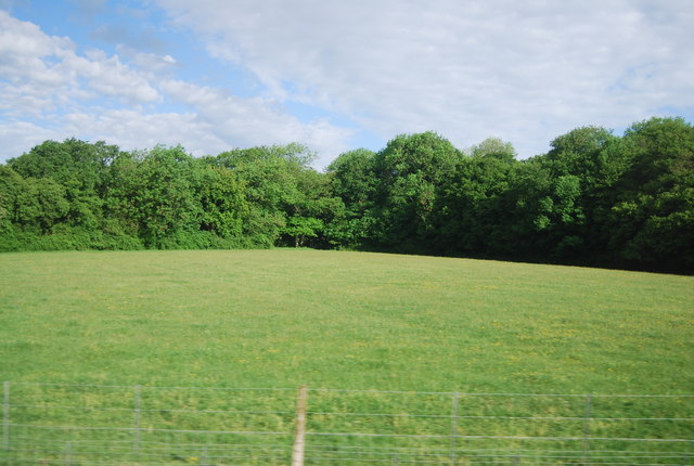
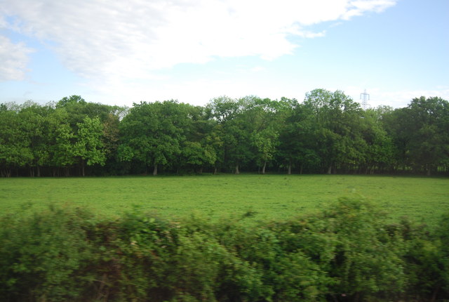
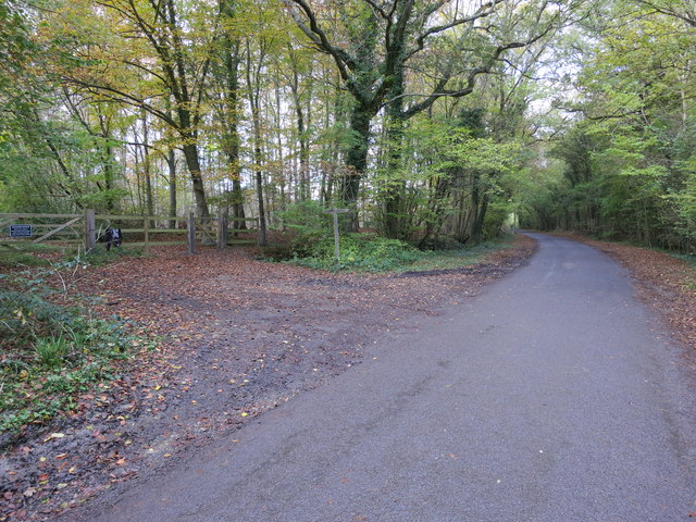
Alder Copse is a charming woodland area located in Sussex, England. Covering an area of approximately 50 hectares, this beautiful copse is characterized by its dense concentration of alder trees, hence its name. The copse is situated within the larger Sussex Weald, a historic forested region known for its natural beauty and rich biodiversity.

The alder trees within Alder Copse are predominantly of the common alder species, which thrive in wetland environments. This is due to the copse's proximity to the River Rother, which provides a constant source of water. The copse also benefits from a relatively mild and moist climate, which further supports the growth of these trees.

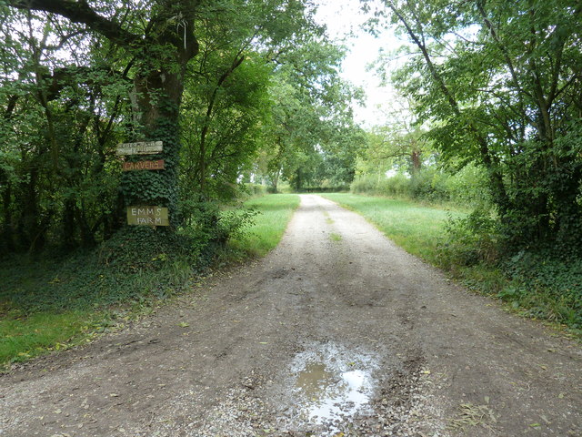
Visitors to Alder Copse can expect to be greeted by a serene and tranquil atmosphere. The copse is a popular destination for nature enthusiasts, hikers, and birdwatchers, who are particularly drawn to the copse's abundant wildlife. The alder trees provide important habitats for a variety of bird species, including the Eurasian treecreeper, the common chiffchaff, and the European goldfinch.

In addition to its natural beauty, Alder Copse is also of historical significance. The copse is believed to have been in existence for centuries, with evidence suggesting that it was used as a source of timber and firewood during medieval times.

Overall, Alder Copse in Sussex is a picturesque and ecologically diverse woodland area, offering visitors the opportunity to immerse themselves in the region's natural wonders while surrounded by the beauty of the alder trees.

If you have any feedback on the listing, please let us know in the comments section below.

Alder Copse Images

Images are sourced within 2km of 51.024609/-0.39822688 or Grid Reference TQ1226. Thanks to Geograph Open Source API. All images are credited.

Rear of house on Marlpost Road The house is called "Woodlands" according to the large-scale map. This is also a cross-grid shot. The camera was just in the square to the west.
Rear of house on Marlpost Road
The house is called "Woodlands" according to the large-scale map. This is also a cross-grid shot. The camera was just in the square to the west.
View north across fields west of Madgeland Farm It had begun to rain lightly when I took this shot.
View north across fields west of Madgeland Farm
It had begun to rain lightly when I took this shot.
An empty manger Over the hedge from West Chiltington Lane.
An empty manger
Over the hedge from West Chiltington Lane.
Pond near footpath 1466/2 There is another pond, just visible beyond the reedmace.
Pond near footpath 1466/2
There is another pond, just visible beyond the reedmace.
Woodhouse Farm Clearly not the original farmhouse, and at some remove from the farm buildings.
Woodhouse Farm
Clearly not the original farmhouse, and at some remove from the farm buildings.
Blackthorn blossom by the junction Looking back from the start of the eastern section of footpath 1921, where it leaves bridleway 1918. The western section of 1921 leaves the bridleway just through the gate.
Blackthorn blossom by the junction
Looking back from the start of the eastern section of footpath 1921, where it leaves bridleway 1918. The western section of 1921 leaves the bridleway just through the gate.
Swifts Farm by the railway Viewed from bridge TBH1 371. TBH stands for Three Bridges to Havant, the 1 being the section prior to Arundel Junction North. The next station in this direction is Billingshurst.
Swifts Farm by the railway
Viewed from bridge TBH1 371. TBH stands for Three Bridges to Havant, the 1 being the section prior to Arundel Junction North. The next station in this direction is Billingshurst.
The River Adur near Rowfold Farm In its early stages, it continues on to become the western arm of the River Adur.
The River Adur near Rowfold Farm
In its early stages, it continues on to become the western arm of the River Adur.
Farmland, Sharpenhurst Farm
Lambs near Barns Green
Level crossing, Emms Lane
Valewood Farmhouse Grade II listed.  <span class="nowrap"><a title="http://www.britishlistedbuildings.co.uk/en-299292-valewood-itchingfield" rel="nofollow ugc noopener" href="http://www.britishlistedbuildings.co.uk/en-299292-valewood-itchingfield">Link</a><img style="margin-left:2px;" alt="External link" title="External link - shift click to open in new window" src="https://s1.geograph.org.uk/img/external.png" width="10" height="10"/></span>
Valewood Farmhouse
Grade II listed. LinkExternal link
Horses in a field near Grassy Copse
Field by the Arun Valley Line
Footpath 1904/2 to Emms Farm and Courtlands Farm
Bridleway BW3214/1 Crosses Marlpost Road into Marlpost Wood
Bridleway BW3214/1
Crosses Marlpost Road into Marlpost Wood
Road Junction Lackenhurst Lane, Trout Lane and Coolham Road
Road Junction
Lackenhurst Lane, Trout Lane and Coolham Road
Show me another place!

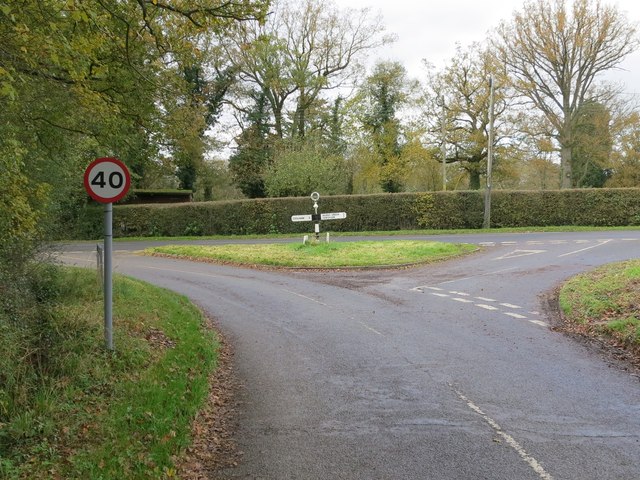
Alder Copse is located at Grid Ref: TQ1226 (Lat: 51.024609, Lng: -0.39822688)

Administrative County: West Sussex

District: Horsham

Police Authority: Sussex

What 3 Words

///legal.games.kidney. Near Southwater, West Sussex

Related Wikis

Barns Green

Barns Green is a village in the Horsham district of West Sussex, England. It lies on the Billingshurst to Itchingfield road 2+1⁄2 miles (4.0 km) north...

Brooks Green

Brooks Green is a hamlet in the Shipley civil parish of the Horsham District of West Sussex, England. It is in the north-west of the parish, approximately...

Billingshurst (electoral division)

Billingshurst is an electoral division of West Sussex in the United Kingdom and returns one member to sit on West Sussex County Council. == Extent == The...

Parson's Brook

Parson's Brook is a minor river (brook) located in the Horsham District of West Sussex, England. It is a tributary to the River Adur. == Course == The...

Newbuildings Place

Newbuildings Place is a 17th-century Artisan Mannerist house near Shipley, West Sussex. The house is a former home of Wilfrid Scawen Blunt, who is buried...

Downs Link

The Downs Link is a 36.7 miles (59.1 km) footpath and bridleway linking the North Downs Way at St. Martha's Hill in Surrey with the South Downs Way near...

Itchingfield

Itchingfield is a small village and civil parish in the Horsham district of West Sussex, England. It lies on the Barns Green to Broadbridge Heath road...

Holy Innocents Church, Southwater

Holy Innocents Church is the Anglican parish church of Southwater, a village in the Horsham District of West Sussex, England. Built in 1849, the church...

Nearby Amenities

Located within 500m of 51.024609,-0.39822688
Crossing Barrier: yes
Crossing Light: yes
Railway: level_crossing
Supervised: no
Lat/Long: 51.0251886/-0.4010353
Fixme: best guess - needs survey
Railway: level_crossing
Lat/Long: 51.0232414/-0.4048145
Fixme: deduction - needs surveying, and extending
Lat/Long: 51.0264966/-0.3981705
Crossing Barrier: yes
Crossing Light: yes
Railway: level_crossing
Supervised: no
Lat/Long: 51.0251739/-0.4010075
Railway: level_crossing
Lat/Long: 51.0232131/-0.4047964
Sumners Ponds
Leisure: fishing
Lat/Long: 51.0286002/-0.3989833
Railway: level_crossing
Source: Landsat photo
Lat/Long: 51.0282085/-0.3952087
Railway: level_crossing
Lat/Long: 51.0281875/-0.3951684
Crossing Barrier: yes
Crossing Light: yes
Railway: level_crossing
Supervised: no
Lat/Long: 51.0251741/-0.4010072
Turning Loop
Lat/Long: 51.0287417/-0.3972401
Parson's Bridge
Place: locality
Lat/Long: 51.0260368/-0.3922207
Bulbrook House Farm
Place: isolated_dwelling
Lat/Long: 51.0221841/-0.4026837
Batchelor's Farm
Place: farm
Lat/Long: 51.0240716/-0.3934578
Batchelor's
Place: isolated_dwelling
Lat/Long: 51.0225293/-0.3932298
Brooklands Farm
Place: farm
Lat/Long: 51.0255373/-0.4043217
Shelley's Farm
Place: farm
Lat/Long: 51.0250821/-0.4022117
Valewood Farm
Place: isolated_dwelling
Lat/Long: 51.0267657/-0.3986977
Life Ring
Emergency: life_ring
Lat/Long: 51.0286844/-0.3988747
The data included in this document is from www.openstreetmap.org. The data is made available under ODbL.

Have you been to Alder Copse?

Leave your review of Alder Copse below (or comments, questions and feedback).