Vale Wood

Wood, Forest in Sussex Horsham

England

Vale Wood

View north across fields west of Madgeland Farm It had begun to rain lightly when I took this shot.
View north across fields west of Madgeland Farm Credit: Ian Cunliffe

Vale Wood, located in Sussex, England, is a picturesque forest known for its natural beauty and rich biodiversity. Spanning over a vast area, this woodland is a haven for wildlife and serves as an important habitat for numerous plant and animal species.

The wood is predominantly composed of broadleaf trees, such as oak, beech, and chestnut, which create a dense canopy overhead, offering shade and shelter for the forest floor. The forest floor itself is adorned with a diverse array of wildflowers, ferns, and mosses, adding a splash of color to the otherwise green landscape.

Vale Wood is crisscrossed by a network of walking trails, allowing visitors to explore its natural wonders at their own pace. These trails wind through the forest, leading to hidden clearings, babbling brooks, and tranquil ponds. The peaceful ambiance of the wood makes it a popular destination for nature enthusiasts, hikers, and photographers.

Birdwatchers flock to Vale Wood for the chance to spot a variety of avian species, including woodpeckers, owls, and various songbirds. The forest is also home to mammals such as deer, foxes, and badgers, which can occasionally be spotted by lucky visitors.

Within Vale Wood, there are designated picnic areas and benches where visitors can relax and enjoy the serene surroundings. Additionally, the forest provides an opportunity for educational activities, as there are information boards along the trails that provide insight into the local flora and fauna.

Vale Wood is a true gem of Sussex, offering a tranquil escape from the hustle and bustle of modern life, and providing a glimpse into the beauty of nature.

If you have any feedback on the listing, please let us know in the comments section below.

Vale Wood Images

Images are sourced within 2km of 51.026842/-0.40305539 or Grid Reference TQ1226. Thanks to Geograph Open Source API. All images are credited.

View north across fields west of Madgeland Farm It had begun to rain lightly when I took this shot.
View north across fields west of Madgeland Farm
It had begun to rain lightly when I took this shot.
An empty manger Over the hedge from West Chiltington Lane.
An empty manger
Over the hedge from West Chiltington Lane.
Pond near footpath 1466/2 There is another pond, just visible beyond the reedmace.
Pond near footpath 1466/2
There is another pond, just visible beyond the reedmace.
Bullocks on Shiprods Farm This was intended to be a view of the farm, but these critturs insisted on hogging the camera.
Bullocks on Shiprods Farm
This was intended to be a view of the farm, but these critturs insisted on hogging the camera.
Orchids by the bridleway Bishop's Wood is full of wild flowers, including a few species of orchid, but of these, only the Early-purple Orchid is flowering in early April.
Orchids by the bridleway
Bishop's Wood is full of wild flowers, including a few species of orchid, but of these, only the Early-purple Orchid is flowering in early April.
Bridleway 1476 heads south No dedicated bridleway gates are provided on this stretch, full farm gates have to be opened.
Bridleway 1476 heads south
No dedicated bridleway gates are provided on this stretch, full farm gates have to be opened.
Woodhouse Farm Clearly not the original farmhouse, and at some remove from the farm buildings.
Woodhouse Farm
Clearly not the original farmhouse, and at some remove from the farm buildings.
Blackthorn blossom by the junction Looking back from the start of the eastern section of footpath 1921, where it leaves bridleway 1918. The western section of 1921 leaves the bridleway just through the gate.
Blackthorn blossom by the junction
Looking back from the start of the eastern section of footpath 1921, where it leaves bridleway 1918. The western section of 1921 leaves the bridleway just through the gate.
Swifts Farm by the railway Viewed from bridge TBH1 371. TBH stands for Three Bridges to Havant, the 1 being the section prior to Arundel Junction North. The next station in this direction is Billingshurst.
Swifts Farm by the railway
Viewed from bridge TBH1 371. TBH stands for Three Bridges to Havant, the 1 being the section prior to Arundel Junction North. The next station in this direction is Billingshurst.
Power poles and pylons near Rowfold Grange
The River Adur near Rowfold Farm In its early stages, it continues on to become the western arm of the River Adur.
The River Adur near Rowfold Farm
In its early stages, it continues on to become the western arm of the River Adur.
Bridleway bridge near Rowfold Farm
Rail bridge over the River Adur The bridge carries the section of line between Billinghurst and Horsham.
Rail bridge over the River Adur
The bridge carries the section of line between Billinghurst and Horsham.
Farmland, Sharpenhurst Farm
Lambs near Barns Green
Level crossing, Emms Lane
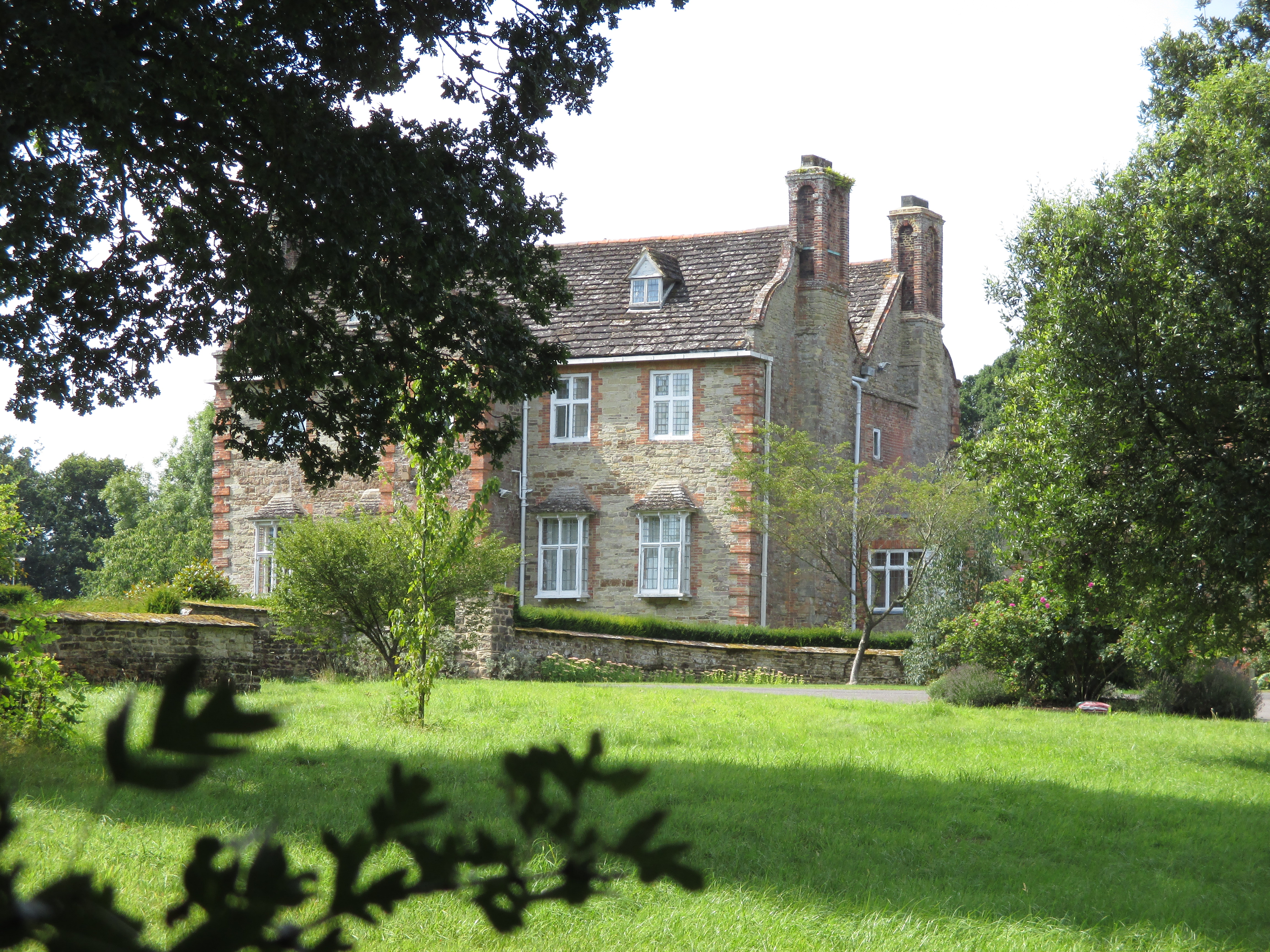
Valewood Farmhouse Grade II listed.  <span class="nowrap"><a title="http://www.britishlistedbuildings.co.uk/en-299292-valewood-itchingfield" rel="nofollow ugc noopener" href="http://www.britishlistedbuildings.co.uk/en-299292-valewood-itchingfield">Link</a><img style="margin-left:2px;" alt="External link" title="External link - shift click to open in new window" src="https://s1.geograph.org.uk/img/external.png" width="10" height="10"/></span>
Valewood Farmhouse
Grade II listed. LinkExternal link
Horses in a field near Grassy Copse
Show me another place!

Vale Wood is located at Grid Ref: TQ1226 (Lat: 51.026842, Lng: -0.40305539)

Administrative County: West Sussex

District: Horsham

Police Authority: Sussex

What 3 Words

///marketing.spelling.cabin. Near Southwater, West Sussex

Related Wikis

Barns Green

Barns Green is a village in the Horsham district of West Sussex, England. It lies on the Billingshurst to Itchingfield road 2+1⁄2 miles (4.0 km) north...

Billingshurst (electoral division)

Billingshurst is an electoral division of West Sussex in the United Kingdom and returns one member to sit on West Sussex County Council. == Extent == The...

Brooks Green

Brooks Green is a hamlet in the Shipley civil parish of the Horsham District of West Sussex, England. It is in the north-west of the parish, approximately...

Itchingfield

Itchingfield is a small village and civil parish in the Horsham district of West Sussex, England. It lies on the Barns Green to Broadbridge Heath road...

Parson's Brook

Parson's Brook is a minor river (brook) located in the Horsham District of West Sussex, England. It is a tributary to the River Adur. == Course == The...

Downs Link

The Downs Link is a 36.7 miles (59.1 km) footpath and bridleway linking the North Downs Way at St. Martha's Hill in Surrey with the South Downs Way near...

Newbuildings Place

Newbuildings Place is a 17th-century Artisan Mannerist house near Shipley, West Sussex. The house is a former home of Wilfrid Scawen Blunt, who is buried...

Coneyhurst Cutting

Coneyhurst Cutting is a 0.2-hectare (0.49-acre) geological Site of Special Scientific Interest south-east of Billingshurst in West Sussex. It is a Geological...

Nearby Amenities

Located within 500m of 51.026842,-0.40305539
Crossing Barrier: yes
Crossing Light: yes
Railway: level_crossing
Supervised: no
Lat/Long: 51.0251886/-0.4010353
Fixme: best guess - needs survey
Railway: level_crossing
Lat/Long: 51.0232414/-0.4048145
Fixme: deduction - needs surveying, and extending
Lat/Long: 51.0264966/-0.3981705
Crossing Barrier: yes
Crossing Light: yes
Railway: level_crossing
Supervised: no
Lat/Long: 51.0251739/-0.4010075
Railway: level_crossing
Lat/Long: 51.0232131/-0.4047964
Sumners Ponds
Leisure: fishing
Lat/Long: 51.0286002/-0.3989833
Slaughterford Farm
Place: farm
Lat/Long: 51.0292762/-0.3977634
Crossing Barrier: yes
Crossing Light: yes
Railway: level_crossing
Supervised: no
Lat/Long: 51.0251741/-0.4010072
Turning Loop
Lat/Long: 51.0287417/-0.3972401
Kingfisher Farm
Place: farm
Lat/Long: 51.0276972/-0.4095441
Brooklands Farm
Place: farm
Lat/Long: 51.0255373/-0.4043217
Shelley's Farm
Place: farm
Lat/Long: 51.0250821/-0.4022117
Clayfield Farm
Place: farm
Lat/Long: 51.027638/-0.406085
Valewood Farm
Place: isolated_dwelling
Lat/Long: 51.0267657/-0.3986977
Life Ring
Emergency: life_ring
Lat/Long: 51.0286844/-0.3988747
The data included in this document is from www.openstreetmap.org. The data is made available under ODbL.

Have you been to Vale Wood?

Leave your review of Vale Wood below (or comments, questions and feedback).