Cottage Copse

Wood, Forest in Surrey Mole Valley

England

Cottage Copse

Direction Sign – Signpost on the B2126 in Sutton Abinger Located in Sutton Abinger on a grass triangle in the centre of the junction of the B2126 Horsham Road and Radnor Lane, Shere parish. 3 arms and cap finial.

Milestone Society National ID: SY_TQ1045
Direction Sign – Signpost on the B2126 in Sutton Abinger Credit: John V Nicholls

Cottage Copse is a charming woodland area located in the county of Surrey, England. Nestled amidst the beautiful countryside, this idyllic forest is a popular destination for nature enthusiasts and those seeking a tranquil retreat.

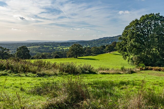
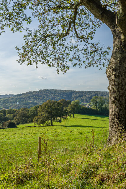
Covering an area of approximately 50 acres, Cottage Copse is characterized by its dense growth of deciduous and evergreen trees, creating a lush and diverse canopy. The forest is predominantly populated by oak, beech, and birch trees, which provide a rich tapestry of colors throughout the seasons.

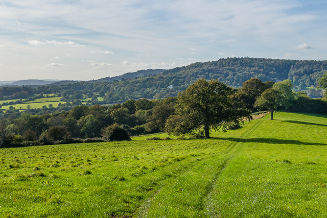
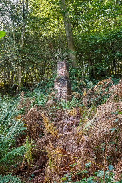
The woodland floor is carpeted with a variety of wildflowers and ferns, adding to the area's natural beauty. The copse is also home to a plethora of wildlife, including squirrels, rabbits, and a wide variety of bird species. Nature lovers can often spot woodpeckers, owls, and other woodland creatures during their visit.

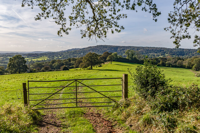
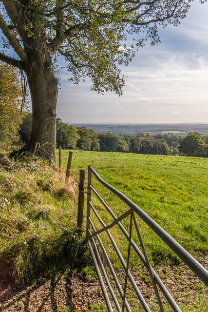
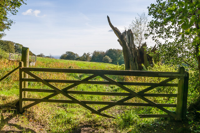
Cottage Copse offers visitors a peaceful escape from the hustle and bustle of everyday life. The forest is crisscrossed with well-maintained trails, providing opportunities for leisurely walks and exploring the enchanting surroundings. There are also picnic areas available, allowing visitors to relax and enjoy the serenity of the forest.

The copse is easily accessible, with a small car park nearby for visitors' convenience. It is recommended to bring appropriate footwear, as some trails can be muddy, especially after rainfall. Additionally, visitors are advised to follow the guidelines for responsible woodland exploration to preserve the natural habitat and ensure the safety of both themselves and the wildlife.

Overall, Cottage Copse in Surrey offers a picturesque and tranquil woodland experience, perfect for those seeking a serene escape amidst nature's beauty.

If you have any feedback on the listing, please let us know in the comments section below.

Cottage Copse Images

Images are sourced within 2km of 51.188395/-0.39626174 or Grid Reference TQ1244. Thanks to Geograph Open Source API. All images are credited.

Direction Sign – Signpost on the B2126 in Sutton Abinger Located in Sutton Abinger on a grass triangle in the centre of the junction of the B2126 Horsham Road and Radnor Lane, Shere parish. 3 arms and cap finial.

Milestone Society National ID: SY_TQ1045
Direction Sign – Signpost on the B2126 in Sutton Abinger
Located in Sutton Abinger on a grass triangle in the centre of the junction of the B2126 Horsham Road and Radnor Lane, Shere parish. 3 arms and cap finial. Milestone Society National ID: SY_TQ1045
West from near Tanhurst Looking west from near Tanhurst, on the western slopes of Leith Hill.  In the far distance is Black Down.
West from near Tanhurst
Looking west from near Tanhurst, on the western slopes of Leith Hill. In the far distance is Black Down.
West from near Tanhurst Looking west from near Tanhurst, on the western slopes of Leith Hill.  In the distance is Holmbury Hill.
West from near Tanhurst
Looking west from near Tanhurst, on the western slopes of Leith Hill. In the distance is Holmbury Hill.
West from near Tanhurst Looking west from near Tanhurst, on the western slopes of Leith Hill.  In the distance is Holmbury Hill.
West from near Tanhurst
Looking west from near Tanhurst, on the western slopes of Leith Hill. In the distance is Holmbury Hill.
West from near Tanhurst Looking west from near Tanhurst, on the western slopes of Leith Hill.  In the distance is Holmbury Hill.
West from near Tanhurst
Looking west from near Tanhurst, on the western slopes of Leith Hill. In the distance is Holmbury Hill.
South from near Tanhurst Looking south from near Tanhurst, on the western slopes of Leith Hill.  In the far distance are the South Downs.
South from near Tanhurst
Looking south from near Tanhurst, on the western slopes of Leith Hill. In the far distance are the South Downs.
South from above Tanhurst Looking south from above Tanhurst, on the western slopes of Leith Hill.
South from above Tanhurst
Looking south from above Tanhurst, on the western slopes of Leith Hill.
Track Track leading along the Tilling Bourne valley from Broadmoor.
Track
Track leading along the Tilling Bourne valley from Broadmoor.
The Old Cottage 17th Century cottage in the small hamlet of Broadmoor.  Grade II listed - see <span class="nowrap"><a title="www.historicengland.org.uk/listing/the-list/list-entry/1028797" rel="nofollow ugc noopener" href="http://www.historicengland.org.uk/listing/the-list/list-entry/1028797">Link</a><img style="margin-left:2px;" alt="External link" title="External link - shift click to open in new window" src="https://s1.geograph.org.uk/img/external.png" width="10" height="10"/></span>.
The Old Cottage
17th Century cottage in the small hamlet of Broadmoor. Grade II listed - see LinkExternal link.
The Old Cottage 17th Century cottage in the small hamlet of Broadmoor.  Grade II listed - see <span class="nowrap"><a title="www.historicengland.org.uk/listing/the-list/list-entry/1028797" rel="nofollow ugc noopener" href="http://www.historicengland.org.uk/listing/the-list/list-entry/1028797">Link</a><img style="margin-left:2px;" alt="External link" title="External link - shift click to open in new window" src="https://s1.geograph.org.uk/img/external.png" width="10" height="10"/></span>.  On the right is Home Farm.
The Old Cottage
17th Century cottage in the small hamlet of Broadmoor. Grade II listed - see LinkExternal link. On the right is Home Farm.
Broadmoor Cottages Late 19th Century terrace of 7 cottages in the small hamlet of Broadmoor.  Seen here is the southern end of the terrace.
Broadmoor Cottages
Late 19th Century terrace of 7 cottages in the small hamlet of Broadmoor. Seen here is the southern end of the terrace.
Whiteberry Cottage House in the small hamlet of Broadmoor.  Older maps suggest that it might once have been a terrace of 4 cottages.
Whiteberry Cottage
House in the small hamlet of Broadmoor. Older maps suggest that it might once have been a terrace of 4 cottages.
Bridleway Bridleway south of Broadmoor.
Bridleway
Bridleway south of Broadmoor.
Chimney What looks like the only remnant of a cottage or other building among bracken south of Broadmoor.  Current and old maps show the outline of a building here, with a small reservoir marked nearby and the 1914 1:2,500 map referring to two hydraulic rams, suggesting it may be connected with water supply.
Chimney
What looks like the only remnant of a cottage or other building among bracken south of Broadmoor. Current and old maps show the outline of a building here, with a small reservoir marked nearby and the 1914 1:2,500 map referring to two hydraulic rams, suggesting it may be connected with water supply.
Moss covered structure A moss covered block south of Broadmoor, by what is marked on large scale mapping  as a reservoir.  In the background is the chimney in <a href="https://www.geograph.org.uk/photo/7011396">TQ1344 : Chimney</a> and <a href="https://www.geograph.org.uk/photo/7011401">TQ1344 : Chimney</a>.
Moss covered structure
A moss covered block south of Broadmoor, by what is marked on large scale mapping as a reservoir. In the background is the chimney in TQ1344 : Chimney and TQ1344 : Chimney.
Track junction Track junction below Sheephouse Lane, with the one on the right leading to Shootlands Farm and that on the left to Broadmoor.
Track junction
Track junction below Sheephouse Lane, with the one on the right leading to Shootlands Farm and that on the left to Broadmoor.
Path junction Path junction below Sheephouse Lane.
Path junction
Path junction below Sheephouse Lane.
Show me another place!

Cottage Copse is located at Grid Ref: TQ1244 (Lat: 51.188395, Lng: -0.39626174)

Administrative County: Surrey

District: Mole Valley

Police Authority: Surrey

What 3 Words

///wallet.jazzy.nest. Near Peaslake, Surrey

Related Wikis

Belmont School, Surrey

Belmont is an independent co-educational school in Surrey which takes pupils from the ages of 3 to 16. The school is a charitable trust, administered...
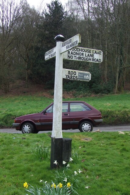
Holmbury St Mary

Holmbury St Mary is a village in Surrey, England centered on shallow upper slopes of the Greensand Ridge. Its developed area is a nucleated village, 4...

Goddards

Goddards is a Grade II*-listed house in Abinger Common, Surrey, England. It was designed by Edwin Lutyens in 1898–1900 in the ideals of the Arts and Crafts...

Leith Hill SSSI

Leith Hill SSSI is a 337.9-hectare (835-acre) biological Site of Special Scientific Interest south-east of Dorking in Surrey. The SSSI consists of four...

Friday Street

Friday Street is a hamlet on the gentle lower north slope of Leith Hill in Surrey, England. It is in a wooded headwater ravine, just to the south of Wotton...

Abinger

Abinger is a large, well-wooded and mostly rural civil parish that lies between the settlements of Dorking, Shere and Ewhurst in the district of Mole Valley...

Wotton and Abinger Commons

Wotton and Abinger Commons is a 324-hectare (800-acre) nature reserve south-west of Dorking in Surrey. It is managed by the Surrey Wildlife Trust. Part...

Woodhouse Copse, Holmbury St Mary

Woodhouse Copse is an Arts and Crafts style house in the village of Holmbury St Mary, Surrey, England. It is a Grade II listed building, with gardens originally...

Nearby Amenities

Located within 500m of 51.188395,-0.39626174
Barrier: stile
Lat/Long: 51.1853324/-0.3928482
Barrier: kissing_gate
Lat/Long: 51.1848433/-0.3944217
Bus Stop
Feldmore Corner
Naptan AtcoCode: 40004408091B
Naptan Bearing: S
Naptan CommonName: Feldmore Corner
Naptan Indicator: Just after
Naptan Landmark: Feldmore Corner
Naptan NaptanCode: surdadmj
Naptan Street: Pasture Wood Road
Naptan Verified: no
Public Transport: platform
Source: naptan_import
Lat/Long: 51.1906804/-0.4024043
Belmont School
Naptan AtcoCode: 40004408300A
Naptan Bearing: S
Naptan BusStopType: CUS
Naptan CommonName: Belmont School
Naptan Indicator: Opp
Naptan Landmark: Belmont School
Naptan NaptanCode: surgwagw
Naptan Street: Pasturewood Road
Naptan Verified: no
Source: naptan_import
Lat/Long: 51.1892514/-0.4031777
Post Box
Collection Times: Mo-Fr 09:00; Sa 07:00
Operator: Royal Mail
Post Box Mounting: brick_pillar
Post Box Type: lamp
Ref: RH5 100D
Royal Cypher: GR
Royal Cypher Wikidata: Q33102273
Lat/Long: 51.189259/-0.4031937
The data included in this document is from www.openstreetmap.org. The data is made available under ODbL.

Have you been to Cottage Copse?

Leave your review of Cottage Copse below (or comments, questions and feedback).