Bush Pasture
Wood, Forest in Bedfordshire
England
Bush Pasture

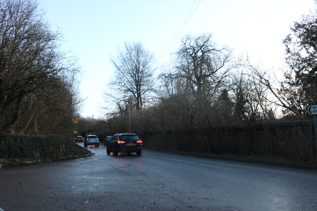
Bush Pasture is a picturesque woodland located in Bedfordshire, England. Spanning over a vast area, this natural haven offers a serene and tranquil environment for visitors to immerse themselves in the beauty of nature. The forest is situated in the southern part of the county, near the town of Bedford, making it easily accessible for locals and tourists alike.
The woodland is predominantly composed of dense deciduous trees, such as oak, beech, and birch, which create a lush and vibrant canopy. Walking through Bush Pasture, one can enjoy the dappled sunlight filtering through the foliage, creating a magical atmosphere. The forest floor is covered with a rich carpet of moss and ferns, adding to the enchanting appeal.
This woodland is not just a haven for nature enthusiasts but also a sanctuary for a diverse range of wildlife. It is home to a multitude of bird species, including woodpeckers, owls, and warblers, providing a delightful symphony of birdsong. Additionally, the forest offers a habitat for various small mammals, such as squirrels, rabbits, and foxes, which can often be spotted darting among the trees.
Bush Pasture is a popular destination for recreational activities such as hiking and picnicking. Numerous well-marked trails wind through the forest, allowing visitors to explore its hidden gems and discover its natural wonders. The serene atmosphere and breathtaking views make it an ideal location for a peaceful retreat or a family outing.
In conclusion, Bush Pasture in Bedfordshire is a magnificent woodland that captivates visitors with its scenic beauty and abundant wildlife. Whether it's for a leisurely stroll, birdwatching, or simply immersing oneself in the tranquility of nature, this forest offers a truly unforgettable experience.
If you have any feedback on the listing, please let us know in the comments section below.
Bush Pasture Images
Images are sourced within 2km of 51.866903/-0.37992668 or Grid Reference TL1119. Thanks to Geograph Open Source API. All images are credited.


Bush Pasture is located at Grid Ref: TL1119 (Lat: 51.866903, Lng: -0.37992668)
Unitary Authority: Central Bedfordshire
Police Authority: Bedfordshire
What 3 Words
///police.voters.issues. Near Luton, Bedfordshire
Nearby Locations
Related Wikis
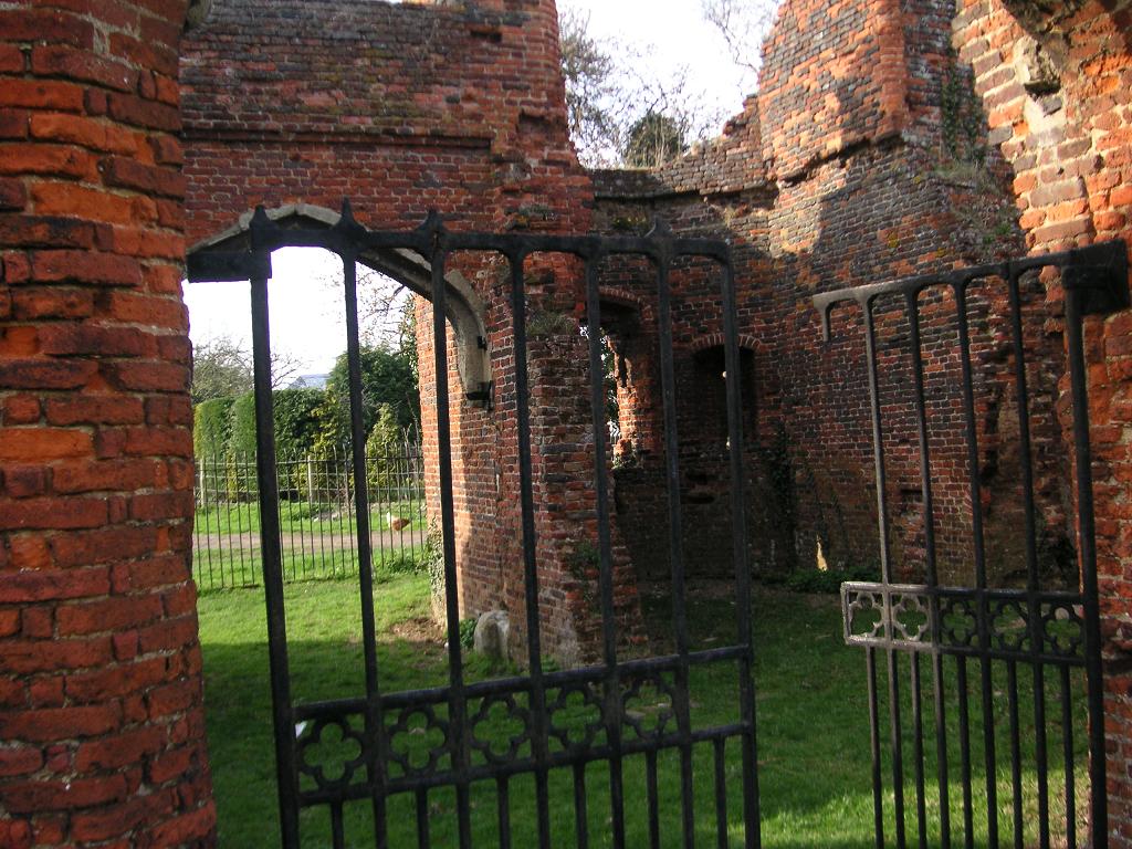
Someries Castle
Someries Castle (sometimes spelt Summeries castle) is a Scheduled Ancient Monument, in the Parish of Hyde, near the town of Luton, Bedfordshire, England...

Court Line Flight 95
Court Line Aviation Flight 95 was an international charter flight from London Luton Airport, Bedfordshire, England, to Munich-Riem Airport, West Germany...
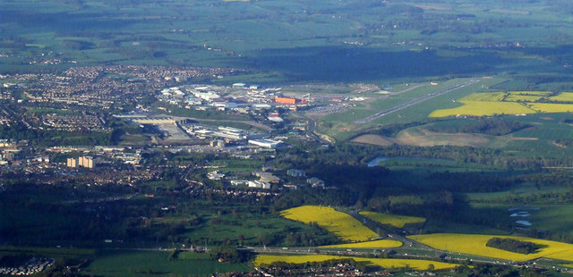
Luton Airport
London Luton Airport (IATA: LTN, ICAO: EGGW) is an international airport located in Luton, Bedfordshire, England, situated 1.7 miles (2.7 km) east of the...

Luton Airport Parkway railway station
Luton Airport Parkway railway station is on the Midland Main Line in England, serving south Luton and Luton Airport in Bedfordshire. The station is situated...

Napier Park
Napier Park is a suburb of Luton, in the south of the town, in Bedfordshire, England. It is roughly bounded by Harrowden Road to the north, the Midland...
Crawley Green F.C.
Crawley Green Football Club is a football club based in Crawley Green, an area of Luton, Bedfordshire England. Affiliated to the Bedfordshire County Football...
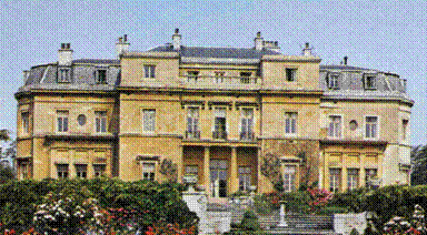
Luton Hoo
Luton Hoo is an English country house and estate near Luton in Bedfordshire and Harpenden in Hertfordshire. Most of the estate lies within the civil parish...
New Mill End
New Mill End is a hamlet located in Bedfordshire, England, close to county border with Hertfordshire. It is in the civil parish of Hyde, Bedfordshire New...
Nearby Amenities
Located within 500m of 51.866903,-0.37992668Have you been to Bush Pasture?
Leave your review of Bush Pasture below (or comments, questions and feedback).